
New Hampshire sits on some of the oldest and most mineralogically productive bedrock in New England. The state's geology is dominated by Devonian-age metamorphic rocks — schist, gneiss, and quartzite — intruded by granitic plutons and pegmatite dikes that formed roughly 350 to 400 million years ago during the Acadian Orogeny. A second pulse of igneous activity during the Mesozoic (around 120–180 million years ago) produced the White Mountain Magma Series: the Conway granite, Mount Osceola granite, and associated ring dike complexes that define the modern White Mountains landscape.
The pegmatite belt that runs from Grafton County through Sullivan and Cheshire Counties is where most gem-quality material originates. These coarse-grained igneous bodies cooled slowly enough to grow large crystals of quartz, feldspar, mica, beryl, tourmaline, garnet, and — in the most evolved pockets — topaz and columbite-tantalite. New Hampshire's pegmatites rank among the best mineralogical localities in New England, producing museum-quality specimens of smoky quartz, aquamarine, and black tourmaline (schorl) since the early 1800s.

Top Collecting Locations
1. Ruggles Mine — Grafton, Grafton County
Land Status: Private. Historically operated as a fee-dig tourist mine. The mine has experienced intermittent closures and ownership changes over the years. Confirm current access status before visiting — check local sources or call Grafton town offices at (603) 523-7903.
GPS: Approx. 43.559°N, 71.949°W (Isinglass Mountain, Grafton).
Vehicle: 2WD sedan to the parking area on paved/gravel roads. The mine itself is a short walk from the lot.
Specimens: Beryl (aquamarine, golden beryl/heliodor, goshenite), smoky quartz, rose quartz, muscovite mica (large books), garnet (almandine), black tourmaline (schorl), feldspar (microcline, albite), uraninite, autunite (fluorescent), columbite-tantalite, and occasional purple fluorapatite.
Ruggles Mine is New Hampshire's most famous mineral collecting site. It opened as an isinglass (muscovite mica) mine in 1803 and operated commercially for nearly two centuries. The pegmatite body is massive — the open pit exposes multiple pegmatite zones with distinct mineralogy. The core zones produced beryl crystals exceeding 30 cm in length, and mica books measuring over a meter across were historically extracted here. The walls of the open pit show textbook pegmatite zonation: a quartz core surrounded by zones of graphic granite, block feldspar, and mica-rich margins grading into the country rock schist.
When open to the public, collectors worked directly in the pegmatite exposures with hand tools. The site produced beryl in multiple colors — pale blue aquamarine, yellow-green heliodor, and colorless goshenite. Smoky quartz crystals with good terminations occurred in pockets. The mine is also a type locality for several rare phosphate minerals. If you visit, bring a UV lamp — autunite and other uranium-bearing phosphates fluoresce bright green under shortwave UV.
2. Palermo Mine Area — North Groton, Grafton County
Land Status: Private. Access by permission only. The Palermo No. 1 mine and surrounding pegmatite workings are on private land. Contact local mineral clubs (see the New Hampshire Geological Society or Micromounters of New England) for field trip access.
GPS: Approx. 43.730°N, 71.834°W (North Groton area).
Vehicle: AWD or high-clearance 2WD recommended. Mine access roads are unpaved and can be rough, especially during spring thaw (late March through mid-May).
Specimens: Beryl (blue-green aquamarine, yellow heliodor), smoky quartz, black tourmaline (schorl), garnet (almandine), triphylite, lithiophilite, vivianite, siderite, apatite, and over 80 described mineral species.
The Palermo No. 1 pegmatite is a lithium-bearing pegmatite classified in the rare-element class. It is one of the most mineralogically diverse pegmatites in New England. The mine was worked commercially for feldspar in the mid-20th century, and the dump material has produced hundreds of rare phosphate mineral specimens now held in museum collections worldwide. For the gem hunter, the primary targets are beryl crystals (up to 15 cm, occasionally gem-quality blue or yellow) and smoky quartz from miarolitic cavities. The dumps contain abundant schorl, feldspar, and mica. Micromount collectors prize this locality for its suite of rare lithium and phosphate minerals — species like triphylite, graftonite, and childrenite occur here.
3. White Mountain National Forest — Surface Collecting
Land Status: US Forest Service (USDA). Surface collecting of reasonable quantities of rocks and minerals for personal, noncommercial use is permitted under 36 CFR 228.62. No digging, excavation, or use of mechanized equipment. No collecting from developed recreation sites, archaeological areas, or areas posted with closure signs. If in doubt, contact the Pemigewasset Ranger District (Plymouth, NH) or the Saco Ranger District (Conway, NH).
GPS: The White Mountain National Forest covers approximately 800,000 acres across Grafton, Carroll, and Coos Counties. The most productive collecting areas for surface specimens are road cuts along the Kancamagus Highway (NH Route 112), Bear Notch Road, and routes through Crawford Notch and Franconia Notch.
Vehicle: 2WD sedan on paved highways. AWD for forest roads (FR numbers), some of which are gated seasonally. Forest roads typically open mid-May through late October, depending on snowpack.
Specimens: Smoky quartz (loose crystals in soil and talus below Conway granite outcrops), almandine garnet in schist and gneiss road cuts, muscovite mica, biotite, feldspar, and occasional beryl fragments in pegmatite float.
The WMNF is the largest block of public land in New Hampshire, and it spans the core of the White Mountains. The Conway granite — a Jurassic-age alkaline granite associated with the White Mountain Magma Series — is the primary host for smoky quartz in the region. Smoky quartz crystals form in cavities and fractures within the granite, and natural weathering frees them into soil and talus. Look for loose crystals at the base of granite cliffs and in stream beds that drain Conway granite terrain. Good float also appears in glacial till — New Hampshire was heavily glaciated, and ice transport scattered mineral specimens far from their source outcrops.
Garnet-bearing schist is exposed in road cuts throughout the WMNF. The Littleton Formation (Devonian metapelite) and similar units contain almandine garnet porphyroblasts ranging from 5 mm to 3 cm. These are common but rarely gem-quality — most are opaque and fractured. Intact dodecahedral crystals weathering out of schist make solid cabinet specimens.
4. Conway and North Conway Area — Carroll County
Land Status: Mix of White Mountain National Forest, state highway rights-of-way, and private land. Collect only from WMNF land or areas where you have explicit permission. Do not collect from posted private land.
GPS: Conway area: approx. 44.000°N, 71.130°W. Road cuts along NH Route 16 and NH Route 302 expose bedrock.
Vehicle: 2WD sedan on paved highways.
Specimens: Smoky quartz crystals, clear quartz, feldspar, garnet in schist, biotite, muscovite.
The Conway granite type locality is here. Road cuts through the Conway granite along Route 16 between Conway and Jackson expose the coarse-grained granite with smoky quartz phenocrysts. While the bedrock exposures themselves rarely yield free crystals without excavation (which is not permitted on highway rights-of-way), weathered slopes and talus fields below granite outcrops on WMNF land produce loose smoky quartz points. After heavy rain or spring snowmelt, surface wash exposes fresh material. Check gravel bars in the Saco River and its tributaries — the river cuts through Conway granite terrain and concentrates heavy minerals including garnet and occasionally small quartz crystals.
5. Grafton County Road Cuts and Pegmatite Exposures
Land Status: Varies — state highway rights-of-way (collecting from road cuts on NH state highways is generally tolerated for hand specimens, but verify with NH DOT if in doubt), WMNF land, and private land. Many old mica and feldspar quarries dot Grafton County on private parcels.
GPS: Distributed locations throughout Grafton County. Notable areas include the towns of Grafton, Groton, Alexandria, Hebron, and Orange.
Vehicle: 2WD on paved roads. AWD recommended for back roads, especially in spring.
Specimens: Beryl, tourmaline (schorl), garnet, smoky quartz, mica, feldspar, occasional rare phosphates.
Grafton County contains the densest concentration of pegmatite bodies in New Hampshire. Dozens of small mines and quarries were worked historically for feldspar and mica. While most are on private land and require permission, the area repays reconnaissance. Road cuts on Routes 4, 4A, and 118 expose pegmatite veins in several places. Look for white quartz-feldspar zones cutting through dark schist — these are the pegmatite margins, and they may contain garnet, tourmaline, and mica visible in the road cut face. Do not hammer on active highway surfaces or block traffic.
Minerals of New Hampshire
| Mineral | Hardness | Where in NH | What to Look For |
|---|---|---|---|
| Smoky Quartz | 7 | Conway granite areas, WMNF, Ruggles Mine | Brown to dark gray translucent hexagonal prisms with pointed terminations. In loose soil, talus, and stream gravels. |
| Beryl (Aquamarine) | 7.5–8 | Ruggles Mine, Palermo Mine, Grafton County pegmatites | Pale blue to blue-green hexagonal prisms in pegmatite. Often etched or frosted on crystal faces. |
| Beryl (Heliodor) | 7.5–8 | Ruggles Mine, Palermo Mine | Yellow to yellow-green hexagonal crystals. Less common than aquamarine. Check pegmatite core zones. |
| Tourmaline (Schorl) | 7–7.5 | Throughout Grafton County pegmatites | Black prismatic crystals with striated faces and triangular cross-section. Very common in NH pegmatites. |
| Almandine Garnet | 7–7.5 | Schist road cuts statewide, WMNF, pegmatite margins | Dark red to reddish-brown dodecahedral or trapezohedral crystals in mica schist. Typically opaque. |
| Topaz | 8 | Rare — evolved pegmatite pockets, Baldface Mountain area | Colorless to pale blue orthorhombic crystals. Excellent basal cleavage. Rare in NH; only from the most fractionated pegmatites. |
| Muscovite Mica | 2–2.5 | Ruggles Mine, Palermo Mine, pegmatites statewide | Silvery transparent sheets with perfect basal cleavage. Books can exceed 30 cm at Ruggles. |
| Feldspar (Microcline) | 6–6.5 | All pegmatite localities | White to cream blocky crystals, sometimes with graphic granite (quartz-feldspar intergrowth) texture. |
| Fluorapatite | 5 | Ruggles Mine, Palermo Mine | Purple, green, or blue hexagonal crystals. Check pegmatite pockets and dump material. |
| Rose Quartz | 7 | Ruggles Mine, some Grafton County pegmatites | Massive pink quartz in pegmatite cores. Rarely forms crystals — usually anhedral masses. |
Field Identification Tips
New Hampshire pegmatites produce a limited but distinctive suite of minerals. Here are the key identification methods for fieldwork.
Smoky Quartz vs. Brown Tourmaline: Both are dark-colored prismatic crystals. Smoky quartz has a hexagonal cross-section with smooth prism faces and conchoidal fracture. Tourmaline (schorl) has a rounded triangular cross-section with vertically striated prism faces. Tourmaline is also piezoelectric — it may attract dust or small paper fragments when heated. In practice, the striated faces on tourmaline are the most reliable quick field distinction.
Beryl vs. Quartz: Both form hexagonal prisms. Beryl is typically wider relative to its length (stubby habit) compared to quartz, which tends toward elongated prismatic. Beryl lacks the pointed rhombohedral termination that quartz displays. Beryl's hardness (7.5–8) is slightly higher than quartz (7), but this difference is hard to detect in the field without a reference plate. Color is the best guide: pale blue or yellow-green in a pegmatite context strongly suggests beryl.
Garnet in Schist: Almandine garnet forms as equant porphyroblasts — roughly spherical grains — embedded in foliated mica schist. In fresh schist, they appear as dark red bumps on the foliation surface. Weathered schist releases the garnets, which accumulate in soil below outcrops. Test hardness: garnet (7–7.5) scratches glass and steel. The dodecahedral crystal form, when visible, is diagnostic.
Topaz: Rare in New Hampshire but worth knowing. Topaz is orthorhombic (not hexagonal like quartz or beryl), colorless to pale blue, and has one perfect basal cleavage — it breaks cleanly across the crystal perpendicular to its length. If you find a hard, colorless crystal in pegmatite that breaks flat on one end, test its hardness. Topaz (8) scratches quartz (7).
Mica Identification: Muscovite is silvery and transparent in thin sheets. Biotite is dark brown to black and opaque. Both have perfect basal cleavage. Muscovite is the economically important species from NH pegmatites — the large "isinglass" sheets that drove early mining at Ruggles and other quarries.
UV Testing: Carry a shortwave UV lamp if you visit Ruggles Mine or Palermo Mine. Autunite (calcium uranium phosphate) fluoresces vivid green under shortwave UV. Fluorapatite may fluoresce orange or yellow. UV testing works best in shadow or after dark.
Recommended Tools
| Item | Purpose |
|---|---|
| Rock hammer (flat/chisel end) | Breaking pegmatite at fee-dig sites. 2–3 lb geological hammer is standard. |
| Cold chisels (set of 3 sizes) | Splitting pegmatite along crystal boundaries and working pocket openings. |
| Safety glasses | Mandatory when hammering any rock. Feldspar and quartz fragments are sharp. |
| 10x hand lens (loupe) | Examining crystal faces, identifying striations on tourmaline, checking for inclusions in beryl. |
| Shortwave UV lamp | Detecting fluorescent minerals — autunite, fluorapatite — especially at Ruggles and Palermo. |
| Steel nail or file (hardness ~6.5) | Scratch testing. Quartz, beryl, garnet, and topaz all scratch steel. |
| Spray bottle | Wetting mineral surfaces reveals color and transparency that dry surfaces hide. |
| Newspaper and small boxes | Wrapping crystals to prevent damage during transport. Beryl and quartz chip easily. |
| Gloves (leather work gloves) | Protecting hands from sharp rock edges and mica splinters while hammering. |
| GPS or phone with offline maps | Cell coverage is poor in the White Mountains. Download maps before entering the forest. |
Legal Notes and Access Rules
White Mountain National Forest (USDA Forest Service): Surface collecting of rocks and minerals in reasonable quantities for personal, noncommercial use is allowed under 36 CFR 228.62. "Surface collecting" means picking up loose material from the ground surface. No digging, excavation, rock hammering on outcrops, or use of any mechanized tools. Do not collect from developed recreation areas, campgrounds, trailheads, or areas with posted restrictions. Commercial collecting requires a special use permit from the Forest Supervisor's office in Campton, NH.
State Highway Road Cuts: New Hampshire does not have a blanket statute explicitly permitting or prohibiting casual collecting from road cuts. In practice, collecting hand specimens from accessible road cut faces is generally tolerated by NH DOT, provided you do not obstruct traffic, damage infrastructure, or create safety hazards. Park safely off the roadway. Do not hammer on active traffic-bearing surfaces. If a road cut is fenced or signed, respect the restriction.
Private Land: Most historic mines in Grafton County — including Ruggles Mine, Palermo Mine, and dozens of smaller pegmatite workings — are on private land. Trespassing on posted land is a violation of NH RSA 635:2. Always obtain written or clear verbal permission before entering private mine sites. Some owners are accommodating to collectors; others are not. Joining a local mineral club (such as the Micromounters of New England or the New Hampshire Geological Society) is the most reliable way to access private sites through organized field trips.
Safety at Old Mines: Abandoned pegmatite mines in New Hampshire present real hazards: vertical shafts, unstable pit walls, and loose overhanging rock. Ruggles Mine's open pit has steep walls with loose blocks. Never enter underground workings. Never work alone at an abandoned mine. Tell someone where you are going and when you expect to return.
Collecting Limits: There is no formal weight limit specified for personal collecting on WMNF land, but the standard guidance across all National Forests is "reasonable quantities for personal use" — generally interpreted as what one person can carry. If you are filling a truck bed, you have exceeded reasonable personal use. Leave specimens that are clearly part of an intact outcrop; take only float and loose material.
Practical Field Notes
- Season: Mid-May through mid-October is collecting season. Forest roads in the WMNF open as snow clears, typically by Memorial Day. Mine sites at elevation may retain snow into early June. Road cuts along paved highways are accessible year-round, though winter conditions (ice, snow, narrow plowed shoulders) make stopping hazardous.
- Weather: White Mountain weather is unpredictable. Summer afternoon thunderstorms are common. Temperatures at elevation can drop 15–20°F below valley readings. Carry rain gear and a warm layer even in July.
- Cell Service: Limited to nonexistent through much of the WMNF, especially in the Pemigewasset Wilderness and along the Kancamagus Highway. Download offline maps and share your itinerary with someone before heading out.
- Accommodation: Lincoln, North Woodstock, and North Conway are the primary service towns bordering the WMNF, with motels, campgrounds, and supplies. Grafton (nearest to Ruggles Mine) is a small rural town — plan fuel and supplies in advance.
- Nearby States: Maine's Oxford County pegmatite belt (1.5–2 hours east) produces gem tourmaline and beryl at fee-dig operations. Vermont's pegmatites yield similar species. A multi-day trip combining NH and Maine gem hunting covers the best of New England pegmatite collecting.
Interactive Map
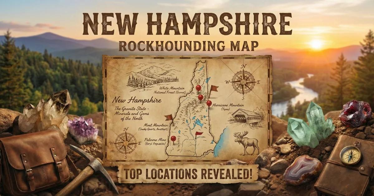
Find all New Hampshire mineral collecting locations, pegmatite mines, and road cut exposures on our New Hampshire rockhounding map with GPS coordinates and access details.