
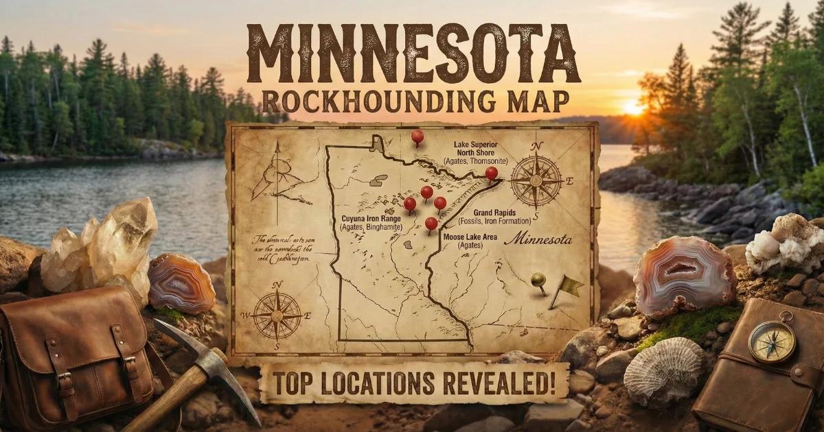
Minnesota Geology: Rift Basalts, Glacial Drift, and Ancient Iron
Minnesota's collectible minerals trace back to two geological events separated by a billion years. The first is the Midcontinent Rift System — approximately 1.1 billion years ago, North America began to split apart along a line running from Lake Superior southwest through central Minnesota and into Kansas. Basaltic lava erupted from fissures along this rift, filling vesicles and voids with silica-rich fluids that precipitated as agate, thomsonite, and various zeolite minerals. The rift failed before the continent separated, but it left behind a thick sequence of volcanic rock buried beneath younger sediment across much of central and southern Minnesota.
The second event is Pleistocene glaciation. Over the past two million years, successive ice sheets advanced from the north and northeast, scouring the exposed basalt along the Lake Superior shoreline and grinding it into glacial till. The agates — harder than the surrounding basalt — survived the transport and were deposited throughout Minnesota in moraines, outwash plains, river gravels, and lake sediments. This is why Lake Superior agates turn up in gravel pits, plowed fields, and road cuts hundreds of miles from the nearest basalt outcrop.
In the northeast, the Mesabi Iron Range exposes Precambrian iron formation — banded sequences of hematite, goethite, chert, and jasper that have been mined commercially since the 1880s. In the southwest, the Sioux Quartzite formation hosts thin layers of catlinite (pipestone), a soft red claystone used for centuries by Native American peoples for pipe carving. Each of these geological provinces produces distinct collectible material.
Top Collecting Locations
1. North Shore Beaches — Lake Superior (Lake and Cook Counties)
Land status: Public shoreline access at state parks, state waysides, and municipal beaches. Some sections are private — check signage.
GPS (approximate): 47.3509, -91.2657 (Agate Bay, Two Harbors) to 47.7475, -90.3370 (Grand Marais harbor)
Vehicle: 2WD. All North Shore access points are paved or maintained gravel.
Target minerals: Lake Superior agates, thomsonite, chlorastrolite (greenstone), prehnite, laumontite, various zeolites
The North Shore of Lake Superior between Duluth and Grand Portage is the origin zone for Lake Superior agates. Storm action continuously liberates agates from basalt exposures on the lake bottom and deposits them on cobble beaches. Walk slowly at the waterline where waves keep stones wet — wet agates show their banding clearly, dry ones look like ordinary brown or gray pebbles. Best collecting follows major storms (northeast winds) that churn the lake bottom and deliver fresh material to shore.
Specific access points include Burlington Bay (Two Harbors), Flood Bay wayside, Gooseberry Falls State Park beach, Split Rock Lighthouse State Park, Temperance River State Park, and the public beach at Grand Marais. Collect only from the beach itself — do not hammer bedrock outcrops in state parks. Minnesota state parks allow surface collecting of small quantities of loose stones for personal use. Check current park rules before collecting.
2. Thomsonite Beach — Good Harbor Bay (Cook County)
Land status: Public beach below the ordinary high-water mark. Adjacent uplands are private — do not trespass above the beach.
GPS (approximate): 47.6815, -90.5038
Vehicle: 2WD to parking area, short walk to beach
Target minerals: Thomsonite (concentric "eye" patterns in pink, green, and white), mesolite, other zeolites, occasional agate
Thomsonite is a calcium-sodium zeolite that forms in the vesicles of basalt. At Good Harbor Bay and nearby beaches between Grand Marais and Tofte, thomsonite nodules weather out of the Terrace Point basalt formation and wash ashore as rounded beach stones. The characteristic concentric eye pattern — radiating rings of pink, green, white, and sometimes orange — makes thomsonite immediately identifiable. Stones range from marble-size to fist-size. Gem-grade thomsonite is rare and commands high prices from collectors and lapidaries. Most specimens are cabochon-cut rather than faceted.
Thomsonite collecting requires patience. Walk slowly, examine every rounded stone at the waterline. Wet stones show color and pattern best. A hand lens helps confirm the radiating zeolite crystal structure. The best thomsonite appears after spring ice-out and after fall storms.
3. Pipestone National Monument (Pipestone County)
Land status: National Park Service — collecting is PROHIBITED for the general public. Only enrolled members of federally recognized Native American tribes may quarry catlinite, and only under NPS permit.
GPS: 44.0133, -96.3253
Vehicle: 2WD. Paved access off US Route 75.
Target minerals (observation only): Catlinite (pipestone), Sioux Quartzite
Pipestone National Monument preserves the most significant catlinite quarry in North America. Catlinite is a fine-grained argillite — a metamorphosed mudstone — colored red by iron oxide (hematite). The catlinite occurs as thin horizontal layers within the harder Sioux Quartzite, a 1.7 billion year old formation. For at least three thousand years, Native American peoples from across the continent have quarried catlinite here to carve ceremonial pipes. The quarries remain active and are reserved by federal law for tribal use only.
Visitors can hike the Circle Trail (0.75 miles) past exposed quarry pits, Sioux Quartzite outcrops, and Winnewissa Falls. The visitor center displays catlinite specimens and finished pipes. You cannot collect any rock material within the monument boundaries. The Sioux Quartzite itself — a pink to reddish metamorphic sandstone — is visible in road cuts and outcrops throughout the surrounding county but is not collectible on NPS land.
4. Bingham Lake Agate Beds (Cottonwood County)
Land status: Private agricultural land. Permission from landowners is required. Some gravel pits in the area allow collecting — ask at the gate.
GPS (approximate): 44.1100, -95.0500 (Bingham Lake township area)
Vehicle: 2WD on county roads. High-clearance useful for field access in wet conditions.
Target minerals: Lake Superior agates, common chalcedony, quartz, occasional jasper
The Bingham Lake area in Cottonwood County sits on glacial outwash gravels that concentrated agates eroded from the Midcontinent Rift basalts far to the northeast. Collectors have found Lake Superior agates here for over a century. The material is distributed through glacial drift deposits — gravel pits, plowed fields after rain, drainage ditches, and road cuts all produce agates. Spring plowing season is prime time: rain washes soil off exposed agates in freshly turned fields, and the iron-stained banding becomes visible. Always get landowner permission before walking fields.
Gravel pits throughout southern Minnesota — not just Bingham Lake — produce agates. Commercial gravel operations in Blue Earth, Nicollet, Brown, and Redwood counties have all yielded quality specimens. Some pit operators allow collecting during off-hours; others do not. Ask directly and respect the answer.
5. Mesabi Iron Range (St. Louis and Itasca Counties)
Land status: Mixed — state land, county land, private mine property. Active and abandoned mine sites are mostly restricted. Some mine dumps and overlooks are publicly accessible. Check with local chambers of commerce.
GPS (approximate): 47.4500, -92.7500 (Hibbing area) to 47.5200, -91.8700 (Ely area)
Vehicle: 2WD on paved mine-view roads. High-clearance for backcountry Forest Service roads.
Target minerals: Hematite, goethite, jasper, banded iron formation (BIF/jaspilite), taconite, quartz
The Mesabi Range is a 110-mile-long iron ore deposit stretching from Grand Rapids to Babbitt. Open-pit mines have exposed Precambrian banded iron formation — alternating layers of hematite/magnetite and chert/jasper — that makes striking display specimens. Banded iron formation (jaspilite) shows red jasper layers alternating with silver-gray hematite. Mary Ellen Mine jasper, named for a historic mine near Biwabik, is a known variety prized by lapidaries.
Active mines are off-limits. However, mine-view overlooks at Hull-Rust-Mahoning (Hibbing) and United Taconite (Eveleth) allow observation. Some abandoned mine dumps on county or state tax-forfeited land may be accessible for surface collecting — verify with the county land office. The Iron Range communities of Hibbing, Virginia, Eveleth, and Chisholm all have mining museums and rock shops where locally collected specimens are available.
6. Superior National Forest (Lake, Cook, and St. Louis Counties)
Land status: USDA National Forest — casual collecting of reasonable quantities of rocks and minerals for personal, non-commercial use is permitted on National Forest land under 36 CFR 228.62.
GPS (approximate): 47.8000, -91.0000 (general Boundary Waters area)
Vehicle: High-clearance recommended for Forest Service roads. Some areas require portage by canoe (Boundary Waters Canoe Area Wilderness).
Target minerals: Lake Superior agates, quartz, feldspar, granite specimens, occasional copper minerals near old prospect pits
Superior National Forest covers over three million acres of northeastern Minnesota. Gravel bars along rivers, glacial eskers, and road cuts on Forest Service roads all produce agates and other glacial erratics. The Boundary Waters Canoe Area Wilderness (BWCAW) within the forest requires special entry permits and has its own regulations — check with the Kawishiwi Ranger District. Collecting within the BWCAW is more restricted than general National Forest rules, and motorized equipment is prohibited. Outside the BWCAW, standard National Forest casual collecting rules apply.
Minerals Found in Minnesota
| Mineral | Composition | Where Found | Notes |
|---|---|---|---|
| Lake Superior Agate | Banded chalcedony (SiO₂) | Statewide in glacial drift; North Shore beaches | State gemstone. Iron-oxide banding in red, orange, yellow, white. Formed in 1.1 Ga rift basalts. |
| Thomsonite | NaCa₂Al₅Si₅O₂₀·6H₂O | North Shore beaches, Cook and Lake Counties | Zeolite mineral with concentric pink/green/white "eye" pattern. Gem-quality material is uncommon. |
| Catlinite (Pipestone) | Argillite (clay/sericite/hematite) | Pipestone National Monument, Pipestone County | Sacred stone. Quarrying restricted to enrolled tribal members. Do not collect. |
| Hematite | Fe₂O₃ | Mesabi Iron Range, St. Louis and Itasca Counties | Steel-gray metallic luster, red-brown streak. Massive and specular forms. |
| Goethite | FeO(OH) | Mesabi Range mine dumps | Yellow-brown iron hydroxide. Botryoidal and stalactitic forms on mine specimens. |
| Jasper (Jaspilite) | SiO₂ (microcrystalline quartz + hematite) | Mesabi Range, especially Biwabik area | Red jasper banded with iron formation. Mary Ellen jasper is a named variety. Takes a good polish. |
| Quartz | SiO₂ | Statewide in glacial erratics; veins in Precambrian bedrock | Clear to milky. Crystal-lined vugs occur in some Iron Range locations. |
| Chlorastrolite (Greenstone) | Pumpellyite — Ca₂MgAl₂(SiO₄)(Si₂O₇)(OH)₂·H₂O | North Shore beaches, Isle Royale (NPS — no collecting) | Green chatoyant pebbles. Very small, easily overlooked. Michigan state gemstone but found on MN shores. |
| Prehnite | Ca₂Al₂Si₃O₁₀(OH)₂ | North Shore basalt, beach pebbles | Pale green botryoidal masses in basalt vesicles. Translucent when polished. |
| Copper (Native) | Cu | North Shore basalt exposures, old prospect pits | Small blebs and sheets in basalt. Not commercially significant in Minnesota. |
Field Identification Tips
Lake Superior Agates
The wet test: Carry a spray bottle. Wet every suspect stone. Agates that look like plain brown or gray pebbles when dry will show red, orange, and white banding when wet. This single technique will increase your find rate tenfold.
Weight: Agate is denser than most common rocks (SG ~2.65). Pick up stones that feel heavy for their size. Basalt (SG ~2.9) is heavier, but basalt is dark and non-translucent. Limestone and sandstone are lighter.
Translucency: Hold small stones up to the sun. Agate transmits light — you will see color and banding through thin edges. Opaque stones are not agate.
Pitted surface: Many Lake Superior agates have a pitted or waxy exterior surface (the "husk") where sofite basalt matrix weathered away. The pitting is shallow and irregular, unlike the deep pits of vesicular basalt.
Banding patterns: True Lake Superior agates show concentric fortification banding, parallel (water-level) banding, or a combination. The banding follows the original vesicle wall. Colors are caused by iron oxides — hematite (red), goethite (yellow-brown), and limonite (yellow). White bands are pure chalcedony.
Thomsonite
Eye pattern: Concentric rings radiating from a center point. Colors range from pink and green to white and cream. The pattern is distinct from agate banding — thomsonite eyes are circular and symmetrical.
Hardness: Thomsonite is softer than agate (Mohs 5-5.5 vs. 7). It will not scratch glass as easily as agate. Handle specimens carefully — they chip more readily.
Iron Range Minerals
Hematite: Steel-gray metallic luster on fresh surfaces. Red-brown streak on unglazed porcelain. Heavy (SG ~5.3). Magnetic only when heated or in massive form with magnetite impurities.
Jaspilite (BIF): Alternating red (jasper) and silver-gray (hematite/magnetite) bands. Very hard and dense. Rings when struck. Takes an excellent polish — prized for cabochons and display slabs.
Goethite: Yellow-brown to dark brown. Botryoidal (grape-like) surface texture. Streak is yellow-brown, distinguishing it from hematite (red-brown).
Recommended Tools
- Spray bottle: Essential for agate hunting. Wet stones to reveal banding. Refill from the lake or any clean water source.
- Hand lens (10x): For examining banding, crystal structure in thomsonite, and mineral identification in Iron Range specimens.
- Rock hammer (16 oz): For breaking suspect stones to check interiors. Not permitted in state or national parks — carry only on unrestricted land.
- Chisel (cold chisel, 3/4 inch): For extracting specimens from matrix on mine dumps and outcrops where collecting is allowed.
- Collecting bucket or bag: Mesh bags drain water from beach-collected stones. A 5-gallon bucket works for gravel pit collecting.
- Knee pads: Beach collecting and gravel pit scanning involve hours on your knees. Foam knee pads reduce fatigue considerably.
- Field guide: "Agates of Lake Superior" by Bob Lynch and Dan Lynch is the standard regional reference. Carry it in the field.
- GPS unit or smartphone: Mark productive spots for return visits. Cell coverage is spotty on the North Shore and nonexistent in the BWCAW.
- Sunscreen and insect repellent: Minnesota mosquitoes and blackflies are aggressive from May through August. DEET-based repellent or treated clothing is not optional — it is a safety item.
- Polarized sunglasses: Reduce glare on wet beach cobble and make translucent agates easier to spot.
Legal Notes and Land Access
State Parks
Minnesota state parks generally allow visitors to collect small quantities of loose surface rocks (agates, pebbles) for personal use. You may not use tools, dig, or disturb bedrock. No hammering, no prying, no excavation. Rules vary by park — check with the park office. State park entry requires a vehicle permit ($7/day or $35/year as of this writing).
National Forest (Superior National Forest)
Casual collecting of reasonable quantities of rocks, minerals, and petrified wood for personal, noncommercial use is permitted under USDA Forest Service regulations (36 CFR 228.62). Power tools and mechanized equipment are not allowed for casual collecting. The Boundary Waters Canoe Area Wilderness has separate, stricter regulations — verify current rules with the Superior National Forest office in Duluth.
Pipestone National Monument
No collecting of any kind by the general public. Catlinite quarrying is exclusively reserved for enrolled members of federally recognized Native American tribes, by federal law and NPS regulation. This restriction is absolute and non-negotiable. Respect it.
Private Land
Minnesota is an agricultural state. Much of the best agate-producing glacial drift lies under privately owned cropland. You must have explicit permission from the landowner before walking fields, accessing gravel pits, or collecting on any private land. Trespass is a misdemeanor in Minnesota. Many landowners will grant permission if asked respectfully — knock on the door, explain what you are looking for, and offer to share any notable finds.
Gravel Pits
Commercial gravel pits are private operations. Some operators allow rockhounds during off-hours or weekends; others prohibit access entirely due to liability concerns. Always ask at the office or gate. Never enter an active pit without authorization — heavy equipment operators may not see you, and pit walls can collapse without warning.
County and State Tax-Forfeited Land
Minnesota counties administer tax-forfeited land that may be open to public access. Some old mine dumps on the Iron Range sit on tax-forfeited parcels. Contact the county land department (St. Louis County, Itasca County) for current access status and any collecting restrictions.
Collecting Limits
There is no statewide statute setting a specific weight limit for hobby rock collecting on public land in Minnesota. Federal land (National Forest) follows the standard 25 lb/day or 250 lb/year limit for casual collecting. On state land, "reasonable personal use" is the standard — a bucket of agates from a beach visit is reasonable; a truckload is not. Use common sense and leave material for others.
Best Seasons for Collecting
Spring (April-May): Snowmelt exposes fresh material on beaches and in fields. Spring plowing turns up agates in agricultural land. Lake Superior ice breaks up in April — the first open-water beaches after ice-out often produce well.
Summer (June-August): Peak season. All sites accessible. Long days allow extended collecting. North Shore beach collecting is best in early morning before tourist foot traffic. Gravel pits are active — coordinate with operators for access windows. Insects are a serious factor in the woods and on shore — prepare accordingly.
Fall (September-October): Lake Superior storms (northeasters) churn the lake and deliver fresh agates to shore. Post-storm beach collecting on the North Shore can be excellent. Fall colors draw crowds to the North Shore highway — plan for traffic on Highway 61 on weekends. Harvest in agricultural areas exposes ground surface in fields.
Winter (November-March): Limited collecting. Lake Superior shore ice and snow cover most beaches. Some gravel pits operate year-round but access may be restricted. Iron Range mine overlooks remain accessible. Indoor rock shows and swap meets are held throughout the winter months in the Twin Cities and Duluth.
Minnesota Rockhounding Map
See our Minnesota rockhounding map for all collecting locations, GPS coordinates, land status, and access details.