
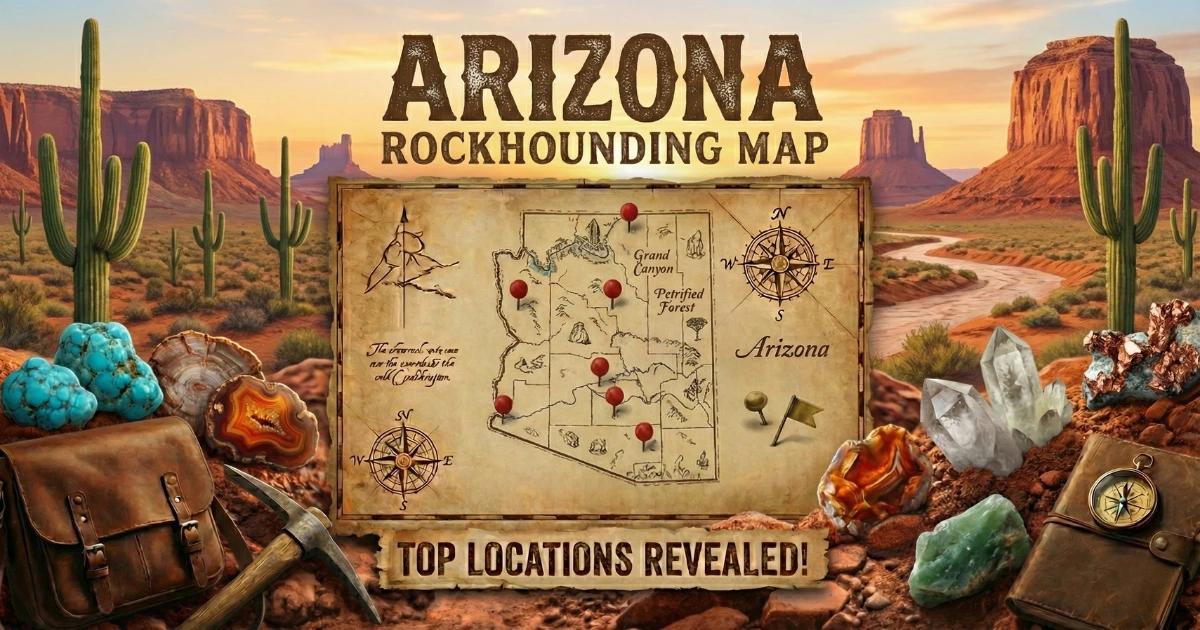

Arizona sits on some of the most geologically active ground in North America. Tertiary volcanism, Laramide-age copper porphyry systems, and Precambrian basement rocks have loaded this state with gem minerals that you can actually go out and collect. Fire agate, turquoise, peridot, chrysocolla, malachite, azurite, amethyst, petrified wood, agate, jasper, and placer gold all come out of Arizona dirt. Around 12 million acres of BLM-administered public land means a significant percentage of the state is open to casual collecting under federal regulations. That combination of mineral diversity and public access makes Arizona one of the top gem-hunting destinations in the country.
This guide covers the geology that put those gems here, the specific locations where you can find them, field identification methods, the tools you need, and the legal framework you must follow.
Geology: Why Arizona Has So Many Gems
The gem minerals in Arizona did not end up here by accident. They are direct products of the state's geologic history, and understanding that history tells you where to look and what to expect in the field.
Start with the basement. The oldest exposed rocks in Arizona are Proterozoic schists and granites visible at the bottom of the Grand Canyon and scattered across the central highlands. These rocks, roughly 1.7 billion years old, provided the structural framework for everything that followed. During the Late Cretaceous and early Tertiary (the Laramide orogeny, about 80 to 40 million years ago), subduction of the Farallon Plate beneath western North America drove magmatic intrusions upward through that old crust. Those intrusions created the porphyry copper deposits that define Arizona's mining history. As hot, metal-rich fluids rose through fractures and cooled, they deposited copper along with secondary minerals: azurite (a deep blue copper carbonate), malachite (green copper carbonate), and chrysocolla (a hydrated copper silicate). The copper belt running from Bisbee through Morenci, Globe-Miami, Ray, and Ajo is the surface expression of this process.
A second major chapter opened during the mid-Tertiary, roughly 25 to 15 million years ago, when Basin and Range extension thinned the crust and triggered widespread volcanism. Rhyolitic and basaltic eruptions blanketed much of southern and western Arizona. Fire agate formed during this period. As silica-rich hydrothermal fluids moved through cavities in volcanic host rock, thin layers of iron oxide (limonite and goethite) were deposited between layers of chalcedony. That layered structure is what produces the iridescent play of color in fire agate. The same volcanic episode created the basalt flows that carry peridot (gem-quality olivine) as mantle xenoliths at Peridot Mesa on the San Carlos Apache Reservation.
Turquoise formation is tied to the weathering of copper-bearing rocks in arid conditions. When acidic surface waters percolate through copper sulfide deposits in the presence of aluminum-bearing clays, the resulting chemical reactions precipitate turquoise (a hydrated copper-aluminum phosphate). Arizona's dry climate slowed erosion enough to preserve turquoise veins near the surface in locations like Kingman, Sleeping Beauty (Globe), Bisbee, and Morenci.
Four Peaks amethyst comes from a different setting entirely. The amethyst occurs in quartz veins within Precambrian Mazatzal quartzite at elevations above 6,000 feet in the Four Peaks Wilderness. Iron impurities in the quartz lattice, combined with natural irradiation over geologic time, produce the purple color. This is one of only a few domestic sources of commercial-grade amethyst.
Petrified wood in northeastern Arizona formed during the Late Triassic, about 225 million years ago, when fallen conifers (primarily *Araucarioxylon arizonicum*) were buried in floodplain sediments. Silica dissolved from volcanic ash replaced the wood cell by cell, preserving the original structure in microcrystalline quartz. The Chinle Formation holds most of this material.
Collecting Locations: GPS, Land Status, and Target Minerals
Below are seven specific collecting areas. GPS coordinates are approximate center points for the general collecting zone. Always verify current land status with the managing agency before you go.
1. Saddle Mountain Fire Agate Area
GPS: 33.0833° N, 111.5000° W (Pinal County)
Land status: BLM (Safford Field Office)
Target minerals: Fire agate, chalcedony, common opal
Saddle Mountain, located east of Tonopah off Interstate 10, is one of Arizona's best-known fire agate sites. The agate occurs in seams within Tertiary rhyolite and andesite. Look for chalcedony veins in weathered volcanic rock, especially along washes and eroded hillsides. Some nodules show fire on fresh surfaces, but many require cutting to reveal the color layers. BLM casual collecting rules apply: hand tools only, no mechanized equipment, and a 25-pound-per-day reasonable quantity limit. The site gets heavy traffic from October through March.
2. Black Hills / Round Mountain Fire Agate
GPS: 33.3833° N, 111.5333° W (Maricopa County)
Land status: BLM (Phoenix District), some adjacent private claims
Target minerals: Fire agate, chalcedony, jasper
The Black Hills area north of the Gila River has produced gem-grade fire agate for decades. Material here occurs in similar Tertiary volcanic host rocks. The terrain is rough desert bajada, so high-clearance vehicles are recommended. Verify that you are on BLM land and not on active mining claims before digging. BLM casual collecting limits apply.
3. Kingman Turquoise District
GPS: 35.2000° N, 114.0500° W (Mohave County)
Land status: Private mining claims (primarily Colbaugh Processing / Kingman Turquoise Mine)
Target minerals: Turquoise, chrysocolla, copper oxides
Kingman turquoise is known for its high blue color with a black or brown matrix. The mines are on private claims and not open to public collecting. Rough and finished Kingman turquoise is available from authorized dealers at the Tucson Gem and Mineral Show and from mine operators directly. For a full treatment of Arizona turquoise, see our turquoise collecting guide.
4. Four Peaks Amethyst Mine
GPS: 33.7050° N, 111.3400° W (Maricopa County)
Land status: Private mining claim within the Four Peaks Wilderness (Tonto National Forest)
Target minerals: Amethyst, clear quartz, smoky quartz
The Four Peaks mine sits at about 7,000 feet in rugged terrain. It operates as a private claim within Wilderness boundaries, which means public access for collecting is not permitted. The mine produces some of the finest amethyst in North America: deep purple material with red flashes. Cut Four Peaks amethyst is available from dealers. The hike to the mine area alone is strenuous, approximately 6 miles one way with significant elevation gain.
5. Rich Hill / Lynx Creek Gold Placers
GPS: 34.3167° N, 112.4500° W (Yavapai County)
Land status: BLM (Prescott area) and Prescott National Forest, mixed with private claims
Target minerals: Placer gold, magnetite, garnet (as indicator minerals)
Rich Hill was the site of one of Arizona's earliest gold strikes in 1863. Lynx Creek, draining the south side of the Bradshaw Mountains, still produces fine placer gold for recreational panners. The Lynx Creek recreation area (managed by Prescott National Forest) allows gold panning with hand tools. No motorized suction dredges or sluice boxes are permitted. Gold occurs as fine flour and occasional small flakes in stream gravels. Work the inside bends and bedrock crevices. This is recreational panning; do not expect commercial quantities.
6. Petrified Forest Area (BLM Lands Adjacent to National Park)
GPS: 34.8500° N, 109.8000° W (Navajo/Apache Counties)
Land status: BLM land adjacent to Petrified Forest National Park boundary
Target minerals: Petrified wood, agate, jasper
Critical note: Collecting any material inside Petrified Forest National Park is a federal crime. No specimens, no small chips, nothing. However, BLM-administered land outside the park boundaries in the Chinle Formation still produces collectible petrified wood. BLM casual collecting allows up to 25 pounds per day plus one piece, not to exceed 250 pounds per year. The wood ranges from red and yellow (iron oxide staining) to black (manganese) and clear (pure silica replacement). Verify the land status at exact GPS coordinates using BLM Surface Management Agency maps before collecting.
7. Copper Basin Mine Dumps (Globe-Miami District)
GPS: 33.3950° N, 110.8600° W (Gila County)
Land status: Mixed private and BLM; verify access before visiting
Target minerals: Chrysocolla, malachite, azurite, cuprite, native copper
The Globe-Miami copper mining district has produced secondary copper minerals for over a century. Some old mine dumps on BLM land may be accessible, but many are on private claims or restricted by current mining operations. Chrysocolla in gem-grade botryoidal masses is the most commonly found collectible here. Malachite occurs as banded specimens and stalactitic growths. Azurite crystals of museum quality have historically come from Bisbee and the Morenci district, but those sites are not open to the public. Always contact the managing company or BLM office before entering any mine dump area.
Mineral Reference Table
| Mineral | Chemical Formula | Hardness (Mohs) | Color | Primary Arizona Locations |
|---|---|---|---|---|
| Fire agate | SiO₂ (with FeOOH layers) | 6.5 - 7 | Brown with iridescent play of color | Saddle Mountain, Black Hills, Round Mountain |
| Turquoise | CuAl₆(PO₄)₄(OH)₈·4H₂O | 5 - 6 | Sky blue to green-blue | Kingman, Sleeping Beauty, Bisbee, Morenci |
| Peridot (olivine) | (Mg,Fe)₂SiO₄ | 6.5 - 7 | Yellow-green to olive green | San Carlos Apache Reservation (Peridot Mesa) |
| Amethyst | SiO₂ (Fe³⁺ impurity) | 7 | Purple to violet | Four Peaks (Mazatzal Mountains) |
| Chrysocolla | (Cu,Al)₂H₂Si₂O₅(OH)₄·nH₂O | 2.5 - 3.5 | Blue-green to cyan | Globe-Miami, Ray, Morenci |
| Malachite | Cu₂CO₃(OH)₂ | 3.5 - 4 | Banded green | Bisbee, Morenci, Globe |
| Azurite | Cu₃(CO₃)₂(OH)₂ | 3.5 - 4 | Deep blue | Bisbee, Morenci |
| Petrified wood | SiO₂ (microcrystalline) | 6.5 - 7 | Variable (red, yellow, black, clear) | Chinle Formation, northeastern AZ |
| Wulfenite | PbMoO₄ | 2.5 - 3 | Orange to yellow-orange | Red Cloud Mine (Yuma County) |
Field Identification: How to Recognize Arizona Gems in the Dirt
Most of the gems you will find in Arizona do not look like gems when you first pick them up. Knowing what to look for in raw, weathered field specimens is the difference between walking past a good find and putting it in your pack.
Fire agate: In the field, fire agate occurs as nodules or seams of brown to reddish-brown chalcedony within volcanic host rock. The exterior is usually dull, rough, and unremarkable. To check for fire, wet the surface with water from your bottle and look for iridescent flashes of red, orange, green, or gold. The play of color is caused by thin-film interference in the iron oxide layers, and it is often visible only on freshly broken or wetted surfaces. Not every chalcedony nodule in a fire agate area will show fire. The ratio of duds to keepers can be high. Bring a spray bottle.
Turquoise: Look for blue to blue-green veinlets and nodules in weathered, iron-stained host rock. Raw turquoise in the field is often coated with clay or matrix rock and may appear as faint blue streaks rather than solid nuggets. Turquoise is softer than a steel knife blade (Mohs 5-6), so a scratch test on an inconspicuous spot can confirm. Do not confuse chrysocolla (Mohs 2.5-3.5, much softer, more glassy luster) with turquoise.
Chrysocolla vs. turquoise: This is the most common misidentification in Arizona. Both are blue-green copper minerals. Chrysocolla is significantly softer; you can scratch it with a copper penny. Turquoise will not scratch with a penny. Chrysocolla also tends to have a more vitreous (glassy) luster when fresh, while turquoise is waxy to sub-vitreous.
Petrified wood: Look for the characteristic wood grain structure. Even heavily silicified pieces usually preserve bark texture, growth rings, or cell structure visible with a hand lens. Petrified wood is heavy for its size (silica density) and will not scratch with a steel blade (Mohs 7). In the Chinle Formation, it weathers out of soft mudstone and is often found as loose float on the surface.
Placer gold: Gold is heavy (specific gravity 19.3), malleable, and stays bright yellow when flattened with a hammer. Iron pyrite ("fool's gold") is lighter, brittle (it shatters when struck), and has a brassy rather than yellow color. Mica flakes are lightweight and blow away with a breath. If it stays in the bottom of your pan after vigorous washing, and it flattens under pressure, it is gold.
Tools and Equipment
The desert will break cheap tools and punish bad preparation. Here is what to bring:
- Rock hammer (3 lb geology pick): Estwing or equivalent. The flat end is for splitting, the pick end is for prying seams.
- Cold chisels: A set of 3/4-inch and 1-inch chisels for working fire agate out of host rock without damaging the fire layer.
- Pry bars: A short 18-inch pry bar for levering rocks and opening seams in volcanic outcrops.
- Hand lens (10x loupe): For examining crystal structure, wood grain in petrified wood, and fire layers in agate.
- Spray bottle: Essential for fire agate identification. Wetting a surface reveals colors invisible when dry.
- Gold pan (14-inch): For Lynx Creek and other placer sites. Black plastic pans show fine gold better than green.
- Classifying screens: 1/4-inch and 1/8-inch mesh for sorting gravel before panning.
- Wrapping material: Newspaper, bubble wrap, or old t-shirts for protecting specimens in your pack.
- GPS unit or phone with offline maps: Cell service is unreliable in most Arizona collecting areas. Download BLM Surface Management Agency maps before you leave.
- Water: A minimum of one gallon per person per day. Two gallons if you are digging. This is not optional. People die from dehydration in the Arizona desert every year.
- Sun protection: Wide-brimmed hat, long sleeves, sunscreen. Ground surface temperatures in the Sonoran Desert can exceed 160°F in summer.
- Snake gaiters or high boots: Western diamondback rattlesnakes are common in every Arizona collecting area. They are active March through October. Watch where you place your hands and feet, especially around rock piles.
Legal Framework for Collecting in Arizona
Arizona's land ownership is a patchwork of federal, state, tribal, and private land. The legal rules change depending on which type of land you are standing on.
BLM land (~12 million acres in Arizona): Casual collecting of rocks, minerals, gemstones, and reasonable quantities of petrified wood is permitted under 43 CFR 8365. Limits: 25 pounds per day plus one piece, not to exceed 250 pounds per calendar year. Hand tools only. No explosives, no mechanized equipment. You may not collect for commercial resale under casual collecting rules; commercial operations require a permit or mining claim.
National Forest land: Generally open to casual mineral collecting with hand tools. Specific forests (like Tonto or Prescott) may have additional restrictions. Motorized equipment for mineral extraction is typically prohibited without a Plan of Operations. Check with the local Ranger District.
National Parks and Monuments: No collecting of any kind. This includes Petrified Forest National Park, Grand Canyon National Park, and all other NPS units. Violators face federal fines up to $5,000 and potential imprisonment. Rangers actively patrol and inspect vehicles.
State Trust Land (9.3 million acres): Requires a recreational permit from the Arizona State Land Department. Permits cost $15/year for individuals. Mineral collecting is allowed with a permit, but commercial operations require a separate lease.
Tribal land: All tribal land is sovereign territory. You need explicit permission from the tribal government to enter, and collecting is generally prohibited. Peridot from the San Carlos Apache Reservation is available only through authorized tribal dealers. Do not enter the reservation to collect without tribal authorization.
Private land and mining claims: Most active and historic mine sites in Arizona are on patented or unpatented mining claims. Trespassing on a mining claim is illegal. Always verify claim boundaries using BLM LR2000 records or the BLM Mining Claims mapper before you dig anywhere.
Heat advisories: This is not a legal issue, but it will determine your collecting season. The National Weather Service issues Excessive Heat Warnings for southern Arizona routinely from June through September when temperatures exceed 110°F. Plan all field work for October through April. If you must go in summer, start before dawn and be off the ground by 10 a.m.
Arizona Rockhounding Map
Use our interactive map below to find gem hunting and rockhounding locations across Arizona. The map includes BLM collecting areas, fee-dig sites, and mineral districts referenced in this guide.
View the full Arizona rockhounding map here.
Related reading: