
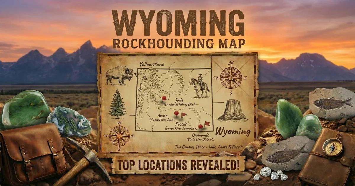
Why Wyoming Works for Geode and Agate Hunters
About half of Wyoming is managed by the Bureau of Land Management or the U.S. Forest Service. That is an enormous amount of open ground where casual mineral collecting is legal without a permit. The state straddles two geological provinces that matter to geode hunters: the Absaroka volcanic field in the northwest and the wind-swept basins of central Wyoming, where Tertiary volcanic ash beds have been releasing agates and nodules into stream gravel for millions of years.
Wyoming is not a classic "geode state" in the way Iowa or Missouri are. You will not find spherical, hollow quartz geodes scattered in every creek. What you will find are Sweetwater agates — some with hollow, druzy-lined cavities — thundereggs from Eocene rhyolite, and occasional quartz-lined nodules eroded from volcanic tuffs. The specimens tend to be tough, desert-polished, and worth the drive.
Geology Behind Wyoming's Geodes and Agates
Wyoming's geode-producing geology falls into two categories. The first is the Absaroka Volcanic Supergroup in the northwest corner of the state. During the Eocene epoch, roughly 50 to 38 million years ago, volcanic activity built a thick pile of andesite, basalt, and rhyolite flows, breccias, and ash deposits across what is now the Absaroka Range. Gas cavities in these flows filled with chalcedony, quartz, and opal over time. Some cavities filled only partially, leaving hollow interiors lined with druzy quartz crystals — these are the thundereggs and geodes of northwest Wyoming.
The second geological engine is the Tertiary-age tuffaceous sediments blanketing central Wyoming's basins. The Sweetwater agate field in Fremont County owes its existence to volcanic ash that was deposited in ancient lake and river systems. Silica leached from the ash cemented into nodules and agates within the sediment. Erosion has been liberating these agates into the modern drainage of the Sweetwater River and its tributaries for thousands of years. Some Sweetwater agates have tiny central cavities with quartz crystal linings — technically making them agatized geodes.
Top Collecting Locations
1. Sweetwater Agate Areas — Fremont County
GPS (general area): 42.49°N, 108.83°W (along Sweetwater River south of Riverton)
Land status: BLM public land
Vehicle: High-clearance recommended; 4WD for spur roads off the main gravel
The Sweetwater agate field stretches along the Sweetwater River between Riverton and South Pass City. These agates are Wyoming's signature collectible — fortification agates with concentric banding in cream, tan, rust, and amber tones. The best specimens show tight, sharply defined banding. Some have hollow centers with small druzy quartz clusters. They weather out of Tertiary volcanic ash beds and accumulate in stream gravel and on exposed desert pavement.
Work the gravel terraces above the modern river channel. Agates concentrate where wind has deflated the finer sediment, leaving a lag surface of heavier cobbles. After rain, freshly exposed agates are easier to spot. The material ranges from marble-size to fist-size, occasionally larger.
2. Absaroka Mountains — Park County
GPS (general area): 44.37°N, 109.38°W (Meeteetse area, Shoshone NF)
Land status: Shoshone National Forest and BLM
Vehicle: High-clearance 4WD required for backcountry forest roads
The Absaroka Volcanic Province holds Eocene-age flows and breccias that produce thundereggs, agate nodules, and occasional geodes with open crystal-lined cavities. The collecting zone runs roughly from Cody south through Meeteetse and into the upper Greybull River drainage. Thundereggs here tend to have chalcedony or moss agate interiors; a smaller percentage are hollow with quartz druzy.
The terrain is steep, timbered, and remote. Roads climb from the Bighorn Basin into the range and deteriorate quickly. Snow closes most access from November through May. This is also grizzly bear habitat — carry bear spray and make noise on the trail.
Critical note: Yellowstone National Park borders this collecting area to the west. Collecting of any kind — rocks, minerals, fossils — is strictly prohibited inside Yellowstone. Verify your position on a GPS or map before picking anything up. The park boundary is not always marked on the ground.
3. Copper Mountain Area — Fremont County
GPS (general area): 42.60°N, 108.50°W (south of Riverton)
Land status: BLM public land
Vehicle: High-clearance recommended
South of Riverton, the Copper Mountain area exposes volcanic terrain that produces small quartz geodes and agate nodules. The host rock is a Tertiary-age tuff and agglomerate. Nodules weather free from the soft matrix and collect in washes. Most specimens are 1 to 3 inches across. Some are solid agate; others are partially hollow with quartz crystal linings. BLM land is open for casual collecting. Bring a rock hammer and a small digging tool to work the softer matrix exposures.
4. Thermopolis Area — Hot Springs County
GPS (general area): 43.65°N, 108.20°W
Land status: BLM and private (verify boundaries)
Vehicle: High-clearance for BLM spur roads
The hills surrounding Thermopolis expose Mesozoic and Tertiary sediments that produce scattered agate and jasper nodules. The Bighorn River gravel bars downstream of town contain water-worn agates transported from volcanic source rocks upstream. Some collectors report small geodes from the volcanic tuff exposures east of town. This is mixed land-ownership territory — carry a BLM surface management map and stay on public land.
5. South Pass — Fremont County
GPS (general area): 42.46°N, 108.80°W
Land status: BLM public land
Vehicle: High-clearance; 4WD for side roads
The historic South Pass mining district south of Lander sits on a mix of Precambrian metamorphic rocks and overlying Tertiary sediments. The area is best known for gold, but collectors have found agate nodules and occasional small quartz geodes in the volcanic sediments. The exposed ridges and washes above the old mining roads are worth walking slowly with your eyes on the ground. BLM land is extensive here, and summer access is straightforward.
What You Will Find: Wyoming Specimens
| Specimen Type | Typical Size | Common Interior | Where Found |
|---|---|---|---|
| Sweetwater agate | 1–4 inches | Fortification banding, occasional druzy center | Fremont Co. river gravel |
| Absaroka thunderegg | 2–6 inches | Chalcedony, moss agate, quartz druzy | Park Co. volcanic terrain |
| Quartz geode (small) | 1–3 inches | Clear to milky quartz crystals | Copper Mountain, South Pass |
| Jasper nodule | 1–4 inches | Solid red-brown jasper | Thermopolis, basin surfaces |
| Petrified wood | Variable | Silicified wood, sometimes with druzy cavities | Scattered across BLM land |
How to Identify Geodes and Agates in the Field
Sweetwater agates are translucent when held up to sunlight. On a bright day, cup the stone in your hands and look for light passing through the edges. Banded agates show concentric rings in cross-section. If the agate feels lighter than expected for its size, tap it gently against another rock — a hollow sound suggests a crystal-lined cavity inside.
Thundereggs look like lumpy, dull-gray or brown volcanic rock on the outside. The exterior gives no hint of what is inside. Size, weight, and a slightly rounded shape are your best clues. If the specimen feels heavy and dense relative to a similar-sized piece of tuff, it is likely solid chalcedony. If it feels lighter, it may be hollow. The only sure test is cutting or cracking it open.
Quartz geodes in Wyoming tend to be small — 1 to 3 inches. They have a rough, knobby exterior shell of silicified tuff or chalcedony. Shake them gently near your ear; loose crystal fragments or sediment inside sometimes rattle.
Recommended Tools and Gear
- Rock hammer (flat/chisel head): For testing specimens and breaking open thundereggs in the field
- Small shovel or mattock: For digging nodules from soft tuff matrix at Copper Mountain and Absaroka sites
- 5-gallon bucket: For carrying specimens back to your vehicle
- Spray bottle: Wetting agates in the field makes banding visible instantly
- GPS unit or phone with offline maps: Cell service is nonexistent in most Wyoming backcountry
- Bear spray: Mandatory in the Absarokas and recommended anywhere in western Wyoming
- Extra water and fuel: Distances between services are long. Plan accordingly.
- BLM surface management maps: Available from the BLM office in Lander or Cody. These show land ownership boundaries.
Legal Rules and Land Access
- BLM casual collecting: 25 pounds per day plus one piece, not to exceed 250 pounds per year. Non-commercial, personal use only. No permit required.
- National Forest: Shoshone National Forest allows personal mineral collecting. No commercial collecting without a permit from the Forest Supervisor.
- Yellowstone National Park: All collecting is strictly prohibited. No exceptions. This includes loose rocks on the ground.
- Private land: Some collecting areas are checkerboarded with state and private parcels. Always verify ownership before collecting. Trespassing laws are enforced.
- State land: Wyoming state trust lands generally require a recreational access permit. Check with the Office of State Lands and Investments.
- Best season: June through October. Most backcountry roads close by late November and do not reopen until late May or June depending on snowpack.
Planning Your Trip
Base yourself in Riverton or Lander for the Sweetwater agate field, Copper Mountain, and South Pass. Both towns have motels, fuel, and supplies. For the Absarokas, Cody and Meeteetse are the logical staging points. The BLM field offices in Lander (Wind River/Sweetwater Field Office) and Cody (Cody Field Office) can provide current road conditions and surface management maps.
Wyoming's collecting areas are spread out. Budget a full day per location, and do not underestimate travel time on gravel and dirt roads. The reward for the effort is uncrowded, productive collecting on some of the most open public land in the Lower 48.
See our Wyoming rockhounding map for GPS coordinates and additional collecting locations.