
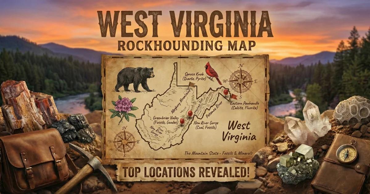
West Virginia Geology and Geode Formation
West Virginia is built almost entirely on Paleozoic sedimentary rock — sandstone, shale, limestone, and coal measures folded and faulted during the Appalachian orogeny roughly 300 million years ago. The state sits on the western flank of the Appalachian fold belt, where these sedimentary layers tilt gently westward from the high ridges of the Allegheny Mountains toward the Ohio River valley.
Geodes in West Virginia form in two primary host formations. The Greenbrier Limestone (Mississippian age, roughly 340 million years old) is the most productive. This thick carbonate unit crops out across the eastern mountain counties and contains small quartz and calcite geodes that weather free from the dissolving limestone. The second source is the Devonian-age shales and limestones in the eastern panhandle and Potomac Highlands, which produce smaller geodes and crystal-lined concretions.
West Virginia geodes are modest compared to Midwest Keokuk geodes. Most range from one to four inches in diameter. But the combination of extensive public land in the Monongahela National Forest and the thousands of creek miles cutting through geode-bearing rock makes this state a reliable collecting destination for patient hunters.
Where to Collect
1. Greenbrier River Drainage (Greenbrier and Pocahontas Counties)
GPS (general area): 38.15°N, 80.30°W
Land status: Monongahela National Forest — personal mineral collecting permitted
Vehicle: 2WD for main roads; AWD for forest service roads
The Greenbrier River and its tributaries cut directly through the Greenbrier Limestone across a broad area of the eastern mountains. This is West Virginia's most productive geode terrain. The limestone dissolves slowly, releasing embedded geodes into the creek gravel. Walk the gravel bars at low water and scan for round, heavy stones that contrast with the flat limestone slabs surrounding them.
The Greenbrier River Trail — a 78-mile rail-trail — parallels the river and provides easy foot access to long stretches of riverbank. Side creeks entering the river from the east (draining the Allegheny ridges) are especially productive because they cut fresh exposures in the limestone with each spring flood. Knapp Creek, Deer Creek, and Sitlington Creek are all worth checking where they cross National Forest land.
2. Cranberry River / Williams River Area (Webster and Pocahontas Counties)
GPS (general area): 38.30°N, 80.45°W
Land status: Monongahela National Forest
Vehicle: AWD recommended — forest roads are rough and steep
The Cranberry Wilderness and surrounding National Forest land exposes Mississippian and Devonian formations along steep creek valleys. The Cranberry River and Williams River drainages contain gravel bars with small quartz geodes, calcite-lined concretions, and occasional siderite nodules. The terrain is rugged — deep valleys with heavy forest cover and limited road access. This area rewards collectors willing to hike in on forest trails.
Note: The Cranberry Wilderness itself (designated federal wilderness area) prohibits mechanized access and most collecting activities. Stay on National Forest land outside the wilderness boundary for legal collecting.
3. Ohio River Valley Streams (Mason, Cabell, and Wayne Counties)
GPS (general area): 38.42°N, 82.10°W
Land status: Public waterways; surrounding land mostly private
Vehicle: 2WD
Streams draining the western slope of West Virginia into the Ohio River cut through Pennsylvanian and upper Mississippian formations. The gravel in Mud River, Twelve Pole Creek, and Guyandotte River tributaries contains geodes and crystal-lined concretions washed down from the limestone and shale layers upstream. Road cuts along US Route 60 and Interstate 64 in the Kanawha and Ohio River valleys also expose geode-bearing beds — though collecting from active highway rights-of-way requires caution and may be restricted.
Most land along these western streams is privately owned. The waterways themselves are public, but access points are limited. Use public bridge crossings, boat ramps, and designated fishing access areas to reach the gravel bars.
4. Canaan Valley / Blackwater River (Tucker County)
GPS (general area): 39.05°N, 79.45°W
Land status: Monongahela National Forest and Canaan Valley State Park (no collecting in state park)
Vehicle: AWD recommended
The high-elevation plateau around Canaan Valley (3,200+ feet) exposes Devonian and Mississippian sandstones and shales with scattered quartz vugs and small geodes. The Blackwater River cuts a deep canyon (Blackwater Falls) through these formations. Creek gravel in the upper Blackwater drainage on National Forest land contains occasional crystal-lined specimens. The terrain is cold, wet, and rugged — this is some of the most remote country in the eastern US.
Do not collect within Canaan Valley Resort State Park or Blackwater Falls State Park boundaries. National Forest land adjacent to these parks is open for personal collecting.
5. Smoke Hole Canyon (Pendleton County)
GPS (general area): 38.85°N, 79.25°W
Land status: Monongahela National Forest
Vehicle: AWD — the road through Smoke Hole is narrow, unpaved, and steep
Smoke Hole Canyon is a deep gorge cut by the South Branch of the Potomac River through folded Devonian and Silurian limestones. The exposed limestone beds contain small geodes, calcite-lined vugs, and fossil-bearing nodules. The canyon walls show cross-sections of geode-bearing beds in places. Creek gravel along the South Branch within the National Forest is collectible. The canyon road (Forest Road 79) is rough but passable for high-clearance vehicles in dry conditions.
Specimens You Can Expect
| Specimen | Formation / Source | Typical Size | Notes |
|---|---|---|---|
| Quartz druzy geodes | Greenbrier Limestone | 1–4 inches | Clear to milky druzy quartz lining; most common type |
| Calcite geodes | Greenbrier and Devonian limestones | 1–3 inches | Calcite crystal clusters inside; sometimes dog-tooth spar |
| Siderite concretions | Mississippian shales | 2–6 inches | Iron carbonate nodules; sometimes hollow with crystal centers |
| Fossil-bearing nodules | Devonian shales | 1–4 inches | May contain brachiopods, bryozoans, or crinoid fragments |
| Quartz vugs | Sandstone and shale contacts | 0.5–2 inches | Small crystal-lined pockets in fractured sandstone |
Field Identification Tips
West Virginia geodes from the Greenbrier Limestone have a distinctive appearance in creek gravel. They are roughly spherical to oblate, with a chalky gray-white rind that feels grittier than the surrounding flat limestone cobbles. They are heavier than they look because of the quartz or calcite crystal mass inside. Tap two together — a hollow sound means a crystal-lined interior. A solid thud means a solid quartz or calcite fill (still potentially interesting, but less dramatic when cracked).
Calcite-filled geodes tend to be lighter in color and slightly translucent at thin edges. Quartz-filled geodes are opaque and often have a faintly blue-gray chalcedony band visible where the rind is chipped. Do not confuse siderite concretions (rusty brown, very heavy) with geodes — concretions are usually solid iron carbonate without crystal interiors, though exceptions exist.
Tools and Gear
- Rock hammer (2–3 lb): For cracking geodes and testing suspect rocks
- Cold chisel: For splitting geodes more cleanly than a hammer alone
- Safety glasses: Quartz and calcite splinters are dangerous
- 5-gallon bucket: For hauling specimens out of creek valleys
- Wading boots or waterproof hiking boots: Mountain streams are cold year-round; the rocks are slippery
- Newspaper: For wrapping crystal specimens
- Topographic map or offline GPS: Cell coverage is unreliable in the Monongahela National Forest
- Rain gear: West Virginia mountain weather changes fast
Legal Notes and Access
- Monongahela National Forest: Personal mineral collecting with hand tools is permitted on National Forest land outside designated wilderness areas. The Cranberry Wilderness, Dolly Sods Wilderness, and Otter Creek Wilderness prohibit collecting. Check with the Greenbrier or Gauley Ranger Districts for specific regulations.
- State parks: Collecting rocks and minerals is prohibited in West Virginia state parks, including Canaan Valley, Blackwater Falls, and Droop Mountain.
- Private land: Most land in western West Virginia (Ohio River valley) is privately owned. Always get permission before crossing fences.
- Safety: West Virginia creek valleys are steep and heavily forested. Tell someone where you are going. Mountain streams rise quickly after rain — do not collect during or after storms. Watch for copperheads and timber rattlesnakes on rocky creek banks.
- Best season: Late June through October. Spring is too wet (high water, muddy roads). Winter brings ice and road closures in the mountains.
Browse our West Virginia rockhounding map for GPS coordinates and more locations.