
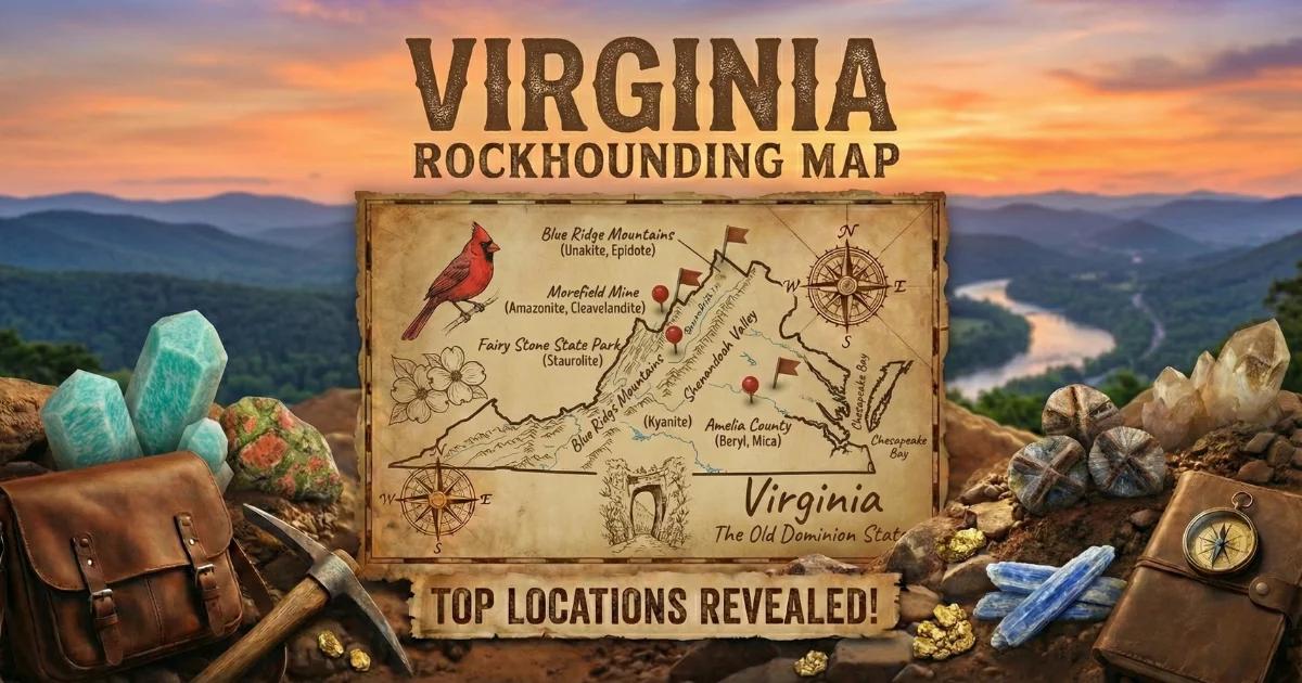
Virginia's Geological Provinces and Geode Sources
Virginia spans five geological provinces from east to west: the Coastal Plain, the Piedmont, the Blue Ridge, the Valley and Ridge, and the Appalachian Plateau. Each is built on different rock types, and each offers different collecting opportunities. For geode hunters specifically, the Valley and Ridge province is the most productive — its folded Paleozoic limestones contain small quartz and calcite geodes that weather into creek gravel. The Piedmont offers a different type of crystal hunting in pegmatite pockets, and the Blue Ridge contact zones produce quartz vugs in volcanic and metamorphic rock.
Virginia will not compete with Iowa or Missouri for classic sedimentary geodes, but it offers variety that most states cannot match. You can dig crystals from a pegmatite pocket at a fee-dig mine, walk creek gravel for limestone geodes in the Shenandoah Valley, and hunt quartz vugs in Blue Ridge basalt — all within a two-hour drive.
Where to Collect
1. Morefield Gem Mine (Amelia County — Piedmont)
GPS: 37.35°N, 78.13°W
Land status: Private — fee-dig operation (check current hours and fees)
Vehicle: 2WD
The Morefield Mine is a historic pegmatite operation in Amelia County that has operated as a fee-dig collecting site for decades. The pegmatite here produced commercial feldspar and mica during its mining days. For collectors, the dump material and exposed pegmatite faces contain crystal-lined pockets — cavities in the coarse-grained rock filled with well-formed crystals of amazonite (green microcline feldspar), smoky quartz, topaz, garnet, and fluorapatite.
These pegmatite pockets function like geodes — you break into the rock and find a hollow cavity lined with crystals. The difference is geological (igneous rather than sedimentary), but the collecting experience is identical. The mine provides tools and instruction for beginners. Experienced collectors can bring their own hammers and chisels to work the exposed rock faces.
The Morefield Mine is Virginia's most accessible crystal-hunting destination. It is family-friendly and does not require any geological knowledge to enjoy. Check their website or call ahead for seasonal hours and pricing.
2. Shenandoah Valley Creeks (Augusta and Rockingham Counties)
GPS (general area): 38.25°N, 79.10°W
Land status: Public waterways; George Washington National Forest (portions)
Vehicle: 2WD for valley roads; AWD for forest service roads
The broad limestone valleys between the Blue Ridge and the Allegheny Front are underlain by Ordovician, Silurian, and Devonian carbonate formations — hundreds of feet of limestone and dolomite that dissolve slowly over geological time. As the limestone weathers, embedded geodes and crystal-lined nodules are released into the creek gravel.
The Middle River, South River, and North River drainages in Augusta County are the most productive. Walk gravel bars at low water and scan for round, heavy stones. Virginia's valley geodes are small (typically one to three inches) and usually contain clear to milky quartz druzy or calcite crystals. Occasional specimens have dog-tooth calcite spar — elongated, pointed calcite crystals that are distinctive and collectible.
Where these streams cross George Washington National Forest land, personal mineral collecting with hand tools is permitted. In the valley itself, most surrounding land is private farmland. Stick to the waterway or get permission from landowners.
3. Loudoun County (Bull Run Mountains / Triassic Basin)
GPS (general area): 38.95°N, 77.65°W
Land status: Mixed — Bull Run Mountains Conservancy (check collecting policy), private land
Vehicle: 2WD
The Triassic basin in northern Virginia (the Culpeper Basin) contains diabase sills and basalt flows intruded into red sandstone and shale. The contact zones between the diabase and the surrounding sedimentary rock produce quartz and amethyst-bearing vugs. The Bull Run Mountains, which form the western boundary of the basin, expose these contact zones in creek cuts and road cuts.
Amethyst — pale to medium purple quartz — has been found in vugs within the diabase in Loudoun and Fauquier counties. The crystals are typically small (under an inch) but well-formed. Access is the primary challenge — much of this area is rapidly developing suburban land or private conservation easements. The Bull Run Mountains Conservancy manages a nature preserve that allows hiking but may restrict collecting. Check their current policies. Construction excavations and road cuts occasionally expose fresh material — with property owner permission, these can be productive.
4. Rockbridge County (Natural Bridge Area)
GPS (general area): 37.60°N, 79.55°W
Land status: George Washington National Forest (portions) and private
Vehicle: 2WD for main roads; AWD for forest roads
Rockbridge County sits in the Valley and Ridge province where Ordovician and Silurian limestones are folded into long, parallel ridges and valleys. The creek drainages — particularly the Maury River and its tributaries — cut through these carbonate formations and release geodes, calcite vugs, and crystal-lined concretions into the gravel. Some of the limestone layers here also contain fossil-bearing nodules with crinoid and brachiopod fragments.
National Forest land along the Allegheny ridges west of the valley floor provides the best public access. The James River Face Wilderness (no collecting in wilderness areas) and the surrounding non-wilderness National Forest are accessible from forest service roads off the Blue Ridge Parkway and US Route 501.
5. Floyd County (Blue Ridge Plateau)
GPS (general area): 36.90°N, 80.30°W
Land status: Mixed private and Jefferson National Forest parcels
Vehicle: 2WD for paved roads; AWD for forest roads
Floyd County sits on the Blue Ridge Plateau where metamorphic and igneous rocks are exposed in creek valleys. Quartz veins cutting through the gneiss and schist produce vugs and small crystal pockets. The Little River and its tributaries carry quartz-rich gravel with occasional crystal-bearing specimens. Jefferson National Forest parcels in the area permit personal mineral collecting. The area is less well known than the Shenandoah Valley sites, which means less competition.
Specimens You Can Expect
| Specimen | Province / Location | Typical Size | Notes |
|---|---|---|---|
| Quartz druzy geodes | Valley and Ridge limestone creeks | 1–3 inches | Clear to milky quartz lining; small but well-formed |
| Calcite geodes (dog-tooth spar) | Valley and Ridge creeks | 1–3 inches | Elongated calcite crystals; distinctive pointed terminations |
| Amazonite | Morefield Mine, Amelia County | 0.5–4 inches | Green microcline feldspar; pegmatite pockets |
| Smoky quartz | Morefield Mine; Blue Ridge creeks | 0.5–3 inches | Pale gray to dark brown; pegmatite and vein sources |
| Amethyst vugs | Loudoun/Fauquier County diabase | 0.5–1 inch | Pale to medium purple quartz in contact zone cavities |
| Topaz | Morefield Mine | 0.25–1 inch | Colorless to pale blue; small but genuine crystals |
| Garnet (almandine) | Blue Ridge and Piedmont creeks | 0.25–0.75 inch | Dark red dodecahedra in metamorphic gravel |
Field Identification Tips
In the Shenandoah Valley, geodes in creek gravel look like round to oval stones with a chalky, slightly rough rind that contrasts with the flat, angular limestone slabs around them. They are heavier than plain limestone cobbles of the same size because of the crystal mass inside. Pick up round stones and compare their weight — the heavy ones are worth cracking.
At the Morefield Mine, pegmatite pockets are identified by a transition from solid, intergrown feldspar and quartz to open cavities with crystal faces pointing inward. The pocket walls are often stained red-brown from iron oxide. When you see this color change, slow down and work carefully with a chisel — the crystals inside are fragile.
For the Loudoun County amethyst, look for fresh basalt or diabase road cuts where the rock has a greenish-gray color with scattered cavities. The cavities may contain quartz or amethyst crystals. Weathered surfaces are less productive — the crystals fall out and are lost in soil.
Tools and Gear
- Rock hammer (2–3 lb): For cracking geodes and testing creek gravel
- Cold chisel set: For working pegmatite pockets at Morefield Mine
- Safety glasses: Mandatory when hammering any rock
- 5-gallon bucket: For creek collecting and hauling specimens
- Wading boots: Valley creeks have rocky, slippery bottoms
- Newspaper or bubble wrap: For wrapping crystal specimens
- Hand lens (10x): For examining small crystals in vugs and pockets
- Topographic map or offline GPS: For navigating National Forest boundaries
Legal Notes and Access
- George Washington and Jefferson National Forests: Personal mineral collecting with hand tools is permitted outside designated wilderness areas. Power tools, explosives, and vehicular off-road access are prohibited. Check with the local Ranger District for area-specific closures.
- Shenandoah National Park: All rock and mineral collecting is prohibited. Do not confuse the Shenandoah Valley (where collecting is possible) with Shenandoah National Park (where it is not).
- Blue Ridge Parkway: Collecting is prohibited within the Parkway corridor.
- Private land: Much of Virginia's most productive geology is on private farmland, especially in the Shenandoah Valley and Piedmont. Always get permission.
- Best season: April through November. Valley creeks are best in late summer and fall at low water. The Morefield Mine operates seasonally — check their schedule before driving.
Find locations on our Virginia rockhounding map for GPS coordinates and more collecting sites.