
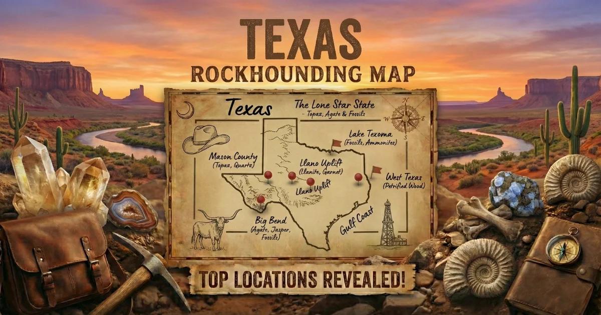
Texas Has Two Geode-Producing Provinces
Texas covers 268,000 square miles, and its geology spans a billion years from Precambrian basement to Quaternary alluvium. For geode hunters, two distinct provinces matter. West Texas — the Trans-Pecos volcanic province around Big Bend — produces agate and quartz geodes in Tertiary-age rhyolite, tuff, and basalt. Central Texas — the Edwards Plateau, locally called the Hill Country — produces small quartz geodes and chalcedony nodules from Cretaceous-age limestone. A third area, the Rio Grande gravel bars in South Texas, produces tumbled agate nodules eroded from volcanic formations upstream.
The Trans-Pecos geodes formed the same way Arizona and New Mexico volcanic geodes did: gas bubbles in cooling lava became hollow cavities, and silica-rich groundwater filled them with quartz, chalcedony, and agate over millions of years. The Hill Country geodes formed differently — they are the product of silica replacement of carbonate nodules and fossils in marine limestone, a process similar to the Keokuk geode formation in the Midwest.
Access is the challenge in Texas. The state has almost no public land compared to western states. BLM manages only a small amount of land in the Trans-Pecos, and most of the Hill Country is private ranch land. Fee-dig operations, ranch access by permission, and creek-bed collecting are the primary options.
Top Collecting Locations
1. Woodward Ranch — Brewster County (Trans-Pecos)
GPS: 30.28°N, 103.78°W (ranch entrance area, approximately)
Land status: Private fee-dig operation
Fee: Varies — contact the ranch for current pricing
Vehicle: High-clearance recommended on ranch roads
Nearest town: Alpine (approximately 16 miles north on TX-118)
Woodward Ranch is a legendary rockhounding destination and the most accessible collecting site in the Trans-Pecos. The ranch has been open to fee-dig collectors for decades, offering access to volcanic terrain that produces agate, jasper, and geodes. The ranch's specialties are red plume agate and bouquet agate — collector-grade material that commands premium prices when cut and polished.
Geodes with quartz and chalcedony fill occur alongside the agate deposits in rhyolite and tuff formations. The ranch provides maps showing different collecting areas and the types of material found in each. Some areas require hiking; others are accessible by vehicle. Open seasonally — call ahead to confirm dates and fees. This is working ranch land, so follow the rules and close all gates behind you.
2. BLM Land South of Alpine — Brewster County
GPS: 29.85°N, 103.60°W (general BLM area south of Alpine)
Land status: BLM (public)
Vehicle: High-clearance 4WD required for most access roads
Nearest town: Alpine
The volcanic terrain between Alpine and Lajitas includes scattered BLM parcels where casual collecting is permitted. The rhyolite and tuff formations here produce geodes, agate, and jasper similar to what you find at Woodward Ranch. The BLM parcels are not well-marked on the ground — use BLM maps or apps like OnX to verify land boundaries before collecting. Standard BLM casual collecting rules apply: 25 pounds per day plus one piece.
Do NOT collect inside Big Bend National Park. The park boundary is strictly enforced, and removing any natural object — including rocks — is a federal offense under 36 CFR 2.1. The fine can exceed $5,000, and rangers actively patrol for violations.
3. Stillwell Ranch — Brewster County
GPS: 29.55°N, 103.05°W (general ranch area)
Land status: Private — fee-dig and guided access
Fee: Varies; contact the ranch
Vehicle: High-clearance required
Nearest town: Alpine (80+ miles)
The Stillwell Ranch east of Big Bend National Park offers rockhounding access on private volcanic terrain. The ranch produces agate nodules, geodes, and petrified wood from the Tertiary volcanic formations. This is remote country — services are nonexistent between the ranch and Alpine. Carry extra fuel, water, food, and a spare tire. The remoteness is part of the experience, and the lack of collecting pressure means better surface finds.
4. Edwards Plateau — Mason and Llano Counties (Hill Country)
GPS: 30.75°N, 99.23°W (general Mason area)
Land status: Mostly private ranch land; public access via creek beds
Vehicle: 2WD for paved access points
Nearest town: Mason or Llano
The Cretaceous limestone of the Edwards Plateau produces small geodes (1 to 4 inches) with quartz druzy interiors. Creek gravel in the Llano River, Pedernales River, James River, and their tributaries is where you find them. The geodes are smaller than the Trans-Pecos specimens but the collecting is easier — walk the creek gravel at low water and pick up round, heavy stones.
Most of the Hill Country is private ranch land. Some ranchers allow collecting with permission; a few charge access fees. Ask at local rock shops in Mason or Llano for current information on which ranches allow access. The Mason area is also famous for blue topaz — the Texas state gemstone — found in stream gravel, so you may pick up topaz along with your geodes.
5. Rio Grande Gravel — Webb and Zapata Counties (South Texas)
GPS: 27.50°N, 99.50°W (general area south of Laredo)
Land status: Public waterway (the river); private ranch land (the banks)
Vehicle: 2WD to access points
Nearest town: Laredo
The Rio Grande gravel downstream from Laredo contains agate-filled nodules eroded from volcanic formations upstream in Mexico and West Texas. These are typically solid agate nodules rather than hollow crystal-lined geodes, but occasional hollow specimens occur. The agates come in a range of colors — red, amber, gray, and banded — and take an excellent polish.
Access to the river gravel bars can be complicated. Much of the river bank is private ranch land, and border security operations restrict access in some areas. Research public access points before visiting and carry identification. Do not cross to the Mexican side of the river.
Specimens You Can Find
| Mineral/Material | Region | Occurrence | Notes |
|---|---|---|---|
| Quartz druzy (clear/milky) | Both | Common | Lines the interior of geodes from both provinces |
| Chalcedony | Trans-Pecos | Very common | Blue-gray to white; shell and fill material |
| Red plume agate | Trans-Pecos (Woodward) | Common at ranch | Red dendritic plumes in clear chalcedony; collector-grade |
| Bouquet agate | Trans-Pecos (Woodward) | Common at ranch | Flower-like mineral inclusions in agate |
| Banded agate | Trans-Pecos, South TX | Common | Concentric banding; polishes well |
| Blue topaz | Hill Country (Mason) | Uncommon | Texas state gemstone; found in creek gravel |
| Jasper | Trans-Pecos | Common | Red, yellow, brown varieties |
| Petrified wood | Trans-Pecos | Uncommon | Silicified wood in volcanic formations |
| Calcite | Hill Country | Common | In limestone geodes; clear to amber crystals |
Recommended Tools and Gear
- Rock hammer (2-3 lb): For cracking geodes and extracting specimens from matrix.
- Chisels: Cold chisels in various widths for working specimens out of volcanic rock without shattering them.
- 5-gallon bucket: Line with newspaper for hauling specimens.
- Eye protection: Mandatory when hammering. Rhyolite and chert throw razor-sharp fragments.
- Water — 2+ gallons per person per day (Trans-Pecos): West Texas is unforgiving. Towns and gas stations are 50+ miles apart. Carry more water than you think you need.
- Full tank of gas and spare tire: Trans-Pecos roads are rough and long. A flat tire 60 miles from a gas station is routine.
- Offline GPS maps: Cell coverage is nonexistent across large portions of West Texas. Download detailed maps before leaving Alpine.
- Wading shoes (Hill Country): Creek gravel collecting means wet feet. Old sneakers or water sandals work.
- Diamond rock saw (at home): Agate nodules and thundereggs should be cut, not cracked, to show their best patterns.
Legal and Access Information
BLM land (Trans-Pecos): Casual collecting is permitted on BLM land under 43 CFR 8365. The limit is 25 pounds per day plus one piece. BLM parcels in the Trans-Pecos are scattered and not always well-marked — verify boundaries before collecting.
Big Bend National Park: Collecting is strictly prohibited. No rocks, minerals, fossils, or any natural objects may be removed from the park. This is federal law (36 CFR 2.1) and is actively enforced. Stay on the correct side of the park boundary.
Fee-dig ranches (Woodward, Stillwell, etc.): These are private operations on private land. Follow the ranch's rules, pay the fees, stay within designated collecting areas, and close all gates. Call ahead for current hours, fees, and seasonal availability.
Private ranch land (Hill Country): Texas has very little public land. Most Hill Country terrain is private. Trespassing is taken seriously — Texas law provides for criminal trespass charges even on unfenced land that is posted. Always ask permission. Many ranchers will say yes, especially if you offer to pick up litter or report fence damage.
Public waterways: In Texas, navigable waterways are public. You may wade and collect from the streambed of navigable rivers. The definition of "navigable" is legally complex and varies by river — when in doubt, ask locally or check with the Texas General Land Office.
Best Time to Go
October through April for West Texas. Summer temperatures in the Trans-Pecos regularly exceed 100 degrees F, and the exposed volcanic terrain offers no shade. Spring and fall are the best windows — daytime highs in the 70s and 80s make for comfortable collecting.
The Hill Country is accessible year-round, though summer can be hot (mid-90s) and winter creek levels may be too high after rain. Late summer through early fall, when the creeks are lowest, gives the best gravel bar exposure.
South Texas (Rio Grande) is best from November through March when temperatures are moderate and river levels are generally lower.
Explore our Texas rockhounding map for all locations.