
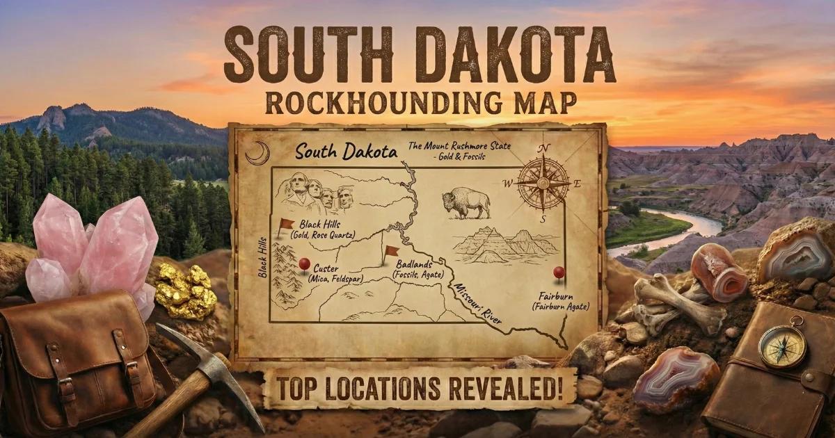
South Dakota's Geological Diversity
South Dakota packs an unusual amount of geological variety into a single state. The Black Hills in the southwest are a dome of Precambrian igneous and metamorphic rock — granites, schists, and pegmatites ranging from 1.7 to 2.5 billion years old — punched up through a thick sequence of Paleozoic and Mesozoic sedimentary rock. The Badlands to the east of the Black Hills expose Eocene and Oligocene-age volcaniclastic sediments — ancient volcanic ash deposits, river channel sandstones, and lake clays laid down between 37 and 28 million years ago. And the rest of western South Dakota is Great Plains prairie underlain by Cretaceous marine sediments.
This diversity means South Dakota does not produce a single type of geode. Instead, you get pegmatite crystal pockets in the Black Hills, chalcedony and agate nodules eroded from the Badlands formations, and Fairburn agates — the state's most famous collectible stone — scattered across the prairie gravel east and south of the Black Hills. None of these fit the narrow definition of a Keokuk-type geode, but the pegmatite pockets are crystal-lined cavities in every functional sense, and the chalcedony nodules from the Badlands region occasionally have hollow quartz-lined interiors.
The geological story that ties these deposits together is the Laramide Orogeny — the mountain-building event that uplifted the Black Hills dome roughly 70 to 40 million years ago — followed by tens of millions of years of erosion that stripped the sedimentary cover off the Precambrian core and spread the debris across the surrounding plains. The Fairburn agates that collectors hunt on the prairie today formed in Precambrian rock, were eroded out of the Black Hills uplift, and were redeposited in gravel beds across the Great Plains.
Top Collecting Sites
1. Fairburn Agate Hunting Grounds (Custer and Pennington Counties)
GPS: Approximately 43.65°N, 103.15°W (area south and east of Fairburn)
Land status: Mixed BLM, private ranch land, and Buffalo Gap National Grassland
Vehicle: High-clearance recommended for ranch and grassland roads
The Fairburn agate is South Dakota's premier collectible stone — a fortification agate with angular concentric banding in reds, oranges, yellows, and whites. These formed in Precambrian host rock within the Black Hills and were transported by erosion to gravel deposits on the surrounding prairie. The collecting area stretches from the town of Fairburn southeast through the French Creek drainage and into the Cheyenne River gravel system.
Finding a Fairburn agate requires patience and persistence. These are small stones — most are 1 to 3 inches — and they look like ordinary brown gravel when dry. After rain, the banding pattern becomes visible. Dedicated hunters walk freshly plowed fields, gravel roads, and exposed prairie ground after storms, scanning for the distinctive angular banding. Some collectors spend years searching before finding a high-quality specimen. The best time to hunt is early morning after rain, when the low sun angle and wet surface make patterns easier to spot.
BLM parcels and Buffalo Gap National Grassland units allow collecting. Private ranch land requires permission. Some ranchers charge informal access fees.
2. Black Hills Pegmatite Mines (Custer and Pennington Counties)
GPS: Approximately 43.77°N, 103.60°W (Custer/Hill City area)
Land status: Black Hills National Forest (portions); private mining claims
Vehicle: 2WD for paved roads; high-clearance for forest roads and mine access
The Black Hills contain some of the most mineralogically complex pegmatites in the world. The Harney Peak granite (now officially named Black Elk Peak granite) generated hundreds of pegmatite dikes during its emplacement roughly 1.7 billion years ago. These pegmatites host crystal-lined pockets — hollow vugs within the pegmatite body where quartz, feldspar, beryl (aquamarine, heliodor), tourmaline (black schorl and rare colored varieties), mica books, and other minerals grew freely in open space.
The Tip Top Mine, Peerless Mine, and other historic pegmatite operations in the Custer-Hill City area have produced museum-quality specimens. Current collecting opportunities are limited — most productive claims are privately held. Check with local rock shops in Hill City and Custer for information about fee-dig opportunities or guided collecting trips. Some claim holders offer occasional access. The Black Hills National Forest allows personal collecting of loose surface specimens on unclaimed National Forest land, but do not dig into pegmatite outcrops without verifying claim status.
3. Badlands Area Chalcedony Nodules (Pennington and Shannon Counties)
GPS: Approximately 43.75°N, 102.50°W (Scenic area, outside park boundaries)
Land status: Buffalo Gap National Grassland (collecting permitted on some units); Badlands National Park (collecting prohibited)
Vehicle: High-clearance for grassland roads; 2WD for paved highway access
The Oligocene-age White River Group sediments — the same formations that form the dramatic eroded spires of the Badlands — contain chalcedony and agate nodules. These formed in volcaniclastic sediments (ancient volcanic ash deposits) through the same silica replacement process that produces geodes in volcanic terrain elsewhere in the West. The nodules range from marble-sized to 3 inches and are typically chalcedony with occasional quartz-lined hollow centers.
The critical rule: Badlands National Park prohibits all mineral and fossil collecting. Federal law applies, and rangers enforce it. Collect only on adjacent Buffalo Gap National Grassland units and private land with permission. The grassland surrounds the park in a patchwork of federal, state, and private parcels — use the USDA Forest Service land status maps to identify which parcels are National Grassland before collecting. The grassland is managed by the Nebraska National Forest office, which oversees South Dakota's grassland units.
4. Teepee Canyon and Rockerville Area (Pennington County)
GPS: Approximately 43.88°N, 103.44°W
Land status: Black Hills National Forest; some private
Vehicle: High-clearance for forest roads
Teepee Canyon south of Rapid City is a well-known collecting area within the Black Hills National Forest. The stream gravel carries rose quartz, smoky quartz crystals, tourmaline, and occasional small geodes eroded from the surrounding pegmatites. Surface collecting from the creek channel and forest road cuts is the primary method. Rose quartz from this area ranges from pale pink to a deeper rose color, though most pieces are massive rather than crystallized. The National Forest designation means personal collecting is permitted — no permit needed for reasonable personal-use quantities.
Specimens You Can Expect to Find
| Specimen | Interior/Pattern | Typical Size | Where Found |
|---|---|---|---|
| Fairburn Agate | Angular fortification banding — red, orange, yellow, white (solid) | 0.5 - 3 inches | Prairie gravel south/east of Black Hills |
| Pegmatite Crystal Pocket | Quartz, feldspar, beryl, tourmaline, mica growing in open cavity | 2 - 10+ inches | Black Hills pegmatite mines |
| Chalcedony Nodule | Chalcedony, occasional druzy quartz center | 0.5 - 3 inches | Badlands area (National Grassland only) |
| Rose Quartz | Massive pink quartz (solid, no cavity) | 1 - 8 inches | Teepee Canyon, Black Hills stream gravel |
| Prairie Agate | Banded chalcedony — less distinctive than Fairburn | 1 - 3 inches | Gravel bars throughout western SD |
Recommended Tools and Gear
- Spray bottle: Essential for Fairburn agate hunting. Wet the ground as you scan — banding patterns are invisible when dry.
- Rock hammer (3 lb): For testing pegmatite outcrops and opening chalcedony nodules in the field.
- Shovel (short-handled): For digging in stream gravel and clearing overburden at pegmatite sites.
- Knee pads: Fairburn hunting means hours of bent-over walking or crawling across gravel.
- Wide-brimmed hat and sunscreen: The open prairie has zero shade. Sunburn is a real hazard from May through September.
- Water (1 gallon per person minimum): No water sources at most prairie and grassland collecting areas.
- GPS or offline maps: Cell service is patchy to nonexistent across western South Dakota. Do not rely on phone maps.
- Binoculars: Some Fairburn hunters use binoculars to scan plowed fields from the road edge, looking for stones that catch the light differently.
- Snake gaiters or high boots: Prairie rattlesnakes are present across western South Dakota from April through October.
Legal Rules and Access
Badlands National Park: Collecting of any rocks, minerals, fossils, or natural objects is strictly prohibited within Badlands National Park boundaries. This is federal land managed by the National Park Service. Violations carry significant fines. The park boundary is clearly marked — stay on the outside when collecting.
Buffalo Gap National Grassland: The USDA Forest Service manages Buffalo Gap National Grassland units, which surround Badlands National Park in a patchwork pattern. Personal collecting of rocks and minerals is permitted on National Grassland land. Verify land ownership before collecting — the checkerboard pattern of federal, state, and private land makes it easy to accidentally cross onto private or park land.
Black Hills National Forest: Personal collecting of minerals and rocks is permitted. Do not disturb active mining claims — check claim status with the BLM before digging at any pegmatite site. Surface collecting of loose material is generally unrestricted.
BLM Land: Casual collecting is permitted under standard BLM rules — 25 pounds per day plus one piece for personal use.
Private Ranch Land: Most of the Fairburn agate hunting ground is on private ranches. Get permission before entering. Some ranchers are welcoming; others have been burned by disrespectful collectors and will refuse. Leave gates as you find them, do not damage fences, and pick up your trash.
Best Season to Collect
Spring and fall are the best seasons. Summer heat on the open prairie is punishing — temperatures regularly exceed 100 degrees F with no shade. Winter brings sub-zero cold and snow that makes backcountry roads impassable. April through June and September through October offer moderate temperatures and the best road conditions.
For Fairburn agates specifically, collect after rain. The wet surface reveals banding patterns, and rain washes soil off exposed stones. Early morning light at a low angle is best for spotting the distinctive angular patterns.
Browse our South Dakota rockhounding map for GPS coordinates and access details on all collecting locations.