
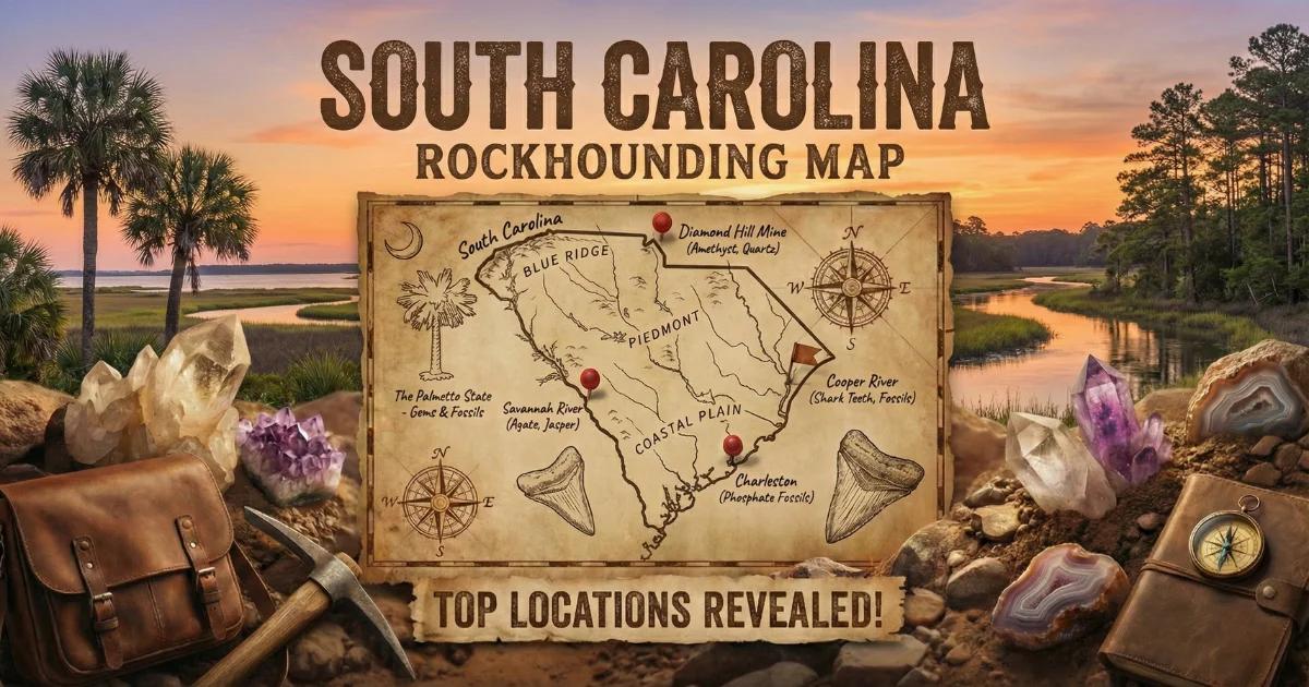
South Carolina's Geological Provinces and Geode Potential
South Carolina is divided into two fundamentally different geological terrains. The eastern two-thirds of the state is the Atlantic Coastal Plain — flat, sandy, underlain by young unconsolidated sediments sitting on top of older basement rock. Nothing in the Coastal Plain produces geodes. The western third is the Piedmont and Blue Ridge — Precambrian to Paleozoic metamorphic and igneous rock that has been folded, faulted, and baked by tectonic events spanning over a billion years.
True sedimentary geodes — the kind that weather out of Mississippian limestone in Iowa or Missouri — do not occur in South Carolina. The state lacks the specific marine carbonate formations that produce classic Keokuk-style geodes. What South Carolina does offer are quartz-lined vugs in metamorphic rock, small agate and chalcedony nodules in creek gravel, and crystal pockets along quartz vein contacts in the Carolina Slate Belt. These are not spectacular by western-US standards, but they give local collectors something to work with.
Understanding the Carolina Slate Belt
The Carolina Slate Belt is a narrow band of metamorphosed volcanic and sedimentary rocks running northeast to southwest through the central Piedmont. It extends from Virginia through the Carolinas and into Georgia. The original rocks were volcanic tuffs, lava flows, and marine sediments deposited roughly 550 to 620 million years ago during the late Precambrian and early Cambrian. Subsequent metamorphism altered them into slate, phyllite, and schist.
Quartz veins intruded these rocks during deformation events. Where the veins intersected open fractures or softer layers, they sometimes formed crystal-lined vugs — hollow pockets with inward-pointing quartz crystals. These vugs erode out of the bedrock and end up in creek gravel as rounded, quartz-rich nodules that can resemble small geodes when cracked open.
Where to Collect
1. Chesterfield County Creeks (Carolina Slate Belt)
GPS (general area): 34.62°N, 80.15°W
Land status: Public waterways; surrounding land mostly private
Vehicle: 2WD
The Carolina Slate Belt runs directly through Chesterfield County, and the streams here cut through metamorphosed volcanic rock with abundant quartz veining. Thompson Creek, Lynch's River tributaries, and other small drainages expose gravel bars containing quartz nodules, small agate pieces, and occasional crystal-lined vugs. The material is modest in size — most specimens are one to three inches — but persistent surface collecting produces finds.
Work the gravel bars at low water during late summer and fall. Look for rounded white quartz pieces that feel heavy for their size or show any hint of banding. Knock two pieces together — a hollow ring suggests a vug interior. Most of the surrounding land is private timberland and farmland. Collect from the waterway itself and do not cross fences without permission.
2. Sumter National Forest (Oconee and Pickens Counties)
GPS (general area): 34.85°N, 83.15°W
Land status: National Forest — personal mineral collecting permitted
Vehicle: 2WD for main roads; AWD for forest service roads
The Andrew Pickens Ranger District of the Sumter National Forest covers mountainous terrain in South Carolina's Blue Ridge corner. The bedrock is Precambrian gneiss and schist intruded by pegmatite dikes and quartz veins. Creek drainages in the Chattooga River and Chauga River watersheds contain quartz specimens with occasional crystal faces and small vugs.
The collecting here is surface work in creek gravel — walk the bars, scan for quartz with visible crystal terminations, and collect anything that looks hollow or unusual. Specimens are scattered and small, but the public access is the main advantage. The Forest Service permits personal mineral collecting (hand tools, reasonable quantities) on National Forest land. Check with the Andrew Pickens Ranger District for any seasonal closures.
3. Kershaw County (Flat Creek / Wateree River Area)
GPS (general area): 34.35°N, 80.58°W
Land status: Public waterways; private land adjacent
Vehicle: 2WD
Kershaw County sits on the Fall Line — the geological boundary where the hard Piedmont bedrock dives beneath the soft Coastal Plain sediments. Streams crossing this boundary cut through both rock types and concentrate resistant quartz and agate material in their gravel. Flat Creek and tributaries of the Wateree River have produced small chalcedony nodules and quartz-lined vugs. The best collecting is right along the Fall Line where the bedrock first becomes exposed in the streambed.
4. Abbeville / McCormick County (Savannah River Tributaries)
GPS (general area): 34.00°N, 82.35°W
Land status: Sumter National Forest parcels and private land
Vehicle: 2WD for paved access; AWD for forest roads
The western Piedmont in Abbeville and McCormick counties contains quartz-veined metamorphic rock. Creek gravel along Long Cane Creek and Little River has produced quartz specimens with crystal-lined cavities. Some Sumter National Forest parcels in this area provide public access. The old gold mining district around McCormick also produced quartz vein material with vugs and crystal pockets.
5. Graves Mountain, Georgia (Nearby Cross-Border Site)
GPS: 33.73°N, 82.52°W (Lincoln County, Georgia)
Land status: Private — periodic open-house collecting events
Vehicle: 2WD
Graves Mountain in Lincoln County, Georgia sits just across the Savannah River from western South Carolina. The property hosts open-house collecting events (typically spring and fall) where collectors can dig for rutile, lazulite, kyanite, iridescent hematite, and quartz crystals in metamorphosed volcanic rock. Crystal-lined pockets in the altered rock function like geodes. The drive from Greenwood or Anderson, SC is under an hour. Check with the Columbia, GA mineral club or Graves Mountain's operators for scheduled event dates.
Specimens You Can Expect
| Specimen | Where Found | Typical Size | Notes |
|---|---|---|---|
| Quartz vugs / crystal pockets | Piedmont creeks, Slate Belt | 1–3 inches | Small cavities with druzy quartz lining; the closest thing to geodes |
| Chalcedony / agate nodules | Fall Line creeks, Chesterfield Co. | 0.5–2 inches | Banded or translucent; occasional hollow centers |
| Vein quartz with crystals | Statewide Piedmont | 2–8 inches | Milky quartz with crystal faces on open surfaces |
| Garnet (almandine) | Blue Ridge creeks, mica schist | 0.25–1 inch | Dark red dodecahedral crystals in creek gravel |
| Gold (placer) | Western Piedmont creeks | Flour to flake | South Carolina had a pre-California gold rush; trace gold persists |
How to Identify Potential Geode Material in the Field
In South Carolina's Piedmont creeks, the dominant rock type is vein quartz — milky white, massive, and featureless. Most of it is solid. The pieces worth cracking open are those that feel lighter than expected for their size (suggesting a hollow interior), show any external banding or concentric structure, or have a rougher texture than the surrounding smooth cobbles.
Tap two suspect pieces together. A dull thud means solid quartz. A higher-pitched ring suggests a cavity inside. Pieces with a chalcedony shell — smooth, waxy, slightly translucent gray or blue — are the best candidates. Carry a rock hammer and crack suspect pieces in the field rather than hauling home buckets of solid quartz.
Tools and Gear
- Rock hammer (2 lb): For field-testing and cracking suspect nodules
- Safety glasses: Quartz throws sharp fragments when struck
- 5-gallon bucket: For carrying creek-collected specimens
- Old sneakers or wading boots: You will be in the water; Piedmont creek beds are rocky
- Spray bottle: Wetting a rock surface reveals banding and crystal faces invisible when dry
- Newspaper: For wrapping anything worth keeping
- Sunscreen and bug spray: South Carolina summers are hot and humid; ticks are abundant in creek-side vegetation
Legal Notes and Access
- Sumter National Forest: Personal mineral collecting with hand tools is permitted. No mechanized equipment. Stay on existing roads and trails to access creek areas.
- Public waterways: South Carolina law allows public access to navigable waterways below the ordinary high-water mark. You can walk and collect in the stream channel. Do not climb up banks onto private land.
- Private land: The majority of productive Piedmont geology is privately owned. Always ask before crossing fences or walking through fields to reach creeks.
- Best season: Year-round collecting is possible. Late summer and early fall offer the lowest water levels and best gravel bar exposure. Avoid creek collecting during or immediately after heavy rain — Piedmont streams rise fast.
Browse our South Carolina rockhounding map for more collecting locations.