
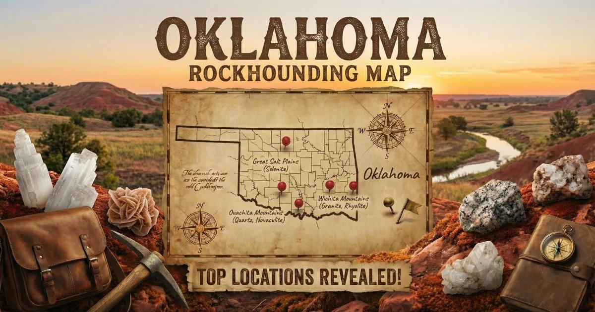
Oklahoma's Geode Geology: Four Provinces, Four Different Finds
Oklahoma is a state that surprises collectors who assume it is nothing but flat prairie. The state spans several distinct geological provinces, each with its own bedrock character and mineral production. From the Permian gypsum plains of the northwest to the folded Paleozoic strata of the Ouachita Mountains in the southeast, Oklahoma delivers a wider variety of crystal-bearing specimens than most collectors expect.
The northwestern plains are underlain by Permian-age evaporite deposits — gypsum, halite, and anhydrite laid down roughly 270 million years ago when shallow seas repeatedly evaporated in an arid climate. These gypsum beds produce Oklahoma's most distinctive collectible mineral: selenite, the clear crystalline form of gypsum. The Glass Mountains (locally called Gloss Mountains) are capped with massive selenite crystal beds that glitter in direct sunlight. Selenite crystals here grow as flat, tabular sheets, desert roses (rosette-shaped clusters), and hourglass-twinned crystals with sand inclusions forming a characteristic interior pattern.
The Ouachita Mountains in southeastern Oklahoma expose Ordovician through Pennsylvanian-age shales, sandstones, and limestones that were intensely folded and faulted during the Ouachita orogeny. Creek drainages cutting through these deformed rocks produce small quartz geodes, crystal-bearing concretions, and chert nodules. The Stanley Shale and Jackfork Sandstone host crystal-filled cavities that weather out as resistant nodules in creek gravel.
The Arbuckle Mountains in south-central Oklahoma expose some of the oldest rocks in the state — Cambrian and Ordovician carbonates thrust to the surface by ancient tectonic forces. Crystal-lined vugs with calcite, quartz, and occasional fluorite occur in the dolomite and limestone formations. The northeastern Ozark Plateau shares geology with Missouri's geode-producing Mississippian limestones, extending productive chert and geode-bearing formations into Oklahoma.
Where to Collect: Five Productive Sites with Access Details
1. Gloss Mountains State Park — Major County
GPS: 36.2111, -98.6750
Land status: Oklahoma State Park (limited collecting permitted in designated areas)
The Gloss Mountains are flat-topped mesas capped with Permian-age gypsum containing massive selenite crystal beds. The crystal-bearing caprock weathers and breaks, sending selenite fragments down the slopes. The state park occupies a portion of the mesa complex and allows limited collecting of loose surface specimens in certain areas — check with park staff for current rules and designated collecting zones. The best material lies at the base of the mesa slopes where weathered selenite accumulates. Look for flat, transparent crystal plates, crystal clusters, and desert rose formations. The selenite here is often remarkably clear — holding a piece up to sunlight reveals the hourglass pattern of sand inclusions that is diagnostic of Oklahoma selenite. The surrounding private ranchland also contains extensive selenite deposits, but access requires landowner permission.
2. Salt Plains National Wildlife Refuge — Alfalfa County
GPS: 36.7500, -98.1900
Land status: U.S. Fish and Wildlife Service (seasonal collecting area open April 1 through October 15)
Salt Plains is the most famous selenite crystal collecting site in Oklahoma — and one of the most unique mineral collecting opportunities in the country. The U.S. Fish and Wildlife Service designates a specific area on the salt flats where visitors can dig for selenite crystals that grow actively in the wet, saline soil just below the surface. The crystals form in the shallow subsurface as groundwater saturated with calcium sulfate precipitates gypsum in the sandy matrix. Crystals found here are typically 2–15 cm, brown to amber colored due to sand inclusions, and display the characteristic hourglass pattern when held to light. The collecting area opens April 1 and closes October 15 each year. Dig with your hands or a small shovel — no power tools. Bring water, sunscreen, and a hat, as the salt flats have zero shade and temperatures climb fast in summer.
3. Ouachita National Forest — LeFlore and Pushmataha Counties
GPS: 34.6500, -94.7500 (general Kiamichi River drainage area)
Land status: U.S. Forest Service (Ouachita National Forest, personal collecting permitted)
The Ouachita Mountains of southeastern Oklahoma are geologically complex — intensely folded Paleozoic strata eroded into rugged ridge-and-valley terrain. Creek drainages cutting through the Stanley Shale, Jackfork Sandstone, and associated formations produce small quartz geodes, crystal-bearing concretions, and chert nodules in their gravel. The Kiamichi River and its tributaries are the most productive waterways. Walk gravel bars at low water and scan for round, heavy stones with rough surfaces. Geodes here tend to be small — 3–8 cm — but can contain clear quartz crystal points and occasional chalcedony linings. The Ouachita National Forest allows personal mineral collecting in reasonable quantities. Check with the Choctaw Ranger District (918-567-2326) for current regulations and road conditions on forest roads, which can become impassable after heavy rain.
4. Arbuckle Mountains — Murray and Johnston Counties
GPS: 34.4100, -97.1400 (general area near Turner Falls)
Land status: Mixed — Turner Falls Park (City of Davis), private land, road right-of-way
The Arbuckle Mountains expose ancient Cambrian through Ordovician carbonates — limestones and dolomites over 450 million years old — pushed to the surface by tectonic forces that created this small but geologically significant mountain range. Crystal-lined vugs containing calcite, quartz, and occasional fluorite occur in the carbonate formations. The road cuts along Interstate 35 through the Arbuckles expose these formations in cross-section, and crystal-bearing vugs are visible in the cut faces after rain washes away loose material. Turner Falls Park allows limited collecting in some areas — check with park staff. Most of the productive private land around the Arbuckles requires landowner permission. The calcite crystals here form as both rhombohedral and scalenohedral habits, with some specimens reaching gem clarity.
5. Ozark Plateau Creeks — Ottawa and Delaware Counties
GPS: 36.8700, -94.8300 (general Neosho River drainage area, near Miami)
Land status: Public waterways; private land (ask permission for bank access)
Northeastern Oklahoma shares the Ozark Plateau geology with Missouri and Arkansas. The Mississippian-age limestones and cherts that produce geodes across the Missouri Ozarks extend into Ottawa, Delaware, and Craig counties. Creek gravel in the Neosho River drainage and its tributaries contains small quartz and calcite geodes, chert nodules, and occasional druzy-lined specimens. The collecting technique is the same as creek-bed geode hunting anywhere in the Midwest — walk the gravel bars at low water and look for round, heavy, rough-surfaced stones. The geodes here tend to be small (3–10 cm) but consistent. This area also produces tripoli (decomposed chert), chat (crushed chert from old mining operations), and galena and sphalerite specimens from the old Tri-State mining district — the same lead-zinc district that extended across the Oklahoma-Missouri-Kansas border.
Specimens You Can Expect to Find
| Specimen | Location | Typical Size | Notes |
|---|---|---|---|
| Selenite crystals (clear gypsum) | Gloss Mountains, Salt Plains | 2–20 cm | Transparent to amber; hourglass sand inclusion pattern; Mohs 2 |
| Selenite desert rose | Gloss Mountains, western Oklahoma | 3–15 cm clusters | Rosette-shaped crystal aggregates with sand matrix |
| Quartz geode (hollow) | Ouachita Mountains, Ozark Plateau creeks | 3–10 cm | Chalcedony shell with druzy or terminated quartz interior |
| Calcite crystal vugs | Arbuckle Mountains | Crystals 1–4 cm | Clear to amber rhombohedral or scalenohedral forms |
| Chert nodules | Ozark Plateau, Ouachita Mountains | 5–15 cm | Dense siliceous nodules; some with druzy quartz centers |
| Crystal-bearing concretions | Ouachita Mountains (Stanley Shale) | 3–10 cm | Iron-cemented concretions with quartz or calcite crystal cavities |
Tools and Equipment
Oklahoma's collecting sites span everything from salt flats to mountain creek beds, so your tool kit needs to match your destination.
- Salt Plains (selenite digging): Small hand shovel or garden trowel, a bucket, old towels for wrapping crystals, and a spray bottle for rinsing sand off specimens in the field. Bring a wide-brimmed hat, sunscreen, and at least a gallon of water per person — the salt flats are fully exposed and brutally hot from June through September.
- Gloss Mountains: Sturdy hiking boots for scrambling on mesa slopes. Selenite is soft (Mohs 2) and fragile — wrap every specimen individually in tissue paper or bubble wrap. Do not stack unwrapped crystals in a bucket.
- Creek collecting (Ouachita, Ozark, Arbuckle areas): Wading boots, a rock hammer, a bucket, and newspaper for wrapping specimens. A 10x hand lens helps identify small crystals in the field.
- Quarry and road cut work: Crack hammer (3 lb), cold chisels, safety glasses, and work gloves. Chert fragments are razor-sharp — leather gloves are not optional.
- Vehicle: 2WD handles all paved-road sites. AWD or 4WD is recommended for Ouachita National Forest back roads, especially in wet conditions. Check road conditions with the ranger district before heading into the backcountry.
Legal Considerations and Access Rules
- Salt Plains National Wildlife Refuge: Collecting is permitted only in the designated collecting area, only during the open season (April 1–October 15), and only with hand tools. No power equipment, no collecting outside the designated area. This is a wildlife refuge — disturbing nesting birds or sensitive habitat is a federal offense. Follow all posted rules.
- Gloss Mountains State Park: Limited collecting of loose surface material is typically allowed in designated areas. Rules change, so check with park staff at the entrance. Do not dig, excavate, or use power tools.
- Ouachita National Forest: Personal mineral and rock collecting for non-commercial purposes is permitted on Forest Service land. No mechanical excavation. Contact the Choctaw Ranger District for current regulations.
- Turner Falls Park: Operated by the City of Davis. Limited collecting may be allowed — check with park staff. The park charges an admission fee.
- Private land: Much of Oklahoma's productive collecting terrain — especially around the Arbuckle Mountains and Ozark Plateau — is private ranch and farmland. Always get landowner permission before entering.
- Tri-State mining district: The old lead-zinc mining areas in northeastern Oklahoma contain contaminated soils (lead, zinc, cadmium). Some areas are EPA Superfund sites. Do not collect from designated cleanup areas. Wash your hands after handling specimens from chat piles.
Planning Your Trip
Oklahoma is a big state, and the collecting sites are spread across its full extent. Plan your trip around one or two provinces rather than trying to hit everything in a single weekend.
For selenite, combine the Salt Plains (Alfalfa County) and Gloss Mountains (Major County) into a two-day trip. The two sites are about 80 miles apart along Highway 64. Both are in northwestern Oklahoma — Enid or Woodward make good bases. The Salt Plains collecting area is open April through October, so plan accordingly.
For creek-bed geodes, the Ouachita Mountains in southeastern Oklahoma require a separate trip. Base yourself in Talihina or Clayton and plan to spend two or three days working creek drainages. The Ouachita terrain is rugged and roads are slow — do not underestimate travel times on forest roads.
Spring and fall offer the most comfortable collecting conditions across the state. Oklahoma summers are hot — triple-digit temperatures are common from June through August, and the salt flats and gypsum plains offer no shade at all.
See our Oklahoma rockhounding map for all documented locations.