
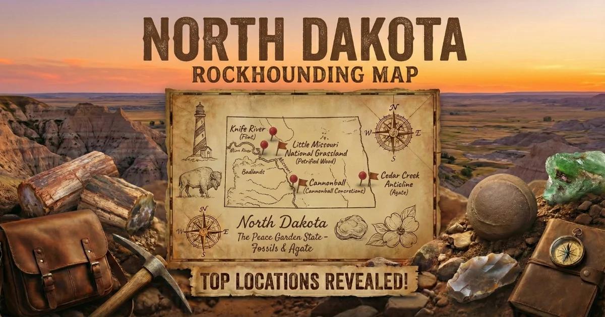
The Western Badlands: North Dakota's Collecting Ground
Eastern North Dakota is a flat expanse of glacial drift — thick clay and gravel deposited by Pleistocene ice sheets. There is almost no bedrock exposure, and collecting opportunities are minimal. Western North Dakota is a different world. The Badlands along the Little Missouri River strip away the soil and expose a stack of Paleocene and Eocene sedimentary formations that have been producing chalcedony nodules, agates, petrified wood, and small geodes for as long as collectors have been walking the terrain.
The primary collecting zone stretches from the South Dakota border north through Slope, Bowman, Billings, Golden Valley, and McKenzie counties. The Little Missouri National Grassland — managed by the U.S. Forest Service and covering over a million acres — provides the largest block of open public land for collecting in the state.
Geological Framework
The geode and nodule-producing formations in western North Dakota are the Bullion Creek, Sentinel Butte, and Golden Valley formations, all Paleocene to Eocene in age (roughly 65 to 50 million years old). These are river and lake sediments with significant volcanic ash content. When groundwater rich in dissolved silica moved through the ash-bearing beds, it precipitated chalcedony and quartz in cavities, around organic material, and within concretionary masses.
The result is three main collectible types: chalcedony nodules (some hollow, making them geodes), petrified wood (silicified logs and fragments from ancient forests), and cannonball concretions (spherical iron-ceite masses that erode from the Cannonball Formation, though these are not geodes — they are solid). There are also scattered agate deposits with banding and moss inclusions.
The Badlands erosion cycle is what makes collecting possible. The soft claystone and siltstone weather rapidly, releasing the harder siliceous material onto slopes and into washes. Every spring, snowmelt and summer thunderstorms expose fresh specimens.
Top Collecting Locations
1. Little Missouri National Grassland — Slope, Billings, McKenzie Counties
GPS (general area): 46.95°N, 103.55°W (southern unit near Medora)
Land status: USFS National Grassland (public, personal collecting permitted)
Vehicle: High-clearance recommended for grassland roads; 2WD on main gravel routes
The Little Missouri National Grassland is the largest grassland in the national system, split into two units flanking Theodore Roosevelt National Park. The badlands terrain here — deeply eroded buttes, draws, and coulees — exposes the Sentinel Butte and Bullion Creek formations across thousands of acres. Surface collecting for chalcedony nodules, agates, and petrified wood is permitted on National Grassland land.
Walk the bases of eroded buttes and the bottoms of dry washes. The siliceous material concentrates on the surface as softer clay weathers away. After heavy rain, fresh specimens appear on slopes and in gullies. Some chalcedony nodules have hollow centers lined with small quartz crystals — these are true geodes, typically 1 to 4 inches in diameter. The nodules are usually tan, gray, or brown on the outside, with translucent chalcedony or quartz crystal interiors.
Critical boundary warning: Theodore Roosevelt National Park (both the South and North Units) is completely enclosed by the National Grassland. Collecting is strictly prohibited inside the park. The park boundary is not always marked with signs in the backcountry. Carry a GPS unit with the park boundary loaded, or use the NPS app. The penalty for collecting in a national park is serious — do not risk it.
2. Bowman County — Chalcedony Buttes
GPS (general area): 46.15°N, 103.50°W
Land status: BLM, National Grassland, private (mixed — verify ownership)
Vehicle: High-clearance for ranch roads
Bowman County in the far southwestern corner of North Dakota exposes the same Paleocene formations with chalcedony nodules and agates. The buttes and badlands south and west of the town of Bowman produce surface-scattered nodules on BLM and National Grassland parcels. Some of the better agate material in North Dakota comes from this area — banded chalcedony in cream, brown, and orange tones. Private ranch land is intermixed with public parcels, so carry a land-ownership map or use the BLM's online surface management status maps.
3. Knife River Flint Area — Mercer and Dunn Counties
GPS (general area): 47.35°N, 101.40°W (along the Knife River)
Land status: Knife River Indian Villages NHS (collecting prohibited); surrounding land is private and public
Vehicle: 2WD for highway access
Knife River flint is one of North Dakota's most distinctive stones — a translucent brown chalcedony that was used by Native peoples for thousands of years to make tools and traded across the continent. It forms as nodules in Tertiary sediments along the Knife River and Missouri River. While not a geode (the nodules are solid), Knife River flint is worth collecting if you are in the area.
The Knife River Indian Villages National Historic Site near Stanton is the type locality and is strictly protected — no collecting. Specimens can be found in gravel bars along the Knife River and Missouri River on non-protected land. Ask local landowners for permission to access river gravel bars on private land. Some specimens wash into publicly accessible stretches of the Missouri River below Garrison Dam.
4. Cannonball River — Sioux and Morton Counties
GPS (general area): 46.30°N, 100.60°W
Land status: Mixed BLM, state, and private
Vehicle: 2WD for highway access; high-clearance for back roads
The Cannonball River is named for the large spherical concretions that erode from the Cannonball Formation along its banks. These "cannonballs" are iron-cemented sandstone concretions, typically 6 to 24 inches in diameter. They are solid — not geodes — but they are geologically interesting and worth seeing. Smaller concretions sometimes have septarian cracking with calcite fill. The river gravel also contains scattered chalcedony, agate, and petrified wood carried downstream from Badlands source rocks.
What You Will Find: North Dakota Specimens
| Specimen Type | Typical Size | Common Interior | Where Found |
|---|---|---|---|
| Chalcedony geode | 1–4 inches | Quartz druzy, hollow chalcedony shell | Badlands buttes, National Grassland |
| Banded agate | 1–3 inches | Concentric chalcedony banding | Bowman Co., Slope Co., washes |
| Petrified wood | Variable (fragments to logs) | Silicified wood, sometimes with druzy cavities | Scattered across western ND |
| Knife River flint | 1–6 inches | Solid translucent brown chalcedony | Mercer/Dunn Co. river gravel |
| Cannonball concretion | 6–24 inches | Solid iron-cemented sandstone | Cannonball River banks |
How to Identify Specimens in the Field
Chalcedony nodules in the Badlands stand out as hard, rounded stones on soft clay slopes. They resist weathering while the surrounding claystone crumbles. Pick them up and check the weight — a hollow nodule feels lighter than a solid one of the same size. Tap two suspect nodules together; a hollow one produces a higher-pitched sound. If you see translucent edges when held up to sunlight, you have chalcedony.
Petrified wood retains visible grain and growth-ring structure. Look for the parallel lines of the original wood texture on broken surfaces. Some pieces have tiny druzy-lined cavities where the original wood structure decayed before silicification was complete.
Knife River flint is translucent brown to dark brown, almost root-beer colored when held to light. It has a waxy luster and conchoidal fracture. It is easy to distinguish from other gravel once you have handled a few pieces.
Recommended Tools and Gear
- Rock hammer: For testing specimens and extracting nodules from soft matrix
- 5-gallon bucket or backpack: For carrying specimens across rough terrain
- GPS unit or phone with offline maps: Essential for staying on legal collecting ground and avoiding park boundaries
- Plenty of water: Western North Dakota is dry. Carry at least 1 gallon per person per day.
- Sun protection: Wide-brimmed hat, sunscreen, and sunglasses. There is no shade in the Badlands.
- Sturdy boots: Badlands clay becomes slippery when wet and the terrain is uneven
- Snake gaiters or awareness: Prairie rattlesnakes are present. Watch where you step and where you place your hands.
- BLM surface management maps: Available online or from the BLM Dickinson Field Office. Critical for distinguishing public from private land.
Legal Rules and Land Access
- National Grassland: The USFS permits personal surface collecting of rocks, minerals, and reasonable amounts of petrified wood on National Grassland land. No motorized digging. Check with the Dakota Prairie Grasslands office in Dickinson for current regulations.
- BLM land: Standard casual collecting rules — 25 pounds per day plus one piece, up to 250 pounds per year. Petrified wood has a specific limit of 25 pounds per day plus one piece, up to 250 pounds per year.
- Theodore Roosevelt National Park: All collecting is strictly prohibited in both the North and South Units. Do not remove any natural objects.
- Knife River Indian Villages NHS: All collecting prohibited.
- Private land: Western North Dakota is a mix of public and private. Ranch gates, fences, and "No Trespassing" signs define private boundaries. Ask before entering.
- Best season: May through October. Winter temperatures drop well below zero, roads become impassable, and the Badlands are dangerously exposed in a blizzard.
Browse our North Dakota rockhounding map for GPS coordinates and additional collecting locations.