
Mississippi's Geode Situation
Mississippi is not a geode state. About 95% of the state's surface is covered by unconsolidated Coastal Plain sediments — sand, clay, silt, and gravel deposited by the Mississippi River, the Gulf of Mexico, and their predecessors over the last 70 million years. You cannot find geodes in sand and clay.
The single exception is the extreme northeast corner. Tishomingo County, and to a lesser extent Itawamba and Alcorn counties, are the only places in Mississippi where Paleozoic bedrock reaches the surface. This bedrock — Mississippian-age limestone, sandstone, and chert — is the same general age and type as the formations that produce geodes in Tennessee, Alabama, and Kentucky.
Small quartz and calcite geodes do occur in this corner of the state. They weather out of the Mississippian limestone and collect in creek gravel. They are small (1-3 inches), not abundant, and not the reason most collectors would drive to Mississippi. But they exist, and if you are in the area, they are worth looking for.
Geological Overview
Mississippi's geology is dominated by a thick wedge of Coastal Plain sediments that thickens from north to south. At the Tennessee border, the Coastal Plain deposits are relatively thin and the underlying Paleozoic bedrock pokes through in the northeastern hills. By the time you reach the Gulf Coast, the sediments are thousands of feet thick and there is no bedrock anywhere near the surface.
The northeast corner of Mississippi is geologically an extension of the Tennessee Valley. The same Mississippian-age formations that produce geodes abundantly in central Tennessee and northern Alabama — the Fort Payne Formation, the Warsaw Limestone, and related units — extend into Tishomingo County. But the exposure is limited. Only the highest hills and the deepest creek cuts in this area reach the Paleozoic bedrock. Most of the surface is still covered by younger Coastal Plain sediments.
The rest of Mississippi's surface geology breaks down like this:
North-central Mississippi (Holly Springs, Pontotoc, Ackerman area). Cretaceous-age sediments — sand, clay, chalk, and marl. The Selma Chalk in this area produces Cretaceous fossils (oysters, ammonites, mosasaur fragments) but no geodes.
Central Mississippi (Jackson area). Tertiary-age sediments — clay, sand, and lignite. Petrified wood occurs in some formations. No geodes.
Southern Mississippi and Gulf Coast. Young (Pleistocene and Recent) river deposits, beach sands, and marsh sediments. No bedrock, no geodes, no minerals of note.
Mississippi Delta. Holocene alluvium — less than 10,000 years old. Flat, agricultural, and entirely composed of river mud. The most geologically uniform (and least interesting for collectors) landscape in the state.
Collecting Locations
1. Bear Creek — Tishomingo County
GPS: 34.6300°N, 88.2000°W (Bear Creek near Tishomingo State Park)
Land status: Tishomingo State Park — check park rules before collecting
Vehicle: 2WD to park; walking access to creek
Bear Creek cuts through Mississippian-age limestone and sandstone as it flows through Tishomingo County. The creek gravel contains a mix of material eroded from these Paleozoic formations — chert nodules, limestone cobbles, sandstone fragments, and occasional small geodes.
The geodes here are small — typically 1-3 inches in diameter. Most are lined with quartz crystals (clear druzy) or calcite. Some are solid (filled completely with quartz or chalcedony). The ratio of solid to hollow specimens is roughly 3:1. Crack a few in the field to check before hauling them out.
Tishomingo State Park provides the best access to Bear Creek's geology. The park has hiking trails along the creek and sandstone outcrops. Check at the park office about collecting rules — state parks in Mississippi generally restrict removing natural materials. If collecting is not permitted in the park, work the creek downstream of the park boundary on public waterway sections.
2. Tishomingo State Park Outcrops — Tishomingo County
GPS: 34.6100°N, 88.1800°W
Land status: Mississippi State Park
Vehicle: 2WD
Tishomingo State Park itself sits on Mississippian-age sandstone — the Hartselle Sandstone and related units. The park's signature feature is massive sandstone outcrops and overhangs along the park's trail system. These sandstone formations are not geode-bearing, but the associated limestone layers in the park area contain chert nodules and occasional small geodes.
The park is worth visiting for the geology even if you do not collect. The exposed Paleozoic stratigraphy is the only place in Mississippi where you can see actual bedrock formations. The sandstone cliffs, creek-cut exposures, and the contact between the Paleozoic bedrock and the overlying Coastal Plain sediments are all visible along the trail system.
Collecting in the park may be restricted. Do not hammer on outcrops or disturb exposed rock faces in the park. If you are allowed to collect, limit yourself to loose material in the creek beds.
3. Creek Drainages South of Iuka — Tishomingo County
GPS: 34.7800°N, 88.1900°W (general area south of Iuka)
Land status: Mixed public waterways and private land
Vehicle: 2WD; some unpaved county roads
The small creeks south and east of Iuka (the county seat of Tishomingo County) drain the Paleozoic hill country. Where these creeks cut through the Mississippian limestone, geodes and chert nodules accumulate in the gravel beds. Yellow Creek, Indian Creek, and Mackintosh Creek are productive drainages.
Work the creek gravel at low water. The best collecting is in late summer and early fall when water levels drop and expose the gravel bars. Look for round, rough-textured stones that feel lighter than expected for their size. The chalky exterior rind of a geode is distinctive once you have seen a few.
The creeks themselves are public waterways, but the banks and surrounding land are often private. Access creeks from bridge crossings and public road right-of-ways. Do not cross fences or enter private land without permission.
4. Tombigbee National Forest — Chickasaw and Pontotoc Counties
GPS: 33.9800°N, 89.0200°W (Tombigbee NF, Ackerman Unit)
Land status: National Forest — personal collecting generally permitted
Vehicle: 2WD for main forest roads; AWD for some side roads
The Tombigbee National Forest covers scattered tracts in north-central Mississippi. The geology here is Cretaceous-age — younger than the Paleozoic bedrock in Tishomingo County, and not as productive for geodes. However, creek gravel in the forest drainages occasionally contains small agate nodules, chert specimens, and transported material from older formations.
The Tombigbee is worth mentioning because it is National Forest land, which means personal collecting of rocks and minerals is generally permitted for non-commercial use. The creeks in the Ackerman Unit (Chickasaw County) cut through the Eutaw Formation and Selma Chalk, producing Cretaceous fossils — oyster shells, gastropods, and occasional vertebrate bone fragments.
True geodes are uncommon in the Tombigbee. Expect chert, agate, and fossils rather than crystal-lined geodes. Check with the Tombigbee Ranger District office in Ackerman for current collecting rules.
5. Tennessee-Tombigbee Waterway — Itawamba and Tishomingo Counties
GPS: 34.3500°N, 88.2500°W (Tenn-Tom Waterway, Bay Springs area)
Land status: US Army Corps of Engineers managed
Vehicle: 2WD
The construction of the Tennessee-Tombigbee Waterway in the 1970s and 1980s cut through millions of cubic yards of bedrock and sediment in northeastern Mississippi. The excavated material was deposited in spoil areas along the waterway. Some of this material came from Paleozoic formations in the Tishomingo County area and may contain geodes, fossils, and mineral specimens.
Access to Corps of Engineers land along the waterway varies. Some recreational areas allow shore access. Spoil piles may be accessible in some locations. Check with the Tenn-Tom Waterway Development Authority or the Corps of Engineers for current access rules.
Specimens You May Find
| Specimen | Where Found | Notes |
|---|---|---|
| Small quartz geodes | Tishomingo County creeks | 1-3 inches; druzy quartz lining; some hollow, most solid |
| Calcite geodes | Tishomingo County creeks | Small; calcite crystal lining; less common than quartz |
| Chert nodules | NE Mississippi creeks and road cuts | Various colors; from Mississippian limestone |
| Agate (small nodules) | Creek gravel, Tombigbee NF | Translucent; banded; uncommon |
| Cretaceous fossils | Selma Chalk belt (north-central MS) | Oysters, gastropods, ammonite fragments, shark teeth |
| Petrified wood | Central MS (Tertiary sediments) | Silicified hardwoods; creek gravel and construction sites |
| Sandstone specimens | Tishomingo County | Hartselle Sandstone; ripple marks and bedding structures |
Field Identification Tips
Geodes vs. chert nodules: Both are round and found in the same creek gravel. The key difference: geodes have a rough, chalky outer rind (weathered limestone shell) and feel lighter than expected because they are hollow. Chert nodules are heavy, solid, and have a smooth or waxy surface. Tap two suspect stones together — a geode sounds slightly hollow; chert sounds dead solid. Chert also breaks with a sharp conchoidal (glass-like) fracture, while a geode's outer shell crumbles.
Quartz vs. calcite lining: Most Mississippi geodes are small enough to see the interior lining through cracks. Quartz linings are hard, glassy, and typically clear to white. Calcite linings are softer, often cloudy, and fizz when touched with dilute hydrochloric acid. Quartz geodes are more durable and make better display specimens. Calcite geodes are more fragile.
Solid vs. hollow: Most small geodes from Tishomingo County are partially or completely filled with chalcedony or microcrystalline quartz. Truly hollow specimens with a good crystal cavity are the minority. Shake the specimen — sometimes loose crystals rattle inside. Weigh it in your hand — a hollow geode feels noticeably lighter than a solid chert nodule of the same size.
Cretaceous fossils: In the Selma Chalk belt, fossils are soft and embedded in chalk (a soft limestone). They crumble easily. Collect fossils with their surrounding chalk matrix and clean at home. Do not try to extract fossils in the field — you will break them.
Recommended Tools
- Rock hammer (16 oz) — for cracking small geodes in the field
- Safety glasses — mandatory when cracking any rock
- 5-gallon bucket — for carrying creek gravel specimens
- Wading shoes or rubber boots — creek collecting requires getting in the water
- Walking stick — creek beds in northeast Mississippi have uneven, rocky bottoms
- Hand lens (10x) — for examining small geode interiors and identifying crystals
- Dilute HCl (10%) — for testing calcite vs. quartz in the field
- Cloth bag or towel — wrap geodes before cracking to contain fragments
- Pipe cutter (cast iron snap cutter) — for clean geode splits at home
- Sunscreen and bug spray — Mississippi creek collecting in summer is hot and buggy
Legal Notes
Tishomingo State Park: Mississippi state parks generally restrict collecting natural materials. Ask at the park office before removing anything. Collecting from loose creek gravel may be treated differently from hammering on rock outcrops — ask specifically about both.
Public waterways: Mississippi allows public access to navigable waterways below the ordinary high water mark. Collecting from creek gravel bars on navigable creeks is generally legal. The banks and surrounding land are often private — do not cross fences.
Tombigbee National Forest: Personal collecting of reasonable quantities of rocks, minerals, and fossils is generally permitted for non-commercial use on National Forest land. Hand tools only. No excavation. Check with the Tombigbee Ranger District office for current rules.
Army Corps of Engineers land: The Tennessee-Tombigbee Waterway corridor is managed by the Corps. Rules about collecting on Corps land vary. Check before collecting.
Private land: Much of Tishomingo County is private land. Get permission before entering. The culture in rural northeast Mississippi is generally friendly to collectors who ask permission, but trespassing will not be tolerated.
Better Options Nearby
If geode hunting is your primary goal, Mississippi is a marginal destination. These nearby states are significantly more productive:
- Northern Alabama — 1-2 hours east of Tishomingo County. The Fort Payne Formation in the Tennessee Valley produces abundant small to medium geodes in creek gravel. Florence, Tuscumbia, and Huntsville are collecting hubs.
- Central Tennessee — 3 hours north. The Mississippian limestone belt produces geodes, fossils, and agate throughout the Nashville Basin and surrounding Highland Rim.
- Mount Ida, Arkansas — 5 hours from Jackson. Fee-dig quartz crystal mines producing world-class clear quartz points.
- Keokuk, Iowa/Illinois/Missouri — 8 hours north. The Keokuk geode belt produces the most abundant and highest-quality sedimentary geodes in the US.
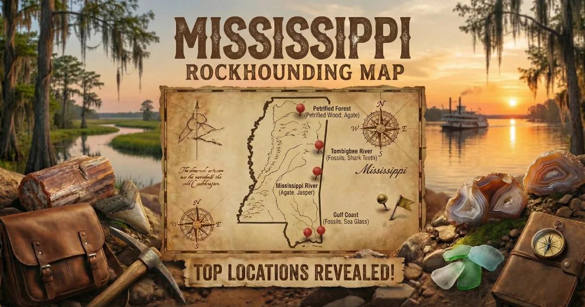
Browse all Mississippi collecting locations on our interactive Mississippi rockhounding map.