
Colorado's Crystal Geology
Colorado is not a classic geode state in the sedimentary sense. You will not find creek beds full of round limestone balls with quartz druzy interiors like you would in Iowa or Kentucky. What Colorado offers instead is something many collectors consider better: crystal-lined pegmatite pockets in Precambrian granite, and volcanic thundereggs in Tertiary rhyolite flows. Both produce the same result as a geode — a cavity in rock, lined with well-formed crystals — but the geology and the minerals involved are entirely different.
The Pikes Peak batholith, a massive body of 1.08-billion-year-old granite covering over 3,000 square miles in central Colorado, is the source of the state's most famous crystal pockets. During the final stages of cooling, volatile-rich fluids concentrated in pegmatite veins and produced large, well-formed crystals of amazonite (green microcline feldspar), smoky quartz, topaz, fluorite, and goethite. Gas pockets within these pegmatites became crystal-lined cavities — geodes in every functional sense.
The San Juan volcanic field in southwestern Colorado adds a second geode-producing province. Tertiary-age rhyolite and tuff formations contain thundereggs and agate nodules, some with hollow quartz-lined interiors. The western slope around Debeque and Palisade produces smaller chalcedony nodules from the Wasatch and Green River formations.
Top Collecting Locations
1. Crystal Peak Area — Teller/El Paso County (Pikes Peak Region)
GPS: 38.90°N, 105.05°W (general Crystal Peak area)
Land status: Mixed Pike National Forest and private mining claims
Vehicle: High-clearance recommended; some roads require 4WD
The Crystal Peak area near Florissant is the most accessible collecting ground on the Pikes Peak batholith. Pegmatite veins here contain crystal pockets with amazonite, smoky quartz crystals (some exceeding 12 inches), and occasionally topaz. The pockets range from fist-sized cavities to rooms large enough to reach your arm into. When you crack into a fresh pocket and find water-clear smoky quartz points sitting on bright green amazonite, it is as good as any geode you will ever open.
Much of the best ground is under private mining claims. Check with the Lake George Gem and Mineral Club or the Pikes Peak Pebble Pups for information on accessible areas. Some claim holders allow collecting for a fee or by arrangement. National Forest land between claims is open for personal collecting, but productive pockets on unclaimed ground are increasingly rare.
2. Mount Antero — Chaffee County
GPS: 38.67°N, 106.25°W (summit area)
Land status: San Isabel National Forest (public)
Vehicle: High-clearance 4WD required for the access road; final mile is on foot
Mount Antero is one of the highest mineral-collecting sites in North America. The pegmatite veins above 13,000 feet produce aquamarine crystals (blue beryl), smoky quartz, phenakite, and bertrandite in pocket vugs. These pockets are functionally identical to geodes — hollow cavities lined with terminated crystals sitting on matrix.
This is serious alpine collecting. The season runs from mid-July through September, weather permitting. Thunderstorms develop almost daily by early afternoon, and lightning above treeline kills people every year. Start your approach at first light, plan to be off the summit by noon, and carry rain gear, extra layers, and emergency supplies. The road to the Baldwin Gulch trailhead requires a capable 4WD vehicle with high clearance — do not attempt it in a passenger car.
3. San Juan Mountains — Creede/Lake City Area (SW Colorado)
GPS: 37.85°N, 106.93°W (Creede area)
Land status: BLM, San Juan National Forest, Rio Grande National Forest
Vehicle: 2WD on paved highways; high-clearance for forest and BLM roads
The Tertiary volcanic rocks of the San Juan Mountains contain agate-filled thundereggs and occasional quartz-lined geodes. The rhyolite and tuff formations around Creede, Lake City, and Silverton were deposited by massive caldera eruptions between 35 and 25 million years ago. Gas cavities in these flows filled with silica-rich fluids, producing thundereggs with banded agate, chalcedony, and quartz crystal interiors.
National Forest and BLM lands throughout this area are open for personal collecting. The terrain is rugged and the roads are often seasonal — many close from October through May due to snow. Check with the Creede Ranger District or the BLM Gunnison Field Office for current road conditions and access.
4. Debeque/Palisade Area — Mesa County (Western Slope)
GPS: 39.33°N, 108.22°W (general Debeque area)
Land status: BLM (public)
Vehicle: High-clearance for BLM roads
The BLM land around Debeque and Palisade on the western slope produces small chalcedony and agate nodules from the Wasatch and Green River formations. These are typically 1 to 3 inches in diameter. Most are solid agate, but occasional specimens are hollow with quartz crystal linings — true geodes by definition. The terrain is accessible desert hills and badlands, a sharp contrast to the alpine sites on the other side of the Continental Divide.
5. South Park Area — Park County
GPS: 39.10°N, 105.80°W (general area)
Land status: Mixed BLM and Pike National Forest
Vehicle: High-clearance recommended
The volcanic formations around the edges of South Park produce small thundereggs and agate nodules. The Thirtynine Mile volcanic field on the east side of the basin is the primary source. BLM and National Forest lands provide public access for personal collecting. These sites are less known and less collected than the Pikes Peak pegmatite areas, making them worth exploring if you prefer solitude.
Specimens You Can Find
| Mineral | Location | Occurrence | Notes |
|---|---|---|---|
| Amazonite (green microcline) | Pikes Peak batholith | Common in pegmatite pockets | Bright green to blue-green; Colorado's signature mineral |
| Smoky quartz | Pikes Peak batholith | Common | Crystals from 1 inch to over 12 inches; some gem-quality |
| Aquamarine (blue beryl) | Mount Antero | Uncommon | Light to medium blue; best above 13,000 feet |
| Topaz | Pikes Peak, Tarryall | Uncommon | Colorless to pale amber; Colorado state gemstone |
| Phenakite | Mount Antero | Rare | Colorless beryllium mineral, often with aquamarine |
| Agate/chalcedony | San Juan Mtns, Debeque | Common | Thunderegg fillings; banded, plume, and moss varieties |
| Fluorite | Pikes Peak batholith | Uncommon | Purple to green; in pegmatite pockets |
| Quartz druzy | San Juan Mtns | Common in volcanic geodes | Clear to white crystal linings |
Recommended Tools and Gear
- Rock hammer and chisels: For extracting crystals from pegmatite pockets. A 3-lb crack hammer and cold chisels (various widths) are essential for Pikes Peak collecting.
- Pry bars: Small pry bars help open pegmatite pockets without damaging crystals inside.
- Eye protection and gloves: Mandatory when hammering on granite and quartz. Splinters are razor-sharp.
- Wrapping material: Newspaper, paper towels, and small plastic bags for protecting individual crystals.
- Alpine gear (for Antero): Rain jacket, warm layers, hat, sunscreen, 2+ liters of water, snacks, and a first-aid kit. Trekking poles help on the loose talus.
- Offline GPS maps: Cell service is absent at most collecting sites. Download maps (Gaia GPS or OnX) before leaving town.
- Spare tire and basic vehicle tools: Mountain roads are rough. A flat tire 30 miles from pavement is routine.
Legal and Access Information
National Forest (Pike, San Isabel, San Juan, Rio Grande): Personal mineral collecting is permitted on National Forest land under Forest Service regulations. Reasonable quantities for personal use — no commercial collecting. No mechanized equipment. Backfill holes.
BLM land: Casual collecting of rocks, minerals, and gemstones is permitted on BLM land under 43 CFR 8365. The limit is 25 pounds per day plus one piece, not to exceed 250 pounds per year. This applies to the San Juan, Debeque, and South Park areas.
Mining claims: Colorado has extensive active and inactive mining claims, especially in the Pikes Peak region and the San Juan Mountains. Collecting on a valid mining claim without the claim holder's permission is illegal — it is the same as trespassing. Check BLM LR2000 claim records or use apps like OnX to identify claim boundaries before digging.
National Parks and Monuments: Collecting is strictly prohibited in Rocky Mountain National Park, Black Canyon of the Gunnison, Colorado National Monument, and all other NPS units. No exceptions.
Best Time to Go
The collecting season depends entirely on elevation. Alpine sites like Mount Antero are accessible only from mid-July through September. Crystal Peak and the Pikes Peak area are generally accessible from May through October. The San Juan Mountain sites vary — many forest roads close by November and do not reopen until late May or June. Western slope BLM lands around Debeque are accessible year-round, though summer heat can be intense.
For alpine collecting, watch the weather forecast obsessively. Clear mornings with afternoon thunderstorm potential are the norm from July through August. Plan to be below treeline by noon.
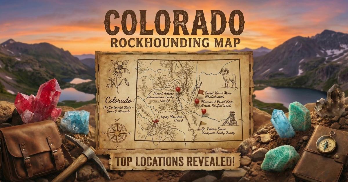
See our Colorado rockhounding map for GPS coordinates and access details on all locations.