
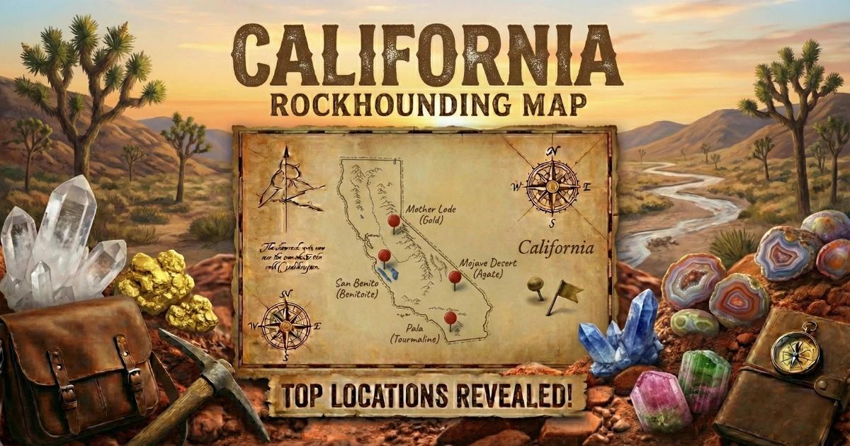
California's Geode-Producing Geology
The geode country in California is concentrated in the Colorado Desert of the southeastern corner — Imperial and Riverside counties, east of the Salton Sea and south of Joshua Tree National Park. This is Basin and Range terrain: fault-block mountains separated by broad alluvial valleys, built from Tertiary-age volcanic rocks that erupted between roughly 25 and 10 million years ago during a period of regional extension and volcanism.
The geode-producing formations are rhyolitic tuffs and mudstones — consolidated volcanic ash deposits that accumulated in ancient lake basins and on volcanic flanks. As the tuff cooled and compacted, gas cavities formed within the matrix. Over millions of years, silica-dissolved groundwater migrated through the porous tuff and deposited concentric layers of chalcedony inside these cavities. The innermost layer grew as druzy quartz crystals pointing inward — the classic geode structure. The chalcedony shells are tough and resistant to erosion, so the geodes survive long after the surrounding tuff weathers away, and they accumulate on the desert surface.
California's desert geodes are among the finest quartz geodes in North America. The Hauser Geode Beds in particular have supplied collectors for over a century and continue to produce quality specimens. The key advantage for collectors is that nearly all of the productive geode terrain is on open BLM land — free to access, free to collect, and managed specifically to accommodate recreational mineral collecting.
Top Collecting Sites
1. Hauser Geode Beds (Imperial County)
GPS: Approximately 33.08°N, 115.34°W
Land status: BLM (Bureau of Land Management) — open for public collecting
Vehicle: High-clearance 4WD strongly recommended; the access road crosses sandy washes and rough volcanic terrain
The Hauser Geode Beds are the most famous geode-collecting site in California and one of the top sites in the western United States. Located approximately 75 miles east of El Centro in the far southeastern corner of the state, the beds sit in a barren desert landscape of low volcanic hills and dry washes. The geodes formed in Miocene-age rhyolitic tuff — a pale tan to gray volcanic ash deposit that weathers easily, releasing the harder chalcedony geode shells onto the surface.
Hauser geodes range from 2 to 8 inches in diameter. The exterior shell is bluish-gray to white chalcedony, smooth to slightly bumpy. Inside, most are lined with quartz crystals — clear, white, smoky, or occasionally pale amethyst. The best specimens have large, well-formed crystal points growing into an open central cavity. Some geodes are completely filled with banded agate (these are solid and technically not geodes, but they cut and polish beautifully).
Surface geodes have been heavily collected near the parking and camping areas. Productive collecting now usually requires digging into the hillsides where the tan-colored tuff layer is exposed. Bring a shovel, pick, and pry bar. The geodes pop out of the soft tuff matrix with moderate effort — look for the round chalcedony shells embedded in the lighter-colored ash. Extract carefully to avoid cracking the shell. Tap two geodes together: hollow ones ring, solid ones thud. You want the ringers.
2. Wiley Well Rockhounding Area (Riverside County)
GPS: Approximately 33.46°N, 115.20°W
Land status: BLM — designated rockhounding area
Vehicle: High-clearance recommended; 2WD possible in dry conditions on the main access road
The BLM has formally designated the Wiley Well area as a recreational mineral collecting site — one of the few places in the country where the federal land agency has specifically designated an area for rockhounding. The site is located north of I-10 between Desert Center and Blythe, making it more accessible than the remote Hauser Beds. A BLM campground with primitive facilities (pit toilets, no water) provides a base for multi-day collecting trips.
Geodes at Wiley Well occur in volcanic terrain similar to the Hauser Beds — rhyolite tuffs and mudstones hosting chalcedony-shelled nodules. The geodes tend to be smaller than Hauser specimens (1 to 4 inches on average) but are more abundant near the surface because the area sees less collecting pressure. Agate, jasper, and chalcedony rough are also common in the surrounding hills. The Wiley Well area covers several square miles of collecting terrain — plan to explore beyond the immediate campground vicinity for the best material.
3. Cinnamon Mine Area (Imperial County)
GPS: Approximately 32.95°N, 115.55°W
Land status: BLM (public)
Vehicle: High-clearance 4WD required; rough desert roads
The Cinnamon Mine area sits near the Chocolate Mountains in Imperial County and produces geodes and thundereggs in rhyolitic host rock. The specimens here tend to have thicker chalcedony walls and smaller crystal cavities compared to Hauser geodes — some are essentially thundereggs with only a thin quartz-lined void at the center. Agate and jasper nodules also occur throughout the area. The access roads are rough, and the area is more remote than Wiley Well, but it sees less collecting traffic as a result.
4. Pebble Terrace (Imperial County)
GPS: Approximately 33.05°N, 115.40°W
Land status: BLM (public)
Vehicle: High-clearance 4WD
Pebble Terrace is in the same general volcanic province as the Hauser Beds, a few miles to the west. The terrain produces chalcedony nodules, small geodes, and agate in volcanic matrix. The nodules here tend to be on the smaller side (1 to 3 inches) but are plentiful. Surface collecting is productive — walk slowly across the desert pavement and scan for round chalcedony shapes that stand out from the angular volcanic rubble. This site works well as a secondary stop on a Hauser Beds trip.
5. Opal Hill Mine Area (Riverside County)
GPS: Approximately 33.52°N, 115.27°W
Land status: Private mining claim — fee-based collecting when open
Vehicle: High-clearance recommended
The Opal Hill Mine near the Mule Mountains produces fire opal and common opal in rhyolite. While not a geode site in the traditional sense, the opal occurs in vugs and seams within the volcanic rock — you crack open the rhyolite and find pockets of opal inside. The mine operates on a fee-dig basis when open, but hours and seasons vary. Call ahead or check with the BLM Desert District office for current status. The fire opal ranges from orange to red, and while most pieces are small, the color can be striking.
Specimens You Can Expect to Find
| Specimen | Interior Fill | Typical Size | Where Found |
|---|---|---|---|
| Quartz Crystal Geode | Clear to smoky quartz druzy, occasional amethyst | 2 - 8 inches | Hauser Geode Beds |
| Chalcedony Geode | Banded chalcedony walls, small quartz center | 1 - 4 inches | Wiley Well, Pebble Terrace |
| Thunderegg | Thick agate/chalcedony fill, minimal or no cavity | 2 - 5 inches | Cinnamon Mine area |
| Agate Nodule (solid) | Banded agate, no crystal cavity | 1 - 4 inches | All desert sites |
| Fire Opal in Rhyolite | Orange to red fire opal in volcanic matrix | Opal pieces under 1 inch | Opal Hill Mine |
Recommended Tools and Gear
- Shovel and garden pick: For digging embedded geodes from tuff matrix at the Hauser Beds. Surface specimens are scarce near roads — you will need to dig.
- Pry bar: For leveraging geodes out of the matrix without cracking the chalcedony shell.
- Rock hammer (3 lb): For testing specimens and breaking open duds in the field.
- 5-gallon buckets: Standard hauling containers. Geodes are heavy — do not overload and face a long carry back to your vehicle.
- Newspaper: Wrap each geode individually to prevent shells from chipping during the rough drive out.
- Water — minimum 2 gallons per person per day: There is zero water at any of these sites. The Colorado Desert is one of the driest and hottest environments in North America. Summer temperatures exceed 115 degrees F. Even in the collecting season (October through April), daytime highs can reach the 90s.
- Full fuel tank: No gas stations within range of any desert geode site. Fill up in El Centro, Blythe, or Desert Center before heading out.
- Two spare tires: Sharp volcanic rock destroys tires. Flats are common on the access roads. Carry two spares, a jack, and a lug wrench. A tire plug kit is also worth having.
- Offline GPS maps: No cell service at any of these sites. Download maps (Gaia GPS, OnX, or similar) before leaving town. Paper BLM surface maps are also reliable backup.
- Recovery gear: Tow strap, shovel, and traction boards for sandy wash crossings. Getting stuck in the desert without cell service is a serious situation.
Legal Rules and Access
BLM Land: All of the major California geode sites are on BLM-managed public land. Casual collecting of rocks, minerals, and reasonable quantities of petrified wood is permitted under 43 CFR 8365. The practical limit is 25 pounds per day plus one piece, not to exceed 250 pounds per year, for personal use only. No commercial collecting without a permit. No mechanized earth-moving equipment — hand tools only.
Wiley Well Designated Area: The BLM has specifically designated the Wiley Well area for recreational mineral collecting. The same casual collecting rules apply, but the designated status means the BLM actively manages the area to support collecting access. The campground is first-come, first-served with a 14-day stay limit.
Military Restrictions: The Chocolate Mountains Aerial Gunnery Range borders the collecting area to the south. Do not cross into the military range — it is clearly marked with signs and fencing. Unexploded ordnance is a real hazard. Stay north of the range boundary.
Joshua Tree National Park: Collecting of any rocks, minerals, or fossils within Joshua Tree National Park is strictly prohibited. The park is well north of the geode sites, but be aware of the boundary if you are exploring the broader region.
Private Claims: Some desert areas have active mining claims. Claim markers (posts or monuments) indicate private mineral rights. Do not collect within the boundaries of an active claim. The BLM maintains claim records at the California State Office.
Desert Safety and Best Season
The collecting season for California desert geode sites runs from October through April. Do not attempt summer collecting — the Colorado Desert regularly exceeds 115 degrees F from June through September, and heat-related emergencies in this remote terrain can turn fatal. Even experienced desert collectors avoid these sites in summer.
Winter months (November through February) offer the most comfortable temperatures, with daytime highs in the 60s to 70s. The Wiley Well campground fills up during peak winter season, especially on weekends. Plan for cold desert nights — temperatures can drop below freezing from December through February.
Tell someone your planned route, destination, and expected return time before heading into the desert. Carry more water and fuel than you think you need. If your vehicle breaks down, stay with it — a vehicle is easier to spot from the air than a person on foot. These are basic desert survival rules, and they save lives every year.
See all California collecting locations on our California rockhounding map for GPS coordinates and access details.