
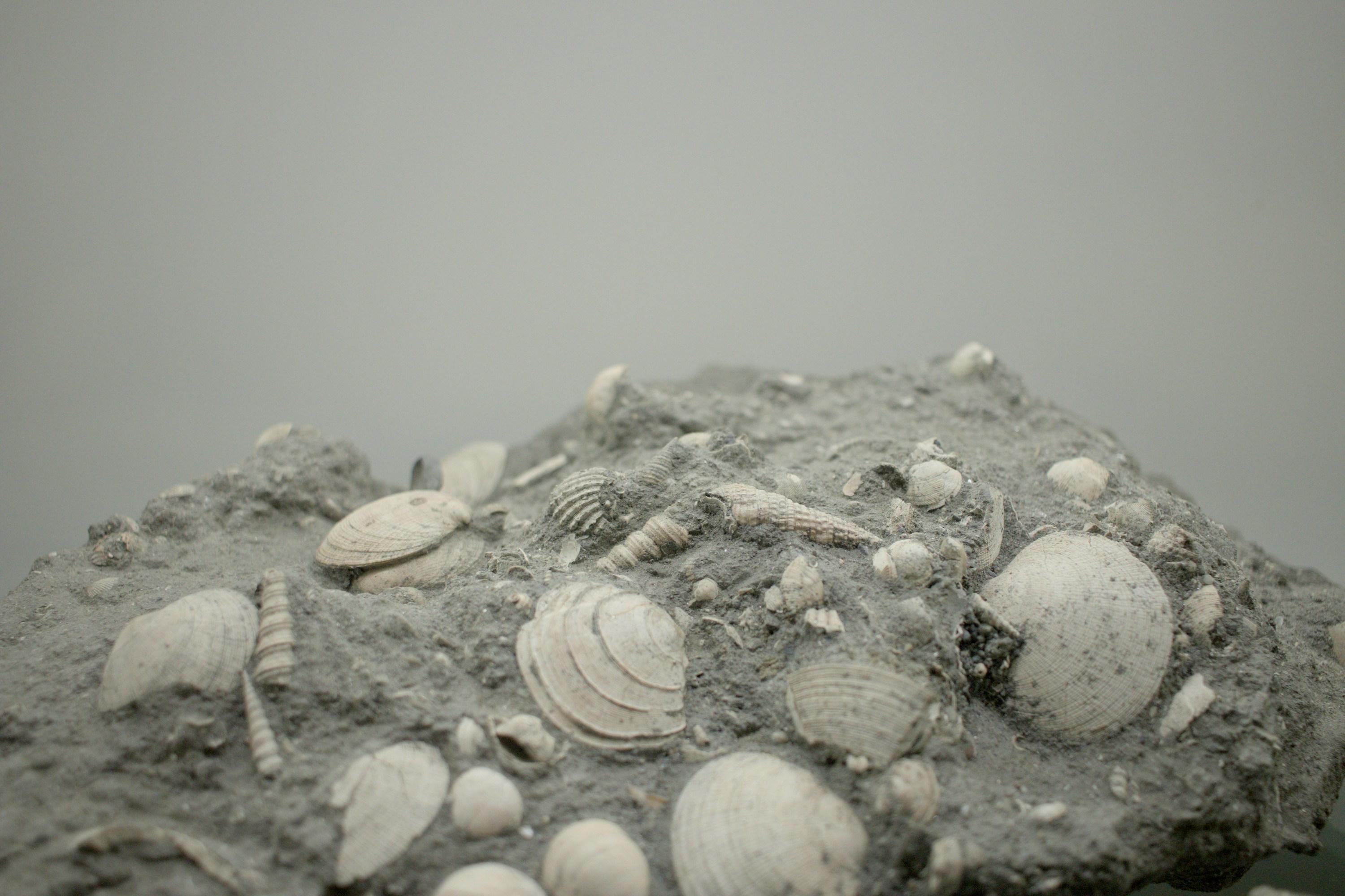
Fossil Collecting Overview and Geology
Every sedimentary rock layer is a page in Earth's history, and fossils are the text written on those pages. Fossil collecting is one of the most accessible and rewarding branches of rockhounding because sedimentary rocks cover roughly 75% of Earth's land surface, and many of them contain preserved remains of ancient life. You do not need to travel to remote deserts or scale mountain cliffs — productive fossil sites exist in road cuts, creek beds, quarry tailings, and eroding bluffs across nearly every state.
The science is straightforward. Organisms die, get buried in sediment, and over millions of years the hard parts (shells, bones, teeth, wood) are mineralized — their original material replaced or infilled by minerals like calcite, silica, pyrite, or phosphate. Soft-bodied organisms rarely fossilize, which is why the fossil record is dominated by shelled marine invertebrates, teeth, and bones. The type of fossil you find depends entirely on the age and depositional environment of the rock you are working.
A critical legal distinction: on federal land (BLM, National Forest), invertebrate and plant fossils can be collected for personal use in reasonable quantities. Vertebrate fossils — anything with a backbone (dinosaur bones, mammal skulls, fish skeletons, reptile remains) — are protected under the Paleontological Resources Preservation Act of 2009 and cannot be collected without a research permit. This distinction matters in the field. If you find a bone on BLM land, leave it in place, document the location with GPS and photographs, and report it to the managing agency.
Top US Locations for Fossil Collecting
1. Caesar Creek State Park / Cincinnati Arch, Ohio (Warren County)
GPS: 39.4870° N, 84.0700° W (Caesar Creek fossil collecting area at spillway)
Land Status: US Army Corps of Engineers land within Caesar Creek State Park. Fossil collecting is permitted at the designated spillway collecting area. Surface collecting from loose shale and limestone debris.
Vehicle: Standard 2WD. Paved road to parking area.
The Cincinnati Arch exposes some of the best Ordovician-age marine fossils in North America. These rocks are roughly 450 million years old — a time when Ohio was covered by a shallow tropical sea teeming with life. The limestones and shales here are packed with brachiopods, bryozoans, crinoid stems, horn corals, trilobites, and gastropods. At Caesar Creek, the Army Corps of Engineers periodically removes rock from the dam spillway and places it in a designated collecting area. You walk through piles of Ordovician limestone and shale, splitting rocks along bedding planes to expose fossils.
Trilobites are the prize find here — Isotelus maximus (Ohio's state fossil) is a large trilobite that reaches 12+ inches, though most specimens are fragmentary. Complete trilobites are uncommon and worth careful extraction. Brachiopods and bryozoans are everywhere — you will fill a bucket in an hour. The Cincinnati Arch region extends south into Kentucky (Falls of the Ohio State Park near Louisville exposes a Devonian coral reef — viewing only, no collecting at the falls itself) and north into Indiana.
2. Peace River, Arcadia, Florida (DeSoto County)
GPS: 27.2150° N, 81.8600° W (public launch at Arcadia)
Land Status: The Peace River is a public navigable waterway. Fossil collecting from the river bottom and gravel bars is legal. Some access points are county parks with small parking fees.
Vehicle: Standard 2WD to launch points.
Florida sits on a thick stack of Cenozoic-age marine sediments, and the Peace River cuts through Miocene and Pliocene formations (roughly 5-20 million years old) that are loaded with shark teeth, ray dental plates, dugong ribs, whale vertebrae, horse teeth, and other vertebrate and invertebrate remains. Unlike most fossil sites, Florida's waterway-based collecting means vertebrate fossils found in river gravel are generally legal to collect — they have been transported out of their original context by the river.
The standard technique: wade into the river with a long-handled screen (sometimes called a "Florida fossil sieve"), scoop gravel from the river bottom, and sift. Shark teeth — ranging from tiny sand tiger shark teeth to occasional Otodus megalodon teeth 4+ inches long — are the most common finds. Megalodon teeth are the prize, but even partial or broken specimens have value. The best collecting is during low-water periods (late spring) when gravel bars are exposed.
Venice Beach on the Gulf Coast (Sarasota County, 27.1000° N, 82.4500° W) is another productive site — shark teeth wash up in the surf zone. Collecting is legal on the public beach.
3. Badlands Region, South Dakota (Pennington & Jackson Counties)
GPS: 43.8550° N, 102.3400° W (BLM land south of Wall — NOT inside Badlands National Park)
Land Status: BLM land and private ranches (with permission) outside Badlands National Park. All collecting prohibited inside the National Park. BLM land permits invertebrate and plant fossil collecting for personal use. Vertebrate fossils on BLM land are protected — do not collect.
Vehicle: High-clearance 4WD for BLM roads. Some are impassable when wet (bentonite clay becomes extremely slick).
Western South Dakota exposes the Pierre Shale (Cretaceous, ~80 million years old) and the Fox Hills Formation (latest Cretaceous, ~66 million years old) — both deposited in the Western Interior Seaway that split North America in half during the Age of Dinosaurs. The Pierre Shale produces ammonites, baculites (straight-shelled cephalopods), clams, and occasional mosasaur vertebrae (report vertebrate finds to BLM). The Fox Hills Formation produces beautiful concretions containing complete ammonites and baculites.
The White River Group (Oligocene, ~30-35 million years old) makes up the dramatic Badlands formations and produces mammal fossils — but these are vertebrate fossils and off-limits to casual collectors on federal land. Stick to invertebrate-bearing Pierre Shale and Fox Hills exposures on BLM land south and west of the park. Ranchers in the area may grant access to private land — ask at local businesses in Wall or Interior.
4. Edwards Plateau / Glen Rose, Texas (Somervell & Travis Counties)
GPS: 32.2300° N, 97.7600° W (Glen Rose area, Somervell County)
Land Status: Mix of state parks (Dinosaur Valley State Park — no collecting), county road cuts (collecting of loose material permitted), and private land. Creek beds on public land are productive.
Vehicle: Standard 2WD for most sites. Some ranch roads require high clearance.
Central Texas is underlain by Cretaceous-age limestone deposited in a shallow sea roughly 100-110 million years ago. The Edwards Limestone and Glen Rose Formation are loaded with echinoids (sea urchins), oysters (Exogyra and Gryphaea), ammonites, gastropods, and bivalves. Invertebrate fossils weather out of limestone road cuts and creek beds across the entire Edwards Plateau — you can find them from Austin to San Angelo.
Dinosaur Valley State Park near Glen Rose preserves famous sauropod and theropod trackways in the Paluxy River bed — these are protected and must not be disturbed. But invertebrate fossils in the surrounding limestone on public rights-of-way and in creek beds are abundant and legal. The best technique is walking creek beds in the Hill Country and scanning exposed limestone ledges for the characteristic shapes of sea urchin tests and oyster shells.
5. Calvert Cliffs, Maryland (Calvert County)
GPS: 38.3940° N, 76.4360° W (Calvert Cliffs State Park beach access)
Land Status: Calvert Cliffs State Park — beach collecting of loose material from the surf zone is permitted. Do not dig into or climb the cliffs (dangerous and prohibited). Fossils that fall from the cliffs onto the beach are fair game.
Vehicle: Standard 2WD. 1.8-mile hike from parking to beach.
The Calvert Cliffs expose the Calvert and Choptank Formations — Miocene-age marine sediments roughly 10-20 million years old. These cliffs erode continuously, dropping shark teeth, whale bones, dolphin vertebrae, ray dental plates, scallop shells, and echinoid spines onto the beach. The 1.8-mile trail from the parking lot to the beach is flat and easy. Once on the beach, walk the waterline scanning the gravel and sand for teeth and bone fragments.
Shark teeth are the primary find — dozens of species represented, from massive Otodus megalodon teeth (rare) to abundant smaller species. Whale ear bones (tympanic bullae), dolphin vertebrae, and colonial coral fragments are also common. The best collecting is after storms or high-water events that erode fresh material from the cliffs. Do not approach the cliff face — the unconsolidated sediment is prone to sudden collapse.
6. Bear Paw Shale, Montana (Blaine & Hill Counties)
GPS: 48.3500° N, 109.5200° W (BLM land near Havre area)
Land Status: BLM land. Invertebrate fossil collecting permitted for personal use. Vertebrate fossils protected.
Vehicle: High-clearance 4WD recommended. Remote ranch roads.
The Bear Paw Shale in north-central Montana is one of the best ammonite collecting localities in North America. This Late Cretaceous marine shale (~75 million years old) produces large ammonites — Placenticeras and Baculites — some of which are preserved in iridescent ammolite (gem-quality nacre). Ammolite-bearing ammonites from this area are internationally sought after. The ammonites occur in concretions that erode out of the shale on BLM land. Split concretions along bedding planes to check for ammonite cross-sections.
The terrain is remote — plan for long drives on unpaved roads with no services. Carry water, food, fuel, and a spare tire. Cell service is unreliable.
7. Sharktooth Hill, California (Kern County)
GPS: 35.4700° N, 118.9600° W (general Sharktooth Hill area)
Land Status: Buena Vista Museum of Natural History operates guided digs on private land at Sharktooth Hill. BLM land in the Temblor Range may also produce fossils. Contact the museum for dig schedules.
Vehicle: High-clearance 2WD for most access roads.
The Sharktooth Hill Bone Bed in the Round Mountain Silt (Miocene, ~15 million years ago) is one of the densest concentrations of marine vertebrate fossils in the world. The bonebed contains shark teeth, whale bones, sea lion remains, sea turtle shell fragments, and fish bones. Public digs organized by the Buena Vista Museum give collectors access to this otherwise restricted site. Shark teeth are the most common find — species range from great white shark ancestors to bizarre filter-feeding sharks.
Fossil Types and Where to Find Them
| Fossil Type | Age Range | Best Locations | Legal Status (Federal Land) | Typical Condition |
|---|---|---|---|---|
| Shark teeth | Cretaceous to Pleistocene | FL (Peace River, Venice Beach), MD (Calvert Cliffs), CA (Sharktooth Hill) | Legal (invertebrate equivalent under PRPA) | Often complete; may be polished by water transport |
| Ammonites | Devonian to Cretaceous | SD (Pierre Shale), MT (Bear Paw Shale), TX | Legal — invertebrate | Complete in concretions; fragmentary in shale |
| Trilobites | Cambrian to Permian | OH (Caesar Creek), UT (Wheeler Shale), OK, NY | Legal — invertebrate | Usually fragmentary; complete specimens rare |
| Brachiopods | Cambrian to present | OH, IN, KY, NY, MO | Legal — invertebrate | Extremely common; often complete |
| Crinoid stems | Ordovician to present | OH, IN, IA, MO | Legal — invertebrate | Individual columnals very common; complete calyxes rare |
| Echinoids (sea urchins) | Ordovician to present | TX (Edwards Plateau), MS, AL, FL | Legal — invertebrate | Often complete; fragile — extract carefully |
| Plant fossils (ferns, leaves) | Devonian to Cenozoic | PA (Carboniferous coal measures), WV, IL, WA | Legal — plant | Compression fossils in shale; fragile |
Field Identification: Fossils vs. Look-Alikes
| Object | How to Distinguish from Fossils |
|---|---|
| Concretions | Rounded, often symmetrical mineral masses that form around a nucleus in sediment. May contain fossils inside, but the concretion itself is not a fossil. Break one open to check — if there is a shell or bone at the center, the concretion formed around the fossil. |
| Dendrites (manganese oxide patterns) | Black, branching patterns on rock surfaces that look like fossilized ferns or plants. These are mineral deposits (manganese and iron oxides) that precipitated along fractures. They are flat, two-dimensional stains — real plant fossils have three-dimensional cellular structure. |
| Weathering patterns | Differential erosion can create shapes that resemble bones or shells. Test by looking for biological structure: growth lines, symmetry, cell walls, tooth serrations. A smooth, featureless object without biological structure is probably a rock. |
| Geodes / vugs | Hollow, crystal-lined cavities in rock. Sometimes confused with fossilized eggs or shells. Geodes are mineral-filled voids — they lack any biological structure on the exterior. |
The best field test for a suspected fossil: look for bilateral symmetry (both sides mirror each other, as in brachiopods), growth lines (as in shells and teeth), or repeated structural patterns (as in coral polyp cavities and crinoid columns). Real fossils almost always show some form of organized biological structure that random rocks do not.
Tools for Fossil Collecting
- Rock hammer and cold chisels: For splitting shale and limestone along bedding planes to expose fossils. A mason's chisel (wide blade) works well for shale. A pointed geological hammer is useful for harder limestone.
- Dental picks and awls: For cleaning matrix from around delicate fossils. A set of dental tools from a surplus store costs a few dollars and is invaluable.
- Newspaper, tissue paper, and small containers: Fossils in shale are often fragile. Wrap individually before placing in a bag or bucket. Pill bottles work well for small shark teeth.
- White glue (PVA / Elmer's): A dilute solution (50/50 glue and water) brushed onto a crumbly fossil stabilizes it in the field. Let it dry before trying to move the specimen.
- Camera or smartphone: Photograph fossils in place before removing them. Context matters — noting the rock layer, orientation, and associated fossils helps with identification later.
- Hand lens (10x): Essential for distinguishing small fossils from mineral concretions, and for examining fine structure on teeth and shells.
- Screen/sieve (for river collecting): A 1/4-inch mesh screen with handles is the standard tool for sifting river gravel in Florida and other waterway sites.
Legal Considerations
BLM land: Invertebrate and plant fossils — legal to collect for personal use in reasonable quantities (no commercial collecting without a permit). Vertebrate fossils (bone, teeth of vertebrates other than sharks) — protected under the Paleontological Resources Preservation Act (PRPA). Leave vertebrate fossils in place and report them.
National Parks and Monuments: All fossil collecting prohibited. Zero exceptions. This includes loose surface material.
State parks: Varies widely. Caesar Creek (OH) allows it. Dinosaur Valley (TX) does not. Always check park-specific regulations.
Public waterways: Fossils collected from river gravel below the ordinary high-water mark are generally legal. This is the basis for Peace River (FL), Venice Beach (FL), and similar waterway collecting.
Private land: Fossils belong to the landowner. Get written permission before collecting. On private land, even vertebrate fossils belong to the landowner (PRPA applies only to federal land).
Reporting significant finds: If you find something unusual — an articulated skeleton, an exceptionally large tooth, a previously unreported species — contact the nearest natural history museum or university geology department. Significant finds reported by amateur collectors have led to major scientific discoveries.
Explore the Interactive Fossil Map
Use our interactive fossil location map to find collecting sites with GPS coordinates, formation ages, land status, and access information across the United States.