
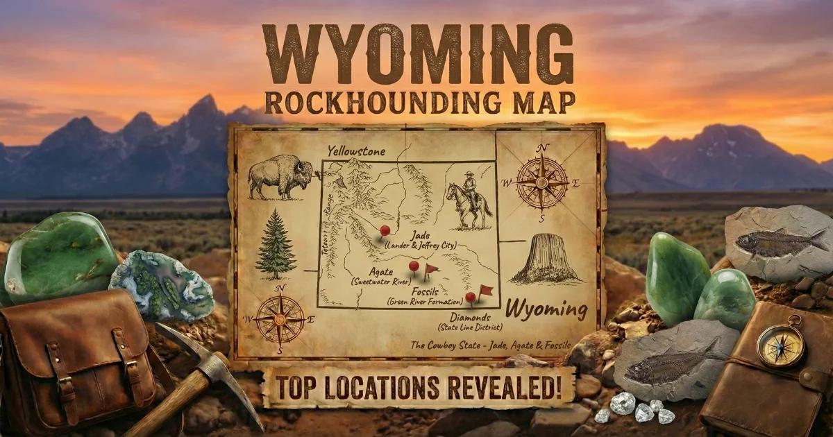
Wyoming is built on some of the oldest exposed rock on the continent. Archean granite and gneiss in the Wind River Range dates back 2.7 billion years. Layered on top of that are Paleozoic sediments, Mesozoic shales, Tertiary volcanics, and vast alluvial basins. This geologic stacking gives the state a mineral diversity that surprises people who think of Wyoming as nothing but sagebrush and cattle.
The state gemstone is nephrite jade, and Wyoming remains the primary domestic source. But jade is only part of the story. Sapphires occur in Precambrian pegmatites in Fremont County. Sweetwater agates — some of the finest moss agate on Earth — weather out of Tertiary-age volcanic ash beds along the Sweetwater River. Fossil fish at Kemmerer preserve Eocene lake fauna in exquisite detail. Petrified wood fills the Bighorn Basin. Placer gold still sits in the gravels at South Pass, where the 1867 rush kicked off a territorial mining boom.
Nearly half the state is federal land — BLM and National Forest — so access for casual mineral collecting is better here than in most of the West. You can work for days and not see another collector.

Geology of Wyoming's Gem-Bearing Terrain
Wyoming's geology divides into three broad provinces that matter for gem hunting.
The Precambrian cores — Wind River Range, Granite Mountains, Bighorn Mountains, Laramie Range — are exposed blocks of Archean and Proterozoic crystalline rock. Nephrite jade forms where serpentinite bodies (altered ultramafic rock) sit along shear zones within these basement complexes. The metamorphic conditions that produce nephrite require pressure, hydration, and calcium — all present where serpentinite meets carbonate or calc-silicate rock. Sapphires at Palmer Canyon occur in Precambrian pegmatite veins cutting metamorphic host rock.
The sedimentary basins — Bighorn Basin, Wind River Basin, Green River Basin, Powder River Basin — are thick stacks of Paleozoic through Tertiary sediment. The Green River Formation (Eocene) produced the fossil fish at Fossil Butte. Petrified wood in the Bighorn Basin formed when silica-rich groundwater permeated buried wood in Tertiary sediments and volcaniclastic deposits.
The volcanic terrain in the Absaroka Range and around Yellowstone produced obsidian, agate, and petrified wood. Tertiary ashfall deposits along the Sweetwater River are the source bed for Sweetwater agates and moss agate — silica mobilized from volcanic ash, precipitated into nodules and cavity fills within the tuff.
Understanding which province you are standing in tells you what to look for underfoot.
Collecting Locations
1. Wyoming Jade — Crooks Mountain / Granite Mountains (Fremont County)
GPS: Approx. 42.49°N, 107.80°W (Crooks Gap area).
Land Status: BLM public land. Some adjacent private claims — check before crossing fences.
Minerals: Nephrite jade (green, black, olive, rare translucent), serpentine, chromite.
This is the heart of Wyoming's jade country. Nephrite jade occurs here as float boulders weathered out of serpentinite bodies in the Precambrian basement rock. The jade formed through metasomatic replacement along contacts between serpentinite and dolomitic marble under greenschist-facies metamorphic conditions. Jade boulders range from fist-sized to multi-ton blocks. Surface collecting has been going on since the 1930s, so the easy roadside material is largely picked over, but jade still turns up in drainages, on ridgelines, and in areas reached by walking a mile or more from the road.
Color ranges from deep spinach green (most valuable) through olive and gray-green to jet black. The rare translucent "mutton fat" jade — pale green to white with a greasy luster — commands the highest prices. You will not identify quality from the weathered rind. Every serious jade hunter carries a diamond saw to window suspect stones in the field.
2. Palmer Canyon Sapphires (Fremont County)
GPS: Approx. 42.65°N, 108.68°W (canyon entrance area).
Land Status: Mix of BLM and private claims. Verify current access — some areas have been staked.
Minerals: Sapphire (blue, pink, colorless), iolite (cordierite), garnet, kyanite, feldspar.
Palmer Canyon, southwest of Lander, exposes Precambrian pegmatite veins and metamorphic rocks that produce sapphires. The corundum occurs in a geological setting similar to some Montana deposits — pegmatite dikes intruding aluminous metamorphic rock. The sapphires are typically small (under 1 carat rough) but can be gem-quality after cutting. Associated iolite (gem-quality cordierite, showing violet-blue color) is also collectible here.
Access requires a high-clearance vehicle. The canyon road is rough and can be impassable after rain. Check with the BLM Lander Field Office (307-332-8400) for current land status, as mining claims in the area change hands.
3. Sweetwater Agates and Moss Agate — Sweetwater County / Along the Sweetwater River
GPS: Approx. 42.48°N, 108.20°W (general collecting area south of the Sweetwater River, near Hwy 28).
Land Status: BLM public land. Large open tracts.
Minerals: Sweetwater agate (fortification type), moss agate, chalcedony, jasper, common opal.
The Sweetwater River corridor between South Pass and Jeffrey City produces what many lapidaries consider the finest moss agate in the world. The material occurs as nodules and seam fills in Tertiary volcanic ash beds (tuffaceous sediments). Sweetwater agates show classic fortification banding — concentric layers of translucent to opaque chalcedony. The moss agate contains dendritic manganese and iron oxide inclusions that form fern, plume, and landscape patterns within clear to milky chalcedony.
Walk ridges and eroded hillsides above the river. The agates weather out of soft tuff and accumulate on the surface as lag deposits. After rain, freshly exposed material is easier to spot. The best specimens have hollow centers lined with druzy quartz. This is wide-open BLM rangeland — no trees, no shade, and no water. Bring everything you need.
4. Fossil Fish — Kemmerer Area (Lincoln County)
GPS: Approx. 41.79°N, 110.55°W (Fossil Butte National Monument).
Land Status: National Monument (no collecting). Private fee-dig quarries adjacent to the monument are open to public digging.
Minerals/Fossils: Fossil fish (Knightia, Diplomystus, Mioplosus, Priscacara), fossil insects, plant fossils.
Fossil Butte National Monument preserves a section of the Green River Formation — Eocene lake sediments deposited roughly 52 million years ago in ancient Fossil Lake. No collecting is permitted within the monument. But several private quarries on adjacent land operate fee-dig programs where you split limestone laminae and extract your own fossil fish. Ulrich's Fossil Gallery and the American Fossil Quarry are established operations.
Knightia is the most common species — a small herring-like fish that appears on nearly every split slab. Diplomystus (a larger predatory fish) and Priscacara (a sunfish relative) are less common and more valuable. Occasional stingrays, turtles, crocodilians, and palm fronds appear. Fee-dig rates typically run $75–150 per person per day. You keep what you find. Bring a flat-head screwdriver, safety glasses, and patience — the work is methodical splitting of thin limestone layers.
5. Petrified Wood — Bighorn Basin (Big Horn / Washakie Counties)
GPS: Approx. 44.15°N, 108.30°W (general area east of Meeteetse).
Land Status: Mix of BLM and private ranch land. Stay on BLM sections — check land status maps.
Minerals: Petrified wood (silicified conifers, some palms), agate, chalcedony.
The Bighorn Basin contains Tertiary sediments and volcaniclastic deposits that preserved large quantities of wood through silicification. Petrified wood occurs as surface float and partially exposed logs in badlands terrain. Colors include reds, oranges, browns, and occasional greens from chromium traces. Some pieces show excellent cellular preservation visible under a hand lens.
BLM casual collecting rules apply: up to 25 pounds per day plus one piece, 250 pounds per year, for personal (non-commercial) use. Do not use heavy equipment. The badlands terrain here is rough — high-clearance and 4WD recommended. Cell service is nonexistent in most of the basin.
6. South Pass Gold (Fremont County)
GPS: Approx. 42.46°N, 108.80°W (South Pass City historic district).
Land Status: BLM public land (some patented mining claims remain). South Pass City itself is a state historic site — no collecting within the site boundary.
Minerals: Placer gold (fine to flake), magnetite, garnet (indicator), quartz.
South Pass and neighboring Atlantic City were the sites of Wyoming's first major gold rush in 1867. Gold occurs in Archean greenstone belt rocks — quartz veins in metavolcanic and metasedimentary sequences. The lode source was the Carissa Mine and associated workings. Placer gold remains in stream gravels on public land surrounding the historic district. Most gold is fine — flour to flake — and requires careful panning or a sluice box. Work the inside bends of Willow Creek and Rock Creek where gravel bars concentrate heavies.
The elevation is 7,800 feet. Snow closes access from November through May in most years. Summer thunderstorms are violent and come fast. Watch for lightning on the exposed ridges.
Wyoming Minerals at a Glance
| Mineral | Hardness | Where in Wyoming | What to Look For |
|---|---|---|---|
| Nephrite jade | 6–6.5 | Granite Mountains, Wind River Range, Crooks Gap | Dense, dark green to black boulders; greasy luster on fresh surfaces; heavier than expected |
| Sapphire (corundum) | 9 | Palmer Canyon, Fremont County | Small blue, pink, or colorless crystals in pegmatite or alluvial gravel |
| Sweetwater agate | 7 | Sweetwater River corridor | Banded nodules in volcanic tuff; concentric fortification patterns |
| Moss agate | 7 | Sweetwater County, BLM land | Clear to milky chalcedony with dendritic manganese/iron inclusions |
| Placer gold | 2.5 | South Pass, Atlantic City, Bighorn streams | Yellow metallic flakes and grains in stream gravel, concentrates with black sand |
| Petrified wood | 6.5–7 | Bighorn Basin | Silicified wood with visible grain and growth rings; agatized colors |
| Fossil fish | N/A | Kemmerer, Green River Formation | Fish impressions in laminated limestone; split along bedding planes |
| Obsidian | 5–5.5 | Yellowstone area (NO collecting in park) | Black volcanic glass with conchoidal fracture; found on NF/BLM land outside park |
| Iolite (cordierite) | 7–7.5 | Palmer Canyon | Violet-blue transparent crystals; strong pleochroism (color changes with viewing angle) |
Field Identification
Jade vs. Serpentine
This is the single most important field ID problem in Wyoming. Both nephrite jade and serpentine come from serpentinite bodies. Both can be green. Both can have a greasy feel. Here is how to separate them.
| Property | Nephrite Jade | Serpentine |
|---|---|---|
| Hardness | 6–6.5 — scratches steel and glass easily | 3–5 — a steel knife scratches serpentine |
| Toughness | Extremely tough — resists breaking with a hammer. Interlocking fibrous structure absorbs impact. | Brittle to moderately tough. Fractures more easily. |
| Density (SG) | 2.9–3.1 — noticeably heavy in hand | 2.5–2.6 — lighter than jade of the same size |
| Sound when tapped | Rings — a clear, bell-like tone when suspended and struck | Dull thud |
| Fracture surface | Splintery, fibrous | Conchoidal to splintery, often flaky |
| Acid test | No reaction to HCl | Slight fizz in some varieties (antigorite) |
The quick field test: try to scratch the stone with a steel knife blade. If the stone scratches the blade (leaving a silver streak on the stone), it is at least as hard as steel and is a jade candidate. If the blade scratches the stone, it is serpentine or something softer. For a definitive answer, you need a saw cut — the interior will show the characteristic fibrous texture of nephrite under a hand lens.
Sweetwater Agate vs. Common Chalcedony
True Sweetwater agate shows well-defined concentric banding or moss/dendritic inclusions. Common chalcedony from the same formation can be plain white to gray without pattern. Both have hardness 7. The distinction matters for lapidary value — banded and moss-patterned material is worth cutting; plain chalcedony generally is not.
Gold vs. Pyrite ("Fool's Gold")
In the South Pass gravels, both gold and pyrite are present. Gold is soft (scratches with a pin), malleable (flattens when struck), and stays bright yellow in all lighting. Pyrite is hard (scratches glass), brittle (shatters when struck), and has a brassy, slightly greenish cast. Gold is dense — it sinks to the bottom of a pan fast and stays put when lighter material washes away.
Tools and Gear
| Item | Purpose |
|---|---|
| 10x hand lens (loupe) | Examining crystal structure, fibrous texture in jade, cell structure in petrified wood |
| Steel knife or file | Hardness testing: jade scratches steel, serpentine does not |
| Portable diamond saw (battery-powered) | Windowing jade boulders to check interior quality — essential for serious jade hunters |
| Gold pan and classifier | Placer gold recovery at South Pass area streams |
| Flat-head screwdriver | Splitting limestone laminae at Kemmerer fossil quarries |
| Rock hammer (crack hammer) and cold chisel | Extracting agate nodules and sampling outcrops |
| GPS unit or phone with offline maps | BLM land in Wyoming has no cell service in most areas — download maps before leaving town |
| 5-gallon buckets with lids | Transporting agates, fossils, and jade; lids prevent rattling and damage |
| Bear spray | Required in the Wind River Range, Absaroka Range, and anywhere near Yellowstone |
| Water — minimum 1 gallon per person per day | No reliable water sources at most BLM collecting areas. Dehydration is the most common field emergency in Wyoming. |
Legal and Access
- BLM casual collecting: Rocks, minerals, and invertebrate fossils may be collected for personal, non-commercial use on BLM land. Limit: 25 pounds per day plus one piece, not to exceed 250 pounds per calendar year. No mechanical equipment. No excavation that causes significant surface disturbance. Authority: 43 CFR 8365.
- National Forest: Similar casual collecting rules apply on National Forest land (Shoshone NF, Bighorn NF, Bridger-Teton NF, Thunder Basin NG). Surface collecting of reasonable quantities for personal use is permitted. Check with the local Ranger District for any area-specific closures.
- Thunder Basin National Grassland: Managed by the USFS. Casual collecting of surface minerals and petrified wood is permitted under standard Forest Service regulations.
- Yellowstone National Park: All collecting is prohibited. No rocks, minerals, fossils, plants, or artifacts may be removed. This is strictly enforced. Obsidian is visible throughout the park, but you cannot take any. Collect obsidian on adjacent National Forest or BLM land outside the park boundary.
- Fossil Butte National Monument: All collecting is prohibited within the monument boundary. Use the private fee-dig quarries on adjacent land.
- State land: Wyoming state trust land requires a recreational access permit. Check with the Wyoming Office of State Lands and Investments. Surface collecting may be permitted with the appropriate permit.
- Vertebrate fossils: On federal land, vertebrate fossils (anything with a backbone — fish, reptiles, mammals) require a permit issued to qualified researchers. The fossil fish at Kemmerer are vertebrates. You can collect them legally only at private fee-dig quarries. Do not collect vertebrate fossils on BLM or NF land without a permit.
- Mining claims: Active mining claims exist throughout the jade belt and at Palmer Canyon. Claim markers are 4x4 posts or rock cairns with claim notices. Do not collect within claim boundaries. Check the BLM LR2000 mining claim database if in doubt.
- Private land: Wyoming is an open-range state, but unfenced land is not necessarily public land. Verify land status using the BLM General Land Office interactive map before collecting. Trespass on private ranch land is prosecuted.
Interactive Map
Find all Wyoming collecting sites — jade, sapphire, agate, gold, fossil, and petrified wood locations — on our Wyoming rockhounding map with GPS coordinates and access details.