
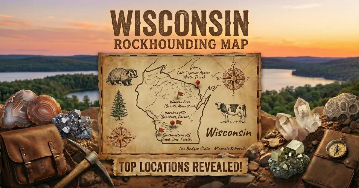
Wisconsin Geology: Two Stories Told by Ice
Wisconsin's collecting geology comes down to two events: Precambrian volcanism along the Lake Superior rift and Pleistocene glaciation that reworked everything south of the terminal moraine. A third factor — the absence of glaciation in the southwest — created the Driftless Area, one of the most geologically distinct regions in the upper Midwest.
About 1.1 billion years ago, basaltic lava flows erupted along the Midcontinent Rift System. Gas vesicles in those flows filled with silica-rich groundwater over millions of years, precipitating banded chalcedony — the Lake Superior agates that collectors prize today. These agates stayed locked in bedrock until the Laurentide Ice Sheet ground south from the Canadian Shield, plucking agate nodules from basalt and scattering them across Wisconsin in glacial till, outwash plains, and gravel deposits.
The ice also carried fine gold. Placer gold found in northern Wisconsin streams did not originate from local bedrock. It was eroded from greenstone belts in Ontario and Manitoba, transported hundreds of miles in the base of the glacier, and deposited in outwash gravels when the ice melted. The gold is fine-grained — flour to flake size — but it is real gold, and it concentrates in stream gravels that reworked glacial drift.
In the southwest corner, the Driftless Area escaped glaciation entirely. Here, Paleozoic sedimentary rocks — Ordovician and Silurian dolomite, limestone, and sandstone — sit exposed and largely unaltered. These carbonate rocks host the Upper Mississippi Valley Zinc-Lead District, which produced galena, sphalerite, smithsonite, and calcite from the 1820s through the mid-20th century. The same limestone beds contain fossils: brachiopods, crinoid stems, trilobites, and colonial corals from shallow Ordovician seas.
Along the Mississippi River bluffs, vugs and cavities in Galena Dolomite and Prairie du Chien Group rocks occasionally produce small geodes lined with quartz or calcite crystals. These are not the large keokuk-type geodes found in Iowa, but they appear in road cuts, stream banks, and eroded bluffs in Crawford, Vernon, and Grant counties.
Top Collecting Locations
1. Lake Superior Beaches — Bayfield and Ashland Counties
GPS: 46.810N, -90.818W (Wisconsin Point, Superior) to 46.575N, -90.660W (Chequamegon Bay area)
Land Status: Public lakefront. Wisconsin Point is city-owned parkland. Beaches along Highway 13 between Washburn and Cornucopia include public access points managed by Bayfield County. Apostle Islands National Lakeshore beaches are federal land — collecting rocks is prohibited within National Lakeshore boundaries. Stay on mainland public beaches outside the park.
Vehicle: 2WD sedan to paved parking areas; short walks to beach.
Minerals: Lake Superior agates (banded chalcedony, iron-oxide staining in red, orange, and yellow), basalt pebbles, occasionally thomsonite and prehnite in basalt cobbles.
This is the primary agate-hunting zone in Wisconsin. The agates formed in Precambrian basalt and were freed by wave action and glacial transport. They concentrate on gravel beaches, especially after storms that rework the beach face. Walk the strand line at low water. Agates are translucent when wet — carry a spray bottle. Look for the characteristic concentric banding in red and orange tones caused by iron oxide. Most beach agates run 0.5 to 3 inches; larger specimens appear but are uncommon. Early morning and late afternoon light makes the translucent glow easier to spot. The best collecting follows strong northeast storms that pull fresh gravel from the lake bottom.
2. Northern Wisconsin Gravel Pits — Rusk, Taylor, and Sawyer Counties
GPS: General area around 45.3N, -90.8W (Taylor County) and 45.5N, -91.4W (Rusk County)
Land Status: Private operations. You must get permission from the pit owner or operator before entering. Some county highway departments allow collecting on their gravel stockpiles — ask at the county highway office. No public-access pits exist by default; all require explicit permission.
Vehicle: High-clearance truck or SUV recommended; pit roads are unpaved and often muddy.
Minerals: Lake Superior agates, gold (flour to fine flake), pudding stone (jasper conglomerate), granite erratics, occasionally copper nuggets.
Gravel pits in glacial outwash are the second-best agate source in the state. Glaciers carried agates far south of Lake Superior, depositing them in gravel beds across the northern third of Wisconsin. After a pit operator exposes fresh gravel or after a heavy rain washes surfaces clean, agates stand out on the sorted gravel. These pits also produce pudding stone — a jasper-pebble conglomerate cemented in a quartzite matrix, originally from the Barron Quartzite formation. The red and cream jasper clasts in a white or gray matrix make pudding stone immediately recognizable. It takes a good polish and is a regional favorite.
For gold, the same glacial gravels contain fine placer gold derived from the Canadian Shield. Stream gravels in Taylor, Rusk, and Lincoln counties have produced colors for recreational panners. The gold is extremely fine — most flakes are under 1mm — and concentrates where streams cut through glacial drift. Black sand (magnetite) in your pan is a good indicator you are in gold-bearing gravels. Do not expect to get rich. This is recreational panning, but you will find gold.
3. Chequamegon-Nicolet National Forest — Northern Wisconsin
GPS: Forest covers large areas; northern unit centered near 46.1N, -91.0W; southern unit near 45.3N, -88.8W
Land Status: U.S. Forest Service (federal public land). Casual collecting of reasonable quantities of rocks, minerals, and gemstones for personal, non-commercial use is permitted under 36 CFR 228.62. Gold panning by hand methods (pan, sluice box, rocker) is allowed without a permit on most National Forest streams unless posted otherwise. No motorized equipment. No collecting in designated Wilderness Areas, Research Natural Areas, or other restricted zones.
Vehicle: High-clearance recommended for forest roads (many are gravel FR-class roads). Some trailheads accessible by 2WD in dry conditions.
Minerals: Lake Superior agates in stream gravels, placer gold (fine), granite and gneiss specimens, occasional copper, jasper, and chert.
The Chequamegon-Nicolet is the largest block of public land in Wisconsin — over 1.5 million acres. For collectors, it offers legal access to streams and gravel exposures that are off-limits on surrounding private land. Target stream gravel bars where the current has sorted material by density. Agates and gold both concentrate in the same places: inside bends, behind large boulders, and in bedrock cracks. Spring runoff season (April-May) reworks gravels and deposits fresh material on bars. Summer low water exposes more bar surface for searching.
4. Upper Mississippi Valley Zinc-Lead District — Lafayette and Grant Counties
GPS: Mineral Point area, 42.860N, -90.179W; Shullsburg area, 42.573N, -90.231W; Platteville area, 42.734N, -90.478W
Land Status: Mixed private and public. Most historic mine sites are on private land. Some road cuts and quarries may be accessible; always verify ownership. Pendarvis historic site in Mineral Point is a state-owned museum — no collecting. Ask at local historical societies or mineral clubs for current accessible locations. Some farmers allow access to old mine dumps on their property with permission.
Vehicle: 2WD sedan; roads in Grant and Lafayette counties are paved or maintained gravel.
Minerals: Galena (lead sulfide — cubic crystals and massive), sphalerite (zinc sulfide — honey to dark brown), marcasite, smithsonite, calcite (scalenohedral and rhombohedral), dolomite, pyrite, cerussite.
The lead-zinc district made Wisconsin a mining state. French explorers found Meskwaki and Ho-Chunk peoples mining galena here in the 1600s. Industrial-scale mining ran from the 1820s to the 1970s. The ore bodies formed as Mississippi Valley Type (MVT) deposits — low-temperature hydrothermal fluids migrated through Ordovician dolomite and precipitated sulfide minerals in fractures, joints, and bedding-plane openings. Galena crystals from this district are classic cubic habit, often with octahedral modifications. Sphalerite ranges from honey-yellow (low iron) to dark brown or black (high iron). Calcite crystals — both dogtooth (scalenohedral) and rhombohedral — occur in vugs alongside the sulfides.
The best specimens historically came from underground workings, most of which are now sealed or flooded. Surface collecting focuses on old mine dumps, quarry walls, and road cuts through the Galena Dolomite formation. The rock is a buff-colored, fine-grained dolomite. Look for vugs lined with calcite crystals and pockets of yellow-brown sphalerite or bright silver-gray galena cubes. Galena is dense (specific gravity 7.6) and heavy in the hand — you will not mistake it for anything else.
5. Mississippi River Bluffs — Crawford and Vernon Counties
GPS: Prairie du Chien area, 43.052N, -91.141W; Genoa area, 43.574N, -91.224W
Land Status: Mixed. River bluffs include state-owned land along the Great River Road, county parks, and private property. Wyalusing State Park (public) has exposed bluffs but collecting in state parks is prohibited. Target road cuts along Highway 35 (Great River Road) and county roads where dolomite and limestone are exposed. Army Corps of Engineers land along the river is federal — check local regulations. Collecting on private bluffs requires landowner permission.
Vehicle: 2WD sedan; Highway 35 is paved.
Minerals: Small geodes (quartz and calcite lined), druzy quartz, calcite crystals, chert nodules, fossils (brachiopods, crinoid columnals, bryozoa) in limestone.
The Mississippi River bluffs expose Prairie du Chien Group dolomite and Galena Dolomite in steep road cuts and natural cliff faces. Geodes here are generally small — 1 to 4 inches in diameter — and occur in vugs and cavities within the dolomite. They are not as abundant or as large as the famous Keokuk geodes downstream in Iowa, but they do appear. Look for round, rough-surfaced nodules weathering out of the bluff face or lying in talus at the base. Crack them carefully — many are lined with small clear quartz crystals or calcite rhombs. The same exposures yield excellent Ordovician fossils: Rafinesquina brachiopods, Receptaculites ("sunflower coral"), crinoid columnals, and occasional trilobite fragments (Isotelus and Flexicalymene).
6. Driftless Area Quarries and Road Cuts — Iowa, Dane, and Sauk Counties
GPS: General Driftless Area, centered around 43.1N, -89.8W
Land Status: Mostly private. Active quarries require company permission. Abandoned quarries may be on private or county land — verify before entering. Road cuts on public right-of-way are generally accessible, but do not park illegally or block traffic. Governor Dodge State Park and Devil's Lake State Park have exposed Paleozoic rock, but collecting in state parks is prohibited.
Vehicle: 2WD sedan for road cuts; high-clearance helpful for some quarry access roads.
Minerals: Fossils (Ordovician and Silurian — brachiopods, crinoids, trilobites, colonial corals, bryozoa), calcite, dolomite crystals, chert, occasional pyrite.
The Driftless Area is the unglaciated region of southwest Wisconsin where Paleozoic sedimentary layers remain exposed at the surface rather than buried under glacial drift. This makes it the best fossil-collecting terrain in the state. The Ordovician Platteville and Decorah formations contain abundant marine invertebrate fossils. Silurian dolomite in the eastern Driftless Area (Dodge and Fond du Lac counties) contains well-preserved coral reefs with Favosites (honeycomb coral) and Halysites (chain coral). Quarries that cut through these formations expose fresh fossiliferous surfaces. After rain, fossils weather out of road-cut talus and are easy to spot on freshly eroded slopes.
Wisconsin Minerals and Specimens
| Mineral / Specimen | Composition | Where Found | Field ID |
|---|---|---|---|
| Lake Superior Agate | SiO₂ (chalcedony, microcrystalline quartz) | Lake Superior beaches, gravel pits statewide, stream gravels in northern WI | Concentric red-orange-white banding; translucent when wet; waxy luster; hardness 7 |
| Galena | PbS (lead sulfide) | Lafayette, Grant, Iowa counties — mine dumps, quarries, road cuts in Galena Dolomite | Silver-gray metallic luster; cubic crystals or massive; very heavy (SG 7.6); perfect cubic cleavage; streak lead-gray |
| Sphalerite | ZnS (zinc sulfide) | Same lead-zinc district locations as galena | Honey-yellow to dark brown/black; resinous to adamantine luster; six directions of cleavage; streak yellow-brown |
| Calcite | CaCO₃ | Lead-zinc district vugs; Mississippi River bluffs; Driftless Area quarries | Colorless to white; rhombohedral or scalenohedral (dogtooth) crystals; fizzes in dilute HCl; hardness 3 |
| Placer Gold | Au | Stream gravels in Taylor, Rusk, Lincoln, Marathon counties; Chequamegon-Nicolet NF streams | Bright yellow; malleable (flattens under hammer); does not tarnish; found with black sand (magnetite) |
| Pudding Stone | Jasper-pebble conglomerate (quartzite matrix) | Glacial till and gravel pits in northern WI; erratics statewide | Red, cream, and pink jasper clasts in white/gray quartzite matrix; hard (7); takes a polish |
| Geodes (small) | Quartz and/or calcite lining in dolomite host | Mississippi River bluffs, Crawford and Vernon counties | Round, rough-surfaced nodules; lighter than solid rock; hollow interior lined with crystals; 1-4 inches typical |
| Marcasite | FeS₂ (iron sulfide, orthorhombic) | Lead-zinc district; Driftless Area dolomite | Pale brass-yellow; tarnishes greenish; tabular or cockscomb crystal habit; brittle; streak dark gray-green |
| Smithsonite | ZnCO₃ | Lead-zinc district, associated with sphalerite weathering | Blue-green, white, or yellow botryoidal crusts; fizzes in warm HCl; pearly luster; hardness 4-4.5 |
| Ordovician Fossils | Calcite replacement in limestone/dolomite | Driftless Area road cuts, quarries, stream exposures | Brachiopods, crinoid stems, trilobite fragments, bryozoa, Receptaculites; preserved in buff dolomite or gray limestone |
Field Identification Tips
Lake Superior Agates
The single most reliable field test: wet the stone. Lake Superior agates become translucent when wet, and the banding pops into visibility. Dry agates on a gravel bar can look like ordinary reddish pebbles. Carry a spray bottle and wet every suspicious stone. The banding is concentric — alternating layers of iron-stained chalcedony in red, orange, yellow, and white. Hardness is 7 (scratches glass and steel). The agate will have a waxy to vitreous luster on fresh fracture surfaces. Pitted exterior surfaces are common — these "husk" marks form where the agate separated from the host basalt. Do not confuse agates with jasper, which is opaque rather than translucent, or with iron-stained quartzite, which lacks banding.
Galena
Galena is one of the easiest minerals to identify in the field. It is extremely heavy — pick up a chunk the size of a golf ball and the weight will surprise you. It has a bright silver-gray metallic luster on fresh surfaces. It cleaves in three directions at 90 degrees, producing perfect cubes or stepped cubic fragments. The streak is lead-gray. Do not lick galena or handle it extensively without washing your hands afterward — it is a lead mineral. Galena crystals from Wisconsin are typically simple cubes, sometimes modified by octahedral faces that truncate the cube corners.
Sphalerite vs. Other Brown Minerals
Sphalerite can look like brown glass or dark honey. The key diagnostic feature in the field is its resinous luster — it looks like rosin or dark amber, not metallic and not waxy. It has six directions of cleavage (dodecahedral), producing angular fragments that glint in the light. The streak is yellow-brown to light brown, which distinguishes it from dark-brown minerals with white or gray streaks. If you scratch it with a knife and get a sulfur smell, that confirms zinc sulfide.
Pudding Stone
Pudding stone is easy to recognize but hard to break. The jasper clasts (rounded pebbles) are distinctly red, cream, yellow, or pink, set in a tough quartzite cement that is white to gray. The overall look resembles a plum pudding — hence the name. Hardness is 7; it will scratch glass. You will find pudding stone as glacial erratics (large boulders dropped by ice) and as cobbles in gravel pits. It polishes well in a tumbler or on a lapidary wheel.
Geodes
Geodes in the Mississippi River bluffs area are small and inconspicuous. Look for rounded nodules with a rough, bumpy exterior that contrasts with the flat-bedded dolomite host rock. They feel lighter than a solid rock of the same size because the interior is hollow. Shake the nodule — occasionally you will hear loose crystals rattling inside. Crack them with a chisel along the equator, not a hammer blow to the center, which will shatter the crystal lining. Many Wisconsin geodes are solid (fully filled with chalcedony) rather than hollow, so not every round nodule will be a true geode.
Tools and Equipment
Wisconsin collecting covers a range of terrain — beaches, gravel pits, road cuts, and forest streams — so gear requirements vary by site. Here is a general-purpose list.
- Rock hammer (22 oz, flat/chisel head): For splitting rock, checking vugs in dolomite, and cracking geodes. A crack hammer works for heavy quarry work.
- Cold chisels (3/4" and 1"): For opening vugs in dolomite without damaging crystal linings. A point chisel helps start cracks.
- Spray bottle: Essential for agate hunting. Wetting stones reveals translucency and banding that is invisible when dry.
- Gold pan (14" steel or plastic): For placer gold in northern streams. A classifier screen (1/4" mesh) speeds up processing.
- Sluice box (optional): For more efficient gold recovery in streams. Hand-operated sluices are legal on National Forest land.
- Hand lens (10x): For examining crystal faces, fossil detail, and mineral identification in the field.
- Streak plate (unglazed porcelain tile): For distinguishing galena, sphalerite, marcasite, and other metallic minerals by streak color.
- Dilute hydrochloric acid (10% HCl in dropper bottle): For confirming calcite (fizzes vigorously) vs. dolomite (fizzes only when powdered or warmed). Also confirms fossils preserved in limestone vs. silicified fossils.
- Safety glasses: Mandatory when hammering rock. Galena and sphalerite produce sharp fragments.
- Gloves: Leather work gloves for hammering. Wash hands after handling galena (lead mineral).
- Collection bags and newspaper: Wrap specimens individually to prevent damage during transport. Label each with location and date.
- GPS or phone with offline maps: Many northern Wisconsin collecting areas have limited cell service. Download maps before you go.
- Field notebook: Record GPS coordinates, formation names, and specimen descriptions. This information determines a specimen's scientific and monetary value.
Legal Notes and Access Rules
Wisconsin's collecting rules depend entirely on who owns the land. There is no single statewide rockhounding permit, so you need to check land status at every site.
State Parks and State Natural Areas
Collecting rocks, minerals, and fossils is prohibited in all Wisconsin State Parks, State Natural Areas, and State Forests managed by the Wisconsin DNR. This includes popular geological attractions like Devil's Lake State Park and Wyalusing State Park. You can look and photograph, but you cannot remove material. Violations carry fines under Wisconsin Administrative Code NR 45.
National Forest (Chequamegon-Nicolet)
Casual collection of reasonable quantities of rocks, minerals, and common invertebrate fossils is permitted for personal, non-commercial use under 36 CFR 228.62. This includes gold panning by hand methods (pan, sluice, rocker). No motorized or mechanized equipment (suction dredges, power sluices) without a Plan of Operations approved by the Forest Supervisor. Collecting is not permitted in designated Wilderness Areas (including Porcupine Lake, Rainbow Lake, and Headwaters Wilderness areas) or Research Natural Areas.
Apostle Islands National Lakeshore
Collecting rocks, minerals, or any natural material is prohibited within the boundaries of Apostle Islands National Lakeshore, which is administered by the National Park Service. This applies to all island and mainland beaches within the park boundary. Collect on public beaches outside the park — there is good agate habitat on non-NPS beaches in Bayfield County.
Private Land
Most productive collecting sites in Wisconsin — gravel pits, quarries, farm fields, old mine dumps — are on private property. Wisconsin trespass law (Wis. Stat. 943.13-943.15) requires permission from the landowner before entering. Do not assume that an unposted property is open to access. Many farmers and quarry operators will grant permission if asked politely. Leave gates as you found them, do not litter, and offer to share interesting finds. Maintaining good relationships with landowners keeps sites open for future collectors.
County and Municipal Land
Some county gravel pits and road-construction stockpiles are technically public property. Contact the county highway department to ask about access. Policies vary by county. Some allow casual collecting; others prohibit it for safety or liability reasons.
Gold Panning Regulations
Gold panning in Wisconsin streams on public land is generally legal. On National Forest land, hand methods are permitted without a permit. On state-owned waterways, check with the Wisconsin DNR — no specific gold-panning permit exists, but activities that disturb stream beds may require review under waterway protection statutes. Always minimize disturbance: fill in your holes, do not divert streams, and avoid working in areas with spawning fish.
When to Go
The best general collecting season runs from May through October. Spring (May-June) is ideal for gold panning because snowmelt runoff reworks stream gravels and concentrates heavy material on bars. Summer offers the longest days and driest conditions for quarry and road-cut collecting. Fall brings lower water levels on Lake Superior beaches, exposing fresh gravel. Winter collecting is possible but limited — frozen ground makes digging impractical, and northern forest roads may be impassable. Lake Superior beach hunting can work in early winter before ice forms, and post-storm wave action exposes agates in late fall. The lead-zinc district in the southwest is accessible year-round since road cuts and surface dumps do not depend on water levels.
Regional Collecting Notes
Northern Wisconsin (Lake Superior Drainage)
This is agate and gold country. Focus on beaches, gravel pits, and National Forest streams. The terrain is rolling glacial topography covered in forest. Cell service is unreliable outside towns. Gas stations are sparse on forest roads — fill your tank before heading into the backcountry. Bring bug spray from May through September; blackflies and mosquitoes in the Northwoods are aggressive.
Southwest Wisconsin (Driftless Area)
This is mineral and fossil country. The landscape is deeply dissected by streams — steep bluffs, narrow valleys, and exposed bedrock. Roads follow river valleys and ridgetops. The geology is layered Paleozoic sedimentary rock: Cambrian sandstone at the base, Ordovician dolomite and limestone in the middle, and Silurian dolomite on top in the east. Each formation has different collecting potential. The Galena Dolomite (Ordovician) is the primary host for lead-zinc minerals. The Platteville and Decorah formations are the best fossil beds.
Central and Eastern Wisconsin
Heavily glaciated terrain with thick drift cover. Surface collecting of agates and pudding stone is possible in gravel pits and plowed farm fields. After spring plowing, walk bean and corn fields with landowner permission — frost heave brings agates and other glacial erratics to the surface each year. This is not prime collecting territory compared to the north or southwest, but it produces the occasional excellent agate or glacial erratic of unusual composition.
Nearby Resources
The Wisconsin Geological and Natural History Survey (WGNHS), operated through UW-Madison, publishes geological maps, educational bulletins, and collecting guides. Their office in Madison maintains a reference mineral collection. The Geology Museum at UW-Madison displays Wisconsin minerals and fossils, including galena crystals from the lead district and Lake Superior agates. The Mining Museum in Platteville covers the history of the lead-zinc district and allows visitors to enter a reconstructed lead mine. The Badger Lapidary and Geological Society (Madison), the Kettle Moraine Geological Society (Waukesha area), and other local clubs hold field trips to collecting sites and can point you to current active locations.
Browse all known collecting locations on our Wisconsin rockhounding map.