
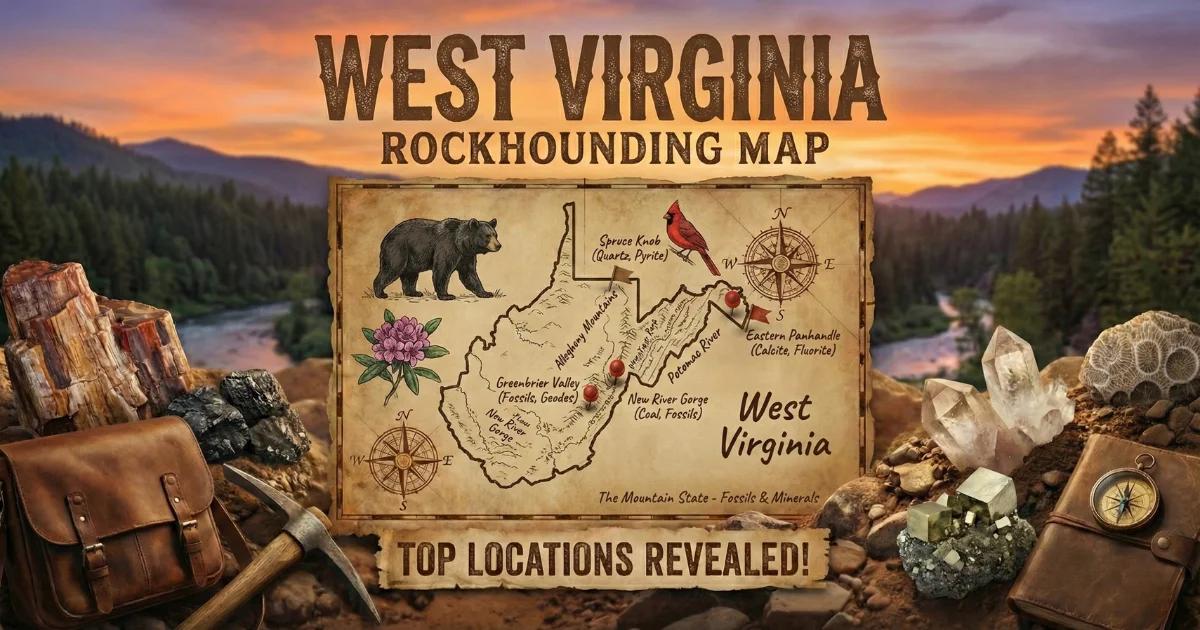
West Virginia sits entirely within the Appalachian province, straddling two major geologic divisions. The eastern panhandle and mountain counties expose Precambrian and Cambrian metamorphic basement rock — part of the same Blue Ridge-Piedmont terrane that produces gold and garnet in Virginia and North Carolina. The central and western portions of the state are dominated by Paleozoic sedimentary sequences: Devonian and Mississippian limestones, Carboniferous shales, and the vast coal-bearing measures of the Pennsylvanian Period. This combination of metamorphic basement and sedimentary cover gives West Virginia a collecting profile distinct from its neighbors — quartz crystals from vein systems, placer gold from Piedmont-sourced streams, well-preserved marine fossils, and secondary minerals formed within coal seams.
The state has no BLM land. Collecting on federal land is limited to the Monongahela National Forest and portions of the New River Gorge National Park and Preserve. Private land dominates the rest. Always verify access before collecting.

Top Collecting Locations
1. Droop Mountain — Quartz Crystals (Pocahontas County)
Land Status: Droop Mountain Battlefield State Park (WV Division of Natural Resources) and surrounding Monongahela National Forest (USDA Forest Service). Collecting is permitted on National Forest land for personal use only — do not collect within the state park boundary.
Coordinates: Approx. 38.115°N, 80.283°W (road cuts along WV Route 219 south of Hillsboro).
Vehicle: 2WD sedan. Paved highway access. Pull-offs available at road cuts.
Specimens: Clear and milky quartz crystals, quartz points, druzy quartz, occasional smoky quartz.
The road cuts along Route 219 near Droop Mountain expose Devonian-age sandstone and underlying metamorphic rock with quartz veins. These veins produce small but well-formed quartz crystals — typically 1 to 3 centimeters, sometimes up to 5 centimeters. Vugs (cavities) in the vein quartz contain the best terminated points. Look for openings in exposed quartz veins where crystals have grown into free space. The milky quartz matrix itself is common, but clear points with good terminations require patience. After rain, float material washes into the ditches below road cuts and can be picked from gravel. Carry a small pry bar to open clay-filled vugs gently. Do not hammer directly on crystals — the thermal shock from impact fractures them.
2. Eastern Panhandle — Placer Gold (Hampshire, Hardy, Grant Counties)
Land Status: Mix of public waterways and private land. Stream beds below the ordinary high-water mark are generally accessible for panning in West Virginia, but adjacent banks may be private. George Washington National Forest extends into the eastern panhandle in some areas — verify boundaries with the USFS.
Coordinates: South Branch of the Potomac River near Moorefield, approx. 38.990°N, 78.967°W. Lost River near Mathias, approx. 38.884°N, 78.862°W.
Vehicle: 2WD for paved access points. High-clearance recommended for forest roads to remote stream sections.
Specimens: Fine placer gold (flour to flake), occasional small garnets, magnetite, ilmenite.
The eastern panhandle of West Virginia lies at the western edge of the Piedmont gold belt — the same geological province that produced gold in Virginia's Fauquier, Culpeper, and Spotsylvania counties. Alluvial gold derived from weathered pyrite in Precambrian and Cambrian metamorphic rock has been transported downstream into Hampshire, Hardy, and Grant county drainages. The gold is fine-grained — flour gold and small flakes. Do not expect nuggets. Work inside bends of streams where heavy minerals concentrate behind boulders and in bedrock cracks. The South Branch of the Potomac, Lost River, and Patterson Creek have all produced colors. Use a green or blue pan — gold shows better against dark backgrounds than against black sand. Classify your material through a 1/4-inch screen to remove large gravel before panning. A snuffer bottle helps pick fine gold from the pan.
The Greenbrier Valley farther south has also yielded fine gold in small quantities, though the source geology is less certain — it may derive from residual weathering of gold-bearing sulfides in Devonian sediments rather than from Piedmont metamorphics.
3. Monongahela National Forest — General Surface Collecting (Randolph, Pocahontas, Tucker, Pendleton Counties)
Land Status: USDA Forest Service — Monongahela National Forest. Surface collecting of reasonable quantities for personal, non-commercial use is permitted under 36 CFR 228 and 36 CFR 261. No mechanized digging. No explosives. No commercial extraction. Leave no holes.
Coordinates: Forest headquarters in Elkins, 38.926°N, 79.847°W. The forest spans nearly 921,000 acres across ten counties.
Vehicle: 2WD for main forest roads. High-clearance 4WD for secondary forest roads (many are gravel or unimproved). Some roads close seasonally.
Specimens: Quartz crystals, calcite, iron concretions, limonite pseudomorphs, chert, fossil-bearing limestone and shale fragments.
The Monongahela National Forest is the largest block of public land in West Virginia and the primary destination for legal surface collecting. Stream beds throughout the forest contain quartz pebbles, calcite fragments weathered from Greenbrier Limestone, and fossiliferous rock. Road cuts along Forest Service roads expose fresh bedrock — check newly graded roads after maintenance for fresh material. Streams in the Cranberry Wilderness area (approx. 38.28°N, 80.35°W) carry quartz float from metamorphic veins in the ridges above. The Seneca Creek drainage near Spruce Knob (38.700°N, 79.533°W) produces quartz and occasional garnet from metamorphic bedrock.
The Greenbrier Limestone, a Mississippian-age carbonate unit that crops out throughout the forest, dissolves to form karst terrain — caves, sinkholes, and springs. Calcite crystals form in solution cavities within this limestone. Small calcite rhombohedra and dogtooth spar crystals can be found in stream gravel derived from Greenbrier Limestone outcrops.
4. Seneca Rocks Area — Geology and Collecting (Pendleton County)
Land Status: Monongahela National Forest (USFS) surrounds the area. Seneca Rocks itself is a designated Special Geologic Area — do not remove rock from the formation. Collecting is permitted on general National Forest land nearby.
Coordinates: Seneca Rocks, approx. 38.834°N, 79.368°W.
Vehicle: 2WD to the visitor center. High-clearance for back roads into the surrounding forest.
Specimens: Quartz, chert, fossiliferous limestone and sandstone in stream gravels.
Seneca Rocks is a 900-foot fin of Tuscarora quartzite — a Silurian-age orthoquartzite so pure it is nearly 99% silica. The formation stands vertical due to folding along the Wills Mountain Anticline. While you cannot collect from the rock formation itself, the surrounding National Forest streams carry eroded material from multiple geologic units: Devonian limestones and shales (fossil-bearing), Silurian sandstones, and Ordovician carbonates. North Fork of the South Branch of the Potomac River, which runs along the base of Seneca Rocks, produces water-worn quartz cobbles, chert nodules, and fossiliferous limestone float. The area is worth visiting for the geology alone — the exposed cross-section of Appalachian stratigraphy visible from the overlook trail is one of the best in the eastern United States.
5. Coal Region — Pyrite, Marcasite, and Coal Ball Fossils (Southern Coalfields)
Land Status: Mostly private land and active/reclaimed mine sites. Get written permission from landowners and mine operators before entering. Some reclaimed mine sites are on state land — contact the WV Department of Environmental Protection for access information. Do not enter active mines or posted property.
Coordinates: McDowell, Mingo, Raleigh, and Fayette counties broadly. Specific accessible sites vary — check with local rock clubs (Kanawha Rock and Gem Club in Charleston).
Vehicle: High-clearance recommended. Many mine access roads are unpaved, steep, and rutted.
Specimens: Pyrite (cubes and nodules), marcasite, siderite concretions, coal ball fossils, fern impression fossils in shale, selenite gypsum, sulfur efflorescence.
West Virginia's Pennsylvanian-age coal measures contain secondary minerals that formed within and around coal seams. Pyrite is the most common — iron sulfide cubes, sometimes perfectly formed, appear in coal and in the shale layers above and below seams. Marcasite, the orthorhombic polymorph of iron sulfide, forms radiating clusters and cockscomb aggregates. Both minerals weather rapidly when exposed to air and moisture, producing sulfuric acid and iron oxide staining (acid mine drainage is the environmental expression of this process). Collect clean, unweathered specimens and store them in sealed containers with desiccant to slow oxidation.
Coal balls are among the most scientifically significant finds in the coal region. These are calcium carbonate concretions that preserved Pennsylvanian-age plant material in cellular detail — fern fronds, lycopod bark, seed fern reproductive structures, and cordaite stems can be visible in cross-section when the coal ball is cut and polished. They form when calcium carbonate replaced plant tissue before compression and coalification. Most coal balls in West Virginia are fist-sized or smaller. Check spoil piles at reclaimed mine sites where overburden has been moved — the disturbance can expose coal balls that were entombed in rock above the coal seam.
Fern impression fossils in Carboniferous shale are abundant. The roof shale (the rock directly above a coal seam) often preserves detailed leaf and frond impressions of Neuropteris, Pecopteris, Alethopteris, and Lepidodendron bark patterns. These are common on mine spoil piles and in road cuts that intersect coal measures.
6. Canaan Valley Area — Garnet in Metamorphics (Tucker County)
Land Status: Canaan Valley Resort State Park (collecting not permitted within the park). Adjacent Monongahela National Forest land is open for surface collecting.
Coordinates: Approx. 39.045°N, 79.460°W (Canaan Valley). Check forest roads south and east of the valley for exposed metamorphic bedrock.
Vehicle: 2WD to paved areas. High-clearance for forest roads.
Specimens: Almandine garnet, staurolite, quartz, mica schist.
The metamorphic bedrock in Tucker County — part of the Appalachian fold-and-thrust belt — contains almandine garnet in mica schist. The garnets are typically small (3 to 10 mm), dark red to reddish-brown, and embedded in the schistose matrix. Look for them in stream gravels where they concentrate as heavy minerals. Weathered schist road cuts occasionally expose garnets in situ. These are collector specimens rather than gem material — most are opaque and fractured. Staurolite, another metamorphic indicator mineral, occurs in the same rock units. Check road cuts along Forest Service roads in the area for fresh exposures.
Minerals Found in West Virginia
| Mineral | Hardness | Where in WV | What to Look For |
|---|---|---|---|
| Quartz (clear/milky) | 7 | Droop Mountain road cuts, Monongahela NF streams, Seneca area | Hexagonal prismatic crystals in vugs; milky vein quartz throughout mountains |
| Smoky quartz | 7 | Pocahontas and Pendleton counties | Brown to gray translucent points in deep vugs; less common than clear quartz |
| Calcite | 3 | Greenbrier Limestone outcrops, caves, stream gravel | Rhombohedral or dogtooth crystals; fizzes with dilute HCl |
| Placer gold | 2.5 | Eastern panhandle streams — Hampshire, Hardy, Grant counties | Fine flakes and flour gold in black sand concentrates |
| Pyrite | 6–6.5 | Coal measures, shale above coal seams, statewide | Brass-yellow cubic crystals; metallic luster; streak is black |
| Marcasite | 6–6.5 | Coal region shales and concretions | Pale brass; cockscomb or radiating crystal aggregates; orthorhombic |
| Almandine garnet | 7–7.5 | Tucker County, eastern metamorphic belt | Dark red dodecahedral crystals in mica schist; heavy for size |
| Siderite | 3.5–4 | Coal measures, concretions in shale | Brown rhombohedral crystals or rounded concretions; often with pyrite |
| Chert/flint | 7 | Devonian and Mississippian limestones statewide | Dense, waxy nodules in limestone; conchoidal fracture; gray, brown, or black |
| Fossils (various) | N/A | Devonian/Mississippian limestones and shales; Carboniferous coal measures | Brachiopods, crinoid stems, bryozoans in limestone; fern impressions in shale |
Field Identification Tips
Quartz vs. calcite: Both are common in West Virginia stream gravel. Quartz (hardness 7) scratches steel; calcite (hardness 3) does not. Calcite fizzes in dilute hydrochloric acid or white vinegar; quartz does not react. Calcite has rhombohedral cleavage — it breaks into parallelogram-shaped pieces. Quartz has no cleavage and breaks with a conchoidal (shell-like) fracture.
Pyrite vs. gold: Pyrite is brass-yellow with a metallic luster and a black streak. It is hard (6–6.5) and brittle — it shatters when struck. Gold is softer (2.5), malleable (it deforms rather than breaking), and has a golden-yellow streak. Gold is also much heavier — specific gravity 19.3 vs. pyrite's 5.0. In a gold pan, gold stays in the bottom of the pan; pyrite, while heavier than most sand, tends to ride higher in the concentrate.
Pyrite vs. marcasite: Both are iron sulfide (FeS2) but different crystal systems. Pyrite is cubic — expect cubes, pyritohedra, or octahedra. Marcasite is orthorhombic — look for bladed, tabular, or cockscomb aggregates. Marcasite is paler (tin-white to pale brass) compared to pyrite's warmer yellow. Both oxidize in humid air, but marcasite deteriorates faster. Specimens that crumble and develop a white powder (melanterite or sulfur) are likely marcasite.
Identifying garnet in schist: Almandine garnet in West Virginia occurs as dark red to brown equant grains embedded in silver-gray mica schist. The garnets are harder than the surrounding matrix — they stand proud on weathered surfaces. Test with a steel nail: garnet scratches steel easily. The dodecahedral crystal form (12-sided) is diagnostic when visible, but most garnets in schist are rounded or anhedral.
Fossil identification basics: Crinoid stem segments are small cylinders or discs with a hole in the center — they look like small stone wheels or beads. Brachiopod shells resemble clam shells but are bilaterally symmetric across the shell (bivalve clams are symmetric between the two shells). Bryozoan colonies appear as patterned, lace-like, or branching growths on rock surfaces. Horn corals are cone-shaped with internal radial septa. All of these are common in the Devonian and Mississippian limestones exposed throughout central and eastern West Virginia.
Tools and Equipment
| Item | Use |
|---|---|
| Rock hammer (pointed tip) | Splitting shale along bedding planes; prying quartz vugs open |
| Cold chisel (3/4-inch) | Opening quartz vugs without shattering crystals |
| Pry bar (small) | Leveraging rock slabs at road cuts; opening clay-filled vug pockets |
| 10x hand lens (loupe) | Examining crystal terminations, fossil detail, and gold flakes |
| Gold pan (14-inch, green or blue) | Panning fine gold; classifying heavy mineral concentrates |
| Classifier screen (1/4-inch mesh) | Removing large gravel before panning |
| Snuffer bottle | Picking fine gold from the pan |
| Newspaper/tissue paper | Wrapping quartz crystals and fossils to prevent damage during transport |
| Spray bottle with dilute HCl or vinegar | Acid test for calcite identification; cleaning carbonate matrix from fossils |
| Safety glasses | Mandatory when hammering rock. No exceptions. |
| Sturdy boots | Stream beds are slippery; road cut scree is loose and sharp |
| Sample bags and permanent marker | Label specimens with location, date, and formation — unlabeled specimens lose most of their value |
Legal Notes
Monongahela National Forest (USDA Forest Service): Surface collecting of rocks, minerals, and common invertebrate fossils is permitted for personal, non-commercial use in reasonable quantities. No mechanized equipment. Do not dig pits or trenches. Do not disturb vegetation or stream banks beyond what normal foot traffic causes. Vertebrate fossils (bones, teeth) on federal land are protected under the Paleontological Resources Preservation Act of 2009 — do not collect them without a permit. Follow regulations under 36 CFR 228 and 36 CFR 261.
New River Gorge National Park and Preserve: The National Park portion prohibits all collecting. The Preserve portion may allow some activities — check with the park superintendent's office for current regulations before collecting anything.
State Parks: Collecting rocks, minerals, and fossils is generally not permitted in West Virginia state parks (Droop Mountain Battlefield, Canaan Valley Resort, Blackwater Falls, etc.). Do not collect within state park boundaries.
Private Land: Most of West Virginia outside the National Forest is private. Written permission from the landowner is required before collecting. This applies to mine spoil piles, road cuts on private property, and streams that cross private land. Coal company land is especially sensitive — trespassing on active mining operations is dangerous and illegal.
Gold panning: West Virginia does not require a specific permit for recreational gold panning with a hand pan. No sluice boxes, dredges, or motorized equipment are permitted in streams without additional permits from the WV Department of Environmental Protection. Work below the ordinary high-water mark and do not excavate stream banks.
Quantity limits: On National Forest land, "reasonable quantities for personal use" is generally interpreted as what one person can carry — a bucket or two of specimens per trip. If in doubt, contact the Monongahela National Forest Supervisor's Office in Elkins: (304) 636-1800.
Planning and Access
Best season: April through October for most sites. Stream levels drop through summer, exposing more gravel bars for gold panning and fossil collecting. Road cuts are accessible year-round, but mountain roads in the Monongahela National Forest can be impassable from November through March due to snow and ice. Forest Service road closures are posted on the Monongahela NF website.
Copperheads and timber rattlesnakes: Both venomous species are present in West Virginia, particularly in rocky areas and road cuts during warm months. Watch where you put your hands when reaching into rock crevices or turning over flat stones. Wear boots that cover the ankle.
Poison ivy: Abundant in road cut margins and stream banks statewide. Learn to identify the three-leaflet pattern. Wear long pants when bushwhacking to collecting sites.
Cell service: Unreliable to nonexistent in the Monongahela National Forest and throughout the mountain counties. Download offline maps before departing. Carry a paper USFS map of the Monongahela — available at the Elkins supervisor's office and some ranger stations.
Fuel and supplies: Gas stations are sparse in the mountain counties. Fill up before entering the forest. The nearest well-stocked towns for supplies are Elkins, Marlinton, Seneca Rocks (limited), and Petersburg.
Interactive Map
Find all West Virginia collecting sites, access points, and GPS coordinates on our West Virginia rockhounding map.