
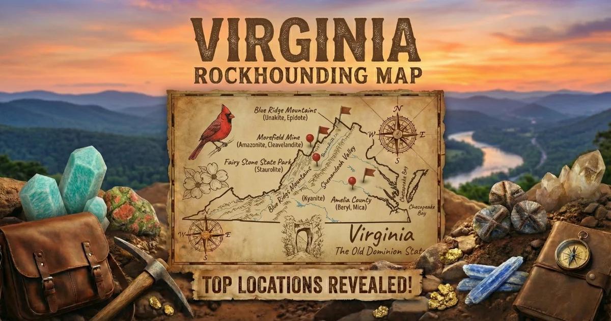
Virginia's Geology: Five Provinces, Five Hundred Million Years
Virginia spans five distinct geological provinces from east to west: the Coastal Plain, the Piedmont, the Blue Ridge, the Valley and Ridge, and the Appalachian Plateau. Each province records a different chapter of Earth history, and each produces different collectible minerals. If you are planning a gem-hunting trip, you need to understand which province you are working in and what the bedrock is doing there.
The Piedmont is the largest province by area. It consists of Precambrian to Paleozoic metamorphic and igneous rocks — schist, gneiss, greenstone, and granite — that have been folded, faulted, and intruded by pegmatite and quartz veins over hundreds of millions of years. The Virginia Gold Belt runs through the Piedmont from Fauquier County south to Halifax County. Gold-bearing quartz veins cut through the metamorphic host rock here, and placer gold concentrates in the stream gravels that drain them.
The Blue Ridge province rises to the west. This is where you find the oldest exposed rock in the state — Grenville-age basement gneiss over one billion years old, overlain by late Proterozoic volcanic greenstone (the Catoctin Formation) and metasedimentary units. The metamorphic grade increases with depth, producing garnet-bearing mica schist, staurolite schist, and kyanite schist. These are the source rocks for the state's garnet and staurolite (fairy cross) localities.
Between the Piedmont and the Blue Ridge, pegmatite intrusions have punched through the country rock. The Amelia pegmatite district in Amelia County is the most famous of these. Pegmatites form from the last, most water-rich fraction of a cooling granitic magma. Because they cool slowly and contain dissolved volatiles (water, fluorine, boron), they grow enormous crystals and concentrate rare elements like lithium, beryllium, niobium, and tantalum. This is where Virginia's amazonite, topaz, beryl, and tantalite come from.
West of the Blue Ridge, the Valley and Ridge province is mostly Paleozoic sedimentary rock — limestone, dolostone, sandstone, and shale. Collecting opportunities shift to fossils, calcite, and occasional fluorite. The Appalachian Plateau in the far southwest is coal-bearing Pennsylvanian sedimentary rock. Gem hunting concentrates in the Piedmont and Blue Ridge provinces.

Location 1: Morefield Mine — Amelia County (Fee-Dig)
GPS: approx. 37.343°N, 78.753°W
Land Status: Private fee-dig mine.
Vehicle: Sedan OK. Paved road to the mine entrance, gravel parking area.
Season: Typically open April through October, weekends and select weekdays. Call ahead: (804) 561-3399.
The Morefield Mine is a historic pegmatite operation in Amelia County that has been producing mineral specimens since the early 1900s. The pegmatite here intruded Precambrian gneiss and schist as a large, zoned body. Different mineral zones within the pegmatite produced different species — feldspar-rich zones yield amazonite, while pockets in the core zone have produced topaz, beryl, and tantalite.
Fee-dig visitors work the dump material — broken rock that was removed during earlier mining operations and piled on the surface. You are not mining the pegmatite in place. You are sorting through pre-blasted rubble. This is still productive. The dump material contains:
- Amazonite — green microcline feldspar. This is what most people come for. Morefield amazonite ranges from pale green to vivid blue-green. Crystal faces are often well-formed. Look for green cleavage surfaces in the white quartz and feldspar matrix.
- Smoky quartz — brown to black translucent crystals, sometimes doubly terminated. Common in the dump piles.
- Topaz — colorless to pale blue prismatic crystals. Less common than amazonite but present. Hardness 8, vitreous luster.
- Garnet — dark red almandine garnet in the schist fragments mixed into the dumps.
- Beryl — hexagonal prismatic crystals, typically pale green or yellow-green (heliodor). Larger crystals can be several inches long.
- Tantalite-columbite — black metallic submetallic crystals. Heavy for their size (SG 5.2–8.0). Rare but present.
- Fluorapatite — green to purple hexagonal crystals. Usually small.
Fee: Approximately $20–30 per person. Check current pricing by phone before visiting.
Collecting strategy: Bring a rock hammer, cold chisel, and safety glasses. Break open feldspar-rich boulders along cleavage planes. Amazonite hides inside white matrix rock. A spray bottle helps — wetting a broken surface reveals the green color instantly. Dry amazonite can look gray or off-white until you wet it.
Location 2: Virginia Gold Belt — Piedmont Streams (Fauquier, Culpeper, Orange Counties)
GPS (example access): Rapidan River near Orange, VA — approx. 38.244°N, 78.109°W
Land Status: Public waterways. Virginia law permits recreational gold panning in navigable streams below the ordinary high-water mark. Private land along banks requires permission for access.
Vehicle: Varies by access point. Some river pulloffs are paved; others require high-clearance for forest roads.
Virginia was the site of America's first gold rush. Gold was discovered in Fauquier County around 1804, decades before Sutter's Mill. From 1830 to 1860, Virginia was one of the leading gold-producing states. Dozens of hard-rock mines operated across the Piedmont, extracting gold from quartz veins hosted in metamorphic greenstone and phyllite.
Those mines are closed now. But the placer gold they chased — fine gold eroded from the veins and concentrated by water — remains in every stream that drains the Gold Belt. The productive counties include Fauquier, Culpeper, Orange, Spotsylvania, Louisa, Fluvanna, Buckingham, and Goochland.
The best panning targets are:
- Rapidan River and its tributaries in Orange County.
- Rappahannock River tributaries in Fauquier and Culpeper counties.
- James River tributaries from Fluvanna through Goochland counties.
- Willis River in Buckingham County — near the historic Buckingham gold mines.
What to expect: Fine flour gold and small flakes. Nuggets are rare in Virginia. Work inside bends where current slows. Sample gravel bars at the bedrock contact — gold settles to the lowest point. You want a 14-inch gold pan, a classifier screen (1/4-inch mesh), and a snuffer bottle to pick up fine gold. A hand sluice increases your volume dramatically.
Black sand concentrates are common. The magnetite and ilmenite in Virginia's metamorphic terrane produce heavy black sand that traps gold. If you are getting black sand, you are in the right spot.
Location 3: Fairy Stone State Park — Patrick County (Staurolite)
GPS: 36.785°N, 80.108°W
Land Status: Virginia State Park. Collecting staurolite (fairy crosses) is permitted within the park — it is the entire purpose of the park's name and visitor program.
Vehicle: Sedan OK. Paved roads throughout the park.
Fairy Stone State Park is named for the cruciform staurolite crystals found in the surrounding metamorphic rock. Staurolite is an iron-aluminum silicate (hardness 7–7.5) that forms twinned crystals in the shape of a cross. These cross-shaped twins — called "fairy crosses" or "fairy stones" — have been collected in Patrick County for centuries.
The staurolite forms in aluminum-rich mica schist under medium-grade regional metamorphism (amphibolite facies). The crystals weather out of the schist and accumulate in the soil and stream gravels. You do not need to break rock. Walk slowly through the designated collecting areas and scan the ground surface and shallow soil. The crosses are brown to dark brown, opaque, with a dull to slightly waxy luster.
Common twin forms:
- 60-degree crosses (most common) — two prisms intersecting at about 60 degrees.
- 90-degree crosses (less common) — a true right-angle cross. These are the most prized.
- Single prisms (common) — untwinned staurolite crystals.
Collecting strategy: After rain is best. Water washes soil off exposed crystals. Bring a small hand rake or trowel to scratch the top inch of soil in the collecting zones. A spray bottle helps distinguish dark staurolite from ordinary brown pebbles — staurolite has a distinctive matte surface and prismatic shape.
Location 4: Unakite — Blue Ridge (Unaka Range / Madison County Area)
GPS (example): Shenandoah National Park roadcuts along Skyline Drive — approx. 38.53°N, 78.35°W
Land Status: Collecting is NOT permitted within Shenandoah National Park or along the Blue Ridge Parkway (National Park Service land). Look for unakite on private land, in streams below park boundaries, or at road cuts on state-maintained roads outside NPS boundaries.
Vehicle: Sedan OK for paved roads. Some back roads in Madison and Greene counties require higher clearance.
Virginia is the type locality for unakite — the distinctive pink-and-green rock composed of pink orthoclase feldspar, green epidote, and clear quartz. It was first described from the Unaka Range along the Tennessee-North Carolina border, but Virginia's Blue Ridge produces large quantities of the material.
Unakite is not a single mineral. It is an altered granite (or granitic gneiss) where plagioclase feldspar has been replaced by epidote through hydrothermal alteration, while the potassium feldspar (orthoclase) remains intact and turns salmon-pink. The result is a hard, durable rock with a striking color pattern that takes a good polish.
The best collecting is in stream cobbles and gravel bars below Blue Ridge exposures. The Robinson River, the Rapidan River, and Rose River in Madison County carry unakite cobbles downstream from their source outcrops. Look for rounded cobbles with the diagnostic pink + green + clear color combination. Material for lapidary use should be dense and free of fractures — tap it with a hammer and listen for a clear ring rather than a dull thud.
Location 5: Garnet in Blue Ridge Schist — Nelson County / George Washington National Forest
GPS (example): Crabtree Falls Trail area — approx. 37.852°N, 79.076°W
Land Status: George Washington & Jefferson National Forest — surface collecting of reasonable quantities of mineral specimens for personal, non-commercial use is permitted under 36 CFR 228 and Forest Service policy. No mechanized digging, no blasting, no commercial extraction.
Vehicle: High-clearance recommended for Forest Service roads (FR designation). Some trailhead parking areas accessible by sedan.
The Blue Ridge metamorphic belt in Nelson, Amherst, and Augusta counties contains abundant garnet-bearing mica schist. The garnets are almandine composition — iron-aluminum silicate — forming dark red to reddish-brown dodecahedral or trapezohedral crystals embedded in silvery muscovite-biotite schist.
Most of these garnets are small (under 1 cm) and deeply included, but occasional specimens reach 2–3 cm across and display good crystal faces. They weather out of the schist and accumulate in stream gravels. Road cuts along the Blue Ridge Parkway and along state routes in Nelson County expose garnet-schist outcrops, but collecting from road cuts may require permission depending on the road authority.
Stream gravels below these exposures are a reliable source. The garnets are heavier than surrounding quartz and feldspar pebbles (SG 3.5–4.3 versus 2.6) and concentrate on the downstream side of boulders and in pothole depressions.
Location 6: Soapstone — Nelson County
GPS (example): Schuyler area — approx. 37.794°N, 78.697°W
Land Status: Mix of private land and National Forest. Historic quarries are mostly on private land — get permission before entering.
Vehicle: High-clearance helpful for back roads.
Nelson County has been quarrying soapstone since before the American Revolution. Soapstone (steatite) is a metamorphic rock composed primarily of talc, with lesser amounts of chlorite, amphibole, and magnetite. It forms when ultramafic rock (peridotite or serpentinite) undergoes hydrothermal alteration. The Piedmont and Blue Ridge of Virginia contain multiple ultramafic bodies that have produced soapstone.
The material ranges from soft and carvable (hardness 1–2 when talc-rich) to somewhat harder when it contains significant chlorite or amphibole. Historic quarries at Schuyler, Alberene, and other Nelson County localities produced soapstone for stoves, sinks, countertops, and industrial applications.
Collecting at active or abandoned quarries requires landowner permission. Float material — loose blocks of soapstone weathered from outcrops — can sometimes be found in stream drainages. The rock is easy to identify: it feels greasy or soapy to the touch, is very soft (a fingernail can scratch pure talc), and is typically gray-green to dark green in color.
Minerals You Can Find in Virginia
| Mineral | Hardness | Where in Virginia | What to Look For |
|---|---|---|---|
| Amazonite (microcline) | 6–6.5 | Morefield Mine, Amelia County | Green to blue-green cleavage fragments and crystals in pegmatite matrix |
| Topaz | 8 | Morefield Mine, Amelia County | Colorless to pale blue prismatic crystals with vitreous luster |
| Beryl | 7.5–8 | Morefield Mine, Amelia County | Pale green to yellow hexagonal prisms in pegmatite |
| Gold (native) | 2.5–3 | Piedmont streams — Fauquier to Halifax counties | Fine yellow flakes and flour gold in black sand concentrates |
| Staurolite | 7–7.5 | Fairy Stone State Park, Patrick County | Brown cruciform (cross-shaped) twins in soil and stream gravel |
| Unakite | 6–7 (composite) | Blue Ridge streams, Madison County area | Pink feldspar + green epidote + clear quartz — rounded cobbles |
| Almandine garnet | 7–7.5 | Blue Ridge schist, Nelson / Augusta counties | Dark red dodecahedral crystals in mica schist or stream gravel |
| Soapstone (steatite) | 1–2 | Nelson County quarries | Gray-green, greasy feel, very soft — fingernail scratches it |
| Smoky quartz | 7 | Morefield Mine, Amelia County | Brown to black translucent prismatic crystals in pegmatite dumps |
| Tantalite-columbite | 6–6.5 | Morefield Mine, Amelia County | Black submetallic crystals, very heavy (SG 5.2–8.0) |
| Fluorapatite | 5 | Morefield Mine, Amelia County | Green to purple hexagonal crystals, vitreous luster |
| Kyanite | 5–7 | Blue Ridge road cuts, Willis Mountain | Blue bladed crystals in schist — hardness varies by direction |
Field Identification Tips
Virginia's collectible minerals span a wide hardness range. A few quick field tests will sort out most of what you find.
| Test | How | What It Tells You |
|---|---|---|
| Fingernail scratch | Try to scratch the specimen with your fingernail (hardness ~2.5) | If it scratches, it could be talc/soapstone (1–2), gypsum (2), or gold (2.5–3). Most gem minerals will NOT scratch. |
| Steel file scratch | Scrape the specimen across a steel file (hardness 6.5) | If the stone scratches the file, it is harder than 6.5. Staurolite (7–7.5), garnet (7–7.5), topaz (8), and beryl (7.5–8) will all scratch steel. |
| Glass plate scratch | Try to scratch a piece of glass (hardness 5.5) with the specimen | Most Virginia gem minerals scratch glass. Soapstone and gold will not. |
| Heft test | Bounce the specimen in your hand. Does it feel heavy for its size? | Garnet (SG 3.5–4.3) and tantalite (SG 5.2–8.0) feel noticeably heavy. Quartz (SG 2.65) feels light. Gold (SG 19.3) is unmistakably heavy. |
| Wet surface test | Spray or dip the specimen in water | Amazonite turns vivid green when wet. Dry amazonite often looks gray. Unakite shows stronger pink-green contrast when wet. |
| Cleavage vs. fracture | Examine broken surfaces with a 10x loupe | Amazonite has two cleavage planes at ~90 degrees. Quartz has conchoidal (curved) fracture with no cleavage. Staurolite has poor cleavage and subconchoidal fracture. |
Amazonite vs. green quartz: Both are green and found at Morefield. Amazonite has two distinct cleavage directions and a slightly lower hardness (6–6.5) than quartz (7). Quartz breaks with curved, shell-like fracture surfaces. If you see flat, reflective cleavage planes, it is feldspar.
Gold vs. pyrite (fool's gold): Gold is malleable — hit it with your hammer and it flattens. Pyrite shatters. Gold stays yellow in shadow. Pyrite's luster shifts with light angle. Gold is found in stream gravels. Pyrite is found in hard rock and weathers to brown rust (limonite).
What to Bring
| Item | Why |
|---|---|
| Rock hammer (16 oz) | Breaking pegmatite matrix at Morefield. Not needed for gold panning or fairy stone collecting. |
| Cold chisel (3/4-inch) | Splitting feldspar along cleavage planes to expose amazonite pockets. |
| Safety glasses | Non-negotiable when hammering pegmatite. Feldspar and quartz produce sharp shrapnel. |
| 10x hand lens (loupe) | Examining crystal faces, cleavage, and identifying small topaz or beryl crystals. |
| Spray bottle | Wetting specimens to reveal color. Critical for identifying amazonite in the dump piles. |
| 14-inch gold pan | Standard size for recreational gold panning in Virginia streams. |
| Classifier screen (1/4-inch) | Screening gravel before panning removes large rocks and speeds up processing. |
| Snuffer bottle | Sucking up fine flour gold from the bottom of your pan. |
| Steel file | Hardness testing in the field — fast, reliable, portable. |
| Small hand rake or trowel | Scratching topsoil at Fairy Stone State Park to expose staurolite crystals. |
| Sample bags / newspaper | Wrapping specimens individually to prevent scratching during transport. |
| Sturdy boots | Stream beds, mine dumps, and forest roads are uneven with sharp rock. |
| Sunscreen, hat, water | Open mine dumps and stream beds have no shade. Virginia summers are humid and hot. |
Legal Notes and Access Rules
Fee-dig mines (Morefield): You are on private land. Follow the operator's rules. You keep what you find. Fees are per person or per bucket — confirm before paying.
George Washington & Jefferson National Forest: Surface collecting of reasonable quantities of rocks, minerals, and gemstones for personal, non-commercial use is permitted under Forest Service regulations (36 CFR 228 Subpart C and forest-specific orders). "Reasonable quantities" is not precisely defined but generally means what one person can carry out. Mechanized equipment, explosives, significant ground disturbance, and commercial collecting all require a permit or are prohibited.
Virginia State Parks (Fairy Stone): Staurolite collecting is specifically permitted at Fairy Stone State Park. General mineral collecting in other Virginia state parks is typically not permitted without specific authorization. Check with park staff.
Shenandoah National Park and Blue Ridge Parkway: All collecting — rocks, minerals, plants, artifacts — is prohibited on National Park Service land. Do not collect from Skyline Drive road cuts, Blue Ridge Parkway road cuts, or any NPS trailhead. The boundaries are clearly marked. Move to state or National Forest land for legal collecting.
Gold panning in streams: Virginia recognizes public access to navigable waterways below the ordinary high-water mark. You may pan in the stream itself without landowner permission on navigable rivers. However, accessing the stream often requires crossing private land — get permission for bank access. Non-navigable streams on private land require full landowner permission.
Private land: Most of Virginia's historic mine sites (gold mines, soapstone quarries, old pegmatite workings) are on private land. Trespassing is illegal and damages the hobby for everyone. Always get written permission before entering private property.
Interactive Map
Find all Virginia gem hunting locations, fee-dig sites, and collecting areas on our Virginia rockhounding map with GPS coordinates and access details.