
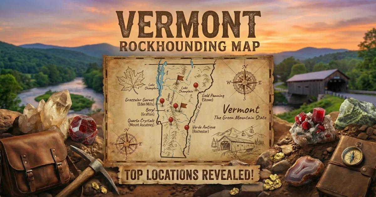
Vermont: Green Mountain Metamorphic Terrain
Vermont's collecting ground sits on the western flank of the Northern Appalachians, centered near 44.0°N, 72.7°W (approximate state center). Land status is a patchwork: Green Mountain National Forest (managed by the USDA Forest Service) covers roughly 400,000 acres across Addison, Bennington, Rutland, Windham, and Windsor Counties. State forests and wildlife management areas are managed by the Vermont Department of Forests, Parks and Recreation. Private quarry land and fee-dig sites make up most of the productive mineral localities. Vermont has no BLM land. The bedrock is Precambrian to Ordovician metamorphic rock — gneiss, schist, phyllite, marble, and quartzite — deformed and recrystallized during the Taconic and Acadian orogenies (roughly 450 to 350 million years ago).
The state is not a major gem producer, but the geology is rich in collectible metamorphic minerals: almandine garnet, staurolite, kyanite, talc, serpentine, marble, chlorite, and actinolite. Vermont's marble industry — once the largest in the United States — left behind quarries that remain the best exposure of commercial-grade calcite marble anywhere in New England.

Top Collecting Locations
1. Vermont Verde Antique Quarries — Rochester / Roxbury Area (Windsor and Washington Counties)
Land Status: Private quarry land. Some quarries are active commercial operations (Vermont Verde Antique LLC). Do not enter active quarries without written permission. Abandoned quarry dumps near Route 100 between Rochester and Roxbury have been historically accessible, but verify current status before collecting.
GPS (approximate): 43.98°N, 72.81°W (Roxbury area serpentine belt)
County: Washington County / Windsor County line
Vehicle Rating: Sedan-accessible on Route 100. Short walks to quarry dumps on gravel roads — no special vehicle needed.
Minerals: Serpentine (antigorite), Vermont Verde Antique marble (a serpentine-calcite breccia), magnetite, chromite, talc, chlorite, actinolite, and occasional chrysotile asbestos veins.
Fees: None for roadside collecting on public right-of-way. Private quarry access requires owner permission.
What to Expect: The Verde Antique is a dark green serpentine rock with white calcite veining. It is technically not a true marble but a serpentinite breccia cemented by carbonate. Fresh surfaces show a deep green-black color with irregular white to cream veins. Weathered surfaces are brown to rusty orange. Look for dumps and waste piles along the road shoulder. Specimen-quality pieces with strong color contrast are common in waste rock. Warning: Some serpentine bodies in this belt contain naturally occurring chrysotile asbestos. Do not saw, grind, or dry-cut serpentine without proper dust control. Wet cutting only.
2. Garnet-Bearing Schist Road Cuts — Route 100 Corridor (Windsor and Washington Counties)
Land Status: State highway right-of-way (Vermont Agency of Transportation). Surface collecting of loose material in ditches is generally tolerated. Do not use hammers on rock faces along active highways — this is a safety and legal issue.
GPS (approximate): 44.10°N, 72.73°W to 44.30°N, 72.70°W (Route 100 corridor between Pittsfield and Waterbury)
County: Windsor County, Washington County
Vehicle Rating: Sedan. Park in pull-offs. Do not park on the road shoulder where sight lines are short.
Minerals: Almandine garnet (in mica schist and garnet-staurolite schist), muscovite, biotite, quartz, staurolite, kyanite.
Fees: None.
What to Expect: Road cuts through the Ottauquechee and Stowe Formations expose garnet-mica schist. Almandine garnets appear as dark red to red-brown dodecahedral crystals embedded in silvery mica schist. Most crystals are 3–10 mm across. Occasional garnets reach 15–20 mm. Crystals are often fractured and included, but some have good faces and luster. Look for garnet fragments in loose material at the base of cuts. Staurolite (brown, prismatic, dull luster) co-occurs with garnet in some outcrops. Bring a hand lens — small garnets are easy to overlook in dark schist.
3. Staurolite Localities — Stowe Area (Lamoille County)
Land Status: Mixed — state highway right-of-way, town roads, and private land. Ask locally before collecting on any land that is not clearly within the road right-of-way.
GPS (approximate): 44.46°N, 72.69°W (Stowe village area)
County: Lamoille County
Vehicle Rating: Sedan on paved roads. Some back roads to outcrops require AWD in spring mud season (March through May).
Minerals: Staurolite (including cruciform twins — "fairy crosses"), almandine garnet, kyanite, muscovite, quartz.
Fees: None for roadside collecting.
What to Expect: Staurolite occurs in medium- to high-grade metamorphic schist of the Stowe Formation (Cambrian–Ordovician). The mineral forms brown to yellowish-brown prismatic crystals, typically 10–30 mm long. The twinned crystals that form cross-shaped penetration twins ("fairy crosses") are the collector target. Not every staurolite crystal is twinned — expect to examine many single prisms before finding a cross. Weathered-out crystals in soil and ditch gravel are easier to extract than those embedded in hard schist. Staurolite has a Mohs hardness of 7–7.5, so it survives weathering well and accumulates in residual soil.
4. Marble Quarries — Proctor and West Rutland (Rutland County)
Land Status: Private land. The historic marble quarries in Proctor and West Rutland are owned by Vermont Quarries Corp and other private entities. The Vermont Marble Museum in Proctor (now closed as a museum; verify current status) displayed quarry specimens. Some abandoned quarry waste piles near town are accessible. Always get permission before entering quarry property.
GPS (approximate): 43.65°N, 73.03°W (Proctor village)
County: Rutland County
Vehicle Rating: Sedan. Quarries are adjacent to town roads.
Minerals: Calcite marble (white, gray, blue-gray), dolomite marble, pyrite (in marble), quartz veins, occasional tremolite, phlogopite mica.
Fees: No established fee-dig. Access is by landowner permission only.
What to Expect: The Rutland County marble belt follows the Shelburne Marble and Clarendon Springs formations (Lower Ordovician to Upper Cambrian). Vermont marble is a coarsely crystalline calcite rock ranging from pure white to dove gray to blue-black. Quarry waste piles contain blocks and chips showing the full color range. Pyrite cubes up to 5 mm occur in some gray marble. Tremolite (white, bladed, silky luster) appears at marble-schist contacts. Marble is soft (Mohs 3) and scratches easily — wrap specimens in cloth or newspaper for transport.
5. Talc Mines — Southern Vermont Serpentine Belt (Windham and Windsor Counties)
Land Status: Private mining land. The talc deposits near Chester, Windham, and Ludlow were mined commercially for decades. Most mines are now closed. Some waste dumps near old mine roads are accessible, but the mine openings themselves are on private land and may be gated or posted. Respect all signage.
GPS (approximate): 43.30°N, 72.60°W (Chester-Windham area)
County: Windsor County, Windham County
Vehicle Rating: AWD recommended for mine access roads, especially during spring and fall. Some roads are seasonal and gated in winter.
Minerals: Talc (massive and foliated), soapstone, serpentine, magnesite, magnetite, chlorite, actinolite.
Fees: None at abandoned sites. Do not enter posted land.
What to Expect: Vermont's talc deposits formed within the ultramafic serpentine belt that runs through the southern part of the state. Talc is the softest mineral on the Mohs scale (hardness 1). It is white, pale green, or gray, with a greasy or soapy feel. Massive talc (soapstone) was quarried for stoves, sinks, and countertops. Foliated talc peels in thin, flexible sheets. Waste dumps contain mixed talc-serpentine rock. Magnetite (black, metallic, magnetic) occurs as accessory grains and can be identified with a pocket magnet.
6. Gold Panning — Mad River, White River, and Tributaries (Washington and Windsor Counties)
Land Status: Public waterways. Vermont law generally allows recreational gold panning in rivers and streams below the ordinary high-water mark. No motorized equipment. No dredging without a permit from the Vermont Department of Environmental Conservation. Gold panning in Green Mountain National Forest streams is permitted for recreational, non-commercial use with hand tools only.
GPS (approximate): 44.10°N, 72.80°W (Mad River, Waitsfield area); 43.75°N, 72.55°W (White River, Bethel area)
County: Washington County (Mad River), Windsor County (White River)
Vehicle Rating: Sedan to most access points. Stream access may require short walks.
Minerals: Placer gold (fine flour gold and occasional small flakes), magnetite (black sand), garnet (heavy mineral concentrate).
Fees: None for recreational hand panning on public waterways.
What to Expect: Vermont gold is fine — flour gold and small flakes, not nuggets. The gold originates from quartz-sulfide veins in metamorphic rock and has been redistributed by glacial action. Concentrate behind large boulders, in bedrock cracks, and at the inside bends of streams. The gold is difficult to see without practice. Use a black pan and work slowly. A snuffer bottle is essential for picking up fine gold. Best results come after spring runoff drops (late May through June).
Minerals and Specimens of Vermont
| Mineral | Hardness (Mohs) | Where in State | What to Look For |
|---|---|---|---|
| Almandine Garnet | 6.5–7.5 | Route 100 corridor road cuts, Stowe area schist, Green Mountain NF | Dark red to red-brown dodecahedral crystals in silvery mica schist. Often 3–10 mm. Check for euhedral faces. |
| Staurolite | 7–7.5 | Stowe area (Lamoille Co.), scattered outcrops in central Vermont schist belt | Brown prismatic crystals. Cross-shaped twins ("fairy crosses") are the prize. Dull to vitreous luster on fresh surfaces. |
| Serpentine (Antigorite) | 3–4 | Rochester-Roxbury belt, Chester-Windham belt | Dark green, waxy to greasy feel. Often veined with white calcite or magnesite. May contain chrysotile — handle with care. |
| Talc | 1 | Southern Vermont serpentine belt (Chester, Windham, Ludlow) | White to pale green, soapy/greasy feel. Scratches with fingernail. Massive or foliated. |
| Calcite Marble | 3 | Rutland County (Proctor, West Rutland, Danby), Addison County | Coarsely crystalline, white to gray to blue-black. Fizzes with dilute HCl. Cleavage rhombs visible on broken surfaces. |
| Kyanite | 5–7 (variable) | Central Vermont schist outcrops | Blue bladed crystals in schist. Hardness varies by direction — scratches easily parallel to blade, harder across it. |
| Magnetite | 5.5–6.5 | Serpentine belt, stream concentrates statewide | Black, metallic, strongly magnetic. Octahedral crystals rare; usually massive or granular. Test with a magnet. |
| Actinolite | 5–6 | Serpentine contacts, marble-schist boundaries | Dark green to black, bladed to fibrous. Vitreous luster. Found at contact zones between ultramafic rock and marble. |
| Chlorite | 2–2.5 | Statewide in low-grade metamorphic rock (phyllite, greenschist) | Green, platy, soft. Common as coatings on fracture surfaces and as a matrix mineral in greenschist. |
| Pyrite | 6–6.5 | Marble quarries (Rutland Co.), quartz veins statewide | Brass-yellow, metallic. Cubes and pyritohedra in marble. Oxidizes to brown-orange (limonite) on weathered surfaces. |
Field Identification Tips
Garnet vs. dark tourmaline: Both are dark and hard. Garnet is isometric — it lacks cleavage and breaks with conchoidal to uneven fracture. Tourmaline is prismatic (elongated) with a rounded-triangular cross section and vertical striations. If the crystal is equidimensional and embedded in schist, it is almost certainly garnet.
Staurolite vs. andalusite: Both are brown prismatic crystals in schist. Staurolite commonly twins into crosses. Andalusite shows a dark cross-shaped pattern (chiastolite variety) in cross section, but its external crystal shape is a single prism, not a twinned cross. If you see two crystals penetrating each other at 60° or 90°, that is staurolite.
Talc vs. pyrophyllite: Both are soft and feel greasy. Talc is Mohs 1 (scratches with a fingernail). Pyrophyllite is Mohs 1.5–2. In Vermont, the soft greasy mineral in serpentine is overwhelmingly talc. Pyrophyllite is rare here.
Serpentine vs. jade: Vermont serpentine is not nephrite jade. Nephrite is an amphibole (actinolite-tremolite series) with a tightly interlocking fibrous structure and a Mohs hardness of 6–6.5. Serpentine is softer (3–4) and scratches with a steel knife. Do not label serpentine as "Vermont jade" — it is geologically incorrect.
Marble test: One drop of dilute hydrochloric acid (10% HCl) on calcite marble produces vigorous fizzing. Dolomite marble fizzes weakly or only when powdered. Serpentine does not fizz. Carry a small dropper bottle of dilute HCl for field identification of carbonates.
Gold identification: Real gold stays bright yellow when flattened with a pin. Pyrite ("fool's gold") shatters. Mica flakes float in your pan and are silver or bronze — gold sinks and stays in the bottom crease. If you can push it flat with a pin tip and it stays yellow, it is gold.
Tools and What to Bring
- Rock hammer (flat head and chisel end): Essential for breaking schist and freeing garnet crystals from matrix. A 16 oz. Estwing is standard.
- Cold chisels (3/4" and 1"): For splitting schist along foliation planes. Place chisel parallel to the foliation and strike lightly.
- Safety glasses: Mandatory when hammering. Schist and marble throw sharp chips.
- Hand lens (10x): Required for identifying small garnets, staurolite grain boundaries, and gold flakes. A Hastings triplet is worth the cost.
- Gold pan (14" black plastic): For placer gold. Black background makes fine gold visible. Bring a classifier screen (1/4" mesh) to remove gravel before panning.
- Snuffer bottle: For picking up flour gold from the pan crease. Squeeze bulb, touch tip to gold flake, release.
- Dilute HCl dropper bottle (10%): For distinguishing calcite marble from dolomite and serpentine in the field.
- Pocket magnet: For identifying magnetite in stream concentrates and serpentine rock.
- Newspaper or cloth wraps: Marble scratches easily. Wrap specimens individually. Do not let marble pieces rattle against each other in a bucket.
- Knee pads: Road cut collecting means kneeling on gravel and broken rock. Protect your knees.
- GPS or smartphone with offline maps: Cell coverage is spotty in the Green Mountains. Download maps before leaving town.
- Tick repellent with DEET or permethrin: Vermont has deer ticks carrying Lyme disease. Treat pants and boots with permethrin before field trips May through October.
Legal and Access Notes
Green Mountain National Forest: Managed by the USDA Forest Service. Recreational mineral collecting (hand tools, reasonable personal-use quantities) is permitted on National Forest land unless otherwise posted. No motorized excavation. No collecting in designated Wilderness Areas (e.g., Breadloaf Wilderness, Lye Brook Wilderness). Contact the Manchester Ranger District (southern half) or Rochester Ranger District (northern half) for current regulations.
Vermont State Parks and State Forests: Collecting rocks or minerals in Vermont State Parks is prohibited without a special use permit. State Forests may have different rules — contact the Vermont Department of Forests, Parks and Recreation at (802) 828-1534 before collecting.
Private Land: Most productive mineral sites in Vermont — quarries, mines, road cuts on private property — require landowner permission. Vermont is a state where trespass law is taken seriously. Posted land means posted. Knock on the door and ask. Most quarry owners will grant permission for small-scale collecting if you ask politely and carry out your trash.
Highway Right-of-Way: Collecting loose material from road cut ditches along state highways is generally tolerated by VTrans, but do not hammer on highway rock cuts. Parking must be fully off the travel lane. Use caution on Routes 100, 4, and 103 — traffic is fast and sight distances are limited on curves.
Gold Panning: Recreational gold panning with hand tools (pan, sluice box, no motorized suction dredges) is permitted in most Vermont rivers and streams below the ordinary high-water mark. No in-stream dredging without a permit from the Vermont Department of Environmental Conservation. Do not disturb stream banks. Stay below the high-water mark.
Asbestos Caution: Vermont's serpentine belt contains naturally occurring chrysotile asbestos. This is a known carcinogen when inhaled as fine fibers. Do not dry-cut, grind, or saw serpentine in the field. Wet-cut only. Do not disturb friable (crumbly) serpentine with visible fiber bundles. Wash hands after handling serpentine before eating.
Seasonal and Safety Considerations
Mud Season (March–May): Vermont back roads become impassable during spring thaw. Dirt roads in the Green Mountains can swallow a sedan to its axles. Stick to paved roads (Routes 100, 4, 7) during mud season or drive an AWD/4x4 vehicle.
Summer (June–September): Best collecting season. Daytime temperatures are typically 70–85°F. Carry 1 liter of water per person per hour of field work. Thunderstorms are frequent in July and August — do not shelter under rock overhangs in quarries during lightning. Black flies peak in June. Mosquitoes persist all summer. Deer ticks are active May through October.
Fall (October–November): Excellent conditions. Cool, dry weather and reduced vegetation make outcrops easier to find. Hunting season begins in October — wear blaze orange when walking in wooded areas or on forest roads.
Winter (December–March): Most sites are inaccessible or buried in snow. Quarry roads are unplowed. River banks are iced over. Plan your Vermont field trips for June through October.
Cell Coverage: Spotty to nonexistent in the Green Mountain interior. Download offline maps. Tell someone where you are going and when you expect to return. Carry a whistle and basic first aid kit.
Interactive Vermont Rockhounding Map
See all collecting locations, quarry sites, and access points on our interactive Vermont rockhounding map. The map includes GPS coordinates, land status, and mineral occurrence data for each site.