
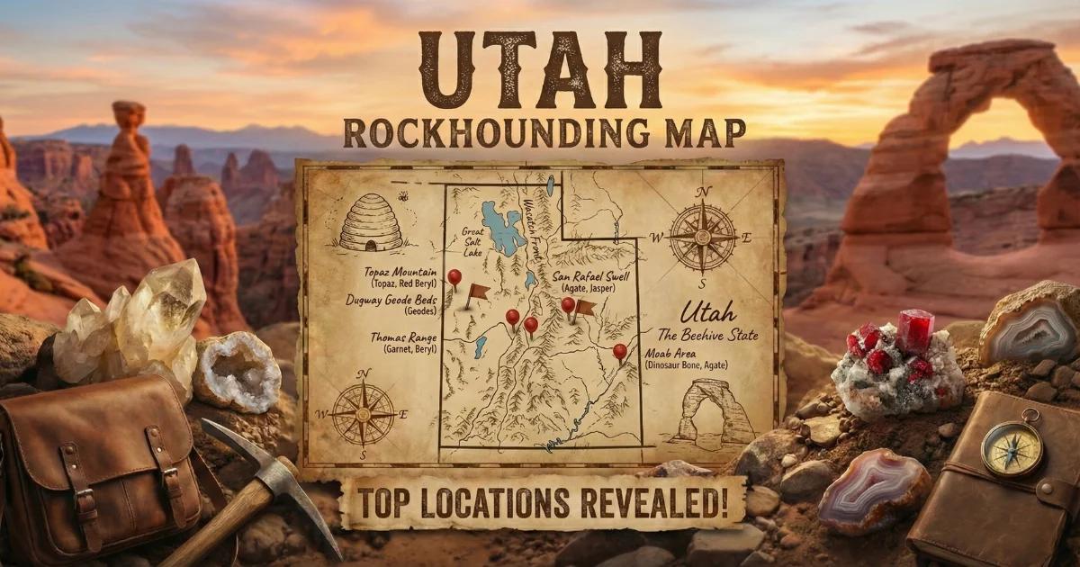

Why Utah Geology Produces Gems Worth Hunting
Utah sits at the intersection of three geologic provinces that have been beating each other up for the better part of a billion years, and the result is one of the most mineral-diverse states in the country. The western half of the state lies within the Basin and Range Province, where the crust has been stretching and thinning since the Miocene. That extensional tectonics produced volcanic eruptions, hydrothermal systems, and the kind of fractured, gas-rich rhyolite flows that grow topaz crystals in their vugs. The eastern half belongs to the Colorado Plateau — thick, flat-lying sedimentary sequences from the Paleozoic and Mesozoic that preserve trilobite faunas, dinosaur bone, and silica-rich groundwater deposits that became agate and jasper.
Between those two provinces sits the Wasatch Front, a major normal fault system still active today. The transition zone concentrated metalliferous fluids along faults and contact zones, which is why the Bingham Canyon district produced one of the world's largest copper-gold-molybdenum deposits and why scattered gold placers turn up in drainages throughout the Oquirrh and Tintic ranges.
The volcanic episodes matter most for gem hunters. During the Oligocene and Miocene (roughly 30 to 6 million years ago), rhyolitic volcanism spread across western Utah. Topaz crystallized from fluorine-rich vapors trapped in cooling lava flows. Red beryl — one of the rarest gem minerals on the planet — formed where those same rhyolitic melts interacted with specific trace-element chemistries in the Wah Wah Mountains. Variscite precipitated from phosphate-bearing groundwater percolating through aluminum-rich clay and limestone sequences. Obsidian formed where silica-rich lava cooled too quickly to crystallize. Every one of these processes left behind collectible material, and the BLM manages roughly 42% of Utah's land surface, which means a staggering amount of it is open to the public.
Collecting Locations: GPS, Land Status, and What You Will Find
1. Topaz Mountain — Juab County
- GPS: 39.7408° N, 113.0817° W
- Land status: BLM public land — free collecting, no permit required
- Target minerals: Topaz (amber/sherry-colored crystals in rhyolite), red beryl (rare micro-crystals), bixbyite, pseudobrookite, hematite rosettes
Topaz Mountain is the type locality for Utah's state gem and the most accessible gem-collecting site in the state. The topaz occurs in gas cavities (vugs) within a Miocene rhyolite lava flow. You break open the host rock and check each cavity. Most crystals run under 1 cm, but well-formed double-terminated specimens to 3 cm turn up with patience. The sherry color fades with prolonged UV exposure, so store your finds out of direct sunlight. The area is about 50 miles northwest of Delta on unpaved BLM roads. No water, no cell service, no shade. High-clearance vehicle required; 4WD recommended if the road is wet.
2. Wah Wah Mountains — Beaver County
- GPS: 38.5042° N, 113.4750° W (general area — the primary mine is on private claims)
- Land status: Mixed BLM and private mining claims
- Target minerals: Red beryl (bixbite), topaz, garnet, pseudobrookite
Red beryl is found at fewer than five locations worldwide, and the Wah Wah Mountains contain the only deposit that has produced gem-quality stones. The mineral forms in lithophysae within a specific rhyolite unit where beryllium, manganese, and other trace elements reached the right concentrations during vapor-phase crystallization. Gem-quality red beryl sells for $10,000 or more per carat. The main producing mine (the Ruby Violet Claims) is privately held and closed to public collecting. You can hunt the surrounding BLM land for small, non-gem-quality red beryl crystals in rhyolite float, but do not cross into staked claims. Check BLM claim records before you go. The area is extremely remote — bring everything you need for a full day in waterless desert.
3. Clay Canyon (Fairfield) — Utah County
- GPS: 40.2833° N, 112.0833° W
- Land status: BLM public land
- Target minerals: Variscite, wardite, crandallite, millisite, gordonite
Clay Canyon near Fairfield has produced some of the finest variscite specimens in North America. Variscite is a hydrated aluminum phosphate — AlPO4-2H2O — that forms striking green nodules in clay-rich limestone. The color ranges from pale mint to deep emerald green, often with attractive web-like matrix patterns of crandallite or wardite that make it desirable for cabochon cutting. Surface collecting on BLM land is permitted. Dig carefully in the clay layers and look for rounded, green nodules weathering out of the host rock. Some nodules reach fist size. The site is relatively accessible compared to western Utah locations — a passenger car can get close, though the final approach benefits from clearance.
4. Lucin Variscite Locality — Box Elder County
- GPS: 41.3500° N, 113.9167° W
- Land status: BLM public land and some private — verify boundaries
- Target minerals: Variscite, amatrice (variscite-quartz intergrowth)
The Lucin area in far northwestern Utah produces variscite similar to the Fairfield material but often with a different matrix pattern. The locality is remote — near the Nevada border along the old Lucin Cutoff railroad grade. Road conditions vary with weather. This is high desert at elevation, with temperature swings of 40 degrees or more between day and night in spring and fall. Check current BLM land status before collecting, as some parcels near the historic mines are under private claim.
5. Dugway Geode Beds — Juab County
- GPS: 39.9375° N, 113.1083° W
- Land status: BLM public land — free collecting
- Target minerals: Quartz-lined geodes (clear quartz, amethyst tinting, chalcedony), agate
The Dugway geode beds sit in a rhyolite tuff unit where gas pockets filled with silica-rich fluids over millions of years. The geodes range from golf-ball size to basketball size, with most in the 2- to 6-inch range. Interiors are typically lined with clear quartz crystals, sometimes with faint amethyst color or banded chalcedony. Surface geodes have mostly been collected, so you will need to dig into the tuff layer. A pick and shovel are essential. The beds are about 3 hours from Salt Lake City on BLM roads branching off Highway 36. No services. For a detailed guide, see our Utah geode guide.
6. Black Rock Desert — Millard County
- GPS: 38.9500° N, 112.5000° W (general area)
- Land status: BLM public land
- Target minerals: Obsidian (mahogany, snowflake, rainbow sheen), Apache tears, perlite
The volcanic flows southwest of Fillmore produce collectible obsidian in several varieties. Mahogany obsidian shows red-brown banding from iron oxide inclusions. Snowflake obsidian contains white cristobalite spherulites. Some pieces exhibit a rainbow sheen caused by thin-film interference in flow layers. Apache tears — small, rounded obsidian nodules weathered out of perlite — can be picked up off the surface in quantity. The area is accessible by graded dirt road from Highway 15. Standard clearance is usually fine in dry conditions.
7. Wheeler Amphitheater — Millard County
- GPS: 39.3650° N, 113.2783° W
- Land status: BLM public land (self-collecting allowed) and U-Dig Fossils (fee site on private lease)
- Target minerals/fossils: Elrathia kingii trilobites, Asaphiscus wheeleri trilobites, associated Cambrian fauna
The Wheeler Shale (Middle Cambrian, approximately 507 million years old) at Antelope Springs and the surrounding amphitheater exposures is one of the most productive trilobite-collecting sites in the world. Elrathia kingii specimens are abundant in thin, fissile shale layers. You split the shale along bedding planes and check each surface. Most specimens are 1 to 3 cm, but larger individuals occur. The commercial fee-dig operation (U-Dig Fossils) provides tools and guidance for a daily fee. You can also collect on adjacent BLM land on your own. Bring a thin-bladed chisel and patience.
Minerals and Gems of Utah: Quick Reference Table
| Mineral | Chemical Formula | Mohs Hardness | Specific Gravity | Primary Localities |
|---|---|---|---|---|
| Topaz | Al2SiO4(F,OH)2 | 8 | 3.49–3.57 | Topaz Mountain, Thomas Range |
| Red Beryl | Be3Al2Si6O18 | 7.5–8 | 2.63–2.70 | Wah Wah Mountains |
| Variscite | AlPO4-2H2O | 3.5–4.5 | 2.57 | Fairfield (Clay Canyon), Lucin |
| Obsidian | Volcanic glass (SiO2) | 5–5.5 | 2.35–2.60 | Black Rock Desert, Millard Co. |
| Quartz (geodes) | SiO2 | 7 | 2.65 | Dugway Geode Beds |
| Labradorite | (Ca,Na)(Al,Si)4O8 | 6–6.5 | 2.68–2.72 | Sunstone Knoll, Millard Co. |
| Elrathia kingii | CaCO3 (calcite replacement) | 3–4 | ~2.71 | Wheeler Amphitheater |
| Agate/Jasper | SiO2 (microcrystalline) | 6.5–7 | 2.58–2.64 | Western Utah (widespread) |
Field Identification: What to Look For on the Ground
Topaz in rhyolite. The host rock is a gray to pinkish-gray, fine-grained rhyolite with visible flow banding. Look for vugs — gas cavities from marble-size to fist-size. Topaz crystals are transparent to translucent, amber to colorless, with a vitreous luster and distinct orthorhombic crystal form (stubby prisms with a dome termination). Hardness 8 — it will scratch quartz. If you find a clear crystal in rhyolite that scratches quartz, you almost certainly have topaz. Bixbyite (black, cubic) and pseudobrookite (dark brown, prismatic) occur in the same vugs and confirm you are in the right unit.
Variscite in clay. Look for rounded nodules weathering out of light-colored clay or limestone. Fresh variscite is a clean, bright green — not bluish like turquoise, not yellowish like serpentine. It is softer than a knife blade (hardness 3.5 to 4.5). The nodules often have a thin weathering rind of pale, chalky material. Break a nodule and check the interior color. High-quality material is uniformly green with a waxy luster on fresh fracture surfaces.
Obsidian. Volcanic glass with conchoidal fracture — smooth, curved fracture surfaces like broken bottle glass. Obsidian feels smooth, is opaque to translucent on thin edges, and has a vitreous to subvitreous luster. Distinguish it from black chert by the fracture pattern: obsidian produces sharper, more curved surfaces. Apache tears are rounded, translucent when held to light.
Geodes. In the Dugway area, look for rounded, roughly spherical masses in the tuff. Unbroken geodes are heavier than solid rock of the same size if the interior is lined with crystals. A light tap with a hammer produces a hollow-sounding ring compared to solid rock. Some geodes are partially eroded and show the crystal lining at the surface.
Trilobites. Split shale along bedding planes. Trilobite impressions appear as dark, slightly raised forms against the lighter shale matrix. Complete specimens show the cephalon (head shield), thorax (segmented body), and pygidium (tail). Partial specimens — isolated cephala or pygidia — are more common. Work slowly and split thin layers. Thick slabs hide the fossils.
Tools and Gear for Utah Gem Hunting
Utah collecting demands desert-specific preparation. Here is what you actually need in the field:
Rock-breaking tools. A 3-pound crack hammer and a set of cold chisels (flat and point) cover most situations. For rhyolite at Topaz Mountain, you are breaking hard volcanic rock — a heavier hammer (4 lb) helps. For trilobite shale, switch to a light geology hammer and thin-bladed chisels to avoid shattering specimens.
Digging tools. A short-handled pick and a folding entrenching tool for excavating geodes from tuff or variscite nodules from clay. A pry bar (18-inch) is useful for leveraging large rhyolite blocks at Topaz Mountain.
Eye protection. Non-negotiable when hammering rhyolite. Flying rock chips are sharp and move fast. Safety glasses at minimum; wraparound goggles are better.
Desert survival gear. This is the part that matters most in Utah:
- Water: One gallon per person per day minimum. Western Utah has no potable water sources at any collecting site listed here. Two gallons per person if you are working in direct sun.
- Sun protection: Wide-brim hat, long sleeves, sunscreen. Shade is nonexistent at most sites.
- Vehicle supplies: Full-size spare tire, jack, basic tool kit, tow strap. Cell service is absent at most western Utah collecting areas. A flat tire or mechanical failure 50 miles from the nearest paved road is a serious situation.
- Navigation: Download offline maps before you leave pavement. GPS coordinates alone are not sufficient — you need road-level navigation to find the correct turnoffs on unmarked BLM roads.
Specimen protection. Wrap topaz crystals individually in tissue paper — they are hard but can cleave along the basal plane if struck. Geodes go in a bucket with newspaper padding. Trilobite shale is fragile; carry flat in a padded container, not loose in a backpack.
Legal Framework: BLM Rules and Utah Collecting Law
The Bureau of Land Management administers approximately 22.8 million acres in Utah — about 42% of the state's total land area. Casual collecting of rocks, minerals, gemstones, and certain invertebrate fossils (like trilobites) is permitted on BLM land under the following rules:
- Volume limit: 25 pounds per person per day, plus one piece that exceeds 25 pounds. Maximum 250 pounds per person per year.
- No commercial collecting without a permit. Casual collecting is for personal use only.
- Reasonable hand tools only. Hand tools, hammers, chisels, small hand screens, gold pans, picks, and shovels are permitted. Mechanized equipment, explosives, and power tools are not allowed without a special permit.
- No collecting in Wilderness Study Areas, national monuments, or areas closed by specific BLM order. Check the BLM Utah interactive map for current closures before visiting any site.
- Invertebrate fossils (trilobites, brachiopods, crinoids) may be collected casually on BLM land. Vertebrate fossils (dinosaur bone, fish, reptiles) are not permitted for casual collecting. Vertebrate fossils on federal land are protected under the Paleontological Resources Preservation Act (2009). If you find vertebrate fossil material, note the GPS location and report it to the local BLM field office. Do not excavate or remove it.
Mining claims. Active mining claims on BLM land restrict surface access and collecting rights. Claims are marked with corner posts in the field, but not all claims are clearly staked. Check the BLM LR2000 database (the official mining claim records system) before collecting in any area where claims may exist — especially near the Wah Wah Mountains, Bingham Canyon, and historic mining districts in the Tintic and East Tintic ranges.
State lands. Utah School and Institutional Trust Lands Administration (SITLA) manages state trust lands scattered across Utah. Collecting on SITLA land requires a permit. Do not assume open-looking desert is BLM — verify the land status on the BLM or SITLA map layer.
National Park Service and US Forest Service lands. Collecting rocks, minerals, and fossils is generally prohibited in national parks and monuments. National forest lands have their own rules — check with the local ranger district. The Uinta-Wasatch-Cache and Fishlake National Forests cover portions of collecting-relevant terrain in Utah.
Utah Rockhounding Map
Use our interactive map to find these locations and plan your collecting trips across the state. The map includes GPS waypoints, land status boundaries, and access road information for each site listed in this guide.