Texas sits on some of the most geologically diverse terrain in the lower 48. A billion-year-old Precambrian core punches through the surface in the Hill Country. Tertiary volcanics blanket the Trans-Pecos. Cretaceous limestones form the Edwards Plateau. And a thick wedge of Cenozoic sediment buries the Gulf Coastal Plain all the way to the barrier islands.
That means a single weekend drive from Austin to Alpine can cross rocks spanning a billion years of earth history. For collectors, the payoff is real: topaz, plume agate, jasper, petrified wood, garnet, llanite, fossils, and turquoise — all from one state.
This guide covers the geology that produces those minerals, the specific locations where you can legally collect them, and the field gear you need to do it right.
Geology: Why Texas Grows Gems
The story starts with the Llano Uplift, a roughly circular dome of Precambrian igneous and metamorphic rock centered on Llano and Mason counties. The rocks here — granites, gneisses, and schists — are 1.0 to 1.3 billion years old. They formed during the Grenville orogeny, when ancient continental masses collided and built a mountain chain that has long since eroded flat.
Topaz crystallized in the pegmatite veins and vugs of these granites. Over hundreds of millions of years, the crystals weathered free and washed into stream gravels. That is why Mason County topaz turns up as waterworn pebbles in creek beds rather than as sharp crystals in matrix.
The Llano Uplift also produced llanite, a porphyritic rhyolite found only in Llano County. Blue quartz phenocrysts and pink feldspar set in a dark groundmass make it one of the most distinctive rocks in North America.
Move west into the Trans-Pecos volcanic province and the geology shifts dramatically. Between roughly 47 and 17 million years ago, a series of volcanic eruptions — calderas, lava flows, ash-fall tuffs — blanketed Brewster, Presidio, and Jeff Davis counties. Silica-rich fluids percolated through the cooling rhyolite and basalt, filling vesicles and fractures with chalcedony, agate, and jasper. That is the origin of the famous Texas plume agates near Alpine and Marfa.
Big Bend sits at the southern end of this volcanic belt, where the Rio Grande has cut deep canyons through Cretaceous limestone and Tertiary volcanics. The river gravels here are a mixed bag of agate, jasper, petrified wood, and calcite crystals tumbled downstream from dozens of source formations.
Along the Gulf Coast, a completely different geologic story plays out. Thick sequences of Eocene and Oligocene sandstone, mudstone, and lignite contain silicified palmetto wood — Texas petrified palmwood, the official state stone. These sediments were deposited in river deltas and coastal swamps tens of millions of years ago, and the wood was preserved by groundwater carrying dissolved silica.
Collecting Locations
1. Mason County — Blue Topaz Creeks
**GPS (town center): 30.7488 N, -99.2306 W**
**Land status: Private ranch land. Fee or permission access only.**
**Target minerals: Blue topaz, smoky quartz, garnet (almandine), feldspar**
Mason County is where you go for the Texas state gem. Topaz here weathers out of Precambrian granite and accumulates in alluvial gravels along Comanche Creek and its tributaries. Most stones are colorless to very pale blue in their natural state. The commercial "Texas Blue Topaz" gets its vivid color from irradiation and heat treatment, but even the natural pale stones are collectible and cuttable.
The granite host rock contains fluorine-bearing minerals that allowed topaz to crystallize in miarolitic cavities. You will be working stream gravels, not hard rock. Look for smooth, glassy pebbles with high clarity — they stand out from the surrounding quartz and limestone cobbles. Topaz is hard (Mohs 8) and dense (specific gravity 3.4–3.6), so it concentrates in the same spots where heavy minerals settle: inside bends, behind large boulders, in bedrock cracks.
Several local ranches have historically allowed collecting for a daily fee. Contact the Mason County Chamber of Commerce or ask at local rock shops for current access. Do not trespass. Almost all land in this area is privately owned.
2. Woodward Ranch — Alpine
**GPS: 30.2900 N, -103.7200 W (approximate ranch entrance)**
**Land status: Private fee-dig operation.**
**Target minerals: Red plume agate, bouquet agate, pompon agate, jasper, opal**
Woodward Ranch has operated as a fee-dig site since the 1960s. It covers thousands of acres of volcanic terrain south of Alpine in Brewster County. The agates here formed in vesicles and fractures within Tertiary rhyolite and ash-flow tuff.
Red plume agate is the star find — translucent chalcedony with feathery iron oxide inclusions that look like frozen fern fronds. Bouquet agate contains plume clusters that radiate from a central point. Pompon agate shows spherical plume formations. All of these are prized by lapidarists.
You pay a per-pound fee for what you collect. The ranch provides basic directions to collecting areas, and you drive or hike to the sites. Bring your own tools. **A rock hammer, chisel, bucket, and plenty of water** are the minimum. The terrain is rough, dry, and remote. Cell service is spotty.
3. Alpine / Marfa Area — Texas Plume Agate
**GPS (Alpine): 30.3585 N, -103.6610 W**
**Land status: Mix of private ranch, state, and some BLM parcels. Verify before collecting.**
**Target minerals: Plume agate, moss agate, jasper, chalcedony, geodes**
The volcanic hills surrounding Alpine and stretching toward Marfa produce some of the best plume agate in the country. The material occurs in weathered rhyolite outcrops and in the alluvial fans and washes that drain them.
Not all of this land is open. Some parcels south and west of Alpine fall under BLM management, but the boundaries are patchy and not always well-marked on the ground. **A GPS unit and a current BLM surface-management map** are essential. Other areas are private ranch land where you need written permission.
The best collecting happens after rainstorms wash fresh material out of the hillsides and into dry creek beds. The agate weathers to a dull, waxy exterior that is easy to overlook. Break a suspicious cobble to check for color and plume structure inside.
4. Big Bend Area — BLM and Public Land
**GPS (Study Butte): 29.1696 N, -103.5538 W**
**Land status: BLM land, Big Bend Ranch State Park, some private. Big Bend National Park is closed to collecting.**
**Target minerals: Agate, jasper, petrified wood, calcite crystals, chalcedony**
The Big Bend region offers the best public-land collecting in Texas. BLM parcels south of Terlingua and around Study Butte/Lajitas allow casual surface collecting of reasonable quantities of rocks and minerals for personal use. You do not need a permit for casual collecting on BLM land, but you cannot use mechanized equipment or collect for commercial sale.
The Rio Grande gravels are the easiest targets. The river has spent millions of years eroding volcanic and sedimentary formations upstream, tumbling the results into gravel bars. Walk the bars and terraces downstream from Santa Elena Canyon for agate, jasper, and occasional petrified wood.
Do not confuse Big Bend Ranch State Park (collecting may be restricted — check with the park) with Big Bend National Park (no collecting allowed, period). The boundaries are close together. Know where you are.
5. Llano Uplift — Enchanted Rock and Surrounding Area
**GPS (Enchanted Rock): 30.5065 N, -98.8198 W**
**Land status: Enchanted Rock is a State Natural Area — no collecting. Surrounding private land requires permission.**
**Target minerals: Llanite, garnet (almandine), feldspar, smoky quartz, magnetite**
Enchanted Rock is a massive exfoliation dome of Town Mountain Granite — a 1.08-billion-year-old pink granite batholith. It is one of the largest exposed granite domes in the country. You cannot collect anything inside the state natural area, but the surrounding region of Llano and Gillespie counties offers the same geology on private land.
Llanite is found specifically near the town of Llano, in roadcuts and ranch land along State Highway 16. The rock is not a gem, but it is unique to this area and popular with collectors. The blue quartz phenocrysts are striking when the rock is cut and polished.
Almandine garnet occurs as small crystals in the Packsaddle Schist and in gravels eroded from the Precambrian metamorphic rocks. These are typically dark red, sub-centimeter crystals — not gem quality, but solid cabinet specimens.
6. Lake Sam Rayburn Area — Petrified Wood
**GPS (Sam Rayburn area): 31.0650 N, -94.1000 W**
**Land status: U.S. Army Corps of Engineers land around the lake. Some collecting allowed below the high-water line. Verify current rules.**
**Target minerals: Petrified wood (including palmwood), agatized wood, fossil casts**
Lake Sam Rayburn in East Texas sits in Eocene-age sediments that contain abundant petrified wood. When the lake level drops, exposed shoreline and gravel bars yield silicified wood specimens. Some of this is petrified palmwood — the official Texas state stone — with its distinctive rod-like cell structure visible in cross-section.
The collecting situation around Corps of Engineers lakes can be complicated. Rules vary by project and can change. Check with the local Corps office before collecting. In general, casual surface collecting of small quantities of common materials like petrified wood is tolerated below the high-water mark, but never dig and never use tools to extract material from in-situ deposits.
The best time to visit is during drought years or winter drawdowns when the water level is lowest.
Texas Minerals at a Glance
| Mineral | Location | Host Rock | Mohs Hardness | Notes |
|---|
| Blue topaz | Mason County | Precambrian granite (alluvial) | 8 | Texas state gem. Waterworn pebbles in creek gravels. |
| Red plume agate | Alpine / Woodward Ranch | Tertiary rhyolite | 7 | Iron oxide plumes in chalcedony. Fee-dig site. |
| Texas plume agate | Alpine / Marfa area | Tertiary volcanics | 7 | Multiple plume varieties. Mixed land status. |
| Llanite | Llano County | Porphyritic rhyolite | 6–7 | Blue quartz phenocrysts. Unique to Texas. |
| Petrified palmwood | East Texas / Sam Rayburn | Eocene sandstone | 6.5–7 | Texas state stone. Rod-like cell structure. |
| Almandine garnet | Llano Uplift | Packsaddle Schist | 7–7.5 | Small dark red crystals in gravels. |
| Jasper | Big Bend / Trans-Pecos | Tertiary volcanics | 7 | Opaque chalcedony. Red, yellow, brown. |
| Calcite crystals | Big Bend / Rio Grande | Cretaceous limestone | 3 | Clear to amber dogtooth crystals in vugs. |
| Turquoise | Culberson County / Van Horn | Altered volcanic rock | 5–6 | Small deposits. Not commercially mined. |
Field Identification Tips
Texas agate and topaz can both be tricky in the field because they often look like ordinary river cobbles until you break them open or examine them closely.
**Topaz vs. quartz:** Topaz is denser than quartz. Pick up two similar-sized pebbles — one suspected topaz, one known quartz — and compare heft. Topaz feels noticeably heavier. It also has a perfect basal cleavage that quartz lacks. If you see a flat, smooth fracture surface on a glassy pebble, that is likely cleavage, and the stone is probably topaz. **A hand lens (10x)** will help you spot this.
**Agate in the rough:** Weathered agate in West Texas develops a chalky white or gray rind. The shape is often rounded or nodular. Tap it with a hammer — agate rings with a higher pitch than limestone or mudstone. When you break it, look for concentric banding, translucency, or plume structures. Even dull exterior stones can contain vivid color inside.
**Llanite identification:** Llanite looks like no other rock. A dark gray to black groundmass contains scattered sky-blue quartz crystals (5–10 mm) and pink feldspar phenocrysts. If you see blue quartz eyes in a dark matrix near Llano, you have found it.
**Petrified palmwood:** In cross-section, petrified palmwood shows a pattern of dark dots or rods (the vascular bundles of the palm) in a lighter silicified matrix. This dotted pattern is diagnostic. No other petrified wood looks quite like it. **A wet finger rubbed across a broken surface** makes the pattern much easier to see.
**Garnet in gravel:** Almandine garnets in the Llano Uplift are typically dark wine-red and sub-rounded. They are hard enough to scratch glass. Look for them in heavy-mineral concentrations in stream gravels — the same spots where you might find topaz, magnetite, and dark sand accumulations.
Essential Tools and Gear
Texas gem hunting spans two very different environments — the semi-arid Hill Country and the true desert of the Trans-Pecos — so your gear list needs to account for heat, remoteness, and rough terrain.
**Rock hammer (22 oz geological pick):** Your primary tool for breaking open agate nodules and exposing fresh surfaces. A flat-faced crack hammer works too, especially if you are splitting larger cobbles.
**Cold chisels (3/4" and 1"):** For controlled splitting of agate and working material out of vugs in host rock.
**Hand lens (10x Hastings triplet):** Essential for identifying topaz cleavage, plume structures in agate, and palm cell patterns in petrified wood.
**GPS unit or phone with offline maps:** Cell service is unreliable to nonexistent in the Trans-Pecos. Download BLM surface management maps and topo maps before you leave town. **The BLM GeoCommunicator website** provides downloadable land-status layers.
**5-gallon buckets and heavy-duty bags:** For hauling material. Agate is heavy. Plan your carry distances.
**Water — at least 1 gallon per person per day, plus extra for the vehicle.** West Texas heat kills. Temperatures hit 100+ degrees from May through September. Carry more water than you think you need.
**Sun protection:** Wide-brim hat, long sleeves, sunscreen. Shade is rare in the Trans-Pecos.
**First aid kit and snakebite supplies:** Western diamondbacks are common in both the Hill Country and Trans-Pecos. Watch where you step and where you put your hands.
**Spray bottle:** A quick spritz of water on a rock surface reveals color, banding, and translucency that are invisible when dry.
Legal Framework for Collecting in Texas
Texas collecting law comes down to one basic fact: most land in Texas is privately owned. Public land is scarce compared to western states like Nevada or Utah.
**Private land (majority of the state):** You must have explicit permission from the landowner. Trespassing on private land in Texas is a criminal offense. Many ranchers are friendly to collectors and will grant permission if you ask politely. Some operate fee-dig sites. Always close gates behind you.
**BLM land (Big Bend area):** The Bureau of Land Management allows casual surface collecting of reasonable quantities of rocks, minerals, gemstones, and petrified wood for personal, non-commercial use. No permit required. You may not use explosives, power tools, or mechanized earth-moving equipment. You may not collect vertebrate fossils, archaeological artifacts, or cultural items. The daily limit is generally interpreted as what one person can reasonably carry.
**State parks and natural areas:** Collecting is prohibited in Texas State Parks and State Natural Areas, including Enchanted Rock. Do not remove any rocks, minerals, plants, or animals.
**National parks (Big Bend NP):** Absolutely no collecting of any kind. This is federal law. Penalties are steep.
**Army Corps of Engineers land (lakes):** Rules vary by project. Some allow casual surface collecting below the high-water line; others prohibit it entirely. Always check with the local office.
**Fossil-specific rules:** Invertebrate and plant fossils on BLM land follow the same casual-collecting rules as minerals. Vertebrate fossils on federal land require a permit and can only be collected by qualified researchers. On private land, fossils belong to the landowner.
If you are unsure about land status, do not collect. Pull up the parcel on a BLM map or county appraisal district map and verify ownership before you break out the hammer.
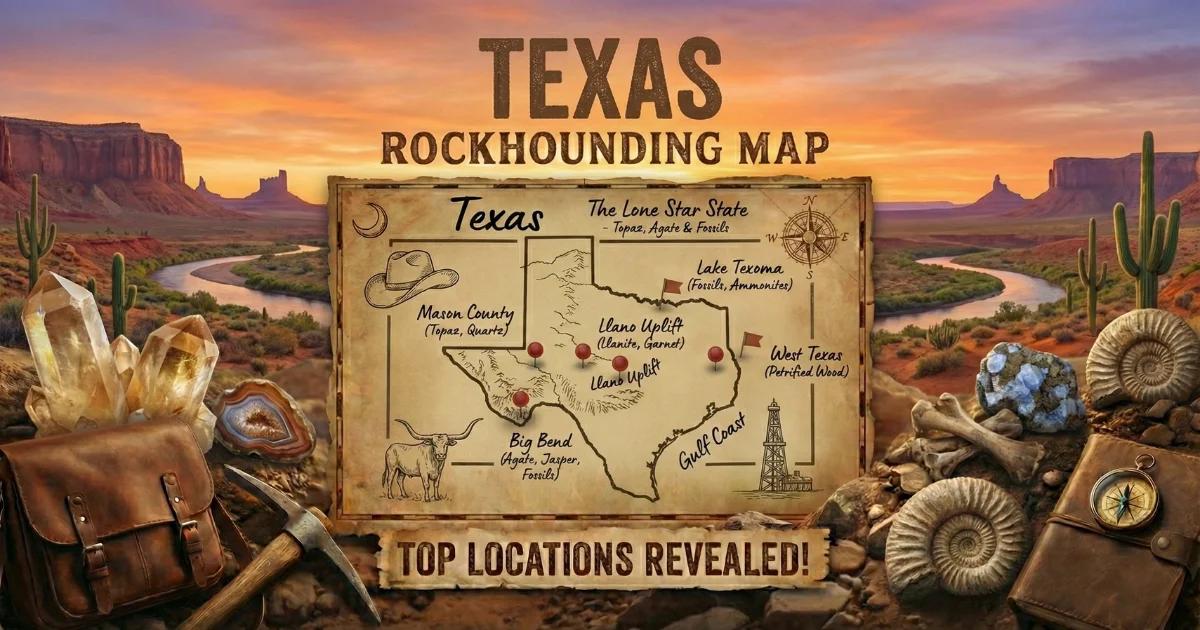
Texas Rockhounding Map
Use our interactive map to find collecting locations across the state, check land ownership, and plan your route.
View the full Texas rockhounding map here.
The map includes fee-dig sites, BLM parcels, and known mineral localities. Filter by mineral type to find exactly what you are looking for.