
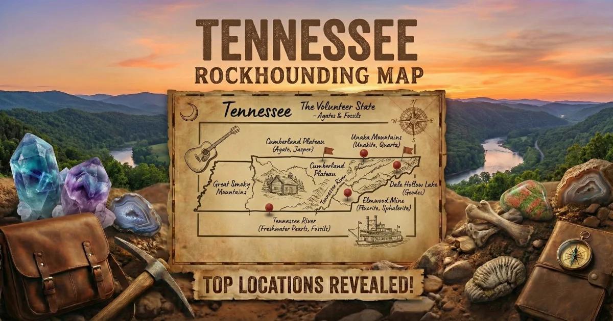
Tennessee sits on a geologic cross-section that runs from billion-year-old Precambrian basement rock in the eastern mountains to Paleozoic carbonate platforms in the center and Cretaceous-to-Quaternary sediments in the west. That east-to-west traverse means the state produces an unusual range of collectible minerals: gold, copper ores, unakite, and corundum-bearing gravels in the Blue Ridge; world-class hydrothermal calcite, fluorite, sphalerite, and barite in the Central Basin; banded agates in the Highland Rim drainages; crinoid fossils throughout the Nashville Dome limestones; and historic freshwater pearls from Tennessee River mussels.
Most collecting here happens in creeks, on gravel bars, and at road cuts — not in commercial fee-dig operations. Tennessee has no BLM land. The relevant public lands are Cherokee National Forest in the east and a patchwork of state parks, WMAs, and Army Corps land along the rivers. Everything else is private, and permission matters.

Tennessee Geology — Why These Minerals Are Here
The state divides into six physiographic provinces, and each one tells a different mineral story.
The Blue Ridge in the far east contains the oldest rock: Precambrian gneiss, schist, and metasediments of the Ocoee Supergroup. These are the same billion-year-old formations that produce rubies and sapphires in North Carolina. In Tennessee, the Blue Ridge yields gold placers (Coker Creek), copper sulfide ores (Ducktown), unakite (Unaka Mountains), and occasional garnet and kyanite in metamorphic float.
The Valley and Ridge province, immediately west, consists of folded and faulted Cambrian-to-Mississippian sedimentary rock — limestone, dolostone, shale, and sandstone. Zinc and lead mineralization in these carbonates fed the East Tennessee Zinc District, one of the largest in North America.
The Cumberland Plateau is a flat-topped upland of Pennsylvanian sandstone and shale sitting on Mississippian limestone. Geodes, iron-stained quartz, and occasional agate occur in the sandstone caprock and in the chert gravel of plateau streams.
The Highland Rim — a donut-shaped band surrounding the Central Basin — exposes Mississippian limestone, chert, and Fort Payne Formation rocks. Paint Rock agate and other chert agates weather out of these formations into the drainages of the Highland Rim.
The Central Basin (Nashville Dome) is the geologic core. Ordovician limestone sits at the surface here, exposed by erosion of the dome's crest. This is crinoid fossil country. It is also the host rock for the Mississippi Valley Type (MVT) zinc-lead-fluorite-barite deposits that produced the specimens at Elmwood Mine.
West Tennessee lies on unconsolidated Cretaceous, Tertiary, and Quaternary sediments of the Mississippi Embayment. Fossil collecting — shark teeth, bivalves, gastropods — is the main draw in this flat, agricultural landscape.
Collecting Locations
1. Agate Creek — Cannon County (Blue and Banded Agate)
GPS: Approx. **35.81°N, 86.05°W** (central Cannon County drainages).
Land Status: Mostly private agricultural land. Some creek access via county road crossings. Always ask landowners before entering private fields or walking creeks beyond public right-of-way.
What to Find: Blue agate, banded agate (cream, gray, blue, and rust bands), chalcedony nodules, and chert with quartz-lined vugs. The agate originates from the Fort Payne Formation chert and weathers into creek gravel.
Collecting Notes: Walk gravel bars at low water. The agates are easiest to spot when wet — carry a **spray bottle**. Look for translucent edges and waxy luster that distinguish agate from ordinary chert. Late summer and early fall provide the lowest water levels. After heavy rains, fresh material washes downstream.
2. Paint Rock — Jackson County (Paint Rock Agate)
GPS: Approx. **36.37°N, 85.60°W** (Paint Rock River drainage, Jackson County).
Land Status: Private land. Permission required. Some limited access where county roads cross the creek.
What to Find: Paint Rock agate — a distinctive variety with red, brown, cream, yellow, and orange banding. Some pieces show scenic patterns. The agate occurs as nodules and cobbles in creek gravel, weathered from Mississippian-age chert beds.
Collecting Notes: Paint Rock agate takes a good polish and is prized by Tennessee lapidaries. The color becomes vivid when wet or cut. Work the gravel bars systematically with a **rock pick** to turn cobbles. The best material tends to concentrate on the inside bends of the creek where flow velocity drops and heavy cobbles settle.
3. Coker Creek — Monroe County (Gold Panning)
GPS: Approx. **35.24°N, 84.27°W** (Coker Creek community, Monroe County). The gold district extends along Coker Creek and its tributaries for several miles.
Land Status: Cherokee National Forest (Tellico Ranger District). Recreational gold panning is allowed on NF land using non-motorized hand tools — **gold pan, classifier, sluice box** (hand-operated). No suction dredging. No motorized equipment. Several private fee-dig gold panning operations also operate near the town of Coker Creek.
What to Find: Fine placer gold, occasional small nuggets. The gold originated from quartz veins in the Precambrian Ocoee Supergroup metasediments and has been concentrated in stream gravels over millions of years. Cherokee people mined gold here before the 1830s gold rush brought European settlers.
Collecting Notes: Work bedrock cracks and crevices in the creek bottom for the best concentrations. Gold settles into natural riffles and behind large boulders. A **crevicing tool** (bent screwdriver or spoon) is essential for cleaning bedrock cracks. Classify your gravel to minus-1/4 inch before panning to speed the process. Black sand (magnetite) is your indicator — if you see black sand concentrating in the pan, gold should follow.
The Coker Creek Welcome Center in town can point you to current public access areas and fee-dig operations.
4. Copper Basin — Ducktown (Polk County)
GPS: Approx. **35.04°N, 84.38°W** (Ducktown, Polk County).
Land Status: Mostly private land, including former mine property. The Ducktown Basin Museum is open to visitors. Mine dumps are on private property — do not collect without explicit permission from the landowner.
What to Find: Copper minerals: chalcopyrite, malachite, azurite, chrysocolla, native copper (rare), bornite, pyrrhotite, and pyrite. The Copper Basin formed from massive sulfide deposits in Precambrian metavolcanic rock. Commercial mining from the 1850s through the 1980s extracted copper and sulfuric acid.
Collecting Notes: The Ducktown Basin Museum (housed in the old Burra Burra Mine office) has displays of local minerals and can advise on any accessible sites. The landscape around Ducktown was famously denuded by sulfur fumes during the smelting era — the barren hillsides are slowly revegetating. Creek gravels downstream of the old mines may contain copper mineral float, but be aware that this is a Superfund-adjacent area. Wash your hands and do not eat or drink while handling material from mine-influenced waters.
5. Elmwood Mine Area — Carthage, Smith County (Calcite, Fluorite, Sphalerite, Barite)
GPS: Approx. **36.25°N, 85.95°W** (Carthage area, Smith County).
Land Status: Private mine property. The Elmwood Mine is an active commercial zinc mine and is NOT open to the public. Surface collecting is not permitted on mine property.
What to Find (via dealers and shows): The Elmwood Mine has produced some of the finest mineral specimens in the world — honey-yellow calcite crystals up to 30 cm, purple and yellow fluorite cubes, dark sphalerite crystals, and tabular white barite. These are Mississippi Valley Type (MVT) deposits in Ordovician limestone.
Collecting Notes: You cannot walk in and collect at Elmwood. Specimens reach the market through mine workers who recover them during commercial operations. Tennessee mineral dealers and the annual Gem and Mineral shows (Nashville, Knoxville) are the places to acquire Elmwood material. Prices range from $20 for small calcite crystals to thousands for museum-grade fluorite and sphalerite combinations.
Road cuts and creek exposures in the Central Basin around Carthage occasionally expose vugs in Ordovician limestone with small calcite crystals and druzy quartz. This is worth a stop if you are in the area.
6. Unaka Mountains (Unicoi and Carter Counties — Unakite)
GPS: Approx. **36.10°N, 82.35°W** (Unaka Mountain area along the TN-NC border).
Land Status: Cherokee National Forest. Surface collecting of reasonable quantities for personal use is permitted on NF land. No digging into bedrock. No commercial extraction. Follow 36 CFR 261.9(a).
What to Find: Unakite — an altered granite composed of pink orthoclase feldspar, green epidote, and quartz. The name comes from the Unaka Mountains themselves. Also look for garnet in metamorphic float, occasional kyanite blades, and quartz crystals in road-cut exposures.
Collecting Notes: Unakite is easy to identify by its distinctive pink-and-green color. It occurs as cobbles in stream gravels and as outcrops in the Precambrian basement rock. The material takes a good polish and is popular for cabochons and tumbling. Walk Forest Service roads after rain — fresh slides and washouts expose new material. A **3-pound rock hammer** is sufficient for trimming specimens in the field.
7. Crinoid Fossils — Central Tennessee Limestone
GPS: No single location. Ordovician limestone exposures throughout the Central Basin (Davidson, Wilson, Williamson, Rutherford, Maury counties) produce crinoid fossils. Road cuts along I-65, I-24, and I-40 expose fossiliferous beds.
Land Status: Road cuts are on state right-of-way — collecting at road cuts is generally tolerated for small personal quantities in Tennessee, but do not block traffic or create hazards. Creek exposures may be on private land.
What to Find: Crinoid stem sections (columnal discs), crinoid calyces (the "head" of the animal), bryozoa, brachiopods, horn corals, and occasional trilobite fragments. The Ordovician limestone here is densely fossiliferous — some beds are essentially solid crinoid hash.
Collecting Notes: Weathered limestone surfaces show crinoid stems in cross-section as small circles or discs. A **chisel and hammer** can split bedding planes to expose complete specimens. The Tennessee pink marble (actually a crinoid-rich limestone) used in government buildings comes from East Tennessee quarries near Knoxville — the same rock, different color.
8. Freshwater Pearls — Tennessee River System
GPS: The Tennessee River and its tributaries throughout the state historically produced pearls.
Land Status: Regulated by Tennessee Wildlife Resources Agency (TWRA). Many native mussel species are state or federally protected. A commercial mussel license is required to harvest mussels. Recreational pearl hunting is a gray area — check TWRA regulations before disturbing any mussels.
What to Find: Freshwater pearls (white, pink, lavender) from native unionid mussels. Tennessee was once the center of the American freshwater pearl button industry, and the river system still holds significant mussel diversity — over 100 species.
Collecting Notes: The conservation status of Tennessee's mussels makes this a "look but be careful" situation. Several species are federally endangered. If you find a pearl in a legally harvested mussel, you may keep it. But actively harvesting mussels for pearls requires a license, and disturbing protected species carries severe federal penalties. The Freshwater Mollusk Conservation Society tracks mussel populations. Respect the regulations — these animals are slow-growing and ecologically important.
Minerals You Can Find in Tennessee
| Mineral | Hardness | Where in TN | What to Look For |
|---|---|---|---|
| Blue/Banded Agate | 7 | Cannon County creeks, Highland Rim drainages | Translucent nodules with blue, gray, cream banding in creek gravel |
| Paint Rock Agate | 7 | Jackson County, Paint Rock River | Red, brown, orange, cream banded cobbles. Vivid color when wet. |
| Gold (placer) | 2.5 | Coker Creek, Monroe County | Fine flakes and small nuggets in bedrock crevices and black sand |
| Calcite | 3 | Elmwood Mine area, Central Basin limestone | Honey-yellow rhombohedral or scalenohedral crystals in vugs |
| Fluorite | 4 | Elmwood Mine area, Smith County | Purple, yellow, or colorless cubic crystals |
| Sphalerite | 3.5–4 | Elmwood Mine area, zinc districts | Dark brown to black resinous crystals with cleavage faces |
| Barite | 3–3.5 | Elmwood Mine area, Central Basin | Heavy white tabular crystals. Noticeably dense for its size (SG 4.5) |
| Unakite | 6–7 | Unaka Mountains, Cherokee NF | Pink and green altered granite cobbles in stream gravel |
| Chalcopyrite | 3.5–4 | Copper Basin, Ducktown | Brassy yellow metallic mineral, often tarnished iridescent |
| Malachite | 3.5–4 | Copper Basin, Ducktown | Green botryoidal crusts and stains on rock |
| Crinoid fossils | 3 (limestone) | Central Basin, Nashville area road cuts | Circular stem cross-sections and calyx fragments in limestone |
| Freshwater Pearl | 2.5–4.5 | Tennessee River system | White, pink, or lavender pearls in unionid mussels (regulated) |
Field Identification Tips
Agate vs. chert: Both are microcrystalline quartz (SiO2, hardness 7). Agate is translucent on thin edges and shows banding or color variation. Chert is opaque and typically dull gray, brown, or black. Wet the specimen — if light passes through the edges, it is likely agate. Tennessee chert can be colorful (reds, yellows) but remains opaque.
Gold vs. pyrite vs. mica: Gold is soft (2.5 Mohs), malleable (flattens when hit), and stays bright yellow in shade. Pyrite is hard (6–6.5), brittle (shatters when hit), and has a greenish-gray streak. Mica flakes are thin, flexible, and light — gold is dense and sinks immediately in a pan. If your "gold" floats or rides on the surface tension of water, it is mica.
Calcite vs. quartz: Calcite is softer (3 Mohs — scratched by a knife), effervesces in dilute hydrochloric acid, and has rhombohedral cleavage. Quartz is harder (7 — scratches steel), does not react to acid, and has conchoidal fracture with no cleavage. In the Elmwood-type deposits, calcite is typically honey-yellow and quartz is clear or smoky.
Copper minerals: Malachite is always green (botryoidal or banded). Azurite is always deep blue. Chrysocolla is blue-green and waxy. Chalcopyrite is brassy metallic yellow. Native copper is pink-red metal. All copper minerals produce a green streak on unglazed porcelain.
Unakite: If it has pink feldspar and green epidote together in a granitoid texture, it is unakite. There is nothing else it looks like. The pink-green combination is diagnostic.
What to Bring
| Item | Why |
|---|---|
| Gold pan (14-inch) | Essential for Coker Creek. Green or black plastic pan — not metal. |
| Classifier (1/4-inch mesh) | Screen out oversize gravel before panning. Speeds gold recovery. |
| Crevicing tools | Bent screwdriver, spoon, or commercial crevicing tool for cleaning bedrock cracks. |
| 3-pound rock hammer | Splitting limestone for fossils, trimming agate and unakite specimens. |
| Cold chisel (1-inch) | Splitting bedding planes in limestone to expose crinoid fossils. |
| 10x hand lens (loupe) | Examining banding in agate, crystal faces in calcite, gold flakes in pan. |
| Spray bottle | Wetting agates and fossils in the field to see detail and color. |
| Snuffer bottle | Picking fine gold from the pan. Essential for the flour gold common at Coker Creek. |
| Safety glasses | Mandatory when swinging a hammer. Limestone chips are sharp. |
| Sturdy boots (waterproof) | Creek walking is the primary collecting method. Wet feet are a given. |
| 5-gallon bucket | Carrying gravel to pan, transporting specimens, sitting on during lunch. |
| Newspaper/bubble wrap | Wrapping calcite crystals and fragile fossils for transport. |
Legal and Access
Cherokee National Forest: Surface collecting of rocks, minerals, and fossils for personal, non-commercial use is permitted under Forest Service regulations (36 CFR 261.9). Hand tools only — no motorized equipment. Do not disturb cultural or archaeological sites. Gold panning with non-motorized equipment (pan, hand sluice) is allowed. Suction dredging is prohibited. Respect seasonal closures on forest roads.
State Parks: Collecting rocks, minerals, and fossils is prohibited in all Tennessee State Parks, State Natural Areas, and State Historic Areas. Leave everything as you find it.
Army Corps of Engineers Land: The Corps manages land around Tennessee's major reservoirs (Norris, Cherokee, Douglas, Center Hill, etc.). Regulations vary by project. Casual surface collecting is generally tolerated on Corps land below the summer pool elevation, but check with the specific lake office.
Private Land: Most of the state. Always get landowner permission before entering. Tennessee has a hunter/landowner liability protection statute, but verbal or written permission is still required. If a gate is closed or land is posted, do not enter.
Freshwater Mussels: Regulated by TWRA. A commercial mussel license is required to harvest mussels. Many species are state-listed or federally endangered. Penalties for disturbing protected species are steep — fines up to $25,000 per violation under the Endangered Species Act. Do not harvest mussels without understanding the current regulations.
Elmwood Mine / Active Mines: Tennessee has active mining operations for zinc, crusite, and limestone. Never enter an active mine or posted mine property. Trespassing at mine sites is dangerous and illegal.
Interactive Map
Find all Tennessee collecting locations, GPS coordinates, and access details on our Tennessee rockhounding map.