
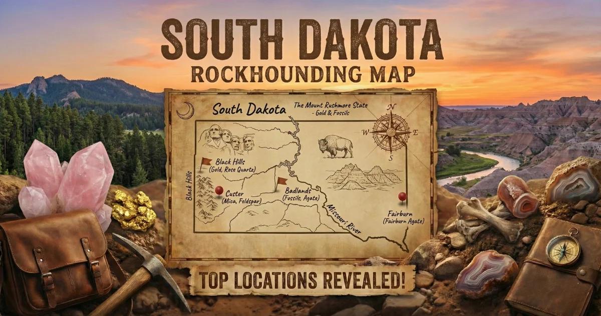

Geology of South Dakota's Gem-Bearing Terrain
South Dakota splits into two geologically distinct provinces, and that split dictates where you hunt and what you find.
The Black Hills are an eroded dome of Precambrian igneous and metamorphic rock — granite, schist, and massive pegmatite intrusions — punching up through younger Paleozoic sedimentary layers. The core rocks are 1.7 to 2.5 billion years old. During the Precambrian, silica-rich fluids infiltrated voids and fractures in the Minnelusa Formation and older units, depositing the chalcedony that would become Fairburn agates. Separate pulses of granitic magma cooled slowly at depth, forming the giant pegmatite bodies that host rose quartz, beryl, tourmaline, feldspar, and lithium minerals. A later episode of hydrothermal activity drove gold into fractures throughout the northern Black Hills, concentrated in the Homestake Formation.
East of the Black Hills, the Great Plains are blanketed by Cretaceous shale (Pierre Shale, primarily) and Tertiary sediments — the White River Group clays and volcanic ash beds that form the Badlands. Millions of years of erosion stripped Fairburn agates from their Precambrian source rock and tumbled them southeast across the prairie. That is why you find them in gravel deposits 30 to 60 miles from the Black Hills, mixed with ordinary river cobbles. The same erosional cycle distributed prairie agates, petrified wood, and chalcedony roses across eastern South Dakota's glacial till and river terraces.
Understanding this two-province setup is the first thing that saves you time. If you want pegmatite minerals, you stay in the Black Hills core. If you want agates, you work the gravel plains to the southeast. If you want gold, you stick to the northern Hills drainages. The geology is the map before you ever open a map.
Collecting Locations
1. Fairburn Agate Beds — French Creek / Cheyenne River Drainages
- GPS (general area): 43.6500 N, -103.1700 W (southeast of Fairburn town)
- Land status: Mix of private ranch land, Buffalo Gap National Grassland (USFS), and scattered BLM parcels. Always verify current ownership before collecting. National Grassland land is open to casual surface collecting for personal use.
- Target minerals: Fairburn agates (fortification agate with angular banding in red, yellow, orange, white, and black), common chalcedony, jasper, prairie agates.
- Notes: Fairburn agates — the South Dakota state gem — formed in Precambrian host rock and were carried southeast by erosion over millions of years. They concentrate in gravel bars along French Creek, the Cheyenne River, and in eroded gullies across the prairie between Fairburn and Scenic. Specimens range from thumbnail size to fist size, but most keepers run 1 to 3 inches. The banding is often invisible when the stone is dry and dusty. Carry a spray bottle. Hunt after rain when water darkens the surface and the banding pops. Walk freshly graded gravel roads, plowed fields (with landowner permission), and eroded cutbanks. Spring snowmelt and hard summer rains expose new material every season. High-grade Fairburn agates with tight, symmetrical banding and strong color sell for $500 to $5,000+ per specimen. Dedicated hunters commonly search for multiple seasons before finding an exceptional piece.
2. Bull Moose Mine / Rose Quartz Area — Custer County
- GPS: 43.7330 N, -103.6170 W (Bull Moose Mine vicinity, south of Custer)
- Land status: Black Hills National Forest (USFS) and patented mining claims. Some areas are open to surface collecting on National Forest land; active claims are off-limits. Check with the Hell Canyon Ranger District for current status.
- Target minerals: Rose quartz (massive, translucent pink), milky quartz, feldspar (microcline, albite), muscovite mica, beryl (rare).
- Notes: The Black Hills produce some of the finest rose quartz on the planet. The color comes from trace amounts of titanium and iron substituting into the quartz lattice, combined with microscopic fibrous inclusions of a dumortierite-like mineral. The rose quartz here occurs as massive (non-crystallized) material in pegmatite veins cutting through Precambrian schist. Pieces can be enormous — multi-pound chunks of translucent pink material sitting in weathered pegmatite outcrop. Look for white quartz float on the surface and follow it uphill to the pegmatite source. Some specimens show asterism (a six-rayed star) when cut into cabochons and held to a point light source. The surrounding forest roads provide good access, but stay on established roads and trails.
3. Keystone / Custer Pegmatite District
- GPS: 43.8950 N, -103.4300 W (Keystone area, general)
- Land status: Mix of Black Hills National Forest, private mining claims, and State of South Dakota land. Many historic mine dumps are on patented claims — do not collect without permission. National Forest land outside of active claims is open to casual collecting.
- Target minerals: Beryl (aquamarine, heliodor, goshenite), black tourmaline (schorl), feldspar (amazonite, microcline), muscovite mica, garnet (almandine), columbite-tantalite, spodumene, lepidolite.
- Notes: The Keystone-Custer pegmatite district contains hundreds of mapped pegmatite bodies. These are zoned pegmatites — the kind that produce gem minerals in their cores and intermediate zones. The Etta Mine once produced the world's largest spodumene crystals (over 40 feet long). The Hugo Mine yielded beryl crystals measured in feet. Most of these historic mines are on private claims today, but the district's pegmatite dikes are so numerous that they crop out across National Forest land as well. Look for white quartz and blocky feldspar in road cuts and hillside exposures. Black tourmaline crystals weather out of the pegmatite and accumulate in the soil downhill. Beryl, when present, appears as hexagonal prisms ranging from pale green to blue-green. This area rewards patience and systematic prospecting along exposed pegmatite contacts.
4. Deadwood / Lead — Gold District
- GPS: 44.3770 N, -103.7300 W (Deadwood Gulch area)
- Land status: Mix of Black Hills National Forest, private land, and municipality land. Recreational gold panning is generally permitted on National Forest waterways. Check for active mining claims before panning — claim markers are typically posted at stream access points.
- Target minerals: Placer gold (fine flour gold to small flakes), magnetite, garnet (almandine), quartz.
- Notes: The 1876 Black Hills Gold Rush started in Deadwood Gulch. The Homestake Mine in Lead operated for 126 years and produced over 40 million ounces of gold from Precambrian iron formation host rock. The lode deposits are off-limits, but placer gold remains in Whitewood Creek, Deadwood Creek, False Bottom Creek, and numerous small tributaries throughout the northern Hills. Gold concentrates behind large boulders, in bedrock crevices, and at the inside bends of streams. Bring a gold pan and a suction bottle (snuffer bottle) for picking fine gold from your concentrate. The gold here is mostly fine — do not expect nuggets. A patient panner working good bedrock can recover visible color in a few pans. The best producing stretches tend to be upstream of the old dredge tailings piles, where undisturbed gravel still sits on bedrock.
5. Prairie Agate Fields — Eastern South Dakota
- GPS: 43.9000 N, -99.3000 W (general area, central SD along the Missouri River breaks)
- Land status: Primarily private agricultural land. Permission required. Some road ditches and public rights-of-way along county roads.
- Target minerals: Prairie agates (banded and plume varieties), chalcedony, jasper, petrified wood, Lake Superior-type agates (glacially transported, northeastern SD).
- Notes: Prairie agates lack the tight fortification banding of Fairburns but carry their own appeal — soft pastel bands, moss inclusions, and plume structures. They weathered out of Tertiary gravels and are scattered across plowed fields throughout central and eastern South Dakota. The best hunting is on freshly turned ground in spring. Walk the fields after a rain, scanning for the waxy luster that separates agate from ordinary gravel. In the northeastern corner of the state, glacial deposits carried Lake Superior agates south from Minnesota. These show up in gravel pits and river bars along the Big Sioux River drainage.
6. Badlands Region — Petrified Wood and Chalcedony
- GPS: 43.8550 N, -102.3400 W (BLM land south of Wall, outside the National Park)
- Land status: BLM land and Buffalo Gap National Grassland (USFS) surround Badlands National Park. Collecting is prohibited inside the National Park. On BLM and National Grassland land, casual surface collecting of reasonable quantities of petrified wood, agates, and common invertebrate fossils is permitted for personal use.
- Target minerals: Petrified wood (agatized, opalized), chalcedony nodules, calcite crystals, selenite gypsum, barite roses.
- Notes: The White River Badlands expose millions of years of Tertiary sediment — volcanic ash, clay, and siltstone deposited 28 to 37 million years ago. Petrified wood occurs where ancient trees were buried in volcanic ash and replaced by silica. Some pieces show excellent cellular detail and take a high polish. Chalcedony nodules and small agate geodes erode out of the Chadron and Brule Formations. Selenite crystals — transparent gypsum blades — form in the clay layers and can be collected on BLM land. The critical rule here is simple: stay outside the National Park boundary. The Park Service enforces collecting prohibitions strictly, and fines are steep. Use a GPS and know where the boundary lines fall before you start picking up material.
Minerals of South Dakota
| Mineral | Color | Where Found | Abundance |
|---|---|---|---|
| Fairburn agate | Red, yellow, white, black banding | French Creek, Cheyenne River drainages, Scenic area | Rare |
| Rose quartz | Translucent pink | Custer County, Bull Moose Mine area, Black Hills | Moderate |
| Beryl | Pale green, blue-green, yellow | Keystone-Custer pegmatite district | Uncommon |
| Black tourmaline (schorl) | Black | Keystone-Custer pegmatite district | Common |
| Feldspar (microcline/amazonite) | White, pink, green (amazonite) | Black Hills pegmatites | Common |
| Muscovite mica | Silver, clear | Black Hills pegmatites | Common |
| Placer gold | Yellow metallic | Deadwood, Lead, northern Black Hills streams | Uncommon (fine) |
| Prairie agate | Banded pastels, plume inclusions | Central and eastern SD fields | Moderate |
| Petrified wood | Brown, red, agatized | Badlands region, BLM land | Moderate |
| Chalcedony | White, gray, blue | Statewide in gravels | Common |
| Selenite (gypsum) | Transparent, bladed | Badlands clay formations | Common |
| Barite rose | Tan, rosette-shaped | Badlands area | Uncommon |
| Garnet (almandine) | Dark red | Black Hills pegmatites and stream concentrates | Uncommon |
Field Identification
Identifying your finds in the field comes down to a few reliable physical tests. Forget the apps — use your hands, a knife blade, and a streak plate.
Fairburn agate vs. common chalcedony: Both have the same hardness (7 on the Mohs scale) and waxy luster. The difference is structure. Fairburns show angular, fortification-style banding — concentric lines with sharp corners, not smooth curves. Common chalcedony is typically uniform or vaguely banded. Wet the stone. If tight, angular color bands appear, you likely have a Fairburn. If the stone is translucent but featureless, it is common chalcedony.
Rose quartz vs. milky quartz: Both are massive (non-crystallized) quartz. Rose quartz has a pink to rose color that persists through the entire piece — it is not a surface stain. Milky quartz is white and opaque due to fluid inclusions. Hold both to sunlight: rose quartz transmits a warm pink glow; milky quartz stays opaque white. Hardness is identical (7), so the color is your primary field indicator.
Beryl vs. quartz in pegmatite: Beryl forms hexagonal prismatic crystals, often with flat terminations. Quartz also forms hexagonal crystals but typically shows pointed terminations. Beryl is slightly softer (7.5-8 vs. 7 for quartz) but you will not distinguish that in the field. Focus on crystal habit: beryl prisms tend to be stubbier and show a distinct pinacoidal (flat) termination. Color helps — pale green, blue-green, or yellow crystals in pegmatite are worth examining as possible beryl.
Placer gold vs. pyrite and mica: Gold is heavy, soft (2.5 Mohs), and malleable. Hit it with a pin — gold dents; pyrite shatters. Mica flakes are flat and flexible. Gold flakes are flat but do not bend back and forth like mica — they fold and stay folded. In your pan, gold settles to the very bottom and stays put when you swirl water over the concentrate. Pyrite and mica ride higher and wash out with gentle panning.
Petrified wood vs. chert: Both are silicified and hard (6.5-7). Petrified wood preserves cellular structure — look for grain lines, growth rings, or bark texture on the exterior. Chert is structureless and breaks with a smooth conchoidal fracture. If you can see wood grain under a hand lens, it is petrified wood.
Recommended Tools
- Spray bottle: Mandatory for agate hunting. Dry agates look like any other gravel cobble. A quick spray reveals banding instantly.
- Hand lens (10x): For examining crystal habit in pegmatite minerals, checking agate banding detail, and identifying wood grain in petrified wood.
- Rock hammer (22 oz, flat/chisel head): For breaking open nodules and trimming specimens. A geological pick works for prying material from pegmatite outcrop.
- Cold chisel set (1/2" and 3/4"): For working material out of pegmatite veins without shattering crystals.
- Gold pan (14" steel or plastic): For placer gold in Black Hills streams. Bring a classifier screen (1/4" mesh) and a snuffer bottle for fine gold recovery.
- GPS unit or phone with offline maps: Critical near the Badlands National Park boundary. You need to know exactly where federal park land begins and BLM/Grassland ends.
- 5-gallon bucket with lid: For hauling specimens from prairie agate fields back to your vehicle. Fields can be a long walk from the road.
- Knee pads: Agate hunting on gravel and plowed fields is hard on the knees. Serious Fairburn hunters spend hours on their knees scanning ground.
- Streak plate (unglazed porcelain): For mineral ID in the pegmatite district. Tourmaline streaks white; garnet streaks white to slightly pink; magnetite streaks black.
- Backpack with padding or bubble wrap: Pegmatite crystals and rose quartz specimens are fragile during transport. Wrap them in the field.
Legal Considerations
Black Hills National Forest (USFS): Casual surface collecting of rocks, minerals, and semi-precious gemstones is permitted for personal, non-commercial use. You may collect reasonable quantities — generally interpreted as what one person can carry. No mechanized equipment (no shovels larger than a hand trowel for mineral collecting, no motorized tools). Power equipment and significant surface disturbance require a permit. Stay on designated roads and trails with vehicles. Check with the local Ranger District (Hell Canyon, Mystic, or Northern Hills) for any area-specific closures or restrictions.
BLM Land: The BLM allows casual collection of rocks, minerals, and reasonable amounts of petrified wood (up to 25 pounds per day plus one piece, not to exceed 250 pounds per calendar year) for personal use on BLM-managed land. No permit required for casual collecting. Commercial collecting requires a permit.
Buffalo Gap National Grassland (USFS): Same regulations as National Forest land. Surface collecting of minerals and common invertebrate fossils for personal use is permitted. Vertebrate fossils are protected and may not be collected without a permit.
Badlands National Park (NPS): Collecting anything — rocks, minerals, fossils, plants, artifacts — is prohibited. The boundary is clearly marked in most places, but in remote areas it can be ambiguous. Use GPS coordinates and a map showing the park boundary. Violations carry fines starting at $150 and can reach felony-level charges for significant fossil removal.
Private Land: Most of eastern South Dakota and much of the prairie around the Fairburn agate beds is private ranch land. You must have the landowner's permission before collecting. Some ranchers will grant access if asked politely; others will not. Never assume open range is public land.
Mining Claims: Active and inactive mining claims dot the Black Hills. Patented claims are private property. Unpatented claims on National Forest land give the claim holder mineral rights — you cannot collect minerals on an active unpatented claim without the claim holder's permission. Look for claim markers (posts or monuments) and check the BLM LR2000 database for claim status in your target area.
South Dakota Gem Hunting Map
Use our interactive map to find specific collecting sites, access points, and land status boundaries across South Dakota.