
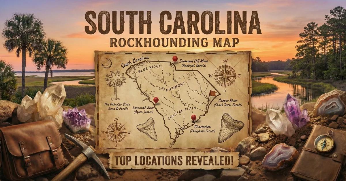
South Carolina Geology and Land Status
South Carolina spans three geologic provinces, each with distinct mineral potential. The Blue Ridge province occupies the northwest corner of the state — a narrow wedge of high-grade metamorphic rock in Oconee and Pickens counties. The Piedmont covers the upper half of the state from the mountains to the Fall Line, running roughly through Columbia. Below that, the Coastal Plain extends to the Atlantic, built from unconsolidated marine sediments dating from the Cretaceous through the Pleistocene.
The Carolina Gold Belt — a northeast-trending zone of volcanic and sedimentary rocks metamorphosed to greenschist facies — crosses the Piedmont through Lancaster, York, Cherokee, Chesterfield, and Kershaw counties. This belt produced commercial gold from the 1820s through the early 1900s and still yields placer gold today. Pegmatite dikes intrude the Piedmont gneisses in Abbeville, Anderson, and Oconee counties, carrying gem-grade amethyst, beryl (aquamarine), and accessory minerals.
Land status varies. The Sumter National Forest (managed by the USDA Forest Service) covers portions of the Piedmont and Blue Ridge and generally permits non-commercial mineral collecting with hand tools. State parks prohibit collecting. Private land — which constitutes the majority of productive mineral ground in South Carolina — requires written landowner permission. The Coastal Plain includes public beaches and state heritage preserves where fossil collecting rules differ by site. Always verify current regulations with the managing agency before digging.
Top Collecting Locations
1. Haile Gold Mine Area — Lancaster County
GPS: 34.3050, -80.5150
Land status: Active commercial mine (OceanaGold) — no public access to the mine itself. Surrounding creeks on private land may be accessible with landowner permission.
County: Lancaster County
Managing agency: Private (OceanaGold Operations)
Vehicle: 2WD sedan to paved roads; high-clearance for back roads near creeks.
Minerals: Placer gold, pyrite, sericite schist.
Fees: None for public waterways; private land requires permission.
The Haile Mine is the largest active gold mine on the East Coast. While the mine itself is closed to collectors, the surrounding drainages in Lancaster County still carry flour to fine placer gold. Creeks cutting through the Carolina Slate Belt expose gold-bearing quartz veins in sericite schist. Work gravel bars at inside bends and behind large boulders. Gold here is fine — a classification screen set (30-mesh and finer) and a green or blue gold pan will help you spot it. Best results come after high-water events flush new material into the stream beds.
2. Smyrna Area Creeks — York and Cherokee Counties
GPS: 35.0450, -81.4200
Land status: Mix of private land and public road crossings. Some sections of Kings Creek and Thicketty Creek are wadeable from public bridge access points.
County: Cherokee County / York County
Managing agency: Private landowners; SCDOT at bridge right-of-ways.
Vehicle: 2WD adequate for most bridge access points.
Minerals: Placer gold, magnetite, garnet, monazite.
Fees: None at public access points.
Cherokee and York counties sit squarely in the Carolina Gold Belt. Kings Creek, Thicketty Creek, and their tributaries have produced recreational gold for decades. The host rocks are metavolcanics and phyllites with quartz stringers. Pan the gravel just upstream of bedrock ledges and in natural riffles. You will also recover heavy black sand (magnetite and ilmenite), small garnets, and occasionally monazite — a rare-earth phosphate mineral that appears as small honey-yellow grains. Use a 14-inch gold pan, a sluice box if legal in the waterway, and rubber boots. Work low-water periods in late summer and early fall for best bedrock exposure.
3. Due West Amethyst Locality — Abbeville County
GPS: 34.3330, -82.3880
Land status: Private land. Permission required from individual landowners.
County: Abbeville County
Managing agency: Private landowners
Vehicle: High-clearance recommended for farm roads.
Minerals: Amethyst, smoky quartz, milky quartz, feldspar, mica.
Fees: Varies by landowner — some charge a small digging fee.
The area around Due West (home of Erskine College) contains pegmatite dikes that produce some of the darkest amethyst in the eastern United States. The crystals occur in pockets within graphic granite pegmatites intruding hornblende gneiss. Individual crystals range from thumbnail size to fist-sized specimens with deep purple saturation that rivals material from Four Peaks, Arizona.
Collecting requires digging into weathered pegmatite or screening the red clay soil above decomposed dikes. Bring a 3-lb crack hammer, cold chisels, pry bars, and 1/4-inch classifying screens. Wrap specimens in newspaper immediately — amethyst scratches easily against other quartz. The best pockets tend to occur at the contact between pegmatite and country rock. Ask locally at Abbeville County hardware stores or the local rock club for current access information.
4. Anderson and Oconee County Pegmatites — Beryl (Aquamarine)
GPS: 34.5800, -82.8400 (general area near Pendleton)
Land status: Mostly private. Some collecting possible in Sumter National Forest (Andrew Pickens Ranger District) — contact the district office for current policy.
County: Anderson County / Oconee County
Managing agency: USDA Forest Service (Sumter National Forest, Andrew Pickens District) for public land; private landowners elsewhere.
Vehicle: High-clearance / 4WD for forest roads. Some sites require short hikes.
Minerals: Beryl (aquamarine, green beryl), muscovite books, feldspar, quartz, garnet, black tourmaline (schorl), columbite-tantalite.
Fees: None on National Forest land for personal, non-commercial collecting.
The Inner Piedmont and Blue Ridge margin in Anderson and Oconee counties host numerous pegmatite bodies. Some of these dikes have produced beryl crystals with pale blue (aquamarine) to green coloration. The pegmatites are typically zoned — look for a quartz core flanked by coarse feldspar and mica zones. Beryl occurs as hexagonal prismatic crystals, often partially etched, ranging from pencil-width to crystals several inches across.
Weathered pegmatite exposures in road cuts and creek banks are the most productive spots. Fresh beryl is hard (7.5-8 on the Mohs scale) and will scratch a steel knife blade. Bring a geological pick, cold chisels, safety glasses, and spray bottle with water to clean surfaces and spot the pale blue-green color against white feldspar matrix. Black tourmaline (schorl) crystals and books of silvery muscovite are common associates that confirm you are in pegmatite.
5. Stumphouse Mountain / Blue Ridge Metamorphics — Oconee County (Staurolite)
GPS: 34.8550, -83.1800 (Stumphouse Tunnel area)
Land status: Oconee County park land and adjacent Sumter National Forest. Verify collecting rules at the Stumphouse Tunnel park office.
County: Oconee County
Managing agency: Oconee County Parks / USDA Forest Service
Vehicle: 2WD adequate to parking area.
Minerals: Staurolite (fairy crosses), kyanite, garnet, mica schist.
Fees: Small parking fee at Stumphouse Tunnel park.
The Blue Ridge metamorphic rocks in Oconee and Pickens counties contain staurolite — an iron-aluminum silicate that forms distinctive cross-shaped twins. These "fairy crosses" weather free from mica schist and collect in residual soils and creek gravels. Individual crosses range from half an inch to two inches. The best specimens show well-defined 60-degree or 90-degree penetration twins.
Search in residual clay soils on hillsides above mica schist outcrops, or screen creek gravels. Staurolite is hard (7-7.5 Mohs) and resists weathering, so it concentrates as a heavy residual mineral. A 1/4-inch soil sifter and a trowel are the only tools needed. Kyanite blades — long, blue, bladed crystals — occur in the same schist units and are worth collecting as specimens.
6. Edisto Beach and Low-Country Rivers — Colleton and Dorchester Counties (Shark Teeth and Fossils)
GPS: 32.4930, -80.3180 (Edisto Beach State Park)
Land status: Edisto Beach State Park (SCPRT) — fossil collecting of loose surface specimens is generally permitted on the beach. Check current park rules. Public river access points on the Edisto, Cooper, and Ashley rivers.
County: Colleton County / Dorchester County / Charleston County
Managing agency: South Carolina Department of Parks, Recreation and Tourism (SCPRT) for Edisto Beach State Park. SCDNR for navigable waterways.
Vehicle: 2WD to all access points.
Minerals/Fossils: Fossilized shark teeth (Megalodon, mako, great white, sand tiger), ray dental plates, whale bone fragments, fossilized shell, phosphate nodules.
Fees: State park admission ($5-$8 per adult).
South Carolina's Coastal Plain produces some of the best shark tooth collecting on the East Coast. The Eocene-through-Miocene marine formations yield teeth from dozens of species. Edisto Beach is the most popular spot — teeth wash out of offshore formations and deposit on the beach, especially after storms and strong tidal cycles. Low tide is the window. Walk the wrack line and the wet sand zone, scanning for dark triangular shapes among the shell hash.
For larger teeth — including Megalodon specimens up to six inches — the black-water rivers of the low country (Cooper River, Edisto River, Stono River) are more productive but require wading, diving, or kayaking. The Cooper River near Summerville (Dorchester County) is the most famous Megalodon tooth locality in the state. Many collectors use mesh scoops, wetsuits, and snorkeling gear to sift river-bottom sediments. A South Carolina Hobby Diver License (issued by SCDNR, currently $25/year for residents) is required for underwater fossil collecting in state waters.
Minerals Found in South Carolina
| Mineral / Fossil | Mohs Hardness | Color | Where Found | Province |
|---|---|---|---|---|
| Gold (placer) | 2.5-3 | Yellow metallic | Lancaster, York, Cherokee, Chesterfield counties | Piedmont |
| Amethyst | 7 | Deep purple | Abbeville County (Due West area) | Piedmont |
| Beryl (aquamarine) | 7.5-8 | Pale blue to blue-green | Anderson, Oconee counties | Piedmont / Blue Ridge margin |
| Staurolite | 7-7.5 | Brown to reddish-brown | Oconee, Pickens counties | Blue Ridge |
| Kyanite | 4.5-7 (directional) | Blue, gray | Oconee, Pickens, Anderson counties | Blue Ridge / Piedmont |
| Smoky quartz | 7 | Gray to black | Abbeville, Anderson counties (pegmatites) | Piedmont |
| Black tourmaline (schorl) | 7-7.5 | Black | Anderson, Oconee counties (pegmatites) | Piedmont |
| Garnet (almandine) | 6.5-7.5 | Red to dark red | Cherokee, York, Oconee counties | Piedmont / Blue Ridge |
| Monazite | 5-5.5 | Honey-yellow to brown | York, Cherokee counties (placer) | Piedmont |
| Shark teeth (fossilized) | 5 (apatite) | Black, gray, brown | Edisto Beach, Cooper River, Ashley River | Coastal Plain |
| Megalodon teeth | 5 (apatite) | Black, gray, tan | Cooper River, Edisto River | Coastal Plain |
Field Identification Tips
Gold vs. Pyrite (Fool's Gold)
Placer gold is malleable — press it with a knife point and it dents without breaking. Pyrite shatters. Gold stays bright yellow in shadow; pyrite has a brassy, slightly greenish cast. Gold is heavy (specific gravity 19.3) and settles to the bottom of your pan behind black sand. Pyrite is much lighter (SG 5.0) and rides higher in the pan. If it flakes when you press it with a pin, it is gold.
Amethyst vs. Fluorite
Both are purple, but amethyst is quartz (hardness 7) and will scratch glass and steel. Fluorite is softer (hardness 4) and can be scratched with a knife. Amethyst has conchoidal fracture and a vitreous luster. Fluorite cleaves in perfect octahedral planes. In South Carolina pegmatites, purple material is almost always amethyst — fluorite is uncommon in this geologic setting.
Beryl Identification
Beryl forms hexagonal prismatic crystals. Cross-sections are six-sided. Hardness is 7.5-8, so it will scratch quartz. In weathered pegmatite, beryl may appear as whitish or pale greenish hexagonal "logs" that resist weathering better than the surrounding feldspar. Spray water on suspect crystals — the pale blue-green color of aquamarine becomes more visible when wet. Check for conchoidal to uneven fracture and vitreous luster.
Staurolite (Fairy Crosses)
Staurolite twins are distinctive — two prismatic crystals intersecting at 60 or 90 degrees to form a cross. Color is dark brown to reddish-brown. Hardness 7-7.5. The mineral is opaque with a vitreous to resinous luster. Crystals weather free from the surrounding mica schist and accumulate in soil. They are often coated with clay and need scrubbing to reveal the cross shape.
Shark Teeth
Fossilized shark teeth are dark-colored (black, dark gray, brown) due to mineral replacement. They are triangular or blade-shaped with serrated or smooth edges depending on species. The root is wider and more porous than the crown. Fresh (modern) shark teeth are white — if the tooth is black or dark brown, it is fossilized and likely thousands to millions of years old. Megalodon teeth are distinguished by their large size (typically 3-7 inches), thick root, and fine serrations.
Recommended Tools
What you carry depends on what you are targeting. Here is a breakdown by collecting type.
Gold Panning (Piedmont Creeks)
- 14-inch gold pan (green or blue for contrast)
- Classifying screens (1/2-inch, 1/4-inch, and 30-mesh set)
- Snuffer bottle for picking fine gold
- Glass vials for storing gold
- Crevicing tools (spoons, screwdrivers, suction bulbs)
- Rubber boots or waders
- Sluice box (if legal in your waterway — check SCDNR regulations)
Pegmatite Minerals (Amethyst, Beryl, Tourmaline)
- 3-lb crack hammer
- Cold chisels (3/4-inch and 1-inch)
- Pry bar (18-inch)
- Safety glasses (mandatory — flying rock chips cause eye injuries)
- Geological pick (pointed and flat-head)
- Spray bottle with water
- Newspaper and bubble wrap for specimen protection
- 5-gallon buckets
Staurolite and Surface Collecting
- Soil sifter / classifying screen (1/4-inch mesh)
- Garden trowel
- Knee pads
- Brush for cleaning specimens
Shark Teeth (Beaches and Rivers)
- Mesh scoop / sand flea rake
- Polarized sunglasses (reduces glare, helps spot dark teeth on sand)
- Small container or zip bags
- Wetsuit and snorkel gear (for river collecting)
- Kayak or canoe (for river access to Cooper River sites)
Graves Mountain — Lincoln County, Georgia (Context Note)
Graves Mountain sits just across the Savannah River in Lincoln County, Georgia, roughly 30 miles from the South Carolina border. It is worth noting for South Carolina collectors because it is one of the premier mineral collecting sites in the southeastern United States. The site produces lazulite, rutile, pyrophyllite, kyanite, iridescent hematite, pyrite, and quartz crystals. Graves Mountain hosts periodic open-dig days (typically twice per year, spring and fall) managed by the landowners. Check the Graves Mountain website or the Georgia Mineral Society for current schedules. The drive from Augusta or Greenwood, SC, takes about an hour.
Legal Notes and Regulations
South Carolina does not have a single statewide rockhounding permit system. Rules vary by land type.
- Sumter National Forest (USDA Forest Service): Non-commercial collecting of rocks, minerals, and common invertebrate fossils is generally allowed with hand tools. No mechanized equipment. Limit: reasonable quantities for personal use. Confirm current policy with the district ranger office (Andrew Pickens District for the Blue Ridge, Long Cane District for the Piedmont, Enoree District for the eastern Piedmont).
- State Parks (SCPRT): Collecting rocks, minerals, and fossils is prohibited in South Carolina state parks. Do not remove material from park boundaries.
- State Heritage Preserves (SCDNR): Collecting is generally prohibited. Some preserves allow surface fossil collecting — check individual preserve rules.
- Private Land: Written permission from the landowner is required. Most productive gem and mineral sites in South Carolina are on private property. Trespassing is a criminal offense.
- Navigable Waterways: South Carolina law generally allows public access to navigable waterways below the high-water mark. Gold panning in creeks from public access points (bridges, public landings) is typically lawful, but check county-specific regulations.
- Cooper River / Underwater Fossils (SCDNR): A South Carolina Hobby Diver License is required for collecting fossils from the bottoms of state waterways. This license is available from SCDNR (currently $25/year for SC residents, $75/year for non-residents). You must report significant finds (vertebrate fossils, artifacts).
- BLM Land: South Carolina has minimal BLM-managed land. Federal land collecting rules apply where BLM parcels exist.
Always check current regulations before collecting. Land status can change due to new mining claims, conservation easements, or management plan updates. The South Carolina Geological Survey (part of SCDNR) is a good resource for mineral locality information and current land-status questions.
Best Time to Collect
Gold panning in Piedmont creeks is best from late summer through early fall (August-October) when water levels drop and expose more gravel bars and bedrock. Pegmatite collecting in Abbeville and Anderson counties can be done year-round, but spring and fall offer the most comfortable temperatures for physical digging. Shark tooth collecting at Edisto Beach peaks after fall and winter storms churn up offshore sediments. Cooper River diving is best in warmer months (May-September) when water temperatures are tolerable. Staurolite hunting is productive any time the ground is not frozen — the Blue Ridge rarely freezes hard enough to prevent surface collecting.
South Carolina Rockhounding Map
Browse our interactive map for collecting locations, public land boundaries, and access points across the state.