
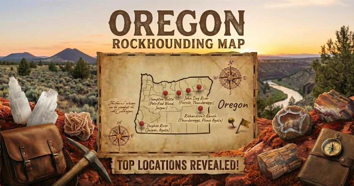

Why Oregon Is Built for Gem Hunting
Oregon sits on some of the most volcanically active ground in the Lower 48. The eastern two-thirds of the state is a lava plateau — layer upon layer of basalt, rhyolite, and ash-flow tuff deposited over the last 17 million years by eruptions tied to the Yellowstone hotspot track and Cascade arc volcanism. That volcanic history created the raw geochemistry responsible for every collectible mineral covered in this guide: copper-bearing feldspar (sunstone), silica-filled lithophysae (thundereggs), hydrated silica gels (opal), and rapidly cooled volcanic glass (obsidian).
What makes Oregon different from most western states is access. The Bureau of Land Management administers roughly 16 million acres here, and BLM policy explicitly permits casual collecting of rocks, minerals, and semi-precious gemstones for personal, non-commercial use — up to 25 pounds per day plus one piece, or 250 pounds per year. That policy, combined with well-marked collection areas and cooperative fee-dig ranches, means you can spend a full week in the field without ever running into a locked gate or a "No Trespassing" sign.
This guide covers the geology that put these minerals in the ground, seven specific locations with GPS coordinates and land-status details, field identification methods, the tools you need, and the legal framework that governs collecting on public and private land in Oregon.
Geology: How Oregon's Volcanic Past Built a Gem State
To understand where Oregon's gems come from, you need to understand three volcanic systems that operated across different time scales.
Columbia River Basalt Group (17-6 Ma). Between 17 and 6 million years ago, massive fissure eruptions flooded eastern Oregon and Washington with fluid basalt. These flows — some individual sheets more than 100 feet thick — buried the landscape under thousands of feet of lava. The basalt itself is not particularly gem-bearing, but the flows created the structural framework (fault zones, fracture networks, contact zones) where later mineralization concentrated.
High Lava Plains Volcanism (10-0 Ma). A younger volcanic province stretches from the Newberry Volcanic area east-southeast toward the Harney Basin. This system produced silicic (high-silica) eruptions — rhyolite domes, obsidian flows, and ash-fall tuffs. The rhyolite is the host rock for thundereggs, and the obsidian flows at Glass Buttes formed directly from this volcanism. Sunstone-bearing basalt flows in the Plush area also belong to this younger volcanic episode; copper was concentrated in plagioclase feldspar crystals as the basalt cooled slowly at shallow depth.
Cascade Arc (5 Ma-present). The subduction of the Juan de Fuca Plate beneath the North American Plate drives the Cascade volcanoes. While the Cascades themselves are not major gem producers, the hydrothermal systems associated with arc volcanism created localized opal, agate, and zeolite mineralization in the Western Cascades terrane.
The practical result of these overlapping volcanic systems is that eastern Oregon contains gem-bearing deposits spread across a huge area of public land. The minerals are genetically tied to specific rock types — sunstone to basalt, thundereggs to rhyolite, obsidian to silicic lava flows, opal to hydrothermal alteration zones — so once you understand the host rock, you can predict where to dig.
Top Collecting Locations: GPS, Land Status, and Target Minerals
The following seven sites represent the best public-access and fee-dig collecting in Oregon. GPS coordinates point to parking areas or known entry points — always verify current road conditions with the local BLM office or ranch operator before driving in.
1. BLM Sunstone Collection Area — Plush, Lake County
- GPS: 42.9008, -120.1717 (approximate center of public collection area)
- Land status: BLM public land — free collecting, no permit required
- Target minerals: Oregon sunstone (gem labradorite feldspar with copper inclusions), clear and schiller feldspar
Oregon sunstone is the official state gemstone, and this BLM-designated area near Plush is the only place in the world where you can legally collect gem-quality copper-bearing feldspar on public land at no cost. The sunstones occur as loose crystals and fragments in weathered basalt soil. You dig into the red-brown clay, screen the material, and sort by hand. Colors range from straw-yellow and pale pink through deep red, green, and rare bicolor or tricolor stones. The copper content controls the color — trace amounts produce yellow and pink; higher concentrations yield red and green schiller. High-clearance vehicle required. No water, no services, no shade for 85 miles from Lakeview. Private fee-dig mines (Spectrum Sunstone Mine, Dust Devil Mine, Ponderosa Mine) operate nearby at $75-$125 per day and offer better material, tools, and shaded work areas.
2. Richardson's Rock Ranch — Madras, Jefferson County
- GPS: 44.6330, -121.1294
- Land status: Private fee-dig operation
- Target minerals: Thundereggs (agate-filled, jasper-filled, opal-filled), common opal
Oregon's state rock is the thunderegg — a spherical nodule formed in rhyolite when silica-rich fluids filled gas cavities (lithophysae) and solidified into agate, jasper, or opal. Richardson's Rock Ranch near Madras has been the premier fee-dig thunderegg site in Oregon for decades. You pay by the pound ($2/lb as of 2025) and dig your own from exposed rhyolite beds. The thundereggs here typically have well-defined star patterns, banded agate fills, and occasional blue chalcedony centers. The ranch provides basic tools, but bring your own rock hammer and pry bar for better results. The Priday and Friend Ranch areas nearby produced famous "Priday Plume" agate thundereggs, though most of that ground is now closed to public digging.
3. Glass Buttes — Lake County
- GPS: 43.5694, -120.0600
- Land status: BLM public land — free collecting, 250 lbs/year personal use limit
- Target minerals: Obsidian (black, mahogany, rainbow, gold sheen, silver sheen, fire obsidian, midnight lace)
Glass Buttes is a cluster of rhyolite and obsidian domes in the high desert of central Oregon. The obsidian here formed from silicic lava that cooled too rapidly for crystal growth — the result is natural volcanic glass in a range of colors and optical effects found at very few other localities. Rainbow obsidian shows thin-film interference colors caused by aligned nanoscale magnetite crystals. Fire obsidian displays bright iridescent layers. The material lies on the surface and in shallow excavations across several square miles of BLM land. You can reach the main collecting areas in a passenger car during dry weather, but a truck or SUV is safer. Bring water and fuel — the nearest services are in Burns or Bend.
4. Beverly Beach and Agate Beach — Lincoln County Coast
- GPS: 44.7275, -124.0580 (Beverly Beach State Park); 44.6600, -124.0600 (Agate Beach)
- Land status: Public beach — Oregon's Beach Bill guarantees public access to all ocean shore
- Target minerals: Agate (carnelian, moss agate, sagenitic agate), jasper, petrified wood, fossil shell
The central Oregon coast between Newport and Lincoln City is classic beachcombing territory. Winter storms and high tides wash agates out of the gravel deposits at the base of coastal bluffs and deposit them on the beach face. The best collecting windows are the first low tides after a strong storm system. Beverly Beach (just north of Newport) and Agate Beach (south of Newport) both produce carnelian agate, clear agate, occasional moss and sagenitic agate, jasper, and water-tumbled petrified wood. Walk the high-tide line and the gravel zones — wet the stones with seawater to see translucency. Early morning light coming through a low sun angle makes agates glow against the darker beach gravel.
5. Opal Butte — Morrow County
- GPS: 44.8900, -119.5300 (general area — active mining claims present)
- Land status: Mixed private claims and BLM land — check current claim status before collecting
- Target minerals: Precious opal (contra luz opal, crystal opal, fire opal), common opal, hyalite opal
Opal Butte has produced some of the finest precious opal ever found in North America. The opal formed in perlitized rhyolite — volcanic glass that hydrated after eruption and developed opal in seams, vugs, and replacement zones. The signature material is contra luz opal, which shows play of color only when light passes through the stone (transmitted light) rather than reflecting off the surface. This makes it unlike any Australian or Ethiopian opal. Most productive ground at Opal Butte is under active mining claims, and access is restricted. Some rough and cut material is available from authorized dealers. If you plan to collect in the general area, verify that you are on open BLM ground and not on a staked claim.
6. Graveyard Point — Malheur County
- GPS: 43.6383, -117.0283
- Land status: BLM public land — free collecting
- Target minerals: Plume agate thundereggs, moss agate, common opal
Graveyard Point sits on the Oregon-Idaho border near the Owyhee River canyon. The thundereggs here are famous for their plume agate fills — delicate, three-dimensional plume structures in white, gold, red, and black suspended in clear to translucent chalcedony. These are among the most sought-after cutting materials in the lapidary world. The thundereggs weather out of rhyolite ash beds exposed along the canyon rim and eroded slopes. Surface collecting is productive after rain, and light digging into the ash tuff yields fresh material. The road in is rough — high-clearance vehicle recommended. The nearest town is Adrian, Oregon, about 30 minutes east on Highway 201.
7. Bohemia Mining District — Lane County
- GPS: 43.5900, -122.5800 (Bohemia City area)
- Land status: Mixed Umpqua National Forest and BLM land — recreational gold panning permitted in most streams
- Target minerals: Placer gold, gold-bearing quartz, pyrite, chalcopyrite
The Bohemia district is a historic hard-rock and placer gold camp in the Western Cascades southeast of Cottage Grove. Gold mineralization here is associated with Tertiary-age volcanic rocks intruded by granodiorite stocks — the hydrothermal fluids from those intrusions deposited gold in quartz veins and sulfide minerals. Stream placers in Sharps Creek, Brice Creek, and their tributaries still produce fine to coarse gold. Recreational gold panning is legal in most National Forest streams without a permit (no motorized equipment). The Sharps Creek Recreation Area is a popular base camp with road access and streamside panning areas.
Key Minerals at a Glance
| Mineral | Composition | Hardness (Mohs) | Where Found | Notes |
|---|---|---|---|---|
| Oregon Sunstone | Labradorite feldspar (Ca,Na)(Al,Si)4O8 with native copper | 6 - 6.5 | Plush, Lake/Harney counties | State gem. Copper inclusions produce schiller and color. Only known source of gem copper-feldspar. |
| Thunderegg | Chalcedony/agate/opal fill in rhyolite | 6.5 - 7 (agate fill) | Richardson's Ranch, Graveyard Point, Priday area | State rock. Exterior is rough rhyolite; interior reveals agate, jasper, or opal when cut. |
| Obsidian | Volcanic glass (SiO2 ~70-75%) | 5 - 5.5 | Glass Buttes, Newberry area | Conchoidal fracture. Varieties include rainbow, fire, mahogany, gold/silver sheen. |
| Precious Opal | Hydrated silica SiO2-nH2O | 5.5 - 6.5 | Opal Butte, Morrow County | Contra luz variety shows play of color in transmitted light. Fragile — avoid rapid temperature changes. |
| Agate / Carnelian | Microcrystalline quartz SiO2 | 6.5 - 7 | Beverly Beach, Agate Beach, eastern Oregon | Beach agates water-tumbled. Best found after winter storms on low tides. |
| Biggs Jasper | Microcrystalline quartz with iron/manganese oxides | 6.5 - 7 | Biggs Junction area, Sherman County | Picture jasper with dendritic landscape patterns. Classic Oregon lapidary material. |
| Placer Gold | Native gold Au | 2.5 - 3 | Bohemia district, Sharps Creek, Brice Creek | Fine to coarse flake gold in stream gravels. Hand panning legal without permit on most forest land. |
Field Identification: How to Recognize Oregon Gems in the Dirt
Finding good material in the field means knowing what you are looking at before you cut, clean, or carry it out. Here are the identification methods I use for each major Oregon collectible.
Oregon sunstone. Fresh sunstone crystals are glassy, transparent to translucent, and range from colorless to deep red-orange or green. The diagnostic feature is schiller — a metallic flash caused by copper platelets aligned along the crystal's cleavage planes. To test for schiller, hold the rough stone up to direct sunlight and rotate it slowly. Copper-bearing stones will produce a bright internal flash, typically red or green, at a specific angle. Non-copper feldspar (also present in the digging area) will look glassy but show no internal metallic flash. Sunstone has two cleavage planes at nearly 90 degrees and a hardness of 6 to 6.5 — it will scratch glass but not quartz.
Thundereggs. In the field, thundereggs look like ugly, rough, rounded balls of gray or brown rhyolite — typically 2 to 6 inches in diameter, though specimens up to basketball size exist. The exterior gives no reliable indication of what is inside. To field-test a suspected thunderegg, look for a roughly spherical shape with a slightly different texture than the surrounding matrix rock. If you can chip the edge with a hammer, look for a hard, dense interior (agate or chalcedony) contrasting with the softer rhyolite shell. The only way to know for certain what you have is to cut it with a rock saw.
Obsidian. Obsidian is unmistakable once you have handled it. It looks like black glass because it is glass. Conchoidal (shell-shaped) fracture surfaces, vitreous luster, and sharp edges are the field indicators. To distinguish obsidian from similar-looking black basalt, check the fracture surface — obsidian breaks cleanly with curved surfaces; basalt breaks irregularly with a dull, grainy texture. Rainbow and fire obsidian require direct sunlight to see the color play; rotate the specimen in the sun and watch for thin-film interference colors.
Agate (beach collecting). On the Oregon coast, agates stand out from ordinary beach gravel because of their translucency. Wet the stone — water fills surface micro-fractures and lets light pass through. A genuine agate will glow or transmit light when held between your eye and a low sun. Carnelian agates show an orange-red color from iron oxide; clear agates are water-white when wet. Pick up anything translucent and sort later.
Opal. Common opal is waxy and translucent, usually white, blue, pink, or green. Precious opal shows play of color — spectral flashes that shift as you rotate the stone. Contra luz opal from Opal Butte requires transmitted light (hold it up to the sun and look through it) to see the color play. Opal is softer than agate (5.5 to 6.5 Mohs) and will not scratch glass as easily. It also has a lower specific gravity — it feels lighter in the hand than a comparable-sized piece of agate.
Essential Tools and Gear for Oregon Field Collecting
Oregon's collecting sites range from paved-road beach access to remote desert digs 80 miles from the nearest gas station. Your tool list depends on where you are going, but here is the full loadout for a multi-day eastern Oregon trip.
- Digging tools: Round-point shovel, trenching shovel, mattock or pick, pry bar. For sunstone — a short-handled pick and a set of classifying screens (1/4-inch and 1/8-inch mesh) are critical.
- Rock hammer: A 2-3 lb geological hammer (flat head and chisel end) for breaking matrix rock and testing specimens.
- Hand lens (10x loupe): For examining schiller in sunstone, plume structures in thunderegg agate, and play of color in opal.
- Spray bottle: Water makes agate translucency and opal play of color visible in the field. Carry a small spray bottle for quick field ID.
- Wrapping materials: Newspaper, bubble wrap, or cloth bags to protect specimens during transport. Opal and sunstone scratch and chip easily.
- Buckets and containers: 5-gallon buckets for screening material. Egg cartons or small compartmented boxes for individual sunstone crystals.
- GPS or mapping app: Cell service is nonexistent at most eastern Oregon sites. Download offline maps (Google Maps, Gaia GPS, or Avenza Maps with BLM Surface Management Agency layers) before you leave town.
- Vehicle and fuel: High-clearance truck or SUV for eastern Oregon. Carry a full-size spare, a tire plug kit, and at least 5 gallons of extra fuel. The Plush sunstone area is 85 miles from the nearest gas station in Lakeview.
- Water and food: There is no potable water at any eastern Oregon BLM collecting site. Carry at least 1 gallon of water per person per day for drinking, plus extra for screening. Pack all food and pack out all trash.
- Sun and weather protection: Eastern Oregon in summer means 95+ degree heat, no shade, and intense UV. Wide-brim hat, sunscreen, long sleeves. In shoulder seasons, temperatures can drop below freezing at night.
Legal Framework: BLM Rules, Fee-Dig Policies, and Claim Awareness
Collecting minerals in Oregon is legal and well-supported by policy, but the rules vary by land status. Here is what you need to know.
BLM Public Land (most eastern Oregon collecting sites). Under the BLM's casual collecting policy (43 CFR 8365), you may collect reasonable amounts of rocks, minerals, and semi-precious gemstones from unencumbered BLM land for personal, non-commercial use. The standard limit is 25 pounds per day plus one piece, up to 250 pounds per calendar year. You may not use explosives or mechanized earth-moving equipment. Hand tools (shovels, picks, screens) are permitted. You must fill in any holes you dig. Collecting for sale or barter requires a permit or mineral lease. The BLM Sunstone Collection Area near Plush is a specifically designated area where these casual collecting rules apply — no additional permit is needed.
National Forest Land. The USFS allows casual mineral collecting on most National Forest land under similar rules. In the Ochoco National Forest (thunderegg collecting) and Umpqua National Forest (gold panning in the Bohemia district), you may collect with hand tools for personal use. Motorized gold dredging requires a Section 404 permit from the Army Corps of Engineers and a 700-PM permit from the Oregon Department of Environmental Quality — but simple hand panning does not require a permit.
Oregon State Parks and Beaches. Oregon's Beach Bill (ORS 390.610-390.770) guarantees public access to the ocean shore. You may collect loose rocks, agates, driftwood, and shells from the beach. Digging into bluffs or cliff faces is prohibited. State parks generally prohibit removing natural materials from upland areas, but beach collecting below the vegetation line is legal.
Private Land and Fee-Dig Operations. Always get explicit permission before collecting on private property. Fee-dig operations (Richardson's Rock Ranch, Spectrum Sunstone Mine, Dust Devil Mine, etc.) set their own rules about tools, hours, and take-home limits. Pay the posted fee and follow their instructions.
Mining Claims. Active mining claims exist across eastern Oregon, especially around Opal Butte and in historic gold districts. A mining claim gives the claimant exclusive rights to the mineral deposit. Collecting on an active claim without the claim holder's permission is illegal regardless of BLM surface access. Check the BLM LR2000 database or the BLM General Land Office records for current claim status in any area you plan to collect. When in doubt, contact the local BLM field office — they can tell you whether specific ground is open or claimed.
Cultural resources. Oregon obsidian was used extensively by Native peoples for toolmaking. If you encounter arrowheads, flaked tool fragments, or other artifacts, do not collect them. The Archaeological Resources Protection Act (ARPA) makes it a federal crime to remove archaeological artifacts from public land. Photograph the find, note the GPS coordinates, and report it to the local BLM office.
Oregon Rockhounding Map
Use our interactive map to see all known collecting locations, fee-dig sites, and BLM access points across Oregon.