
Oklahoma Geology: Red Beds, Salt Flats, and Ore Bodies
Oklahoma sits on a geologic cross-section that runs from Precambrian granite in the southwest to Pennsylvanian limestones and shales in the east, with a thick wedge of Permian red beds across the center. That range of bedrock produces a collecting list most people do not expect from a plains state: hourglass selenite crystals, barite roses, lead-zinc ores, massive gypsum exposures, and petrified wood.
The western half of the state is dominated by Permian evaporites — gypsum, halite, and anhydrite deposited when shallow seas evaporated roughly 250 million years ago. Those evaporite beds are directly responsible for the Salt Plains salt flats in Alfalfa County, where selenite crystals grow today in saturated brine just below the surface. The same Permian sequence includes the Garber Sandstone, which hosts the barite rose concretions that became Oklahoma's state rock in 1968.
In the northeast corner, Ottawa County sits within the Tri-State Mining District — the zinc-lead province that spans the Oklahoma-Kansas-Missouri border. Mining here ran from the 1890s through the 1970s, and the old mine dumps still produce collectible galena, sphalerite, calcite, and secondary minerals. In the southeast, Carboniferous-age sediments preserve silicified wood, and the Wichita Mountains in the southwest expose 500-million-year-old granite and rhyolite with associated mineral occurrences.
Top Collecting Locations
1. Salt Plains National Wildlife Refuge — Hourglass Selenite (Alfalfa County)
Land status: U.S. Fish & Wildlife Service — National Wildlife Refuge. Public crystal digging permitted in the designated Crystal Digging Area only.
GPS: 36.7303° N, 98.3132° W (Crystal Digging Area parking lot)
Fee: Free. No permits required.
Season: April 1 through October 15 only. Gates close outside this window.
Vehicle: 2WD. Paved road to the parking area; short walk to the digging flat.
This is one of the only places on Earth where you can dig hourglass selenite crystals. The crystals form in the top 2 feet of salt-saturated sediment beneath the bare salt flat. Groundwater supersaturated with calcium sulfate precipitates gypsum crystals around sand grains, producing the characteristic brown "hourglass" pattern visible when you hold a crystal up to light — a sand inclusion shaped like a bow-tie or hourglass that marks the crystal's growth planes.
Crystals range from thumbnail-sized singles to clusters exceeding 7 inches. Most collectors find usable specimens within 15 to 30 minutes of digging. Selenite was designated the Oklahoma state crystal in 2005, and this site is the primary reason.
Method: Bring a flat-blade shovel and a small hand trowel. Dig a hole roughly 2 feet deep. Crystals appear in layers — once you hit a cluster, switch to hand tools and clear mud by feel. Do not pry crystals apart with metal blades; selenite is soft (Mohs 2) and fractures easily. Rinse specimens in fresh water back at the parking lot to remove salt crust.
Rules: USFWS limits digging to the marked Crystal Digging Area. No digging outside that boundary. No mechanized equipment. Each visitor may keep whatever they find. Stay off the adjacent refuge lands — the salt flats are critical habitat for the interior least tern and snowy plover.
2. Barite Rose Collecting — Noble, Cleveland, and Garvin Counties
Land status: Mostly private land. Permission required from landowners.
GPS (general area): 35.15° N, 97.35° W (near Noble, Cleveland County)
Fee: Varies. Some landowners allow free collecting; others charge a small fee.
Vehicle: 2WD on county roads; some pasture access may require high clearance.
Oklahoma's state rock is the barite rose — a rosette cluster of barite (barium sulfate) crystals with reddish-brown sand inclusions from the Permian Garber Sandstone. These concretions form when barium-rich groundwater meets sulfate in pore spaces within the sandstone, precipitating barite crystals that radiate outward in petal-like plates. Locals call them "Cherokee roses" or simply "rose rocks."
Single rosettes typically measure 1 to 4 inches across. Compound clusters can reach a foot or more. The best specimens come from road cuts, construction excavations, and eroded outcrops in the Garber Sandstone belt running through Cleveland, Garvin, Murray, and Noble counties. After heavy rain, erosion exposes fresh specimens in creek banks and plowed fields.
Field ID: Barite roses are heavy for their size (barite has a specific gravity of 4.5, roughly twice that of a comparable sandstone piece). The crystal plates feel gritty because of sand inclusions but show a pearly luster on fresh fracture surfaces. They do not effervesce in acid — this separates them from calcite rosettes.
3. Tri-State Mining District — Galena, Sphalerite, Calcite (Ottawa County)
Land status: Mixed private and Superfund remediation land. Many mine dumps are on private property. Some are within the Tar Creek Superfund Site — do not enter posted Superfund areas.
GPS (Picher area): 36.98° N, 94.83° W
Vehicle: 2WD on paved roads. High clearance helpful on mine-dump access roads.
The Tri-State Mining District produced lead and zinc from Mississippi Valley-type ore deposits in Mississippian limestone for nearly a century. The towns of Picher, Cardin, and Commerce sit on or adjacent to old chat piles and mine dumps. Collectible minerals include galena (lead sulfide — metallic gray cubic crystals), sphalerite (zinc sulfide — resinous brown to honey-yellow), calcite (often as scalenohedral "dogtooth" crystals), marcasite, dolomite, and secondary smithsonite.
Access warning: Much of this area is an EPA Superfund site due to lead and heavy-metal contamination. The town of Picher was evacuated and decommissioned. Do not enter fenced or posted remediation areas. Some adjacent private chat piles and mine dumps remain accessible with landowner permission. Wash hands thoroughly after handling material. Do not eat, drink, or smoke while handling specimens. Lead dust is the primary hazard.
4. Glass Mountains — Selenite Mesas (Major County)
Land status: Primarily private ranch land. Limited public road-cut access.
GPS (Gloss Mountains State Park): 36.2084° N, 98.7933° W
Fee: Free at state park for surface observation and hiking; crystal collecting within the park is restricted.
Vehicle: 2WD to the state park. High-clearance recommended for back-road approaches on private land.
The Glass Mountains (locally called Gloss Mountains) are flat-topped mesas capped with massive selenite gypsum deposits from the Permian Blaine Formation. The selenite cap weathers into large transparent sheets and crystal plates that catch sunlight — giving the hills their "glass" appearance. Individual selenite plates on eroded slopes can exceed 12 inches across. The underlying red Permian shale erodes faster than the gypsum cap, producing the mesa topography.
Gloss Mountains State Park allows hiking and surface observation. Collecting on park land is restricted. The surrounding private ranch land is where most specimen collecting occurs — with permission. Road cuts along SH-15 and county roads expose the gypsum beds and can yield loose selenite plates.
5. Wichita Mountains Area (Comanche County)
Land status: Wichita Mountains Wildlife Refuge (USFWS — collecting prohibited inside refuge). Private ranch land surrounds the refuge.
GPS (refuge HQ): 34.7389° N, 98.7172° W
Vehicle: 2WD to all paved access points.
The Wichita Mountains expose some of the oldest rocks in Oklahoma — Cambrian-age (approximately 530 Ma) granite, rhyolite, and gabbro. Mineral occurrences in the granites include magnetite, ilmenite, zircon, apatite, and occasional pegmatite accessory minerals. Carlton Rhyolite outcrops in the surrounding area sometimes contain small vugs with quartz crystals.
Important: The Wichita Mountains Wildlife Refuge does not allow mineral collecting. All collecting must occur on private land outside the refuge boundary, with landowner permission. The geological interest here is primarily educational and photographic — the exposed Cambrian intrusions are the best-displayed example of the Southern Oklahoma Aulacogen rift system.
6. Eastern Oklahoma — Petrified Wood
Land status: Mixed — creek gravel bars on public rights-of-way, road cuts, and private land.
GPS (general area): 34.8° N, 95.5° W (McAlester-area creek drainages)
Vehicle: 2WD on paved roads; high clearance useful on dirt ranch roads.
Pennsylvanian-age coal-bearing strata in eastern Oklahoma (Pittsburg, Latimer, Le Flore, and Haskell counties) contain silicified wood. Petrified wood specimens appear in creek gravel, road cuts, and strip-mine spoil piles. Most pieces show well-preserved cell structure and take a good polish. Colors range from tan and brown to red and black, depending on the iron oxide and manganese content of the silicifying fluids.
Creek gravel bars accessible from county road bridges are the most practical collecting spots. Pick through exposed gravel after high water events. Pieces range from small hand-sized fragments to occasional logs. Coal strip-mine spoil piles on private land sometimes expose excellent specimens.
Oklahoma Minerals at a Glance
| Mineral | Composition | Mohs Hardness | Primary Location | Land Status |
|---|---|---|---|---|
| Selenite (gypsum) | CaSO4·2H2O | 2 | Salt Plains NWR, Glass Mountains | USFWS (public digging) / Private |
| Barite rose | BaSO4 with sand | 3–3.5 | Cleveland, Garvin, Noble counties | Private |
| Galena | PbS | 2.5 | Tri-State District, Ottawa County | Private / Superfund restricted |
| Sphalerite | ZnS | 3.5–4 | Tri-State District, Ottawa County | Private / Superfund restricted |
| Calcite | CaCO3 | 3 | Tri-State District, Ottawa County | Private / Superfund restricted |
| Petrified wood | SiO2 (replacement) | 6.5–7 | Eastern OK creek drainages | Mixed public/private |
| Magnetite | Fe3O4 | 5.5–6.5 | Wichita Mountains area | Private (refuge closed to collecting) |
Field Identification Tips
Selenite vs. calcite: Selenite is softer (Mohs 2 — a fingernail scratches it). Calcite is Mohs 3 and effervesces in dilute hydrochloric acid. Selenite does not react to acid. Both can form transparent crystals, but selenite crystals at Salt Plains have the distinctive brown hourglass sand inclusion visible in transmitted light.
Barite rose vs. sandstone concretion: Heft is the first test. Barite roses are noticeably heavy — roughly twice the weight of a same-sized sandstone piece. Crystal plates in a barite rose show a pearly to vitreous luster on fresh surfaces. Sandstone concretions are cemented by calcite or iron oxide and lack this crystal luster. If you have dilute HCl, sandstone concretions cemented by calcite will fizz; barite will not.
Galena vs. magnetite: Both are dark metallic minerals, but galena has perfect cubic cleavage — it breaks into small cubes and rectangular fragments. Galena also feels heavy (SG 7.5). Magnetite is attracted to a magnet; galena is not. Streak test: galena streaks gray-black on unglazed porcelain; magnetite streaks black but with a slightly different tone.
Sphalerite vs. dark chert: Sphalerite has a resinous (greasy) luster and shows conchoidal fracture surfaces with an amber to brown color. Dark chert is duller and has a waxy rather than resinous luster. Sphalerite also has six directions of cleavage (dodecahedral), though this is not always obvious in massive specimens.
Petrified wood vs. chert cobble: Petrified wood retains the original wood structure — look for growth rings, bark texture, or elongated cell patterns on broken surfaces. A 10x hand lens makes this easy. Chert cobbles are structureless internally.
Recommended Tools
- Flat-blade shovel — essential for Salt Plains selenite digging; also useful for barite rose sites
- Hand trowel or garden claw — for extracting selenite clusters without damage
- Rock hammer (2 lb) — Tri-State mine dump work, trimming specimens
- Cold chisel set — for splitting matrix at mine dumps
- 10x hand lens — field ID for petrified wood cell structure, sphalerite luster, crystal habit
- Dilute HCl (10%) — acid test to distinguish calcite from barite and gypsum
- Small magnet — quick test for magnetite vs. galena vs. other dark metallic minerals
- Streak plate — unglazed porcelain tile for mineral identification
- Buckets and newspaper — for transporting soft selenite crystals (wrap individually)
- Spray bottle with fresh water — rinse salt off selenite specimens in the field
- Safety glasses — required when hammering at mine dumps
- Nitrile gloves — recommended at Tri-State District sites due to lead contamination
- Sunscreen, hat, water — Salt Plains has zero shade; Glass Mountains and Wichita Mountains are exposed terrain
Legal Notes and Access Rules
Salt Plains NWR: Crystal digging is permitted only in the designated Crystal Digging Area, April 1 through October 15. No off-season access. No mechanized tools. No collecting outside the marked area. The rest of the refuge is closed to mineral collecting. Check current hours and any seasonal closures at the USFWS Salt Plains NWR office (580-626-4794) or the refuge website before driving out.
Wichita Mountains Wildlife Refuge: Mineral and rock collecting is not permitted anywhere within the refuge boundary. This is federal land managed for wildlife conservation. Geological observation and photography are allowed.
Gloss Mountains State Park: Oklahoma state parks generally prohibit removal of natural resources, including rocks and minerals. Check current park rules before assuming you can collect. Surrounding private land requires landowner permission.
Tri-State Mining District: Portions of Ottawa County are within the Tar Creek Superfund Site. Fenced and posted areas are off-limits. The town of Picher has been decommissioned — do not enter restricted zones. Mine dumps on private land require landowner permission. Wear gloves and wash hands after handling material from this area due to lead and cadmium contamination in the chat and soil.
Private land: Oklahoma is a private-property state. Most barite rose localities, Glass Mountains ranch land, eastern Oklahoma petrified wood sites, and non-Superfund mine dumps are on private land. Always get permission before entering. Verbal permission is legally sufficient in Oklahoma, but written permission is better practice. Close gates behind you, stay on agreed-upon areas, and report any problems to the landowner.
BLM land: Oklahoma has very little Bureau of Land Management land compared to western states. Do not assume that undeveloped land is public. Verify ownership using county assessor records or the BLM's General Land Office records search.
Collecting limits: On federal land where collecting is permitted (Salt Plains NWR), the standard limit is reasonable quantities for personal use — not commercial resale. No weight or piece limits are formally published for Salt Plains selenite, but USFWS officers enforce the personal-use standard.
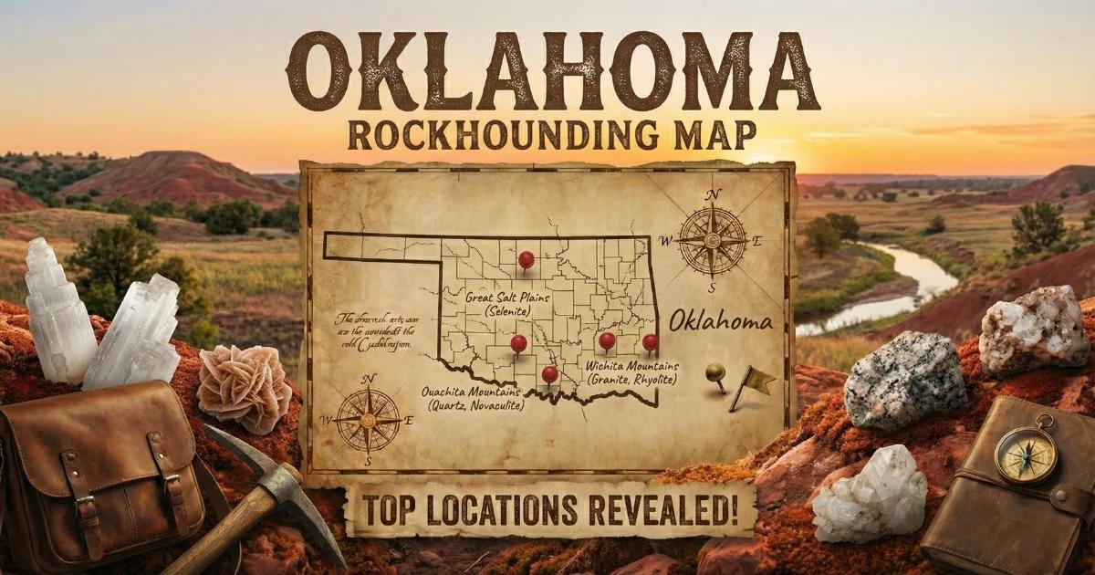
Oklahoma Rockhounding Map
View all documented collecting locations, land boundaries, and access points on our interactive Oklahoma rockhounding map.