
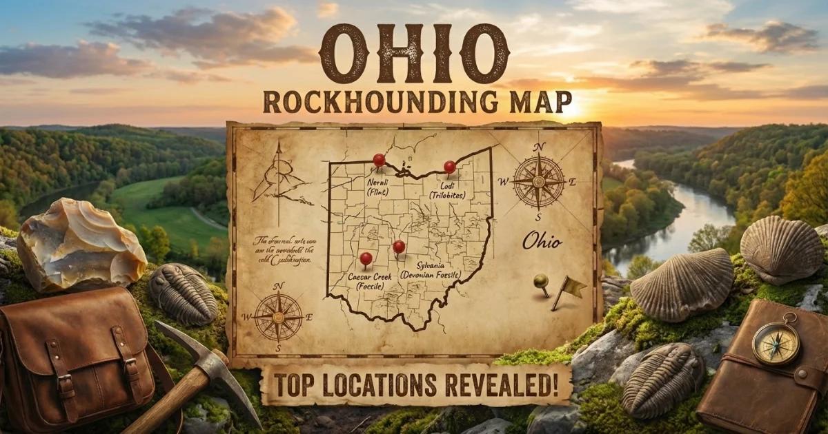
Ohio Geology: Paleozoic Bedrock and Glacial Cover
Ohio sits on a thick sequence of Paleozoic sedimentary rocks — Ordovician, Silurian, Devonian, Mississippian, and Pennsylvanian strata stacked like pages in a book, oldest to youngest from southwest to northeast. The Cincinnati Arch, a broad structural high running through the western half of the state, exposes some of the oldest rocks at the surface: Upper Ordovician limestones and shales loaded with marine fossils. East of the arch, progressively younger formations crop out, including the Silurian dolomites that host celestite and the Pennsylvanian-age Vanport limestone that contains Ohio's famous flint.
Pleistocene glaciation reshaped the northern two-thirds of the state. The Wisconsin and earlier ice sheets deposited thick till, outwash gravel, and glacial lake sediments that blanket the bedrock. For collectors, this matters: glacial gravels in stream beds carry transported material — chert nodules, quartz pebbles, and occasional Lake Superior agates dragged south by ice. South of the glacial boundary, unglaciated terrain in the Hocking Hills and Wayne National Forest region exposes bedrock directly, making outcrop collecting more productive.
One geological anomaly worth noting: the Serpent Mound impact structure in Adams County, a roughly 8-km-wide cryptoexplosion feature. The impact scrambled local stratigraphy, juxtaposing rock units that would otherwise be separated by hundreds of feet. Collectors have found unusual breccias, shatter cones, and deformed chert in the disturbed zone.
Top Collecting Locations
1. Flint Ridge — Licking and Muskingum Counties
Land status: Flint Ridge State Memorial (Ohio History Connection, state-managed); surrounding areas are a mix of private land and township roads
GPS: 40.0050° N, 81.8625° W (memorial parking area)
Vehicle: 2WD; paved access to the memorial
Target minerals: Vanport flint (multicolored chalcedony/chert), druzy quartz in flint cavities
Flint Ridge is the single most important mineral locality in Ohio. The Vanport flint — Ohio's official gemstone since 1965 — formed as a siliceous replacement within the Pennsylvanian-age Vanport limestone. What makes this flint exceptional is its color range: solid reds, blues, grays, creams, greens, and banded combinations of all of these. No two pieces look alike. Native Americans quarried Flint Ridge for at least 14,000 years, and artifacts made from this material have been found across eastern North America, evidence of extensive pre-Columbian trade networks.
The Flint Ridge State Memorial preserves a portion of the historic quarry pits. The museum on site displays specimens and explains the geology. Collecting within the memorial boundaries is prohibited — this is a protected archaeological and geological site. Do not remove material from the memorial grounds.
Collecting opportunities exist outside the memorial. Road cuts along State Route 668 and Township Road 382 in the Flint Ridge area occasionally expose Vanport flint in situ. Private landowners in Licking and Muskingum Counties sometimes grant permission to collect on their property. Agricultural fields after plowing can produce surface flint. Always get written permission before entering private land. The flint takes an excellent polish and is prized by lapidarists and knappers alike. Cab-grade material with strong color banding is the most sought after.
2. Crystal Cave / Put-in-Bay — South Bass Island, Ottawa County
Land status: Private (Heineman's Winery property); island quarries are a mix of private and village-owned
GPS: 41.6565° N, 82.8380° W (Crystal Cave)
Vehicle: Ferry to South Bass Island from Catawba or Port Clinton; golf cart or bicycle on-island
Target minerals: Celestite (strontium sulfate, SrSO₄), calcite, dolomite
Crystal Cave, located beneath Heineman's Winery on South Bass Island, contains what is considered the world's largest known celestite geode. The geode measures roughly 10 meters (35 feet) in diameter at its widest point. Celestite crystals line the walls — tabular, pale blue to colorless crystals up to 45 cm (18 inches) across. The cave was discovered in 1897 during well drilling and has been a tourist attraction since. No collecting is allowed inside Crystal Cave. You can view the crystals on a guided tour (fee applies, seasonal operation May through September).
The celestite occurs in the Silurian-age Put-in-Bay dolomite. Dissolution cavities in the dolomite provided the void space for celestite crystallization from strontium-rich groundwater. Smaller celestite crystal pockets have been found in quarries and excavations across the Lake Erie islands — South Bass, Middle Bass, and Kelleys Island. Most of these quarries are either closed, flooded, or on private land. If you visit the islands, ask locally about current access. Quarry owners occasionally allow collecting. Celestite specimens from Put-in-Bay are well represented in museum collections and are a classic Ohio mineral.
3. Caesar Creek State Park — Warren County
Land status: U.S. Army Corps of Engineers (federal); fossil collecting permitted in the spillway area
GPS: 39.4880° N, 84.0620° W (spillway parking)
Vehicle: 2WD; paved road to parking area
Target specimens: Ordovician fossils — brachiopods, bryozoans, trilobites, horn corals, crinoid stems
Caesar Creek is the best-known fossil collecting site in Ohio and one of the finest Ordovician fossil localities in the Midwest. The emergency spillway of Caesar Creek Lake cuts through Upper Ordovician limestones and shales (Kope, Fairview, and Grant Lake formations, approximately 445 million years old). After heavy rains and controlled dam releases, fresh rock is exposed along the spillway floor and walls.
Brachiopods — especially Rafinesquina and Platystrophia — are abundant. Bryozoan colonies (both ramose and encrusting forms) cover bedding planes. Trilobites, primarily Flexicalymene and Isotelus (Ohio's state fossil), occur but require more searching. Horn corals and crinoid columnals are common. The Army Corps permits surface collecting of loose fossils — no hammering on bedrock, no digging into the spillway structure. Bring a bucket and a sharp eye. Wet rock shows fossils better than dry rock.
4. Trammel Fossil Park — Sharonville (Hamilton County)
Land status: City of Sharonville public park; collecting permitted
GPS: 39.2870° N, 84.3890° W
Vehicle: 2WD; suburban location with paved parking
Target specimens: Ordovician fossils — brachiopods, bryozoans, trilobites, crinoids
Trammel Fossil Park is a former construction site where Ordovician bedrock was graded and left exposed as a public collecting area. The city of Sharonville maintains it specifically for fossil hunting. The site exposes the same Upper Ordovician formations found at Caesar Creek. Fossils weather out of the shale and limestone on the hillside. This is an excellent site for beginners and families — no climbing, no wading, easy terrain, and fossils are genuinely abundant. The park is free, open year-round, and requires no permit. Surface collecting only; no power tools.
5. Wayne National Forest — Athens, Hocking, and Washington Counties
Land status: U.S. Forest Service (federal public land)
GPS: Various; the forest is divided into three ranger districts across southeast Ohio
Vehicle: High-clearance recommended for forest roads; 2WD adequate for main access roads
Target minerals: Quartz crystals (small druzy to Herkimer-type doubly terminated), coal-measure fossils (fern impressions, Calamites, Lepidodendron bark), ironstone concretions, siderite
Wayne National Forest is Ohio's only national forest, covering approximately 245,000 acres of reclaimed mine lands and second-growth forest in the unglaciated Appalachian Plateau of southeast Ohio. Federal regulations allow casual surface collecting of reasonable quantities of rocks, minerals, and common invertebrate fossils for personal use on National Forest land. No permit is required for casual collecting. Do not use mechanized equipment or explosives, and do not collect vertebrate fossils without a permit.
The Pennsylvanian-age sandstones, shales, and limestones in the forest contain small quartz crystal pockets in sandstone vugs. Some of these crystals are doubly terminated — similar in habit to Herkimer diamonds from New York, though typically smaller (under 2 cm). Creek beds and road cuts through sandstone are the most productive spots. Coal-measure plant fossils — fern frond impressions, Calamites stem casts, and Lepidodendron bark patterns — occur in shales associated with coal seams. Old strip mine highwalls (where accessible and safe) can expose fossil-bearing horizons.
6. Serpent Mound Area — Adams County
Land status: Mix of state park (Serpent Mound Historical Site), private land, and township roads
GPS: 39.0252° N, 83.4307° W (Serpent Mound)
Vehicle: 2WD; paved roads to the site
Target specimens: Impact breccia, shatter cones, deformed chert, unusual mineral assemblages in disturbed strata
The Serpent Mound cryptoexplosion structure is an approximately 8-km-diameter feature formed by a meteorite or comet impact. The impact disrupted the normal stratigraphic sequence, bringing Ordovician rocks to the surface in an area otherwise covered by Silurian and Devonian formations. The famous Serpent Mound earthwork (a Native American effigy mound) sits on the rim of the structure. No collecting is permitted within the state historical site.
Road cuts and creek exposures in the surrounding area expose the disturbed zone. Look for shatter cones — conical fracture surfaces with distinctive horsetail striations, formed by the shock wave of impact. Breccias containing mixed fragments from different stratigraphic levels are diagnostic. This is a research-grade geological locality; take field notes and GPS readings. The disturbed strata also expose Ordovician fossils that would not otherwise be found at the surface in this part of the state.
Ohio Minerals and Specimens
| Mineral / Specimen | Composition | Primary Locations | Occurrence |
|---|---|---|---|
| Vanport Flint (Ohio Flint) | SiO₂ (microcrystalline quartz / chalcedony) | Flint Ridge, Licking and Muskingum Counties | Replacement nodules and beds in Vanport limestone; multicolored |
| Celestite | SrSO₄ | South Bass Island (Put-in-Bay), Ottawa County | Crystals in dissolution cavities in Silurian dolomite |
| Quartz (Herkimer-type) | SiO₂ | Wayne National Forest, southeast Ohio; dolomite quarries | Doubly terminated crystals in vugs in sandstone and dolomite |
| Calcite | CaCO₃ | Statewide in limestone formations; quarries | Crystals in vugs and veins; dog-tooth and scalenohedral habits |
| Fluorite | CaF₂ | Clay Center area, Ottawa County; various quarries | Cubic crystals in dolomite vugs; often amber to brown |
| Dolomite | CaMg(CO₃)₂ | Northwest Ohio quarries | Saddle-shaped (curved) rhombohedral crystals |
| Sphalerite | ZnS | Northwest Ohio dolomite quarries | Dark brown to black crystals with resinous luster |
| Pyrite | FeS₂ | Statewide; coal-bearing shales, Ordovician limestones | Cubes and pyritohedra; also replaces fossils |
| Septarian Concretions | Variable (calcite veins in clay-ironstone) | Devonian shales, north-central Ohio | Concretions with internal calcite-filled cracks |
| Ordovician Fossils | CaCO₃ (calcified organisms) | Cincinnati area, Caesar Creek, Trammel Fossil Park | Brachiopods, trilobites, bryozoans, corals, crinoids |
| Devonian Fossils | CaCO₃ / SiO₂ replacement | Sylvania area (Lucas County), Silica Shale | Silicified corals, brachiopods; museum-quality preservation |
Field Identification Tips
Vanport Flint vs. Common Chert
Vanport flint from Flint Ridge has a waxy to glassy luster and conchoidal fracture — the same as any chert. What distinguishes it is color. Common Ohio chert (from glacial gravels or other limestone formations) is typically gray, tan, or dark brown. Flint Ridge material shows bands, swirls, or solid fields of red, blue-gray, cream, pink, green, or combinations thereof. If you find colorful chert in Licking or Muskingum County, it is likely Vanport flint. Outside that area, multicolored chert in glacial till could be transported Flint Ridge material or Upper Mercer flint (another Pennsylvanian chert, usually darker with less color variation).
Celestite vs. Calcite vs. Barite
Celestite is orthorhombic, pale blue to colorless, with a vitreous to pearly luster. It is heavier than calcite (specific gravity 3.9–4.0 vs. 2.7 for calcite) but lighter than barite (4.3–4.5). Celestite does not fizz in dilute hydrochloric acid (calcite does). A flame test is diagnostic: celestite produces a crimson-red flame due to strontium content. In the field, the combination of pale blue color, tabular crystal habit, and heft relative to calcite is usually sufficient to confirm celestite from the Put-in-Bay dolomite.
Herkimer-Type Quartz
Doubly terminated quartz crystals from Ohio are typically small (5–15 mm), water-clear to slightly smoky, and form in vugs within dolomite or sandstone. They resemble Herkimer diamonds from New York in habit but are usually smaller. Check for natural terminations on both ends and the absence of an attachment point. Matrix specimens — crystals still embedded in their host rock — are more valuable for study than loose crystals.
Ordovician Fossils
In the Cincinnati-area Ordovician rocks, identification is mostly about learning to distinguish the major groups. Brachiopods have two shells of unequal size (unlike bivalve mollusks, which have mirror-image shells). Bryozoans look like lacy or branching colonies with tiny pores. Flexicalymene trilobites are oval, segmented, and often found enrolled (curled up). Crinoid stems appear as stacked disc-shaped segments, sometimes called "Indian beads." Horn corals (Grewingkia) are cone-shaped solitary corals, often with visible internal septa when broken.
Recommended Tools
- Rock hammer (flat head + chisel end): Standard 22 oz geological hammer for breaking rock and trimming specimens. Essential at quarry and road-cut sites.
- Cold chisels (set of 3 widths): For splitting shale along bedding planes and opening vugs. A 1-inch and a 3/4-inch chisel cover most situations.
- Safety glasses: Non-negotiable. Flying rock chips from hammering cause eye injuries. Wrap-around polycarbonate preferred.
- Hand lens (10x): For field identification of crystal habit, fossil details, and mineral luster. A Hastings triplet is clearest.
- Collecting bag or 5-gallon bucket: Buckets are better for heavy material (flint, fossils). Bring newspaper or bubble wrap for crystal specimens.
- Spray bottle with water: Wetting rock surfaces reveals fossils and color patterns invisible on dry surfaces. Cheap and indispensable.
- Dilute hydrochloric acid (10%): Field test for calcite (fizzes) vs. dolomite (fizzes slowly with warming) vs. quartz/flint (no reaction). Carry in a dropper bottle.
- GPS or smartphone with offline maps: Ohio collecting sites are often on unmarked roads. Download county-level maps before visiting remote areas in the Wayne National Forest.
- Field notebook: Record GPS coordinates, formation names, and stratigraphic context for each specimen. Notes taken in the field are worth ten times those reconstructed from memory later.
- Knee pads: Fossil collecting at Caesar Creek and Trammel involves prolonged kneeling on limestone. Cheap insurance against joint pain.
Legal Notes and Land Access
State Parks and State Memorials
Collecting rocks, minerals, and fossils is generally prohibited in Ohio state parks and state nature preserves. Flint Ridge State Memorial is a protected site — removing material from the memorial grounds is illegal. The Serpent Mound Historical Site has the same restrictions. Always check with the managing agency before collecting on any state-managed land.
Federal Land — Wayne National Forest
Casual collecting of rocks, minerals, and common invertebrate fossils is permitted on National Forest land under the Paleontological Resources Preservation Act (2009) and Forest Service regulations. "Casual collecting" means: hand tools only, reasonable quantities for personal use, no significant disturbance to the land surface. Vertebrate fossils (bones, teeth) require a research permit. No mechanized equipment (no backhoes, no rock saws in the field).
Army Corps of Engineers — Caesar Creek
The Army Corps permits surface fossil collecting at the Caesar Creek spillway. Do not hammer or chisel on the spillway structure itself — collect only loose material. The Corps may close the spillway area during dam operations or high water. Check conditions before visiting.
Private Land and Quarries
Most quarries in Ohio are privately owned and actively operated. Entering an active quarry without permission is trespassing and extremely dangerous. Contact the quarry operator in advance. Some quarries allow collecting on weekends when operations are shut down. Expect to sign a liability waiver. Bring your own safety gear (hard hat, steel-toed boots, high-visibility vest). Abandoned quarries on private land still require landowner permission.
Lake Erie Islands
Land on South Bass, Middle Bass, and Kelleys Islands is almost entirely private or village-owned. Crystal Cave is a commercial attraction on private property. Do not collect from winery grounds, private yards, or posted areas. Kelleys Island has a state park with exposed glacial grooves — collecting is not permitted at the glacial grooves site.
Ohio Revised Code
Ohio has no state-level recreational mining or rockhounding statute equivalent to some western states' regulations. Access and collecting rights default to land ownership. When in doubt, verify ownership through the county auditor's GIS system (most Ohio counties have free online parcel viewers) and get written permission from the landowner.
Ohio Rockhounding Map
View collecting locations, quarries, fossil parks, and public land boundaries on our interactive Ohio rockhounding map.