
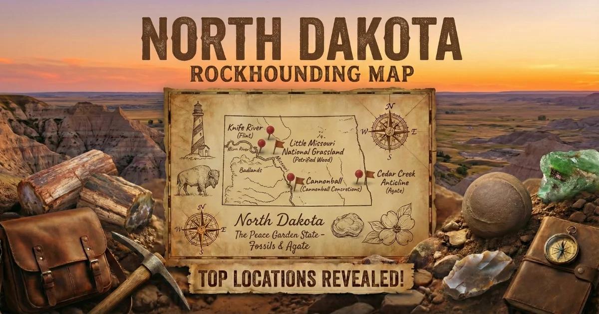
North Dakota: Knife River Flint Country
North Dakota sits on the northern Great Plains, where Pleistocene glaciation and Paleocene-era volcanism deposited the state's collectible mineral inventory. The western third of the state exposes the Bullion Creek and Sentinel Butte formations — Paleocene sedimentary sequences of sandstone, mudstone, lignite, and clinker (scoria) that host petrified wood, selenite, and iron-cemented concretions. The eastern two-thirds is glacial drift: till, outwash, and lake sediment from the Laurentide Ice Sheet, which carried agates, jasper, and assorted erratics south from the Canadian Shield.
The state's signature collectible is Knife River flint — a brown translucent chalcedony unique to west-central North Dakota. It formed as silica-replaced lignite within the Paleocene formations and was the most widely traded lithic material on the northern Great Plains for at least 11,000 years. Archaeological sites across North America have yielded Knife River flint tools and debitage traced back to quarries in Dunn and Mercer counties.
North Dakota is not a major gem-producing state. Collecting opportunities are limited in number but distinctive in character. The materials here — Knife River flint, prairie agates, Badlands petrified wood, selenite crystals, cannonball concretions — are regionally specific and worth the drive if you know where to look and what land you are standing on.
Collecting Locations
1. Knife River Flint Quarries Area — Dunn County
Land status: Mixed — Knife River Indian Villages National Historic Site (closed to collecting), surrounding private ranch land, and scattered state-owned sections. Do not collect within the National Historic Site boundaries.
GPS (general area): 47.35°N, 101.40°W
Vehicle: 2WD on paved and maintained gravel roads. High-clearance recommended on ranch tracks.
Minerals: Knife River flint (brown translucent chalcedony), common chalcedony, petrified wood fragments.
The primary Knife River flint quarries are concentrated along the Knife River and its tributaries in Dunn and Mercer counties. The flint occurs as nodules and tabular masses within the Bullion Creek Formation, typically associated with lignite beds. Surface-collected pieces — weathered out of eroding cutbanks and hillsides — are the standard method of acquisition. Quality ranges from opaque brown to gem-grade material that transmits amber light when held to the sun. The best pieces show a waxy luster and conchoidal fracture. Archaeological debitage (flakes and fragments from ancient tool-making) is common in the area — leave all worked material in place. Federal law (the Archaeological Resources Protection Act) prohibits removal of artifacts from federal or tribal land.
2. Little Missouri National Grassland — Billings and Slope Counties
Land status: USDA Forest Service (Dakota Prairie Grasslands). Casual collecting of rocks and minerals is permitted under the 1955 Surface Resources Act — 25 lbs/day, 250 lbs/year, non-commercial.
GPS (Medora Ranger District): 46.92°N, 103.52°W
Vehicle: High-clearance required. Many grassland roads are unimproved gumbo clay — impassable when wet. Do not attempt after rain.
Minerals: Petrified wood (various species, some with preserved cell structure), prairie agates, chalcedony nodules, selenite crystals, iron concretions.
The Little Missouri National Grassland flanks Theodore Roosevelt National Park on the east, south, and west. Unlike the park, the grassland is open to casual mineral collecting. The Sentinel Butte Formation exposures here produce petrified wood in stream cuts, eroded buttes, and gullies. Some logs are large — 2 to 4 feet in diameter — and show excellent silicification with visible annual rings. Prairie agates (small, water-worn chalcedony nodules with banding or plume inclusions) turn up in gravel bars along the Little Missouri River and its tributaries. Check gravel bars at low water in late summer and early fall. Selenite crystals — transparent to translucent gypsum — occur in clay beds of the Sentinel Butte Formation, often as tabular twins or rosette clusters up to 3 inches across.
3. Theodore Roosevelt National Park Vicinity — Billings County
Land status: National Park Service. Collecting of any natural material — rocks, fossils, plants, soil — is strictly prohibited within park boundaries. Zero tolerance. This section covers adjacent public land only.
GPS (South Unit entrance, Medora): 46.93°N, 103.54°W
Vehicle: 2WD to Medora and park roads. High-clearance for adjacent BLM and grassland access roads.
Minerals (adjacent BLM/grassland only): Petrified wood, clinker (fused red scoria), selenite, lignite with amber inclusions.
Theodore Roosevelt National Park contains some of the best-exposed Paleocene badlands in the northern Great Plains, but it is off-limits for collecting. The same geological formations continue onto adjacent BLM land and Little Missouri National Grassland. BLM land in this area is administered by the Dickinson Field Office. Casual collecting of common rocks and petrified wood is permitted on BLM land under standard regulations (reasonable quantities, non-commercial, no mechanical disturbance). Clinker — the bright red and purple fused rock formed when lignite beds burned underground — is abundant and makes a distinctive landscape specimen. Some collectors also find small pieces of amber associated with lignite seams, though quality is typically low.
4. Cannonball River Area — Sioux and Morton Counties
Land status: Mixed federal, state, tribal (Standing Rock Reservation), and private. Verify land ownership before collecting. Tribal land requires explicit permission from the Standing Rock Sioux Tribe — do not assume access.
GPS (general area near Breien): 46.37°N, 100.93°W
Vehicle: 2WD on Highway 1806. High-clearance for side roads.
Minerals: Cannonball concretions (iron-cemented sandstone spheres), siderite concretions, occasional calcite crystals.
The Cannonball Formation — a marine sandstone of Late Cretaceous to Paleocene age — gives the Cannonball River its name. Large spherical concretions, cemented by iron carbonate (siderite) and calcium carbonate (calcite), weather out of the soft sandstone matrix and litter the eroded slopes. Sizes range from a few inches to over 6 feet in diameter. Some are hollow or contain septarian fractures filled with calcite. The concretions are heavy and difficult to transport — plan accordingly. Smaller specimens (baseball to softball size) are manageable. Collecting is permitted on state land and private land with landowner permission. Stay off reservation land without authorization.
5. Glacial Drift — Statewide (Eastern North Dakota)
Land status: Primarily private agricultural land. Permission required from landowners. Some gravel pits on state or county land may allow collecting — ask locally.
GPS: No single location. Check gravel pits, road cuts, and river gravels across the eastern half of the state.
Vehicle: 2WD for most access.
Minerals: Lake Superior-type agates, jasper, granite erratics, occasional thomsonite, petoskey-type coral fossils.
The Laurentide Ice Sheet transported material from the Canadian Shield, northern Minnesota, and the Lake Superior basin across eastern North Dakota. Glacial till and outwash gravels contain a mixed assemblage of northern erratics, including Lake Superior agates, banded iron formation (BIF) jasper, and various granites and gneisses. Commercial gravel pits are the most productive spots — operators sometimes allow collectors to search stockpiles when the pit is not in active use. Ask the pit foreman. River gravels along the Sheyenne, James, and Red rivers also produce occasional agates. Quality is lower than Minnesota or Wisconsin agate grounds, but the material is there if you put in the time.
North Dakota Specimens
| Mineral / Material | Composition | Color | Where Found | Notes |
|---|---|---|---|---|
| Knife River Flint | Chalcedony (microcrystalline quartz) | Brown, translucent amber | Dunn, Mercer counties | Unique to ND; traded continent-wide for 11,000+ years |
| Prairie Agate | Chalcedony with inclusions | White, gray, tan with banding | Western ND river gravels, grassland | Small nodules, best found wet |
| Petrified Wood | Silicified wood (quartz replacement) | Brown, tan, red, black | Western ND Badlands, Sentinel Butte Fm. | Some specimens show excellent cell preservation |
| Selenite | Gypsum (CaSO₄·2H₂O) | Transparent to white | Western ND clay beds | Tabular twins and rosettes up to 3 inches |
| Cannonball Concretions | Iron carbonate–cemented sandstone | Brown, rust, gray | Cannonball River, Sioux/Morton counties | Spherical, some hollow or septarian |
| Lake Superior Agate | Banded chalcedony with iron oxide | Red, orange, white banding | Eastern ND glacial drift | Glacial transport from Lake Superior basin |
| Clinker (Scoria) | Fused sedimentary rock | Red, purple, orange | Western ND near burned lignite beds | Formed by underground coal fires |
Field Identification Tips
Knife River Flint vs. common chalcedony: Hold the specimen between your thumb and a bright light source (sunlight or a strong flashlight). Knife River flint transmits a warm amber-brown glow. Common brown chalcedony and jasper are typically opaque. The fracture surfaces of genuine Knife River flint are waxy and smooth with sharp conchoidal ridges. Material that has been heated (either by ancient peoples or modern treatment) may show a reddish tint and increased luster.
Prairie agates: Wet the stone. Banding, plume structures, or moss inclusions become visible when the surface is wet. Dry agates on the prairie look like nondescript pebbles. Carry a spray bottle. Translucency is the key field marker — hold small nodules against the sky.
Petrified wood vs. sandstone: Petrified wood is heavier than sandstone of the same size because silica (quartz) has replaced the wood fibers. Look for preserved bark texture, annual growth rings, and knot structures on the surface. A hand lens (10x) reveals cellular structure in well-silicified pieces. Hardness is 7 (quartz) — a steel knife will not scratch it. Sandstone scratches easily.
Selenite: Selenite is soft — hardness 2 on the Mohs scale. You can scratch it with a fingernail. It is transparent to translucent, has perfect cleavage in one direction, and is distinctly lighter than quartz. Do not confuse with calcite (hardness 3, reacts to dilute hydrochloric acid).
Cannonball concretions vs. other rounded rocks: Concretions from the Cannonball Formation have a distinct spherical shape, dense iron-cemented core, and often show a rusty rind from iron oxide weathering. Some split open to reveal internal star-shaped (septarian) fracture patterns filled with calcite. Glacial erratics can also be rounded but lack the uniform sphericity and concentric internal structure.
Recommended Tools
- Rock hammer (flat head and chisel end): For breaking open concretions and trimming petrified wood. A 16 oz geological hammer is standard.
- Hand lens (10x): Required for identifying cell structure in petrified wood and distinguishing chalcedony varieties.
- Spray bottle: Essential for agate hunting. Wet surfaces reveal banding and translucency invisible on dry stone.
- Strong flashlight or penlight: For backlighting Knife River flint and checking translucency of chalcedony.
- Chisel and crack hammer: For extracting selenite clusters from clay matrix without breaking crystals.
- GPS unit or phone with offline maps: Cell service is unreliable to nonexistent in western North Dakota grasslands and badlands. Download maps before you leave town.
- 5-gallon buckets with lids: For hauling specimens. Line with newspaper to protect selenite and delicate material.
- Eye protection: Always wear safety glasses when hammering rock.
- Digging tools: Short-handled shovel, pry bar, and a stiff brush for exposing petrified wood in clay matrix.
- Topographic maps (USGS 7.5-minute): Essential for identifying land boundaries in areas with mixed federal, state, private, and tribal ownership.
Legal Notes
Theodore Roosevelt National Park: Collecting of any natural material is prohibited. This includes rocks, minerals, fossils, petrified wood, plants, and soil. Penalties include fines up to $5,000 and confiscation of material. The park service enforces this.
National Grassland (Little Missouri): Casual collecting of common rocks, minerals, and reasonable quantities of petrified wood is permitted for personal, non-commercial use under USDA Forest Service regulations. Limit is 25 lbs per day and 250 lbs per calendar year. No mechanical equipment. No disturbance of paleontological resources (vertebrate fossils).
BLM land: Casual collecting of common invertebrate fossils, rocks, and minerals (including petrified wood up to 25 lbs/day plus one piece) is allowed on BLM land for personal use. Vertebrate fossils may not be collected without a permit.
Tribal land: The Standing Rock Sioux Reservation and Fort Berthold Reservation (Three Affiliated Tribes) occupy significant portions of western North Dakota. Collecting on tribal land without written permission is trespassing. Contact the relevant tribal natural resources office before entering reservation land for any purpose.
Private land: Most of eastern North Dakota and much of the western part is privately owned ranch and farmland. Always obtain landowner permission before entering. North Dakota has criminal trespass statutes — posted or not, entering private land without permission is illegal for collecting purposes.
Archaeological sites: Knife River flint artifacts — points, scrapers, flakes, debitage — are protected under the Archaeological Resources Protection Act (ARPA) on federal and tribal land. Removal carries criminal penalties. If you find worked flint or other artifacts, leave them in place and note the GPS coordinates for reporting. Natural, unworked flint nodules are mineral specimens and are legal to collect on land where mineral collecting is permitted.
Planning Your Trip
Best season: Late May through September. Western North Dakota roads — especially unimproved clay tracks on the grassland — become impassable after rain. Winter collecting is impractical due to snow cover and extreme cold (temperatures routinely reach -20°F). Spring snowmelt and rain make clay roads dangerous into late May some years.
Base towns: Dickinson (full services, closest to Badlands and grassland collecting). Medora (limited services, gateway to Theodore Roosevelt National Park South Unit). Beulah and Hazen for Knife River flint area. Bismarck for eastern ND and Cannonball River access.
Fuel and water: Fill up before leaving paved roads in western North Dakota. Gas stations are sparse west of Dickinson. Carry at least 2 gallons of drinking water per person per day — summer temperatures reach 100°F on the open prairie with no shade.
Hazards: Rattlesnakes (prairie rattlesnake, Crotalus viridis) are present in the western Badlands. Watch where you step and reach. Ticks are common in grassland from May through July. Lightning storms move fast across open prairie — seek low ground or your vehicle if storms approach. Gumbo clay roads are slick as ice when wet — do not attempt to drive them.
Browse our North Dakota rockhounding map for all collecting locations.