

Geology of New Mexico: Why This State Produces So Many Minerals
New Mexico sits at a geological crossroads. The Rio Grande Rift -- a continental rift zone that has been pulling the Earth's crust apart for roughly 30 million years -- runs north to south through the center of the state. That extension thinned the crust, opened pathways for magma, and generated the volcanic fields, hydrothermal vein systems, and exposed basement rocks that make this state one of the most mineralogically diverse in the country.
In the north, Precambrian metamorphic and igneous rocks (1.4 to 1.7 billion years old) crop out in the Sangre de Cristo Range and the Picuris Mountains. These old rocks host pegmatite bodies -- coarse-grained igneous intrusions where lithium, beryllium, and rare-earth minerals crystallized from residual melts. The Harding Pegmatite Mine near Dixon is a type locality for this kind of deposit.
Across the central and southern parts of the state, Tertiary volcanism produced massive rhyolite and basalt flows. Where hydrothermal fluids circulated through fractured rock, they deposited copper, zinc, and lead sulfides along with gangue minerals like fluorite and barite. The Magdalena-Socorro mining district formed this way. The Cerrillos turquoise deposits owe their origin to copper-bearing solutions percolating through weathered volcanic tuff and monzonite porphyry.
In the southern desert, Quaternary maar volcanoes blasted craters through the crust and ejected xenoliths -- fragments of the upper mantle -- onto the surface. Kilbourne Hole, a maar in Dona Ana County, is one of the few places on Earth where you can pick up olivine (peridot) that originated 40 to 60 kilometers below your feet.
The Bisti/De-Na-Zin badlands in the San Juan Basin preserve a different chapter entirely: Cretaceous coastal and swamp environments where trees were buried in sediment and silicified over tens of millions of years, producing petrified wood in a stark, eroded landscape.
This geological diversity -- Precambrian basement, Paleozoic sedimentary sequences, Tertiary volcanism, Quaternary maars, and rift-related faulting -- is why New Mexico produces turquoise, peridot, fluorite, beryl, spodumene, fire agate, thundereggs, petrified wood, galena, and dozens of other collectible minerals.
Top Gem Hunting and Collecting Locations
1. Rockhound State Park -- Deming, Luna County
GPS: 32.1936 N, 107.6167 W
Land status: New Mexico State Park (day-use fee: $5 per vehicle)
Key minerals: Thundereggs, agate, jasper, perlite, quartz, opal, and occasional geodes
Rockhound State Park holds a unique distinction: it is the only state park in the United States specifically created for mineral collecting. The park sits on the western slope of the Little Florida Mountains, where Tertiary rhyolite flows contain gas-pocket nodules (thundereggs) and seams of agate and jasper.
The rhyolite here erupted roughly 30 to 35 million years ago. As the lava cooled, gas cavities formed and were later filled by silica-rich groundwater depositing chalcedony, opal, and microcrystalline quartz. The result is thundereggs -- spherical nodules with rough gray exteriors that, when sawed open, reveal banded agate, plume patterns, or solid jasper interiors.
Visitors are allowed to collect up to 15 pounds of material per visit. Digging tools are permitted. The best collecting is on the slopes above the campground, where erosion continually exposes fresh nodules. Work the loose gravel and decomposed rhyolite on steep slopes after rain -- water runoff uncovers material that was buried days before. Perlite (volcanic glass with a pearly luster) is abundant in the soil and is a good indicator that you are in productive rhyolite.
2. Cerrillos Turquoise District -- Santa Fe County
GPS: 35.4300 N, 106.1200 W (Cerrillos Hills area)
Land status: Mixed -- Cerrillos Hills State Park (no collecting), private mining claims, and some BLM parcels
Key minerals: Turquoise, cerussite, galena, malachite, chrysocolla
The Cerrillos turquoise mines are among the oldest worked mineral deposits in North America. Ancestral Puebloan people mined turquoise here at least 1,000 years before Spanish contact. The turquoise occurs as veinlets and nodules in weathered monzonite porphyry and altered volcanic tuff, where copper-bearing groundwater reacted with aluminum and phosphorus in the host rock to precipitate the hydrated copper-aluminum phosphate mineral.
Most of the historic mine workings are on private claims and are not open to public collecting. Cerrillos Hills State Park allows hiking but prohibits mineral removal. If you want Cerrillos turquoise specimens, the best route is through dealers at the Albuquerque Gem and Mineral Show or at shops in Santa Fe and Cerrillos village. The Cerrillos district produced turquoise in shades from sky blue to deep green, depending on the copper-to-iron ratio in the mineral.
3. Kilbourne Hole -- Dona Ana County
GPS: 31.9700 N, 106.9700 W
Land status: BLM (designated National Natural Landmark)
Key minerals: Peridot (olivine), peridotite xenoliths, pyroxene, basalt
Kilbourne Hole is a maar volcano -- a low-relief crater formed by a phreatomagmatic explosion when rising basaltic magma contacted groundwater roughly 80,000 years ago. The blast ejected chunks of the Earth's upper mantle (peridotite xenoliths, sometimes called "olivine bombs") onto the crater rim and surrounding desert floor. These xenoliths contain granular olivine crystals, some of which reach gem quality as peridot.
The peridot crystals here are typically small (under 5mm), olive green, and embedded in a matrix of dark pyroxene and spinel. You find them by breaking apart the partially weathered xenolith fragments scattered on the crater rim. Look for rounded, dark greenish-black nodules in the basalt ejecta. When you crack them, the glassy green olivine grains are immediately visible.
Because Kilbourne Hole is a National Natural Landmark, collecting restrictions may apply. Contact the BLM Las Cruces District Office (575-525-4300) before visiting to confirm current regulations. The site is remote -- about 30 miles southwest of Las Cruces on dirt roads. Carry water, a spare tire, and do not rely on cell service.
4. Harding Pegmatite Mine -- Dixon, Taos County
GPS: 36.1800 N, 105.7400 W
Land status: University of New Mexico (educational site, open to public collecting by appointment)
Key minerals: Spodumene, beryl, lepidolite, microlite, muscovite, rose quartz, tantalite, columbite
The Harding Pegmatite Mine is one of the most historically significant pegmatite deposits in the American Southwest. Located on a hillside near Dixon in the Picuris Mountains, the mine was originally worked for lithium (from spodumene) and tantalum-niobium minerals during the 1940s and 1950s. The University of New Mexico acquired the property in 1969 and has operated it as a field education site and public mineral collecting area since.
The pegmatite is a zoned body intruded into Precambrian amphibolite. The outer zones contain massive quartz and feldspar. The intermediate zones produced large crystals of spodumene (lithium pyroxene) -- some logs exceeded 3 feet in length. The inner zones host beryl, lepidolite (lithium mica with a distinctive lavender color), and the rare tantalum minerals microlite and tantalite.
Visitors can collect on the mine dumps. Large crystals of spodumene, sheets of muscovite, and chunks of lepidolite are common finds. Beryl crystals (typically pale green to white, hexagonal prisms) show up less frequently but are present. Contact the UNM Department of Earth and Planetary Sciences for current access hours and any seasonal closures.
5. Blanchard Mine (Bingham District) -- Socorro County
GPS: 34.2500 N, 107.0500 W (Bingham, NM area)
Land status: Private mining claims (access varies -- check locally)
Key minerals: Fluorite, galena, barite, smithsonite, cerussite, wulfenite, linarite
The Blanchard Mine in the Bingham mining district of the Magdalena Mountains produced some of the finest fluorite specimens in the American Southwest. The lead-zinc-fluorite ore bodies formed along fault zones in Paleozoic limestone where hydrothermal fluids deposited sulfide and gangue minerals. Fluorite from Blanchard ranges from water-clear to deep purple and occurs as sharp cubic and octahedral crystals on matrix.
The nearby Kelly Mine area (also in the Magdalena Mountains) produced world-class smithsonite specimens -- zinc carbonate in blue-green botryoidal crusts that collectors prize. Galena (lead sulfide, metallic gray cubes), barite (heavy white tabular crystals), and occasional wulfenite (orange lead molybdate) round out the mineral suite from this district.
Access to the Blanchard and Kelly mine workings is on private claims and changes over time. Some claim holders have allowed supervised collecting; others have not. Before driving out, confirm current access status with the Socorro County mining community or the New Mexico Bureau of Geology and Mineral Resources.
6. Bisti/De-Na-Zin Wilderness -- San Juan County
GPS: 36.2500 N, 108.1500 W
Land status: BLM Wilderness Area (collecting prohibited inside wilderness boundary; BLM land adjacent may allow limited surface collecting)
Key minerals: Petrified wood, selenite, gypsum, iron concretions
The Bisti/De-Na-Zin badlands expose Late Cretaceous (about 70 million years old) shale, mudstone, and sandstone from the retreating Western Interior Seaway. Fossil logs silicified by groundwater lie scattered across the eroded landscape. Some petrified wood pieces retain bark texture and cell structure and display colors from red and orange (iron oxides) to white and gray (pure silica).
Collecting rocks, minerals, and fossils is prohibited within the designated Wilderness Area boundary. The adjacent BLM land outside the wilderness may allow limited surface collection of common minerals and petrified wood (typically up to 25 pounds per day, 250 pounds per year for personal use under the BLM casual collecting rule). Verify the exact boundary and current regulations with the BLM Farmington Field Office before your trip. The terrain is trackless and GPS navigation is essential.
Minerals of New Mexico: Quick Reference
| Mineral | Hardness (Mohs) | Color | Where Found | Notes |
|---|---|---|---|---|
| Turquoise | 5-6 | Sky blue to green | Cerrillos, Burro Mountains | Cu-Al phosphate; historic mines, mostly private claims |
| Peridot (olivine) | 6.5-7 | Olive green | Kilbourne Hole | Mantle xenoliths in maar ejecta; small crystals |
| Fire agate | 6.5-7 | Iridescent brown-red | Boot Heel region (Hidalgo County) | Chalcedony with iron-oxide layers; rare in NM |
| Fluorite | 4 | Purple, clear, green | Blanchard Mine, Bingham district | Cubic/octahedral crystals in limestone veins |
| Galena | 2.5 | Metallic gray | Blanchard Mine, Magdalena district | Lead sulfide; heavy, cubic cleavage |
| Spodumene | 6.5-7 | White, gray, pale green | Harding Pegmatite Mine | Lithium pyroxene; prismatic logs |
| Beryl | 7.5-8 | Pale green to white | Harding Pegmatite Mine | Hexagonal prisms; occasionally gem-grade |
| Lepidolite | 2.5-3 | Lavender to purple | Harding Pegmatite Mine | Lithium mica; flaky, soft, distinctive color |
| Smithsonite | 4-4.5 | Blue-green, pink | Kelly Mine, Magdalena Mountains | Zinc carbonate; botryoidal habit |
| Agate / Jasper | 7 | Banded, varied | Rockhound State Park, Luna County | Thundereggs and seam agate in rhyolite |
| Petrified wood | 7 | Red, orange, gray | Bisti area, San Juan County | Silicified Cretaceous logs; wilderness restrictions |
| Perlite | 5.5 | Gray-white, pearly | Rockhound State Park | Hydrated volcanic glass; lightweight |
Field Identification Tips
Knowing what you are looking at before you bag it will save you from hauling 15 pounds of valueless rock back to camp. Here is how to identify the key New Mexico minerals in the field without lab equipment.
Turquoise: Look for blue to blue-green veinlets and nodules in weathered, iron-stained rock. True turquoise has a waxy to dull luster and is opaque. It will not scratch glass (hardness 5-6), but a steel knife blade will barely scratch it. Common lookalikes include chrysocolla (softer, often more blue-green, crumbly) and dyed howlite (sold in shops, not found in nature). In the Cerrillos district, turquoise is associated with limonite staining and kaolinized feldspar in the host rock.
Peridot (olivine): Gem olivine is distinctly olive green with a vitreous (glassy) luster. It is transparent to translucent and harder than a knife blade. In the Kilbourne Hole xenoliths, peridot grains are embedded in a dark matrix of pyroxene and spinel. Break a xenolith fragment and the green olivine crystals stand out immediately against the black groundmass. Do not confuse olivine with green epidote (more pistachio green, lower luster) or green glass (no crystal form, conchoidal fracture).
Fluorite: Fluorite has perfect octahedral cleavage -- it breaks along four planes, producing triangular fragment faces. It is softer than glass (hardness 4) and often fluoresces under ultraviolet light (a small UV flashlight is useful in the field). Blanchard fluorite ranges from water-clear to deep purple. Do not confuse it with quartz (harder, no cleavage, conchoidal fracture) or calcite (rhombohedral cleavage, effervesces in acid).
Thundereggs vs. ordinary cobbles: Thundereggs at Rockhound State Park have a rough, knobby gray exterior and are roughly spherical (2 to 6 inches diameter). They are slightly heavier than similarly sized porous rhyolite fragments. The only way to confirm the interior is to saw one open -- but experienced collectors learn to recognize the slightly denser feel and more regular shape compared to random volcanic rubble.
Galena: Metallic gray, very heavy (specific gravity 7.5), and cleaves into perfect cubes. If you pick up a small chunk that feels unexpectedly dense and has flat, shiny, right-angle faces, it is almost certainly galena. It will leave a gray streak on unglazed porcelain.
Lepidolite: Lavender to pale purple, flaky, soft enough to peel with your fingernail. The color and micaceous habit are diagnostic. At Harding, lepidolite occurs in massive aggregates mixed with quartz and feldspar on the mine dumps.
Recommended Tools for New Mexico Gem Hunting
The tool list varies depending on whether you are surface collecting in the desert or working pegmatite dump material. Here is what covers most situations in this state.
- Rock hammer (flat head and pick end): Essential for breaking xenolith fragments at Kilbourne Hole, splitting matrix at Harding, and general prospecting. A 2-pound head is sufficient for most field work.
- Cold chisels (3/4" and 1"): Useful for extracting fluorite crystals from limestone matrix at the Blanchard district without shattering the specimen.
- Safety glasses: Mandatory whenever you swing a hammer or chisel. Basalt and rhyolite produce sharp fragments.
- Hand lens (10x): For examining crystal faces, checking turquoise veinlets, and identifying small olivine grains in xenolith fragments.
- UV flashlight (shortwave or longwave): Fluorite from the Blanchard district often fluoresces. A small UV light helps confirm identification in the field, especially in shaded overhangs or mine dumps.
- Small digging tools (garden trowel, screwdriver): For working decomposed rhyolite at Rockhound State Park and sifting through pegmatite dump soil at Harding.
- Spray bottle with water: Wetting a rock surface reveals color, banding, and crystal faces that are invisible on dry, dusty surfaces.
- GPS unit or phone app with downloaded offline maps: Many New Mexico collecting areas are on unmarked dirt roads far from cell service. Do not rely on live navigation.
- 5-gallon bucket and newspaper: For transporting specimens. Wrap fluorite and other fragile crystals individually in newspaper to prevent cleavage damage.
- Streak plate (unglazed porcelain tile): A quick diagnostic tool for distinguishing galena (gray streak), malachite (green streak), and other metalite minerals.
Legal Rules for Collecting in New Mexico
New Mexico has a patchwork of land ownership -- federal (BLM, Forest Service), state, tribal, and private -- and the rules differ on each.
BLM land: The Bureau of Land Management administers roughly 13.4 million surface acres in New Mexico, more than any other land agency in the state. Under the BLM casual collecting rule (43 CFR 3622), you may collect reasonable amounts of common rocks, minerals, and invertebrate fossils for personal, non-commercial use on BLM land without a permit. The general guideline is up to 25 pounds per day plus one piece, not to exceed 250 pounds per year. Power tools and explosives require a permit. Vertebrate fossils and archaeological artifacts are always prohibited to collect.
National Forest: The Santa Fe, Carson, Cibola, Gila, and Lincoln National Forests allow personal mineral collecting under similar guidelines. Suction dredging and mechanized equipment require special permits. Check with the specific Ranger District for any area-specific closures or restrictions.
State Parks: Rockhound State Park explicitly allows mineral collecting (up to 15 pounds per visit). Other New Mexico state parks generally prohibit removing natural materials. Do not assume that collecting is allowed at any state park other than Rockhound without confirming with park staff.
Wilderness Areas: Collecting is prohibited within designated Wilderness Areas, including Bisti/De-Na-Zin. Mechanical transport, motorized equipment, and removal of geological materials are all restricted under the Wilderness Act.
Tribal land: New Mexico has 23 federally recognized tribes and pueblos. Tribal land is sovereign territory. Collecting without explicit tribal permission is trespassing. The Navajo Nation, Zuni Pueblo, and other tribal entities have their own natural resource regulations. Do not collect on tribal land unless you have written authorization from the relevant tribal government.
Private claims and property: Many historic mine sites (Cerrillos, Blanchard, Kelly) are on private mining claims. Entering an active or inactive mining claim without the claim holder's permission is trespassing under both federal and state law. Verify ownership through BLM LR2000 or county records before visiting any mine site.
Safety and liability: Abandoned mines are dangerous. Shafts, adits, and stopes may have unstable timbers, bad air, and hidden drops. Never enter an underground mine opening unless it has been professionally assessed and is open to the public.
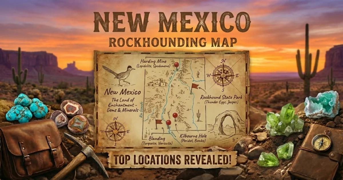
New Mexico Rockhounding Map
Use our interactive New Mexico rockhounding map to find collecting locations, land status boundaries, and directions to the sites listed in this guide. The map includes BLM and National Forest layers so you can verify land ownership before you drive out.
Planning your trip: Southern New Mexico (Rockhound State Park, Kilbourne Hole) is best visited October through April, when daytime temperatures are manageable. Northern sites (Harding Mine, Cerrillos) are accessible from late spring through fall. The Bisti badlands are best in spring or fall -- summer heat is extreme and there is no shade. Always carry at least one gallon of water per person per day, a full tank of gas, and a spare tire. Cell service is unreliable or nonexistent at most backcountry sites.