

Nevada's Geology: Why This State Produces World-Class Gems
Nevada sits at the intersection of three geologic provinces — the Basin and Range, the Sierra Nevada batholith, and the tail end of the Columbia Plateau volcanic field — and that collision of tectonic forces has made it one of the most mineralogically productive states in the country. I have spent entire field seasons in Nevada and still find new material on ground I thought I had already exhausted. The state delivers.
The Basin and Range extension that has been pulling western North America apart for roughly 17 million years created Nevada's signature geography: long, narrow mountain ranges separated by broad alluvial valleys. Each range is a tilted fault block exposing a different slice of the stratigraphic column. That means you can drive fifty miles and move from Precambrian metamorphic basement rock into Tertiary volcanic ash deposits. Every new range is a new collecting opportunity.
Miocene and Pliocene volcanism is responsible for the state's most famous gem material. The Virgin Valley opal deposits formed when silica-rich volcanic ash buried organic material — wood, bone, even pinecones — and groundwater carrying dissolved silica replaced those materials atom by atom. The same volcanic episodes produced the rhyolitic host rock for turquoise deposits, the obsidian flows at Davis Creek, and the wonderstone beds in Esmeralda County. Southern Nevada's older volcanic terrain, related to the same tectonic activity that built the Mojave, generated fire agate in iron-rich chalcedony veins.
Nevada's arid climate preserved what wetter states would have eroded away. Mineral specimens that would crumble in a single Pacific Northwest winter persist intact for thousands of years in Nevada's desert washes. This combination — extreme geologic diversity plus aridity plus 67% BLM public land — makes Nevada one of the best collecting states in the country for anyone willing to tolerate the heat and the distances.
Top Collecting Locations
1. Virgin Valley Opal District — Humboldt County
GPS: 41.175°N, 118.789°W (general area — individual mines have specific access points)
Land status: Private fee-dig mines and surrounding BLM public land
Target minerals: Black fire opal, white opal, crystal opal, common opal, opalized wood
Virgin Valley is the premier precious opal locality in North America. The opal occurs in Miocene volcanic ash (the Virgin Valley Formation) where silica-bearing groundwater replaced buried wood and other organic debris. The result is opal that ranges from common white material to some of the most vivid black fire opal found anywhere on Earth. The "Roebling Opal," a 2,585-carat black opal from this deposit, sits in the Smithsonian.
The Royal Peacock Opal Mine and the Bonanza Opal Mine both run fee-dig operations, typically $75 to $190 per day depending on whether you dig virgin bank material or search the tailings piles. The season runs from late May through September — the mines sit at 5,700 feet and winter snow closes access. Come prepared for full sun with no shade and bring your own water. The nearest services are in Denio Junction, and "services" is a generous word.
Critical note on crazing: Virgin Valley opal is notorious for developing cracks (crazing) as it dehydrates. The opal formed in a water-saturated environment and contains up to 20% water by weight. When it dries in open air, internal stress fractures the stone. Keep your specimens submerged in water from the moment you extract them. Ask the mine operators about glycerin treatment and stabilization methods. Not all Virgin Valley opal crazes — some pieces are stable — but you will not know which is which for weeks or months.
2. Otteson Brothers Turquoise Mine — Nye County (near Tonopah)
GPS: 38.08°N, 117.22°W (approximate — verify current access with operators)
Land status: Private mining claim — fee-dig access periodically available
Target minerals: Turquoise, variscite
Nevada has produced turquoise from over 120 documented mines across the state, and the Otteson Brothers operation near Tonopah is one of the few that has offered public collecting in recent years. Nevada turquoise forms where acidic groundwater carries copper through weathered volcanic rock and deposits hydrated copper aluminum phosphate in fractures and voids. The host rock varies — some deposits occur in altered rhyolite, others in sedimentary formations near porphyry copper systems.
The Royston, Number 8, Blue Gem, Carico Lake, and Lone Mountain mines have all produced gem-grade turquoise that commands high prices from jewelry makers. Most of these operations are closed to public collecting. Contact the Otteson Brothers directly for current fee-dig availability and scheduling. When the mine is open, you work the exposed turquoise veins with hand tools and keep what you find.
3. Garfield Flat Turquoise Area — Mineral County
GPS: 38.50°N, 118.36°W (general area)
Land status: BLM public land (verify current status — some adjacent parcels are claimed)
Target minerals: Turquoise, chrysocolla
The Garfield Flat area in Mineral County contains turquoise occurrences on BLM-managed land. The material tends toward lighter blue-green grades compared to the deep spider-web turquoise from the famous private mines, but it is genuine Nevada turquoise and it is free to collect under BLM casual collecting rules. The turquoise occurs as thin seams and nodules in weathered volcanic host rock. Bring chisels and patience — you are working seams measured in millimeters. A rock hammer, cold chisels, and safety glasses are essential. Check with the BLM Tonopah Field Office for current land status, because mining claims in this area shift.
4. Fire Agate Deposits — Southern Nevada (Clark/Nye County border area)
GPS: 35.87°N, 115.35°W (scattered deposits — no single point location)
Land status: BLM public land
Target minerals: Fire agate, chalcedony, common agate
Fire agate occurs in scattered localities across southern Nevada's Tertiary volcanic terrain, particularly near the California and Arizona borders. The material forms when iron oxide (limonite and goethite) deposits in thin layers within botryoidal chalcedony, creating iridescent color play similar to opal but in warmer tones — reds, oranges, golds, and greens. Southern Nevada fire agate does not match the volume or average quality of the Arizona deposits near Safford, but good stones appear. You are looking for chalcedony nodules and veins in rhyolite and basalt. The fire layer is often buried under a rind of common chalcedony and only reveals itself when the piece is cut or carefully ground down. Collect everything that shows a hint of internal color and evaluate later.
5. Wonderstone — Esmeralda County
GPS: 37.78°N, 117.86°W (general area, west of Goldfield)
Land status: BLM public land and some private claims
Target minerals: Wonderstone (banded rhyolite), chalcedony
Wonderstone is a banded rhyolite with alternating layers of tan, brown, red, and cream caused by iron oxide staining during volcanic cooling. The Esmeralda County deposits produce slab-grade material that takes a good polish and is popular for cabochons, bookends, and decorative objects. The patterns are caused by differential iron migration through the cooling rhyolite — no two pieces are alike. Collecting is straightforward: the wonderstone weathers out of outcrops and litters the desert floor as loose pieces. Bring a rock saw if you want to evaluate the banding before hauling material out.
6. Davis Creek — Washoe County (Obsidian)
GPS: 40.20°N, 119.95°W (near the California border)
Land status: BLM public land and Modoc National Forest (California side)
Target minerals: Obsidian (black, mahogany, rainbow, sheen varieties)
The Davis Creek area straddles the Nevada-California border and produces several varieties of obsidian from Pleistocene rhyolitic lava flows. Black obsidian is abundant. Mahogany obsidian (with iron oxide banding) and occasional rainbow obsidian (with thin-film iridescence from nano-scale mineral inclusions) also occur. The obsidian weathers out of the flow margins and accumulates in the soil and creek gravels. Surface collecting is productive — you rarely need to dig. Bring wrapping material; obsidian fractures conchoidally and the edges are literally surgical-sharp. I have seen collectors bleed through a first aid kit in an hour from careless handling.
7. Rhyolite Ghost Town Area — Nye County
GPS: 36.90°N, 116.83°W (near Beatty)
Land status: BLM public land (the ghost town itself is managed as a historic site — collect on surrounding BLM land, not within the site)
Target minerals: Agate, jasper, chalcedony, calcite, fluorite
The volcanic terrain surrounding the historic ghost town of Rhyolite near Beatty produces agate, jasper, and various chalcedony varieties. The Bullfrog mining district that gave rise to the town worked gold-bearing quartz veins in Tertiary volcanic rock, and the same volcanic environment produced the silica-rich groundwater that formed agates and jasper in voids and fractures throughout the formation. Do not collect within the Rhyolite historic site boundaries. The surrounding BLM desert is open for casual collecting and produces decent material in the washes and exposed outcrops.
Key Minerals of Nevada
| Mineral | Composition | Where Found | Collectibility |
|---|---|---|---|
| Precious Opal | SiO₂·nH₂O (hydrated silica) | Virgin Valley, Humboldt County | Fee-dig mines; surrounding BLM land |
| Turquoise | CuAl₆(PO₄)₄(OH)₈·4H₂O | 120+ mines statewide — Tonopah area, Mineral County, Lander County | Mostly private claims; some BLM occurrences; occasional fee-dig |
| Fire Agate | SiO₂ with FeOOH layers | Southern Nevada — Clark and Nye counties | BLM public land; scattered deposits |
| Wonderstone | Banded rhyolite (SiO₂-rich volcanic rock) | Esmeralda County, west of Goldfield | BLM public land; surface collecting |
| Obsidian | Volcanic glass (SiO₂) | Davis Creek area, Washoe County | BLM public land; surface collecting |
| Variscite | AlPO₄·2H₂O | Damele Mine, Lander County; scattered elsewhere | Mostly private claims |
| Gold (placer) | Au | Numerous mining districts — Comstock, Goldfield, Tonopah, Round Mountain | BLM and National Forest waterways; recreational panning permitted |
| Petrified Wood | SiO₂ (silicified wood) | Scattered across volcanic terrain statewide | BLM public land; casual collecting limits apply |
| Agate/Jasper/Chalcedony | SiO₂ (microcrystalline quartz) | Desert washes and volcanic outcrops statewide | BLM public land; abundant and widespread |
Field Identification Tips
Nevada's gem minerals are easier to identify in the field than most collectors assume, once you know what you are looking at and stop second-guessing yourself.
Opal: Look for a waxy to vitreous luster on fracture surfaces. Common opal is translucent to opaque white, yellow, or brown. Precious opal shows play of color — flashes of spectral color that shift as you rotate the stone in sunlight. In Virgin Valley, opal often retains the form of the wood it replaced, so look for material with a wood grain texture and a glassy, non-crystalline fracture. Wet the surface with water or saliva for an instant check — play of color becomes obvious when the surface is wet.
Turquoise: Sky blue to blue-green, opaque, waxy luster. Hardness 5-6 on the Mohs scale — a steel knife will not scratch good turquoise, but it will scratch chrysocolla (hardness 2-4), which is the most common misidentification. If your knife leaves a mark, it is probably chrysocolla or low-grade turquoise mixed with clay. True turquoise has a specific gravity around 2.6-2.8 and feels heavier than it looks. Spider-web matrix patterns (dark veins of host rock through the turquoise) are caused by limonite or other iron minerals filling fractures.
Fire agate: Externally, fire agate looks like ordinary brown or gray chalcedony — a botryoidal (bubbly, grape-like) mass in a vein or cavity. The fire is internal. Wet the surface and look for any hint of iridescent color beneath the outer rind. In the field, I carry a small spray bottle for this purpose. The color play comes from thin-film interference in iron oxide layers inside the chalcedony, so the fire is often deepest 1-2 mm below the surface. Collect anything that shows even a faint color flash — you can evaluate properly with a grinding wheel later.
Wonderstone: Banded rhyolite with smooth, almost soapy feel. The banding is usually tan, brown, cream, and reddish-brown in flowing, swirled patterns. Break a fresh piece and look for the fine-grained, uniform texture of devitrified volcanic glass. It takes a polish readily and is unmistakable once you have handled it.
Obsidian: Glassy, conchoidal fracture. Black is most common; mahogany obsidian shows reddish-brown banding. Rainbow obsidian reveals iridescent color bands when held at the correct angle to a light source. If it looks like broken glass and fractures into curved shards, it is obsidian. The only confusion species is slag glass from old mining operations — slag tends to have bubbles and a more uniform, artificial-looking color.
Recommended Tools and Gear
Nevada field conditions are harsh. Your tool kit needs to handle both the geology and the environment.
- Rock hammer (20-22 oz) — Estwing or equivalent. The pointed end is for prying; the flat face is for chisel work.
- Cold chisels (3/4" and 1") — For working turquoise seams and opal-bearing matrix. Bring at least three; you will dull them.
- Safety glasses — Non-negotiable. Chipping volcanic rock sends razor fragments in every direction.
- Pry bar (18-24") — For moving overburden and levering rock at opal and turquoise sites.
- Screens (1/4" and 1/8" mesh) — For screening opal-bearing dirt and gravel at Virgin Valley.
- Spray bottle — For wetting surfaces to check for opal play-of-color and fire agate iridescence.
- Container with water — For storing Virgin Valley opal immediately upon extraction. A wide-mouth jar with a secure lid works.
- GPS unit or phone with offline maps — Cell service is nonexistent across most of rural Nevada. Download BLM surface management maps before you leave civilization.
- Water (minimum 1 gallon per person per day) — This is a survival item, not a comfort item. Dehydration kills people in the Nevada desert every year.
- High-clearance 4WD vehicle — Required for nearly all backcountry collecting. Many access roads are unmaintained two-tracks across BLM land.
- Full-size spare tire, jack, tire plug kit — Flat tires on sharp volcanic rock are common. The nearest tire shop may be 100 miles away.
- Sun protection — Hat, long sleeves, sunscreen. Nevada UV exposure at 4,000-6,000 feet elevation is severe.
- Wrapping material — Newspaper, bubble wrap, or cloth for protecting specimens during transport. Obsidian in particular needs careful wrapping.
Legal Requirements and Land Access
Nevada's collecting regulations are straightforward, but the sheer volume of BLM land and the patchwork of mining claims demand that you do your homework before you swing a hammer.
BLM casual collecting: The BLM manages approximately 67% of Nevada's land area — roughly 48 million acres. Under 43 CFR 8365, casual collecting of rocks, minerals, and semiprecious gemstones is permitted on BLM land for personal, non-commercial use. The standard limit is 25 pounds per day plus one piece, not to exceed 250 pounds per year. No permit is required for casual collecting. You may use hand tools only — no mechanized equipment, no explosives, no suction dredges without separate permits.
Mining claims: Nevada has one of the highest densities of active mining claims in the United States. A mining claim gives the claimant exclusive rights to the mineral resources on that parcel. You cannot collect on an active mining claim without the claimant's permission, even if the land is otherwise BLM public land. Check the BLM LR2000 database or use a land-status app (OnX Hunt, Avenza with BLM maps) before collecting. Claims are recorded by county and with the BLM State Office in Reno.
National Forest land: The Humboldt-Toiyabe National Forest covers portions of central and eastern Nevada. Mineral collecting rules on National Forest land are similar to BLM — casual collecting with hand tools for personal use is generally permitted. Check with the local Ranger District for any area-specific closures.
Fee-dig operations: Private mines like the Royal Peacock and Bonanza at Virgin Valley operate on private mining claims and set their own rules and fees. You keep what you find (that is the deal), but follow their safety rules and dig within designated areas only. Fees typically run $75-$190 per day depending on the operation and type of access.
Wilderness areas and protected sites: Mineral collecting is prohibited in designated Wilderness Areas, National Monuments, and other specially designated areas. Nevada has multiple wilderness study areas on BLM land — verify boundaries before collecting.
Petrified wood: On BLM land, petrified wood has a specific collecting limit: 25 pounds per day plus one piece, not to exceed 250 pounds per calendar year. Commercial collecting of petrified wood requires a permit and fee.
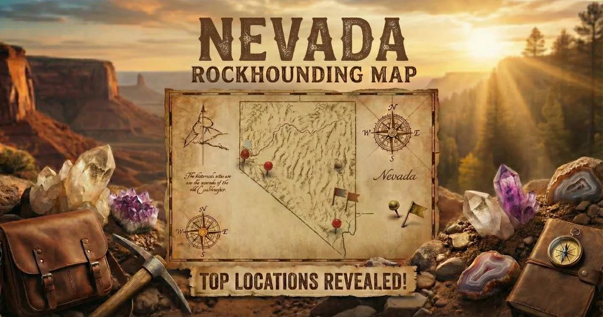
Nevada Rockhounding Map
Use our interactive Nevada rockhounding map to find collecting locations, verify land status, and plan your routes. The map shows fee-dig operations, BLM collecting areas, and known mineral localities across the state.
Plan your trips with fuel stops in mind. Nevada has long stretches of highway with no gas stations. Fill your tank at every opportunity, carry extra fuel for backcountry exploration, and tell someone your itinerary before you leave pavement. The gem material in this state is worth the effort — but Nevada does not forgive poor planning.