
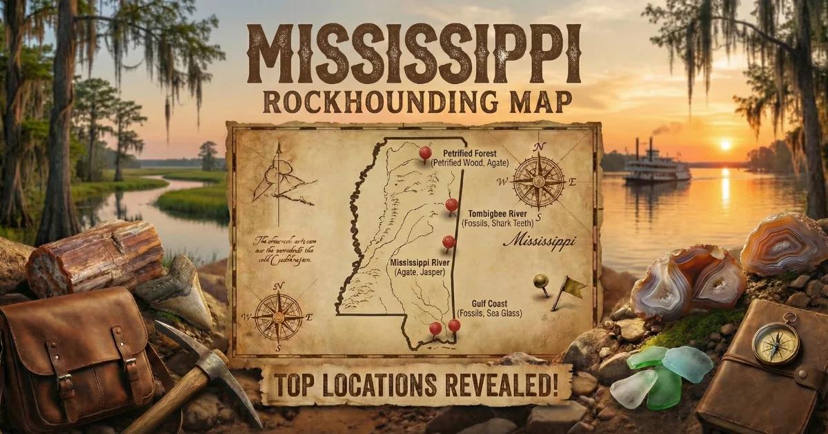
Mississippi sits entirely on the Gulf Coastal Plain, a wedge of Cretaceous through Quaternary sediments that thickens from a few hundred feet in the northeast to over 30,000 feet near the coast. The one exception is the far northeast corner — Tishomingo County — where Paleozoic limestone and sandstone of the Tennessee Valley outlier break the surface. The rest of the state is sand, clay, gravel, marl, and loess. There is no igneous or metamorphic bedrock exposed anywhere in Mississippi.
Land status varies. Federal holdings include De Soto National Forest (managed by the U.S. Forest Service, National Forests in Mississippi), Bienville National Forest, Holly Springs National Forest, Tombigbee National Forest, Delta National Forest, and Homochitto National Forest. The Army Corps of Engineers manages lands around several reservoir projects. State land includes wildlife management areas and state parks operated by the Mississippi Department of Wildlife, Fisheries, and Parks and the Mississippi Department of Finance and Administration. Most of Mississippi is privately owned. Always verify land ownership and get permission before collecting on private ground.

What Mississippi Produces
Mississippi is not a hard-rock mineral state. You will not find gem-quality crystals or metallic ore deposits here. What the state does produce — and in quantity — is petrified wood, agates from river gravel, iron concretions, sedimentary fossils, and occasional chalcedony. Petrified wood is the Mississippi state stone, designated in 1976. The silicified wood comes from Cretaceous and Tertiary forest horizons buried under Coastal Plain sediments and later exposed by erosion in stream cuts and road grades.
Agates and jasper ride the Mississippi River south from Precambrian and Paleozoic source rocks in Minnesota, Wisconsin, Iowa, and Illinois. By the time they reach Mississippi's gravel bars, they are waterworn cobbles — Lake Superior agates, Keokuk geodes, and various cherts mixed into the alluvium. These are not native Mississippi minerals, but they are collectible here.
Top Collecting Locations
1. Red Creek Area — Petrified Wood (Stone County / George County)
Land Status: De Soto National Forest, U.S. Forest Service. Some adjacent private land — check boundaries.
GPS: Approx. 30.95°N, 89.05°W (general area along Red Creek).
Managing Agency: National Forests in Mississippi, De Soto Ranger District.
Vehicle: High-clearance recommended. Forest roads are unpaved and can be rutted after rain. Some stretches require 4WD in wet conditions.
Fee: None for casual collecting on National Forest land.
Specimens: Petrified wood (silicified, often with preserved bark texture and annual rings), iron concretions, fossilized plant material.
Red Creek is one of the best-known petrified wood collecting areas in Mississippi. The creek and its tributaries cut through Miocene-age Hattiesburg and Pascagoula formations, exposing silicified logs and fragments in the stream gravel. Some pieces show excellent cellular preservation — under a hand lens, you can see individual xylem cells replaced by chalcedony and quartz. Colors range from brown and tan (iron-stained) to gray, black (organic carbon), and occasional red or yellow where iron oxides infiltrated the wood structure during silicification.
Walk the creek bed at low water. Check gravel bars and cutbanks. Larger logs sometimes protrude from the clay banks — these are in situ specimens weathering out of the formation. Do not dig into banks on National Forest land; collect only loose surface material and float in the stream channel. The U.S. Forest Service allows reasonable quantities of petrified wood for personal use under the casual collecting provision (36 CFR 228.62). The limit is 25 pounds per day plus one piece, not to exceed 250 pounds per year.
2. Mississippi River Gravel Bars — Agates and Chert (Warren County / Claiborne County / Adams County)
Land Status: Mixed. Gravel bars below the ordinary high-water mark are generally public (navigable waterway). Adjacent land may be Army Corps of Engineers, state, or private. Verify before crossing private property to reach the river.
GPS: Approx. 32.30°N, 90.90°W (Vicksburg area bars) and 31.56°N, 91.40°W (Natchez area bars).
Managing Agency: U.S. Army Corps of Engineers (Vicksburg District) for flood control lands. Mississippi Commission on Wildlife, Fisheries and Parks for some adjacent WMAs.
Vehicle: 2WD to access points. Walking required to reach gravel bars.
Fee: None.
Specimens: Lake Superior agate, Keokuk geode fragments, various cherts, jasper, chalcedony, quartz pebbles, fossiliferous limestone cobbles.
The Mississippi River carries glacial and Paleozoic debris from the upper Midwest. Every flood deposits fresh gravel on point bars and mid-channel islands. The best collecting happens after the river drops from spring flood stage — usually late May through October, depending on the year. Check USGS river gauge data for Vicksburg (gauge 07289000) before making the trip. You want the river below 30 feet on the Vicksburg gauge for exposed gravel bars.
Lake Superior agates are the prize find. They are banded chalcedony with iron-stained red, orange, and white bands. Most are small (thumbnail to fist size) and heavily waterworn, but they take a good polish. Look for translucent, waxy-surfaced cobbles that stand out from the dull gray and brown chert. Wet the stone — banding becomes visible when the surface is wet. Keokuk geodes (hollow, quartz-lined) also appear, though most are broken fragments by the time they reach Mississippi.
Access the Vicksburg-area bars from public boat ramps and riverside parks. Near Natchez, the Natchez Under-the-Hill area and public boat launches provide river access. Do not cross levees or enter posted Army Corps of Engineers maintenance areas without permission.
3. Tishomingo County — Paleozoic Outcrops (Tishomingo County)
Land Status: Tishomingo State Park (Mississippi state park — collecting prohibited in state parks). J.P. Coleman State Park (same restriction). Private land and road cuts outside park boundaries.
GPS: Approx. 34.60°N, 88.20°W (general Tishomingo County area).
Managing Agency: Mississippi Department of Finance and Administration (state parks). Private landowners outside parks.
Vehicle: 2WD. Paved and gravel roads throughout the county.
Fee: State park entry fees apply ($4 per vehicle at Tishomingo State Park) but no collecting allowed inside parks. Private land — ask permission and offer to pay if requested.
Specimens: Quartz pebbles, small agates, chert, crinoid fossils, brachiopod fossils, Devonian-Mississippian limestone and sandstone.
Tishomingo County is geologically unique in Mississippi. While the rest of the state sits on soft Coastal Plain sediments, this northeast corner exposes Paleozoic (Devonian through Mississippian) sandstone, limestone, and chert. The Bear Creek watershed has cut through these formations, creating rock outcrops and bluffs — rare terrain in Mississippi. The hard Paleozoic rocks contain crinoid stems, brachiopods, and bryozoan colonies as fossils, along with chert nodules and small quartz-filled vugs.
Collecting inside Tishomingo State Park and J.P. Coleman State Park is not allowed. Focus on road cuts along Highway 25 and county roads outside park boundaries where Paleozoic rock is exposed. Always confirm you are not on park or posted private property. Some county road cuts expose fossiliferous limestone where crinoid columnals and brachiopod shells weather out of the rock face and accumulate on the shoulder. These are easy to collect without tools.
4. Bienville National Forest — Petrified Wood and Iron Concretions (Scott County / Smith County)
Land Status: Bienville National Forest, U.S. Forest Service.
GPS: Approx. 32.30°N, 89.55°W (general forest area near Forest, MS).
Managing Agency: National Forests in Mississippi, Bienville Ranger District.
Vehicle: High-clearance recommended for forest roads. 2WD adequate on main forest roads in dry weather.
Fee: None for casual collecting.
Specimens: Petrified wood, iron concretions (ironstone), siderite nodules, fossilized plant impressions.
Bienville National Forest covers approximately 178,000 acres in central Mississippi. The forest sits on Eocene and Oligocene sediments — older than the formations in De Soto to the south. Petrified wood here tends to be smaller fragments rather than the large logs found at Red Creek, but cellular preservation can be excellent. Iron concretions — dense, heavy, rust-colored spheres and irregular masses of limonite and goethite — are common throughout the forest. Some concretions contain internal structures or fossils.
Forest roads and stream crossings are the most productive spots. Where roads cut through ridges, exposed sediment layers may contain petrified wood and concretions. Stream beds carry float material eroded from upstream formations. The same casual collecting rules apply: 25 pounds per day plus one piece, 250 pounds per year, surface collection only.
5. Mississippi Petrified Forest — Flora (Madison County)
Land Status: Private (National Natural Landmark). This is a privately owned tourist attraction, not a collecting site.
GPS: 32.61°N, 90.36°W (124 Forest Park Rd, Flora, MS 39071).
Managing Agency: Private ownership. Designated a National Natural Landmark by the National Park Service in 1965.
Vehicle: 2WD. Paved access.
Fee: Admission charged (approximately $7 adults, $5 children — verify current pricing).
Specimens: None — collecting is not permitted.
This is an observation-only site, but it is worth visiting for geological context. The Mississippi Petrified Forest contains in-situ silicified logs from a 36-million-year-old (late Eocene) hardwood forest. Entire tree trunks lie where they fell, replaced by silica carried in groundwater through the surrounding sediments. The site demonstrates the geological process that produced the collectible petrified wood scattered across the state. A nature trail loops through the exposed logs. The gift shop sells petrified wood specimens from other localities.
Minerals and Specimens Found in Mississippi
| Specimen | Hardness | Where in Mississippi | What to Look For |
|---|---|---|---|
| Petrified wood (chalcedony/quartz replacement) | 6.5–7 | Red Creek (Stone/George Co.), Bienville NF, statewide in Tertiary formations | Wood grain texture, conchoidal fracture, heavier than regular wood. Tan, brown, gray, black, occasional red/yellow. |
| Lake Superior agate | 7 | Mississippi River gravel bars (Warren, Claiborne, Adams Co.) | Banded red/orange/white chalcedony. Waxy luster. Translucent when wet. |
| Chert/flint | 7 | Mississippi River gravel, Tishomingo County outcrops | Opaque, conchoidal fracture, dull gray to brown. Some pieces contain microfossils. |
| Jasper | 7 | Mississippi River gravel, scattered in Coastal Plain gravels | Opaque, red/brown/yellow. Iron-stained variety of chalcedony. |
| Iron concretions (limonite/goethite) | 5–5.5 | Bienville NF, statewide in Tertiary sediments | Dense, heavy, rust-colored spheres or irregular masses. Streak is yellow-brown. |
| Siderite | 3.5–4.5 | Central Mississippi Tertiary formations | Brown to gray carbonate. Rhombohedral crystal habit. Reacts weakly with cold HCl. |
| Crinoid fossils | 3 (calcite) | Tishomingo County Paleozoic limestone | Circular disc-shaped columnals, sometimes as connected stem segments. |
| Brachiopod fossils | 3 (calcite) | Tishomingo County | Bilateral shell impressions in limestone. Articulated or as single valves. |
| Shark teeth (fossil) | 5 (apatite) | Coastal counties, Yazoo Clay exposures, creek gravels statewide | Dark brown/black triangular teeth. Eocene and Oligocene marine deposits. |
| Calcite | 3 | Tishomingo County limestone | White to clear rhombohedral crystals in vugs. Reacts with HCl. |
Field Identification Tips
Petrified wood vs. regular rock: Petrified wood retains the external shape and internal grain structure of the original wood, but it fractures like rock — conchoidal (shell-shaped) breaks rather than splintery wood fracture. Under a 10x hand lens, well-preserved specimens show cell walls replaced by microcrystalline quartz. If you see wood grain on the outside and glassy fracture on a fresh break, it is petrified wood. Hardness is 6.5–7 (scratches steel, scratches glass).
Agate vs. chert: Both are varieties of chalcedony (microcrystalline quartz), but agates display banding or translucency. Chert is opaque and homogeneous. Wet both stones — an agate will show internal structure (bands, plumes, or translucent zones) when wet. Chert remains opaque. On Mississippi River gravel bars, this wet-test is the fastest sorting method. Carry a spray bottle.
Iron concretions vs. meteorites: New collectors sometimes mistake iron concretions for meteorites. Iron concretions are sedimentary — they form when iron-rich groundwater cements sand or clay into dense masses. They are common in Mississippi. A true iron meteorite will attract a magnet strongly, show a nickel content on a chemical test, and display Widmanstatten patterns when sliced and etched. Iron concretions do not attract magnets (they are iron oxide, not metallic iron), have no nickel, and show no internal crystalline pattern. If you think you have a meteorite, weigh it — meteorites are abnormally dense (7.0+ g/cm3). Concretions weigh about 3.5–4.0 g/cm3.
Fossil shark teeth: Mississippi's Eocene and Oligocene marine sediments (particularly the Yazoo Clay of Jackson Group age) contain abundant shark teeth. Look in creek gravel and eroded clay banks in central and southern Mississippi. The teeth are dark brown to black (phosphate replacement) and triangular. Common species include Otodus (large triangular teeth), various Carcharhinus species, and sand tiger shark teeth. Creek gravel concentrates the teeth — they are denser than the surrounding sediment and lag behind as lighter material washes away.
Tools and Equipment
| Item | Purpose |
|---|---|
| 10x hand lens (loupe) | Examine cellular structure in petrified wood, identify banding in agates |
| Spray bottle | Wet stones on gravel bars to reveal banding and translucency |
| Rock hammer (crack hammer) | Break concretions open to check internal structure. Not needed for gravel bar collecting. |
| Small garden trowel | Digging in stream gravel on National Forest land |
| 5-gallon bucket | Carry collected specimens back to the vehicle |
| Old towels or newspaper | Wrap specimens to prevent scratching during transport |
| Sturdy boots (waterproof preferred) | Creek walking at Red Creek and river gravel bars. Expect wet feet. |
| Sunscreen, hat, insect repellent | Mississippi summer heat and mosquitoes are serious. Ticks are common in National Forest land. |
| GPS unit or phone with offline maps | National Forest roads are poorly marked. Download USFS Motor Vehicle Use Maps (MVUMs) before the trip. |
| Water (1 gallon per person minimum) | No potable water at most collecting sites. Carry more than you think you need. |
Legal Notes and Access Rules
National Forest land (De Soto, Bienville, Holly Springs, Tombigbee, Homochitto, Delta NF): Casual collecting of common invertebrate fossils, petrified wood, and mineral specimens for personal use is permitted under 36 CFR 228.62. The limit is 25 pounds per day plus one piece, not to exceed 250 pounds per calendar year. No commercial collecting. No digging into bedrock or geologic formations. Surface collection and shallow hand digging only. Do not use motorized equipment. Vertebrate fossils (bones, teeth of mammals, reptiles, fish) require a permit — contact the Forest Supervisor's office.
State parks (Tishomingo State Park, J.P. Coleman State Park, others): Collecting rocks, minerals, fossils, or any natural objects is prohibited in Mississippi state parks. Look, photograph, do not remove.
Army Corps of Engineers land: Collecting policies vary by project and area. Contact the Vicksburg District office (601-631-5000) for current rules on specific areas along the Mississippi River and reservoir projects. Some areas allow collecting; others do not.
Private land: Most of Mississippi is private property. You must have landowner permission before collecting. This applies even if land appears unoccupied or unposted. Mississippi law treats unauthorized entry as trespassing. Many timber company lands in southern Mississippi (Weyerhaeuser, others) are managed for forestry and may or may not grant access — contact the land management office rather than assuming access is permitted.
Mississippi River gravel bars: Gravel bars below the ordinary high-water mark of the Mississippi River are within the federal navigation channel and are generally open for foot access. However, reaching them may require crossing private land, Corps of Engineers levee rights-of-way, or state wildlife management areas, each with its own access rules. Use public boat ramps and designated access points.
Best Seasons and Conditions
Fall and winter (October through March) are the best collecting seasons for most Mississippi sites. Lower humidity, fewer insects, and lower water levels in creeks expose more gravel. Mississippi summers (June through August) bring extreme heat (95°F+ with high humidity), dense mosquito and tick populations, and afternoon thunderstorms.
Mississippi River bars are best from late summer through fall, after the spring flood crest passes and the river drops to low stage. Check USGS gauge data before making a river trip.
Red Creek and forest streams are best after a period of dry weather when water levels drop and gravel bars are fully exposed. After heavy rain, creeks run high and muddy — wait 3–5 days for water to clear.
Nearby Rock Shops and Clubs
The Mississippi Gem and Mineral Society (Jackson area) is the primary organized collecting group in the state. They hold meetings, sponsor field trips, and can provide current access information for collecting areas. Rock shops are sparse in Mississippi compared to western states. The Mississippi Petrified Forest gift shop near Flora sells specimens and reference material. For lapidary supplies and specimen purchases, collectors often travel to shops in Jackson, the Gulf Coast (Biloxi/Gulfport), or neighboring states (Alabama, Louisiana, Tennessee).
Interactive Map
Find all Mississippi collecting locations, GPS coordinates, and access details on our Mississippi rockhounding map.