
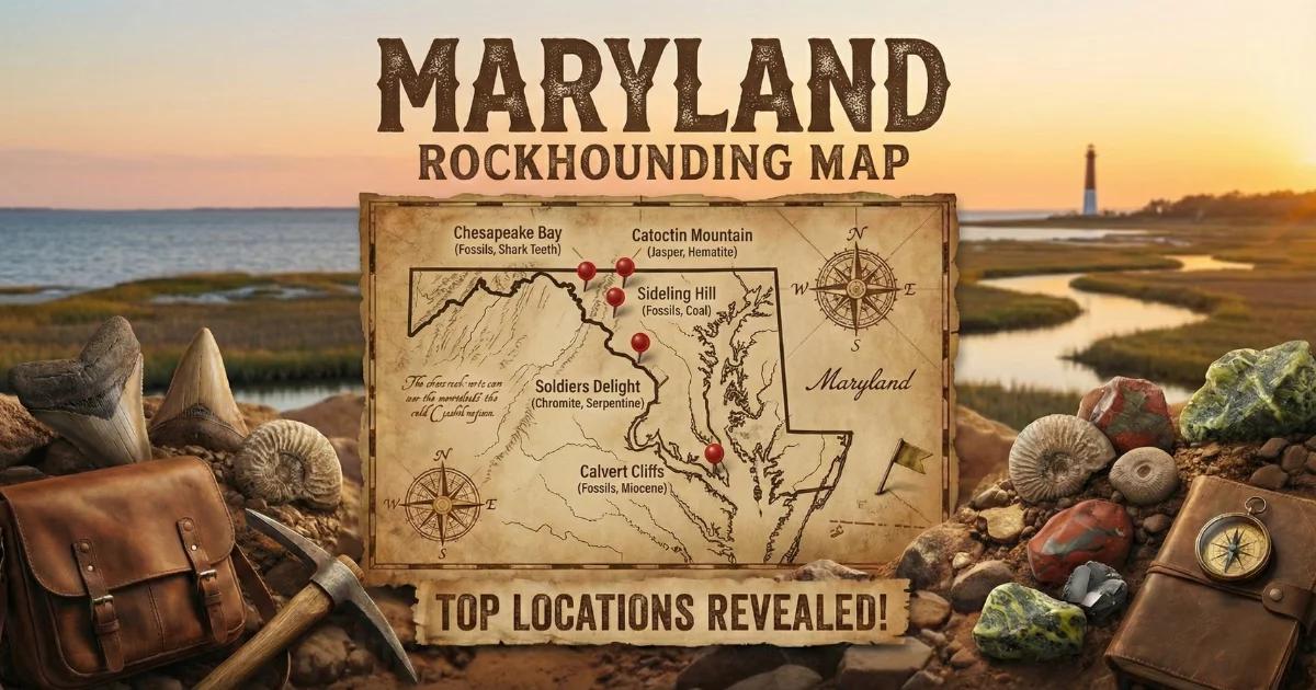
Maryland is a small state — tenth smallest by area — but it spans four distinct geologic provinces: the Coastal Plain, Piedmont, Blue Ridge, and Valley and Ridge. The Piedmont and Blue Ridge belts contain the state's collectible minerals. Precambrian and Paleozoic metamorphic rocks — schist, gneiss, quartzite, serpentinite, and greenstone — host garnets, chromite, serpentine, gold, and soapstone. The Coastal Plain's Miocene-age Calvert Formation delivers some of the best Cenozoic fossil collecting on the East Coast. Maryland will never rival Montana or North Carolina for gem material, but collectors who know the geology can pull good specimens from a half-dozen well-documented sites within an hour of Baltimore or Washington, D.C.

Geologic Overview
Maryland's Piedmont province — the broad belt of metamorphic rock between the Coastal Plain fall line and the Blue Ridge — is the core of the state's mineral collecting. This province consists of highly deformed Precambrian and lower Paleozoic schist, gneiss, phyllite, and amphibolite, intruded by granitic pegmatites and mafic-ultramafic bodies. The ultramafic rocks (serpentinite) form a discontinuous chain of small outcrops from Baltimore County southwest into Howard and Montgomery counties, part of the larger Appalachian serpentinite belt.
The Blue Ridge province in Frederick and Washington counties is a narrow band of Catoctin metabasalt (greenstone) and metasediments. The Catoctin formation contains soapstone (steatite), a material used by Native Americans for centuries and still collectible in limited amounts.
West of the Blue Ridge, the Valley and Ridge province consists of folded Paleozoic sedimentary rock — limestone, shale, and sandstone — with occasional calcite veins and geodes. The Coastal Plain, east of the fall line, is flat-lying Cretaceous and younger sediment. The Miocene-age Calvert Formation — exposed along the western shore of the Chesapeake Bay — is the state's most accessible fossil-collecting horizon.
Top Collecting Locations
1. Soldiers Delight Natural Environment Area — Serpentine Barrens (Baltimore County)
Land Status: Maryland Department of Natural Resources — state-managed natural area. Mineral collecting is restricted; surface collecting of loose float only. No digging, hammering outcrops, or removing vegetation. Check current DNR regulations before visiting.
GPS: Approx. 39.384°N, 76.834°W (Deer Park Road trailhead).
Vehicle: Sedan OK. Paved roads to the trailhead; level trails.
Specimens: Serpentine (antigorite, chrysotile varieties), chromite, magnetite, magnesite, talc, deweylite.
Soldiers Delight is the largest serpentine barren in the eastern United States — roughly 1,900 acres of thin, magnesium-rich soil derived from underlying serpentinite bedrock. The serpentinite here is part of the Baltimore Mafic Complex, a Paleozoic ultramafic intrusion. The soil chemistry suppresses most hardwood growth, creating an open grassland-savanna ecosystem that supports rare plant species found nowhere else in Maryland.
For collectors, the interest is the rock itself. Serpentinite outcrops are dark green to nearly black, waxy to the touch, and break with a splintery or conchoidal fracture. Chromite — a black, heavy, submetallic mineral (FeCr₂O₄) — occurs as small grains and pods within the serpentinite. Maryland's chrome mining industry operated here in the early 1800s; the Bare Hills chrome pits, just east of Soldiers Delight, were among the first chrome mines in the United States. Magnetite grains are also present — bring a magnet to test black heavy minerals. Magnesite (white, earite-like crusts) and talc (soft, greasy feel, hardness 1) occur along fracture surfaces.
Because Soldiers Delight is a protected natural area with rare plant communities, collecting is limited. Do not dig, break outcrops, or disturb soil. Loose surface float on trails and in stream beds is the only collectible material. If you want unrestricted serpentinite specimens, look for construction excavation sites in the same geologic belt in Baltimore, Howard, or Montgomery counties — road cuts and building sites in serpentinite terrain occasionally expose fresh material.
2. Cecil and Harford Counties — Piedmont Garnets
Land Status: Mostly private land. Permission required. Some stream access on public rights-of-way.
GPS: General area — Piedmont schist belt from approx. 39.55°N, 76.10°W (near Port Deposit) to 39.60°N, 76.30°W (near Bel Air).
Vehicle: Sedan OK on paved roads. Hiking required to reach stream beds.
Specimens: Almandine garnet, staurolite, kyanite, sillimanite, mica (muscovite, biotite), quartz.
The Piedmont schist belt in Cecil and Harford counties contains the best garnet collecting in Maryland. The host rock is the Wissahickon Formation — a sequence of pelitic (clay-rich) schists and paragneisses metamorphosed to amphibolite facies during the Paleozoic Taconic and Acadian orogenies. Almandine garnet (Fe₃Al₂Si₃O₁₂) occurs as porphyroblasts — crystals that grew larger than the surrounding groundmass during regional metamorphism. Individual garnets range from a few millimeters to over 2 centimeters in diameter.
The best collecting method is to search creek gravels downstream of garnet-bearing schist outcrops. Garnets are dense (SG 4.3) and concentrate in stream gravel bars the same way gold does. Look for dark red to brownish-red dodecahedral crystals, often partially embedded in quartz or mica matrix. Well-formed loose garnets with clean crystal faces turn up after heavy rains that wash new material out of the banks. Staurolite — brown, prismatic, occasionally twinned into cross shapes — co-occurs in the same schist units and can be found in the same creek gravels.
Construction sites in the Piedmont schist belt near Baltimore, Towson, and Bel Air periodically expose garnet schist during excavation. If you see fresh dark schist with visible red crystals in a road cut or building foundation, ask the contractor for permission to collect from the spoil piles.
3. Maryland Gold Belt — Carroll, Frederick, and Montgomery Counties
Land Status: Mix of private land, county parks, and public waterway access. Gold panning in navigable streams is generally legal in Maryland; dredging and sluicing may require permits. Verify local regulations.
GPS: Great Falls area — approx. 39.000°N, 77.243°W (Potomac River near Great Falls Tavern). Liberty Reservoir area — approx. 39.415°N, 76.930°W.
Vehicle: Sedan OK to most access points.
Specimens: Placer gold (fine to flour), pyrite, quartz vein material.
Maryland sits on the northern extension of the Piedmont Gold Province — the same belt that produced gold rushes in Virginia, the Carolinas, and Georgia before California. Gold was discovered in Maryland in the early 1800s, and small-scale mining occurred in Carroll, Frederick, and Montgomery counties through the Civil War era. The gold occurs in quartz veins cutting through Piedmont schist and gneiss, and as fine placer gold in streams that drain the gold-bearing rock.
The most accessible panning area is the Potomac River near Great Falls. The Chesapeake & Ohio Canal National Historical Park runs along the Maryland side of the river. Gold panning (pan only — no mechanized equipment) is permitted within the park. The Potomac here cuts through metamorphic bedrock, and fine gold concentrates in crevices and behind boulders in the riverbed. Expect flour gold — particles visible but extremely fine. A good day might yield a few small flakes.
Tributaries in Carroll County (near Westminster) and Frederick County (near the Monocacy River drainage) have also produced placer gold historically. The amounts are small — Maryland never had a commercial gold rush — but the gold is real, and patient panning in the right streams can still produce color. Focus on inside bends of streams where gravel bars form, and work the material down to bedrock crevices.
4. Calvert Cliffs State Park — Miocene Fossils (Calvert County)
Land Status: Maryland State Park. Fossil collecting is permitted on the beach below the cliffs. Do not climb, dig into, or disturb the cliff face. Collecting from the fallen cliff material on the beach is legal and encouraged.
GPS: 38.394°N, 76.440°W (park entrance and trailhead).
Vehicle: Sedan OK. Paved parking lot; 1.8-mile trail to the beach.
Specimens: Shark teeth (Carcharodon megalodon, Hemipristis serra, Carcharhinus, Galeocerdo, Isurus), whale bone, ray dental plates, echinoids, gastropods, bivalves, coral.
Calvert Cliffs is Maryland's most famous collecting site and one of the best Miocene fossil localities on the Atlantic seaboard. The cliffs — up to 100 feet tall — expose the Calvert, Choptank, and St. Marys formations, deposited 8 to 18 million years ago when southern Maryland was a shallow marine shelf. The warm Miocene sea supported a rich fauna of sharks, whales, dolphins, rays, sea turtles, and invertebrates.
The collecting method is simple: walk the beach and pick up fossils that have eroded out of the cliffs and washed onto the sand. Wave action, rain, and freeze-thaw cycles continuously shed new material from the cliff face. Shark teeth are the primary find — the Miocene formations contained abundant sharks, and their teeth, being dense and mineralized, survive erosion better than bone. The teeth range from small Carcharhinus (bull shark) teeth under a centimeter long to occasional megalodon teeth over 4 inches. Meg teeth are uncommon but not rare; patient collectors who visit regularly find them.
Whale bone fragments — dense, spongy-textured, dark brown — wash out of the upper formations. Complete whale bones are rare on the beach surface but do appear after major storms or cliff collapses. Ray dental plates (flat, tessellated crushing plates) are another diagnostic find. Invertebrate fossils — especially the echinoid Clypeaster and various gastropod and bivalve molds — are common in the clay and sand matrix.
The 1.8-mile trail from the parking lot to the beach is flat but can be muddy. Arrive at low tide for the most exposed beach area. The best collecting is after storms, when fresh cliff falls deposit new material. Do not approach the cliff base — overhangs collapse without warning. Work the surf line and the back-beach zone where wave action has concentrated dense material.
5. Catoctin Mountain Park — Soapstone (Frederick County)
Land Status: National Park Service. Collecting is prohibited within NPS boundaries. This entry is informational — view outcrops only. Historic quarry sites are visible along park trails.
GPS: 39.638°N, 77.448°W (visitor center). Soapstone outcrops along the Catoctin metabasalt contact zone.
Vehicle: Sedan OK. Paved park roads.
Specimens (view only): Steatite (soapstone — talc-rich rock), chlorite, actinolite, magnetite.
The Catoctin Formation — a thick sequence of Neoproterozoic metabasalt (greenstone) — underlies Catoctin Mountain. Where the metabasalt contacts carbonate and pelitic country rock, hydrothermal alteration produced bodies of soapstone (steatite). Native Americans quarried this soft, easily carved rock for bowls, pipes, and other implements. Several quarry sites are preserved within the park and are visible along hiking trails. The soapstone is gray-green, greasy to the touch, and can be scratched with a fingernail (hardness 1-2 on the Mohs scale).
While collecting is prohibited inside the park, the same Catoctin formation and associated soapstone extends onto private and state land outside park boundaries in Frederick County. Collectors interested in soapstone specimens should look for the same rock type in road cuts and private land (with permission) along the Catoctin Mountain ridge south and north of the park.
6. Patuxent River and Tributaries — Fossils and Minerals (Prince George's, Anne Arundel, Howard Counties)
Land Status: Mix of county parkland, state land, and private property. Access varies by location. Stream walking on public land is generally permitted.
GPS: General area — 39.05°N, 76.80°W (middle Patuxent) to 38.70°N, 76.65°W (lower Patuxent near Chesapeake Bay).
Vehicle: Sedan OK to access points; hiking along stream banks.
Specimens: Cretaceous fossils (plant material, lignite), Miocene shark teeth, ironstone concretions, quartz, siderite.
The Patuxent River and its tributaries cut through multiple geologic formations as they drop from the Piedmont across the fall line and into the Coastal Plain. In the upper reaches, stream gravels contain Piedmont minerals — quartz, garnet, and mica. Below the fall line, the river cuts through Cretaceous Potomac Group sediments (iron-stained sands and clays) that produce fossil plant impressions, lignite (fossil wood), and ironstone concretions. Farther downstream, where the river encounters Miocene formations, shark teeth and marine fossils similar to those at Calvert Cliffs appear in bank exposures and gravel bars.
The Jug Bay Natural Area on the Patuxent (Anne Arundel/Prince George's county line) is a managed wetland where stream access may require a permit. Check with the Jug Bay Wetlands Sanctuary before visiting. Upstream areas in Howard County — particularly near Savage and Laurel — offer walk-in access to Piedmont-Coastal Plain transition zone gravels.
Minerals and Fossils of Maryland
| Mineral/Fossil | Hardness | Where in Maryland | What to Look For |
|---|---|---|---|
| Almandine garnet | 6.5–7.5 | Piedmont schist — Cecil, Harford, Baltimore counties | Dark red dodecahedral crystals in schist or as loose grains in creek gravel |
| Serpentine (antigorite) | 3–4 | Soldiers Delight NEA, Baltimore County serpentinite belt | Dark green, waxy, splintery fracture. Greasy feel. |
| Chromite | 5.5 | Soldiers Delight, Bare Hills, Baltimore County | Black, submetallic, heavy grains in serpentinite. SG 4.5–4.8. |
| Placer gold | 2.5–3 | Potomac River (Great Falls), Carroll/Frederick county streams | Fine bright yellow flakes in black sand concentrates. Malleable — does not shatter. |
| Staurolite | 7–7.5 | Piedmont schist — Cecil, Harford counties | Brown prismatic crystals, occasionally cross-twinned ("fairy crosses") |
| Soapstone (steatite) | 1–2 | Catoctin Mountain area, Frederick County | Gray-green, greasy, scratched by fingernail. Talc-dominated rock. |
| Magnetite | 5.5–6 | Serpentinite belt, Piedmont mafic rocks | Black, metallic, strongly magnetic. Octahedral crystals or massive. |
| Quartz (vein) | 7 | Throughout Piedmont — road cuts, creek gravel | White to clear, glassy. Occasional crystal pockets in pegmatite. |
| Shark teeth (Miocene) | 5 (apatite) | Calvert Cliffs, Patuxent River, Chesapeake Bay beaches | Dark gray to black triangular teeth. Glossy enamel surface on one side. |
| Megalodon teeth | 5 (apatite) | Calvert Cliffs — uncommon but present | Large (2–6 inch) triangular teeth with serrated edges and V-shaped root |
Field Identification Tips
Garnet vs. dark quartz: Almandine garnet has a vitreous luster, a dodecahedral crystal habit (12-sided), and a hardness of 6.5–7.5. It will scratch glass. Dark smoky quartz is prismatic (six-sided) and has a hardness of 7. The crystal shape is the fastest way to tell them apart in the field. Garnet also has no cleavage — it fractures irregularly — while quartz shows conchoidal (shell-like) fracture.
Serpentine vs. green schist: Serpentinite is soft (hardness 3–4), waxy, and greasy to the touch. Green chlorite schist is slightly harder (hardness 2–3 for chlorite itself, but the rock often contains harder minerals) and has a distinctly foliated texture — thin parallel layers that split apart. Serpentinite is massive, not foliated. Rub the rock with your thumb: serpentinite feels slick like soap; chlorite schist feels gritty and flaky.
Chromite vs. magnetite: Both are black, heavy, and submetallic. The magnet test separates them instantly. Magnetite is strongly magnetic — it will stick to a magnet firmly. Chromite is weakly magnetic to non-magnetic. Chromite also has a brown streak on unglazed porcelain; magnetite has a black streak.
Gold vs. pyrite (fool's gold): Real gold is malleable — press it with a knife blade on a hard surface and it flattens without shattering. Pyrite is brittle and crumbles or sparks. Gold stays bright yellow in shade; pyrite has a brassy, slightly greenish cast. In a gold pan, gold sits in the very bottom of the heaviest concentrate; pyrite, being lighter (SG 5.0 vs. gold's SG 19.3), rides slightly higher.
Shark teeth vs. rocks: Miocene shark teeth at Calvert Cliffs are dark gray to black with a glossy enamel surface on the labial (outer) face. The root is lighter colored and porous. A fresh tooth feels smooth and slightly waxy on the enamel surface. Dark pebbles and shell fragments are common look-alikes — check for the triangular shape, serrated edges (on many species), and the distinct enamel-root boundary.
Tools and Equipment
| Item | Purpose |
|---|---|
| Gold pan (14-inch) | Panning for gold on the Potomac and Carroll/Frederick streams. Also useful for concentrating garnet from creek gravel. |
| 10x hand lens (loupe) | Examining crystal faces, identifying mineral species, checking shark tooth serrations. |
| Rock hammer (flat head + pick) | Breaking float specimens (not outcrops in protected areas). Needed for Piedmont schist. |
| Cold chisel (1-inch) | Splitting schist along foliation to expose garnets. |
| Streak plate (unglazed porcelain) | Mineral identification — chromite (brown) vs. magnetite (black) vs. hematite (red). |
| Small magnet | Testing for magnetite in serpentinite. Quick chromite-magnetite separation. |
| Spray bottle | Wetting shark teeth and minerals reveals true color and surface detail. |
| Knee pads | Calvert Cliffs beach collecting — you will spend time on your knees scanning sand. |
| Sturdy shoes or boots | Creek walking, rocky stream beds, muddy trails. Waterproof boots for Patuxent River. |
| Small containers/ziplock bags | Protect specimens. Wrap shark teeth individually — enamel chips if teeth knock together. |
| Sunscreen and hat | Calvert Cliffs beach has zero shade. Piedmont creek beds are partially shaded but reflect UV off water. |
Legal Notes and Access
- State Parks: Calvert Cliffs State Park permits fossil collecting from beach material below the cliffs. Do not dig into the cliff face or climb the cliffs. Collecting is for personal use only — no commercial quantities. A day-use fee may apply for parking.
- National Park Service (Catoctin, C&O Canal): Collecting rocks, minerals, and fossils is generally prohibited on NPS land under 36 CFR 2.1. Exception: gold panning by hand (pan only, no mechanized equipment) is permitted in the C&O Canal NHP along the Potomac River. Confirm current regulations with the park office before visiting.
- Soldiers Delight NEA: Maryland DNR manages this site. Surface collecting of loose rock may be tolerated, but digging and hammering are prohibited. The area is a protected natural environment — tread carefully and stay on trails.
- Private land: Most garnet and gold sites are on private property. Always get written permission before collecting. In Maryland, trespassing on posted land is a misdemeanor.
- Stream access: Maryland law allows public access to navigable waterways below the mean high-water mark. Non-navigable streams (most small creeks) may have private bed ownership. When in doubt, ask.
- No BLM land: Maryland has no Bureau of Land Management land. Unlike western states, there is no general federal public land open to casual mineral collecting. All collecting requires verifying the specific land status — state park, national park, county park, or private — and following that jurisdiction's rules.
Best Time to Collect
Spring (March–May): Best for creek and river collecting. Snowmelt and spring rains flush new material into stream gravels — fresh garnets, gold, and fossils appear. Water levels may be high; use caution on the Potomac.
Summer (June–August): Low water exposes more gravel bars for gold panning and garnet searching. Calvert Cliffs beach is at its widest at low tide. Heat and humidity are intense in tidewater Maryland — bring water.
Fall (September–November): Post-hurricane season is peak time for Calvert Cliffs. Major storms erode the cliff face rapidly, dumping fresh fossil material onto the beach. September through early November — after tropical storms and nor'easters — is when the largest shark teeth wash out. Piedmont streams are low and clear, good for garnet gravel.
Winter (December–February): Cold but productive at Calvert Cliffs. Freeze-thaw cycles break up the cliff face nightly, depositing fresh material. Fewer visitors mean less competition. Dress for wind off the Chesapeake Bay. Piedmont creek collecting is uncomfortable but possible.
Interactive Map
Find all Maryland collecting locations — garnet sites, gold panning areas, fossil beaches, and serpentine outcrops — on our Maryland rockhounding map with GPS coordinates and access details.