
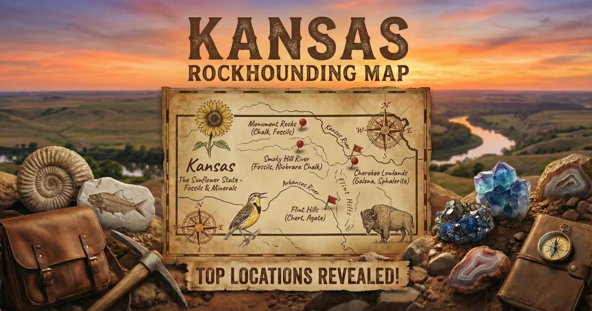
Kansas sits on a geologic cross-section that runs from Precambrian basement granite in the northeast, through stacked Paleozoic limestones and shales in the east, to Cretaceous chalk in the west. The eastern third of the state exposes Pennsylvanian and Permian sedimentary rock — limestone, shale, sandstone, and chert — that dips gently westward beneath younger Mesozoic and Cenozoic cover. In the southeast corner, the Tri-State Mining District straddles the Kansas-Missouri-Oklahoma border, where Mississippi Valley-type lead-zinc deposits produced galena and sphalerite crystals for over a century. Across the center of the state, the Flint Hills — a north-south belt of Permian limestone and chert — yield multicolored flint nodules and prairie agates. In western Kansas, the Niobrara Formation exposes Upper Cretaceous chalk beds containing shark teeth, mosasaur bone, and other marine fossils. Central Kansas produces some of the largest selenite (gypsum) crystals found anywhere in the United States.
Kansas is not a state where you walk into a mine and pull gem-quality stones from a pegmatite vein. The collecting here is different — it rewards patience, land access, and knowledge of stratigraphy. What the state lacks in traditional "gem" minerals, it compensates for with world-class selenite, excellent lapidary flint, well-preserved Cretaceous marine fossils, and historic lead-zinc specimens that belong in any mineral collection.

Top Collecting Locations in Kansas
1. Tri-State Mining District — Galena and Sphalerite (Cherokee County, SE Kansas)
Land Status: Primarily private land. Some former mine dumps may be accessible with written landowner permission. Portions of the Galena area fall under EPA Superfund designation — check current site boundaries before entering.
GPS (Galena, KS area): Approx. 37.075°N, 94.640°W
Vehicle: 2WD sedan on paved roads to the towns of Galena and Baxter Springs. Access to mine dump areas may require a truck on unimproved dirt tracks.
Specimens: Galena (lead sulfide — cubic crystals, often with octahedral modifications), sphalerite (zinc sulfide — resinous brown to honey-yellow crystals), calcite (scalenohedral and rhombohedral crystals, often on galena matrix), marcasite, dolomite, chalcopyrite, and druzy quartz.
The Tri-State Mining District was one of the most productive lead-zinc districts in the world from the 1870s through the 1970s. The ore bodies formed as Mississippi Valley-type (MVT) deposits — hydrothermal fluids migrated through Mississippian limestone (Boone Formation) and precipitated galena and sphalerite in solution cavities, fractures, and breccia zones. The district produced over 50% of the nation's lead and zinc during World War I.
Collecting today is limited. Most mine properties are privately owned. Some dumps remain where cubic galena crystals, sphalerite, and associated calcite can be found in loose rubble. The key obstacle is access — nearly all productive ground requires landowner permission. The Galena Mining and Historical Museum in downtown Galena is a good starting point for local contacts and information on which properties may allow collecting. Environmental contamination from lead and zinc tailings is present in parts of the district. Avoid ingesting dust, wash hands after handling specimens, and keep children supervised.
2. Flint Hills — Permian Chert and Prairie Agates (Chase, Butler, and Greenwood Counties)
Land Status: Mixed — mostly private ranch land. Public road cuts and KDOT right-of-way exposures are accessible. Tallgrass Prairie National Preserve (Chase County) is federal land — no collecting permitted within preserve boundaries. Kansas state highway road cuts are open for surface picking unless posted.
GPS (Flint Hills Scenic Byway area): Approx. 38.430°N, 96.560°W (near Cottonwood Falls)
Vehicle: 2WD on paved highways. The Kansas Flint Hills Scenic Byway (K-177) between Council Grove and Cassoday crosses prime chert country. Gravel county roads require higher clearance in wet weather.
Specimens: Multicolored chert (flint) nodules in cream, gray, brown, red, and banded patterns. Prairie agates — translucent chalcedony nodules with banding, typically walnut-sized to fist-sized. Occasional geodes with druzy quartz linings in limestone cavities.
The Flint Hills are an erosional feature carved from Permian-age limestone and shale of the Chase Group and Council Grove Group. The chert (flint) nodules formed as diagenetic silica replacements within the limestone — dissolved silica precipitated as microcrystalline quartz within carbonate beds. These nodules weather out of the host limestone and accumulate in creek gravels and on exposed hillsides. The material varies in color and pattern depending on the specific formation. Some pieces show fine banding similar to agate, hence the name "prairie agate." The best flint takes an excellent polish and has been used for tool-making and lapidary work for thousands of years — Flint Hills chert was a primary raw material for Indigenous peoples across the Great Plains.
Road cuts along K-177, US-50, and US-77 through the Flint Hills expose fresh limestone with embedded chert nodules. Creek beds in Chase, Butler, and Greenwood counties produce water-tumbled flint in diverse colors. The best strategy is to drive the scenic byway, stop at road cuts with exposed limestone, and check the drainage ditches and creek crossings. Always pull completely off the road and wear a high-visibility vest when collecting near highways.
3. Smoky Hill Chalk — Niobrara Formation Fossils (Gove, Logan, and Trego Counties, Western Kansas)
Land Status: Almost entirely private ranch land. Some public road exposures along county roads. Castle Rock and Monument Rocks are on private land with public access — surface collecting of loose material is generally tolerated, but verify current landowner policy. Do not dig into formations.
GPS (Monument Rocks): Approx. 38.787°N, 100.783°W
GPS (Castle Rock): Approx. 38.790°N, 100.068°W
Vehicle: High-clearance vehicle recommended. Access roads to Monument Rocks and Castle Rock are unimproved dirt/chalk tracks that become impassable when wet. Do not attempt after rain. 4WD provides a margin of safety in dry conditions; a truck with decent clearance will suffice when the roads are dry and firm.
Specimens: Shark teeth (Cretoxyrhina, Squalicorax, and others), mosasaur vertebrae and teeth, fish vertebrae and scales (Xiphactinus, Gillicus), oyster shells (Pseudoperna congesta), ammonites, and inoceramid bivalve shell fragments. The chalk itself contains abundant coccoliths (microscopic marine algae).
The Niobrara Formation is an Upper Cretaceous (roughly 87–82 million years old) chalk deposit laid down on the floor of the Western Interior Seaway, a shallow sea that split North America in half during the Late Cretaceous. The chalk is composed of compressed coccolithophore tests — calcium carbonate skeletons of single-celled marine algae. Within this chalk, the remains of the seaway's apex predators are preserved: mosasaurs (marine lizards up to 40 feet long), giant fish, pteranodons, and large sharks.
Most significant fossils in western Kansas are found on private ranch land. Landowner permission is essential. The Sternberg Museum of Natural History in Hays (Fort Hays State University) is the regional authority on Niobrara paleontology and can provide guidance on ethical collecting practices and permit requirements for vertebrate fossils. Note that vertebrate fossils on private land in Kansas belong to the landowner. Collecting vertebrate fossils on state or federal land without a permit is illegal. Surface-collected shark teeth and invertebrate shell fragments on private land with permission are the most accessible targets for recreational collectors.
4. Selenite Crystals — Barton County and Central Kansas
Land Status: Private land. The productive selenite areas near Great Bend are on private agricultural land. Written permission from the landowner is required.
GPS (Great Bend area): Approx. 38.360°N, 98.765°W
Vehicle: 2WD to area towns. A truck is useful for reaching field sites on dirt farm roads.
Specimens: Selenite (transparent gypsum) crystals — single blades, twins, clusters, and "arrowhead" twins. Some crystals exceed 3 feet in length. Clear to amber-tinted. Often with clay inclusions or sand-filled hourglass phantoms.
Central and western Kansas overlie thick Permian evaporite sequences — gypsum, anhydrite, and halite deposited in shallow restricted seas during the Permian Period. Groundwater dissolving and reprecipitating this gypsum produces selenite crystals in clay and silt deposits near the surface. The Barton County area, particularly near Great Bend and Ellinwood, has produced some of the largest selenite crystals documented in the United States — individual blades over 3 feet long and crystal clusters weighing dozens of pounds.
These crystals grow in clay-rich soils and alluvial deposits, often just a few feet below the surface. Excavation is straightforward — a shovel and hand tools are sufficient — but the crystals are fragile. Wrap specimens immediately in newspaper or bubble wrap. The challenge is access: all productive ground is private farm and ranch land. Local rock clubs and the Kansas Geological Survey office in Lawrence can sometimes facilitate introductions to willing landowners. Do not prospect on land without explicit permission.
5. Barite Roses — Southeastern and South-Central Kansas
Land Status: Private land. Surface collecting with landowner permission.
GPS (general area): Approx. 37.200°N, 96.100°W (Elk and Chautauqua counties)
Vehicle: 2WD to area towns; truck on county dirt roads.
Specimens: Barite rosettes ("desert roses") — flat bladed clusters of barite (BaSO4) with sand inclusions, forming rosette shapes 1–4 inches across. Brown to tan in color. Also barite crystals in tabular and prismatic forms.
Barite roses form when barium-rich groundwater percolates through porous sandstone and reacts with sulfate in solution. The barite crystallizes around sand grains, producing the characteristic petal-like bladed clusters. Similar material occurs across the Oklahoma border (where the barite rose is the state rock), but Kansas localities in the Chautauqua Hills and along the Elk River drainage produce clean specimens. Look in eroded stream banks, plowed fields after rain, and road cuts through Permian sandstone and red-bed formations. The roses weather out of the host rock and accumulate on slopes and in gullies.
6. Petrified Wood — River Gravels Statewide
Land Status: Mixed. Gravel bars on navigable rivers below the ordinary high-water mark may be public access under Kansas water law, but verify. Many prime locations are on private land along stream banks.
GPS (Smoky Hill River area): Approx. 38.800°N, 99.300°W (general area, western Kansas)
GPS (Republican River area): Approx. 39.820°N, 97.800°W (general area, north-central Kansas)
Vehicle: 2WD to access points; some river access roads are unimproved.
Specimens: Silicified (petrified) wood in various colors — brown, tan, black, red, and occasionally with visible cell structure. Pieces range from pebble-sized to logs. Opalized and agatized varieties occur but are uncommon.
Petrified wood in Kansas derives from multiple sources. Some pieces erode from Cretaceous and Tertiary formations in western Kansas, where ancient forests were buried in volcanic ash and floodplain sediments. Other material is reworked Ogallala Formation gravel (Miocene-Pliocene) that contains petrified wood from the High Plains ancient drainage system. River gravels throughout the state concentrate this material as it is transported downstream. The Smoky Hill River, Republican River, Solomon River, and Arkansas River all produce petrified wood in their gravel bars. After spring floods recede, check freshly deposited gravel bars for newly exposed material. The best pieces show clear grain structure and take a good polish.
Minerals and Specimens Found in Kansas
| Mineral / Specimen | Hardness (Mohs) | Where in Kansas | What to Look For |
|---|---|---|---|
| Galena (PbS) | 2.5 | Tri-State District, Cherokee County | Silver-gray cubic crystals, heavy (SG 7.6), metallic luster. Often on calcite matrix. |
| Sphalerite (ZnS) | 3.5–4 | Tri-State District, Cherokee County | Resinous brown to honey-yellow crystals. Tetrahedral habit. Rotten-egg smell when scratched. |
| Calcite (CaCO3) | 3 | Tri-State District; Flint Hills limestone | Scalenohedral "dogtooth" crystals, rhombohedra. Effervesces in dilute HCl. |
| Selenite (gypsum, CaSO4-2H2O) | 2 | Barton County, central/western Kansas | Transparent bladed crystals, sometimes over 3 ft. Soft — fingernail scratches it. Hourglass phantoms. |
| Flint / Chert (SiO2) | 7 | Flint Hills — Chase, Butler, Greenwood counties | Dense, waxy-luster nodules. Gray, brown, cream, red, banded. Conchoidal fracture. |
| Prairie Agate (chalcedony) | 7 | Flint Hills creek gravels | Translucent nodules with banding. Walnut to fist-sized. Best seen when wet. |
| Barite (BaSO4) | 3–3.5 | Elk, Chautauqua counties; SE Kansas | Rosette-shaped clusters with sand inclusions. Tan to brown. Heavy for its size (SG 4.5). |
| Marcasite (FeS2) | 6–6.5 | Tri-State District; Cretaceous shale exposures | Pale brass-yellow, often in cockscomb or radiating crystal groups. Metallic luster. |
| Petrified Wood (SiO2) | 6.5–7 | River gravels statewide, esp. Smoky Hill and Republican rivers | Brown/tan/black silicified wood with visible grain structure. Conchoidal fracture. |
| Shark Teeth (phosphatic) | 5 | Niobrara Chalk, Gove/Logan/Trego counties | Dark brown to black teeth in cream-colored chalk. Glossy enamel surface. |
Field Identification Tips
Galena vs. other metallic minerals: Galena is extremely dense — a 1-inch cube weighs noticeably more than any other common mineral of the same size. It has perfect cubic cleavage: break a piece and it fractures into smaller cubes. The fresh surface is bright silver; tarnished specimens are dull gray. Galena is soft (hardness 2.5) — a steel nail scratches it easily. Do not lick galena specimens; it is a lead ore.
Sphalerite vs. dark quartz: Sphalerite has a resinous (almost greasy) luster that differs from the vitreous (glassy) luster of quartz. It has six directions of cleavage, so broken surfaces show angular flat faces at various angles rather than the smooth conchoidal fracture of quartz. Scratch it with a steel blade on an unglazed porcelain streak plate — sphalerite gives a light brown to yellow streak. Quartz leaves no streak. If you scratch sphalerite forcefully, you may detect a faint sulfur smell.
Flint/Chert vs. quartzite: Both are hard (Mohs 7) and break conchoidally. The difference is texture: flint/chert has a waxy, almost matte luster and is microcrystalline (no visible grains). Quartzite shows visible interlocking quartz grains and a sugary or vitreous surface. In the Flint Hills, nearly all hard siliceous nodules in the limestone are chert.
Selenite vs. clear calcite: Both are transparent and relatively soft. Selenite (hardness 2) is scratched by a fingernail; calcite (hardness 3) is not scratched by a fingernail but is scratched by a copper coin. Selenite has one perfect cleavage direction and bends slightly without breaking (thin sheets are flexible). Calcite has rhombohedral cleavage — three cleavage directions at oblique angles — and produces double refraction (place calcite on printed text and you see two images). Selenite does not effervesce in acid; calcite does.
Prairie agate vs. plain chert: Both are silica, but prairie agates are translucent when held to strong light and show concentric banding. Plain chert is opaque or only marginally translucent on thin edges. Wet both specimens — an agate will show visible internal banding through the surface, while chert remains uniform. For lapidary grading, the best prairie agates have strong color contrast between bands and lack fractures.
Shark teeth in chalk: Fresh Niobrara chalk is cream to light gray and soft enough to carve with a knife. Shark teeth are dark brown to black, smooth, and have a glossy enamel surface that contrasts sharply with the chalky matrix. Teeth often weather out and sit on the surface of eroded chalk slopes. Look for the characteristic triangular outline. Bring a soft brush — do not pry teeth from matrix with metal tools, as they chip easily.
Recommended Tools
- Rock hammer (flat head, 16 oz): General-purpose tool for breaking limestone to check for chert nodules and splitting mine dump rock in the Tri-State District.
- Cold chisel (1-inch): For separating galena and calcite crystals from matrix without damage.
- Flat-blade screwdriver: Prying chert nodules from soft limestone.
- Short-handle shovel or garden trowel: Digging selenite crystals from clay near Great Bend. Also useful for scooping creek gravel.
- 10x hand lens (loupe): Examining crystal faces, identifying mineral cleavage, and checking fossil detail.
- Spray bottle with water: Wetting chert and agate reveals color, banding, and translucency that are invisible on dry specimens.
- Streak plate (unglazed porcelain): Distinguishing sphalerite from dark quartz or garnet. Also useful for marcasite and galena identification.
- Steel file or nail: Scratch testing. Anything softer than 6.5 is scratched by a steel file.
- Newspaper and bubble wrap: Selenite crystals and calcite crystals are fragile — wrap immediately in the field.
- 5-gallon bucket: Carrying gravel for sorting. Also useful for washing creek-collected material.
- Knee pads: For extended surface searching on chalk beds and mine dumps.
- GPS or smartphone with offline maps: Western Kansas has limited cell coverage. Download maps before going to Monument Rocks or Castle Rock.
- High-visibility vest: Required when collecting near highway road cuts in the Flint Hills.
- Safety glasses: Mandatory when hammering any rock, especially galena (lead content) and chert (sharp conchoidal fragments).
Legal Notes and Access Rules
Private land dominates Kansas collecting. Unlike western states with large tracts of BLM and National Forest land, Kansas is overwhelmingly private. The state is roughly 97% privately owned. This means that for nearly every collecting locality described in this guide, you need explicit permission from the landowner before entering the property or removing any material. Trespassing on posted land is a misdemeanor in Kansas (K.S.A. 21-5808). Get written permission when possible.
Road cuts and highway right-of-way: Kansas Department of Transportation (KDOT) right-of-way along state and US highways is technically state property. Surface collecting of loose material in drainage ditches along highways is generally tolerated but not formally authorized. Park safely, stay off the road surface, and do not dig into cut faces. If a road cut is on an active construction site, it is off-limits.
Tallgrass Prairie National Preserve (Chase County): This is National Park Service land. No collecting of rocks, minerals, fossils, or any natural objects is permitted under 36 CFR 2.1. Look, photograph, and leave everything in place.
State parks and wildlife areas: Kansas Department of Wildlife and Parks manages state parks and wildlife management areas. Collecting rocks and minerals is generally not permitted in state parks without specific authorization. Contact the individual park office for current policy.
Fossils on private land: In Kansas, fossils found on private land are the property of the landowner. With the landowner's permission, you may collect. Vertebrate fossils (bones, teeth of fish, reptiles, mammals) are scientifically significant — if you find an articulated skeleton or large vertebrate fossil, consider reporting it to the Sternberg Museum of Natural History in Hays or the University of Kansas Natural History Museum in Lawrence before extracting it. Improper removal of vertebrate fossils destroys scientific context.
Tri-State District environmental concerns: Parts of the Galena and Treece areas in Cherokee County are EPA Superfund sites due to lead and zinc contamination from historic mining. Some mine waste piles and chat piles are within the cleanup zone. Check the EPA Cherokee County Superfund site map before visiting. Do not collect from areas marked as active remediation zones. Wash your hands thoroughly after handling any material from the mining district, and do not allow children to play in mine tailings.
Collecting limits: Kansas does not have a statewide statute governing recreational mineral collecting quantities on private land — that is between you and the landowner. On any federal land (limited in Kansas), standard BLM and USFS rules apply: reasonable quantities for personal use, no commercial collecting without a permit.
Practical Field Notes
Best seasons: Spring (April–June) and fall (September–October) are the most productive collecting seasons. Spring flooding exposes fresh gravel in rivers and creeks. Fall offers cooler temperatures and recently plowed fields where selenite, barite roses, and fossils weather out. Summer heat in western Kansas is severe — temperatures routinely exceed 100°F in Gove, Logan, and Trego counties. Carry far more water than you think you need. Winter collecting is possible in the Tri-State District and Flint Hills but is limited by short days and frozen ground in the selenite and chalk areas.
Western Kansas logistics: Towns are small and widely spaced. Fill your gas tank before leaving I-70. The nearest significant services to Monument Rocks are in Oakley or WaKeeney. Cell coverage is spotty to nonexistent on the chalk roads south of I-70. Tell someone where you are going and when you expect to return. If you get stuck on a wet chalk road, you may wait hours before another vehicle passes.
Rock clubs: The Kansas Geological Survey maintains a list of active mineral and fossil clubs in the state. The Emporia Gem and Mineral Society, the Kaw Valley Gem and Mineral Society (Lawrence), and the Wichita Gem and Mineral Society hold regular field trips to collecting locations across Kansas and can provide introductions to private landowners who allow collecting.
Museums worth visiting: The Sternberg Museum of Natural History in Hays has one of the best collections of Niobrara Chalk fossils in the world — including a mounted mosasaur and the famous "fish within a fish" specimen. The University of Kansas Natural History Museum in Lawrence displays Kansas minerals and fossils. The Galena Mining and Historical Museum covers the Tri-State District's mining history.
Interactive Kansas Rockhounding Map
Find all Kansas collecting locations, including GPS coordinates and access details, on our Kansas rockhounding map.