
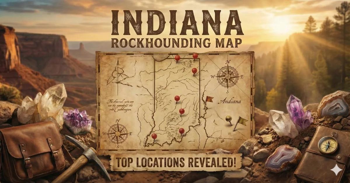
Southern Indiana sits on a thick sequence of Paleozoic sedimentary rock — Mississippian-age limestone, shale, and siltstone — that produces collectible geodes, calcite and celestite crystals, placer gold from glacial deposits, and some of the best fossil collecting in the Midwest. The primary public collecting area is the Hoosier National Forest in Monroe, Lawrence, and Brown counties, managed by the USDA Forest Service. Surface collecting for personal use is permitted on National Forest land under 36 CFR 261.9. Quarries and creek beds on private land require landowner permission.
Indiana does not have BLM land. Most mineral collecting outside the National Forest happens on private property, in active or abandoned limestone quarries (with permission), and along public road cuts. The state's geology is entirely sedimentary — no igneous or metamorphic basement rock is exposed at the surface — so you will not find the corundum, beryl, or tourmaline common in Appalachian states. What Indiana does produce, it produces well: geodes filled with quartz, calcite, and occasionally celestite; fossiliferous limestone loaded with Paleozoic marine life; and fine-grained gold deposited by Pleistocene glaciers.

Geology Overview
Indiana's bedrock is almost entirely Paleozoic sedimentary rock, ranging from Ordovician limestones in the southeast to Pennsylvanian sandstones and shales in the southwest. The south-central part of the state — Monroe, Lawrence, Owen, and Orange counties — is the heart of the Indiana limestone belt, where the Salem Limestone (Mississippian age, roughly 340 million years old) has been quarried for building stone since the 1820s. This same formation and the overlying Harrodsburg and St. Louis limestones host the geode-bearing zones that make Indiana a destination for collectors.
The northern two-thirds of the state is covered by glacial till — unsorted sediment deposited by Pleistocene ice sheets. The Illinoian and Wisconsinan glaciations scraped material from as far north as Canada and dumped it across Indiana. This till contains Lake Superior agates, jasper, and small quantities of placer gold eroded from gold-bearing source rock in Ontario and deposited in stream gravels as the glaciers melted.
The geodes form in the Harrodsburg Limestone and the Fort Payne Formation. They started as concretions or voids in the original marine sediment, then were slowly filled with silica-rich groundwater over millions of years. The result: hollow or partially hollow spheres lined with quartz crystals, sometimes with calcite, dolomite, pyrite, sphalerite, millerite, kaolinite, or celestite inside.
Top Collecting Locations
1. Hoosier National Forest — Geode Creek Beds (Monroe / Lawrence / Brown Counties)
Land Status: USDA Forest Service — Hoosier National Forest. Surface collecting of reasonable quantities for personal use is permitted. No commercial extraction. No motorized digging equipment on NF land.
GPS (general area): 38.88°N, 86.52°W (south of Bloomington along State Road 446 corridor).
Vehicle: 2WD sedan to most trailheads. Some forest roads are gravel and may require higher clearance in wet conditions.
Specimens: Keokuk-type geodes with quartz crystal linings, calcite crystals, pyrite, millerite (nickel sulfide needles), kaolinite clay, occasional celestite and sphalerite.
Fee: None. Free public land.
The creek beds within the Hoosier National Forest are the most accessible geode collecting sites in Indiana. Geodes weather out of the Harrodsburg Limestone and Fort Payne Formation and accumulate in stream gravels. Walk the creeks and look for round or oblate gray-brown nodules ranging from golf ball to basketball size. The exterior is typically rough, chalky, and lighter in color than surrounding limestone cobbles. Geodes feel lighter than solid rock of similar size because they are hollow or partially hollow.
The best collecting is after spring rains, when high water moves fresh geodes downstream and deposits them on gravel bars. Concentrate on the outside bends of creeks where heavier material accumulates. Many geodes can be picked up by hand. To check if a nodule is a geode before cracking it, tap it with a rock hammer — a hollow geode produces a distinctly higher-pitched ring than a solid concretion.
Access the area from State Road 446 south of Bloomington, or from forest roads branching off State Road 37 and State Road 58. The Hickory Ridge and Charles C. Deam Wilderness trailheads provide direct access to creek drainages. Park at designated trailheads and walk downstream.
2. Falls of the Ohio State Park (Clark County)
Land Status: Indiana State Park, managed by Indiana Department of Natural Resources (DNR). Collecting fossils from the exposed fossil beds is prohibited. Loose material from the riverbank gravel bars below the dam may be collected in small quantities — confirm current rules at the visitor center.
GPS: 38.278°N, 85.770°W (Clarksville, directly across the Ohio River from Louisville, KY).
Vehicle: 2WD. Paved parking lot.
Specimens: Devonian-age (approximately 386 million years old) tabulate and rugose coral fossils, brachiopods, bryozoans, crinoid stems, and trilobite fragments exposed on the bedrock surface. Geodes and chert nodules in river gravel.
Fee: Parking fee applies ($7 in-state / $9 out-of-state as of 2025 — verify current rates).
The Falls of the Ohio exposes one of the largest naturally exposed Devonian fossil beds in the world — over 220 acres of fossiliferous limestone visible at low water. The coral reef here is approximately 386 million years old, from a time when Indiana sat near the equator under a shallow tropical sea. Tabulate corals (Favosites, Halysites), rugose horn corals, massive stromatoporoids, and brachiopods are visible in situ on the bedrock surface.
You cannot remove material from the fossil beds themselves. They are protected. But the interpretive center is excellent, and the exposure is worth the visit for any collector interested in paleontology. The river gravel bars downstream and along the bank do contain loose fossils, chert, and occasional geodes — check with park staff for current collecting regulations before picking anything up.
3. Morgan Creek / Brown County — Glacial Gold
Land Status: Mix of private land and Brown County State Park (Indiana DNR). Gold panning in the state park is not permitted without specific authorization. Most productive panning sites are on private land along Morgan Creek and its tributaries — seek landowner permission.
GPS (general area): 39.17°N, 86.23°W (Morgan Creek area, south of Nashville, IN).
Vehicle: 2WD to access roads. Walking access to creek sites.
Specimens: Fine flour gold and occasional small flake gold in stream gravels. Associated heavy minerals include magnetite, garnet sand, and ilmenite.
Fee: None on private land with permission.
Indiana is not a gold state in the traditional sense, but glacial action deposited fine gold across the southern till boundary. The Illinoian glaciation carried gold-bearing material from sources in Ontario and Michigan and deposited it across central and southern Indiana. As streams eroded through this glacial till, gold concentrated in gravel deposits — particularly at bedrock contact points and behind large boulders in stream channels.
Morgan Creek in Brown County and its tributaries are the most reported gold-bearing streams in the state. The gold is fine — typically flour gold smaller than a pinhead — and requires patience with a gold pan. You will not find nuggets. Use a 14-inch gold pan, classify your material through a 1/4-inch screen, and work slowly. Black sand concentrates are the indicator you are in the right material. A snuffer bottle helps pick the smallest flakes from the pan.
Gold has also been reported in Morgan County creek gravels near Martinsville and in the glacial drift of Knightstown (Henry County). Amounts are always small. This is prospecting for the experience and the geology lesson, not for economic return.
4. Limestone Quarries — Calcite and Celestite Crystals (Lawrence / Monroe Counties)
Land Status: Private. All active and abandoned quarries are on private land. You must obtain written permission from the quarry operator before entering. Trespassing in quarries is illegal and dangerous.
GPS (general area): 38.85°N, 86.50°W (Bedford-Bloomington limestone belt corridor).
Vehicle: 2WD to quarry access roads (if permitted entry).
Specimens: Calcite crystals (dog-tooth spar and rhombohedral forms), celestite (strontium sulfate — pale blue tabular crystals), pyrite, marcasite, sphalerite, fluorite (rare), and fossil-rich limestone slabs.
Fee: Varies. Some quarry operators allow collecting during organized club visits at no charge. Others may deny access entirely.
The Bedford-Bloomington limestone belt in Lawrence and Monroe counties contains dozens of active and abandoned quarries cutting through the Salem Limestone and associated formations. Vugs (solution cavities) within the limestone occasionally contain well-formed calcite crystals, sometimes with celestite. Celestite from Indiana quarries forms pale blue to colorless tabular crystals up to several centimeters across. These are among the better celestite specimens found in the Midwest.
The best approach is to join the Indiana Geological Society or a local rockhounding club (the Central Indiana Gem and Mineral Society or the Bloomington Gem and Mineral Club) that organizes permitted quarry trips. Going through an organized group is often the only way to access active quarry sites. Do not attempt to enter any quarry — active or abandoned — without explicit permission. Quarry walls are unstable, equipment is in operation, and legal liability makes operators cautious about visitors.
5. Knobstone Escarpment Road Cuts (Clark / Floyd / Washington Counties)
Land Status: Public road right-of-way and adjacent National Forest land.
GPS (general area): 38.55°N, 86.15°W (along I-64 and State Road 60 corridor through the Knobstone Escarpment).
Vehicle: 2WD. Pull off at road cuts along state highways.
Specimens: Mississippian-age fossils (crinoids, brachiopods, bryozoans, horn corals), geodes, chert nodules with fossil inclusions.
Fee: None.
The Knobstone Escarpment is a prominent geological feature running north-south through south-central Indiana where the resistant Knobstone shales and siltstones form a line of steep hills. Road cuts along I-64, State Road 60, and State Road 135 through this region expose Mississippian-age formations rich in marine fossils. Crinoid stem fragments are abundant — look for small disc-shaped segments in the limestone rubble. Complete crinoid calyxes (the flower-like head) are rare but present. Horn corals, brachiopods, and lacy bryozoans are common.
Park safely off the road. Stay within the right-of-way. Collect only loose material from the base of cuts — do not climb on or dig into road cut faces.
6. Pipe Creek Junior Fossil Site (Grant County)
Land Status: Private land — access managed through the Indiana State Museum and associated research programs. Public collecting is not currently permitted, but the site is worth noting.
GPS: Near 40.52°N, 85.67°W (near Swayzee, IN).
Specimens: Late Pliocene vertebrate fossils — one of the most important pre-Ice Age fossil sites in eastern North America.
This site has produced fossils of mastodons, ground sloths, giant beavers, and other Pliocene megafauna. It is a research site and not open for casual collecting, but the Indiana State Museum in Indianapolis occasionally runs public outreach events related to the site. Check their calendar.
Minerals Found in Indiana
| Mineral | Hardness | Where in Indiana | What to Look For |
|---|---|---|---|
| Quartz (geode linings) | 7 | Hoosier NF creek beds, south-central IN | Crystal-lined hollow spheres in stream gravel. Gray-brown rough exterior. |
| Calcite | 3 | Limestone quarries, geode interiors | Dog-tooth spar (pointed scalenohedral crystals) and rhombohedral crystals. White to honey-colored. Fizzes with dilute HCl. |
| Celestite (Celestine) | 3–3.5 | Lawrence/Monroe County quarries | Pale blue to colorless tabular crystals in limestone vugs. Strontium sulfate — SG 3.96 (heavier than calcite). |
| Pyrite | 6–6.5 | Geode interiors, coal measures, quarries | Brassy yellow metallic cubes or pyritohedra. Common inside geodes and in shale. |
| Sphalerite | 3.5–4 | Geode interiors | Resinous brown to honey-colored crystals with six directions of cleavage. Smells of sulfur when scratched. |
| Millerite | 3–3.5 | Geode interiors (rare) | Extremely fine, hair-like brass-colored nickel sulfide needles inside geodes. Distinctive and collectible. |
| Fluorite | 4 | Quarries (rare) | Cubic or octahedral crystals, purple to green to colorless. Rare in Indiana — more common across the border in the Illinois-Kentucky fluorspar district. |
| Gold (placer) | 2.5–3 | Brown/Morgan County streams, glacial gravels | Fine flour gold in black sand concentrates at bedrock contact in streams. Very fine — use a gold pan and snuffer bottle. |
| Marcasite | 6–6.5 | Geode interiors, shale | Pale brassy yellow, tabular or cockscomb crystal groups. More brittle than pyrite. |
| Chert / Flint | 7 | Statewide in limestone formations | Gray to brown, waxy luster, conchoidal fracture. Common as nodules in limestone. Indiana chert was used for tools by prehistoric peoples. |
Field Identification Tips
Geode vs. Concretion
Both are round and found in the same stream gravels. A geode is hollow or partially hollow, lined with crystals. A concretion is solid. Pick it up — a geode of the same size feels lighter. Tap it with a rock hammer — a hollow geode rings at a higher pitch than a solid concretion, which thuds. If you are unsure, a controlled crack with a hammer and chisel along the equator will reveal the interior without destroying the specimen.
Calcite vs. Quartz
Both form crystals inside geodes and in quarry vugs. Calcite fizzes when you apply a drop of dilute hydrochloric acid (10% HCl) or even strong white vinegar. Quartz does not react. Calcite has a hardness of 3 — a steel knife scratches it easily. Quartz (hardness 7) scratches steel. Calcite crystals tend toward rhombohedral or scalenohedral (dog-tooth) shapes. Quartz forms hexagonal prisms with pointed terminations.
Celestite vs. Calcite
Both can be white or pale-colored in Indiana quarries. Celestite (SG 3.96) is noticeably heavier than calcite (SG 2.71) for the same size crystal. Celestite has orthorhombic crystal habit (tabular) while calcite is trigonal (rhombohedral). Celestite does not fizz with HCl. A flame test is the most definitive field method: celestite produces a crimson-red flame due to its strontium content. Touch a chip to a lighter or propane torch flame. Red flame = celestite.
Pyrite vs. Gold
In Indiana, the question is mostly academic — pyrite occurs in geodes and shale, while gold occurs as fine placer grains in stream gravels. Pyrite is brassy yellow with a greenish tint, hard (6–6.5), and brittle — it shatters when struck. Gold is softer (2.5–3), malleable (flattens when struck), and a warmer, richer yellow. In the gold pan, gold stays at the very bottom of the pan with the heaviest material. Pyrite is lighter and washes out with the black sand if you are aggressive with your pan technique.
Recommended Tools
| Tool | Use |
|---|---|
| Rock hammer (crack hammer, 2-3 lb) | Opening geodes, breaking limestone to check for fossils and crystals |
| Cold chisel (1 inch) | Splitting geodes cleanly along the equator |
| Safety glasses | Mandatory when hammering. Rock and quartz fragments are sharp. |
| 10x hand lens (loupe) | Examining crystal faces, identifying millerite needles in geodes, checking fossil detail |
| Gold pan (14-inch) | Panning glacial gold in Brown/Morgan County streams |
| Classifying screen (1/4-inch mesh) | Screening gravel before panning to remove oversize material |
| Snuffer bottle | Picking fine flour gold from the pan — essential for Indiana's very fine placer gold |
| Dilute HCl or white vinegar | Acid test for calcite (fizzes) vs. quartz (no reaction) |
| Spray bottle with water | Wetting fossils and crystal surfaces in the field reveals detail invisible when dry |
| Bucket and newspaper | Transporting geodes. Wrap individually in newspaper to prevent crystal damage from contact. |
| Sturdy boots (waterproof preferred) | Creek walking for geodes. You will be wading. |
| Knee pads | Kneeling on limestone gravel while panning or sorting fossils |
Legal Notes and Collecting Regulations
- Hoosier National Forest (USDA Forest Service): Surface collecting of rocks, minerals, and common invertebrate fossils for personal, non-commercial use is permitted under 36 CFR 261.9. No power tools, no explosives, no commercial extraction. Collect reasonable quantities only. Vertebrate fossils are protected on all federal land — do not collect fossil bone or teeth.
- Indiana State Parks (DNR): Collecting rocks, minerals, and fossils is generally prohibited in Indiana State Parks and State Forests unless specifically posted otherwise. The Falls of the Ohio fossil beds are protected — do not remove material from the bedrock exposure. Brown County State Park does not permit gold panning or mineral collecting. Check with the specific park office before collecting anything.
- Private Land: Most quarries, creek banks, and agricultural land in Indiana are privately owned. Always obtain written permission before entering private property. Many quarry operators will grant access for organized club visits but refuse unannounced individuals due to liability concerns.
- Road Cuts: Material that has fallen to the base of a road cut within the public right-of-way is generally collectible. Do not dig into the road cut face, climb on cut walls, or obstruct traffic. Park safely and legally.
- Creek Access: In Indiana, navigable waterways are public to the ordinary high-water mark. Many smaller creeks cross private land — access may require landowner permission even if the water itself is public. When in doubt, ask.
Best Times to Collect
- Geodes (creek beds): Spring (April–June) after snowmelt and spring rains flush fresh geodes out of eroding banks and into the stream gravel. Water levels should be low enough to wade safely. Avoid collecting during or immediately after heavy rains when creek levels rise fast.
- Fossils (road cuts, quarries): Year-round, but fall and early spring offer the most comfortable temperatures and best visibility. Freeze-thaw cycles in late winter break fresh fossil material from limestone faces.
- Gold panning: Late summer and early fall when stream levels are lowest and gravel bars are maximally exposed. Low water concentrates heavy material at bedrock contact.
- Quarry visits (club trips): Typically scheduled in spring and fall. Contact the Central Indiana Gem and Mineral Society or Bloomington Gem and Mineral Club for their field trip calendar.
Getting There and Logistics
The primary collecting region in south-central Indiana is centered around Bloomington (Monroe County), which is 50 miles south of Indianapolis on State Road 37. Bedford (Lawrence County), the center of the Indiana limestone industry, is 25 miles south of Bloomington. Both towns have motels, restaurants, and fuel. The Hoosier National Forest offices in Bedford can provide current forest road conditions and trail information.
For the Falls of the Ohio, the site is in Clarksville (Clark County), directly across the Ohio River from Louisville, Kentucky. Interstate access via I-65. The interpretive center is open year-round; the fossil beds are best viewed at low water levels, typically late summer through fall. Check the Ohio River stage at the McAlpine Dam gauge before visiting.
For gold panning in Brown County, Nashville, Indiana is the nearest town with services. The area is hilly and rural. Cell service is spotty. Carry a paper map of the Hoosier National Forest (available at the Bedford Ranger District office or online from the USDA Forest Service website).
Local Resources
- Indiana State Museum (Indianapolis) — Geology exhibits including Indiana minerals and fossils.
- Falls of the Ohio Interpretive Center (Clarksville) — Excellent Devonian fossil displays and guided walks on the fossil beds.
- Indiana Geological and Water Survey (Bloomington) — Publication office with geological maps and mineral locality reports. Worth a stop for serious collectors.
- Central Indiana Gem and Mineral Society — Organizes field trips to quarries and collecting sites. Membership provides access to locations not available to individual collectors.
- Bloomington Gem and Mineral Club — Local club with field trips focused on the south-central Indiana geode and fossil region.
Interactive Map
Find all Indiana collecting locations, geode sites, fossil beds, and quarry access points on our Indiana rockhounding map with GPS coordinates and access details.