
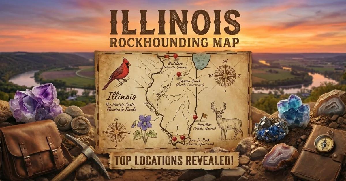
Illinois sits on Paleozoic sedimentary bedrock — mostly Ordovician through Pennsylvanian limestones, dolomites, shales, and sandstones — draped over a Precambrian basement that never surfaces within state lines. That sedimentary package, however, hosts several mineral deposits of genuine collecting interest. The Illinois-Kentucky Fluorspar District produced more fluorite than any other region in North America. The Warsaw Formation along the Mississippi River corridor yields geodes filled with quartz, calcite, and occasional kaolinite. Pennsylvanian-age ironstone concretions from the Mazon Creek area preserve some of the finest Carboniferous fossils in the world. The northwestern corner of the state, in Jo Daviess County, sits on the eastern edge of the Upper Mississippi Valley lead-zinc district, where galena and calcite crystals formed in Ordovician dolomite. Glacial drift across the northern half of the state carries agates, jasper, and Lake Superior–derived material into gravel pits and river bars.
The land situation in Illinois is straightforward: there is no BLM land and no National Forest open to unrestricted mineral collecting. Shawnee National Forest in the southern part of the state allows surface collecting of reasonable quantities of common minerals for personal use under USFS regulations (36 CFR 228.62), but digging into bedrock or using mechanized equipment is prohibited. Everything else is either state land (collecting generally prohibited without permit), county/municipal land, or private property requiring landowner permission. Fee-dig operations and rock-club field trips are the most reliable legal access points.

Top Collecting Locations
1. Illinois-Kentucky Fluorspar District — Cave-in-Rock Area (Hardin and Pope Counties)
Land Status: Mostly private land and former mining company holdings. Some areas within Shawnee National Forest boundaries. No open public mine access without permission.
GPS (town center): Approximately 37.468°N, 88.162°W (Cave-in-Rock, IL).
Vehicle: 2WD sedan to towns. High-clearance recommended for back roads to mine dump areas.
Minerals: Fluorite (purple, yellow, green, blue, amber, colorless), calcite, barite, sphalerite, galena, quartz, celestine, witherite.
This district was the largest fluorite-producing region in the United States from the late 1800s through the 1990s. Mines like the Minerva No. 1, Denton Mine, Annabel Lee, Hill Mine, and Rosiclare operations extracted fluorite from replacement deposits in Mississippian-age limestone. The fluorite formed when hydrothermal fluids — heated brines carrying dissolved calcium and fluorine — migrated upward along fault systems and replaced carbonate host rock. These same fluids deposited the associated minerals: calcite as massive white rhombohedra, barite as tabular crystals, sphalerite in honey-brown masses, and galena as cubic or octahedral crystals.
Active mining ceased by the mid-1990s. The mines are flooded and sealed. What remains for collectors are mine dumps — piles of waste rock left on the surface during decades of extraction. Some dumps still produce excellent cabinet-grade fluorite specimens, but nearly all sit on private land. The Ben E. Clement Mineral Museum in Marion, KY (just across the Ohio River) displays specimens from the district and can direct visitors to local landowners who occasionally grant access. The Rosiclare area on the Illinois side and the Denton Mine dump near Cave-in-Rock are the most historically productive surface-collecting sites, but you must secure written permission before entering any dump.
Illinois fluorite is the official state mineral. Specimens from this district are recognized worldwide. Purple cubes on white calcite matrix are the classic association, but the district also produced rare blue fluorite, yellow cubes with phantom growth zones, and green octahedral crystals. If you are serious about collecting here, contact the Southern Illinois Mineral Society or attend the annual Gem, Mineral, and Fossil Show in Marion, IL, where local collectors sell and trade district specimens and can provide current access information.
2. Warsaw and Hamilton Area — Mississippi River Geodes (Hancock County)
Land Status: Mix of private farmland, creek access (varies by county), and occasional public road cuts. Permission required for creek banks on private property.
GPS (collecting area): Approximately 40.350°N, 91.430°W (Warsaw, IL). The geode-producing zone extends along the Mississippi River bluffs from Warsaw south to Hamilton and across the river into Keokuk, Iowa.
Vehicle: 2WD sedan for road-accessible sites. High-clearance for unpaved county roads after rain.
Minerals: Geodes containing quartz crystals (druzy to macro), chalcedony, calcite (including scalenohedral dogtooth spar), kaolinite, pyrite, sphalerite, millerite, goethite, and occasional barite.
The Warsaw Formation is a Mississippian-age limestone (approximately 340 million years old) that contains geodes in a specific dolomitic zone. These geodes formed when groundwater dissolved carbonate nodules and later deposited silica and other minerals inside the resulting cavities. The geodes weather out of the formation and accumulate in creek beds, plowed fields, and river gravel bars below the bluffs. Sizes range from golf balls to basketballs. Most are lined with druzy quartz — a surface of tiny, sparkling quartz crystals — but a percentage contain well-formed quartz points, calcite crystals, or chalcedony botryoids. A small number are hollow and rattle when shaken (called "rattlers" by local collectors — these contain loose quartz crystals or sediment).
Creek collecting is the most productive method. Streams that cut through the Warsaw Formation carry geodes downstream. Look for round, rough-textured, slightly heavy stones in creek gravel bars. The outer shell of a Warsaw geode is typically a gray-brown chalcedony rind, harder than the surrounding limestone. A broken geode is easy to spot — the interior sparkles. Whole geodes can be tested by weight: they are heavier than equivalent-sized limestone cobbles because of the dense quartz and chalcedony lining.
The town of Hamilton, IL, calls itself the "Geode Capital" and has hosted geode-related festivals. The Keokuk, Iowa, side of the river has more established public access points (see our Iowa geode guide), but the Illinois side produces identical material from the same formation. Ask at local hardware stores or gas stations in Warsaw and Hamilton about creek access — some landowners allow collecting for a small fee or by permission.
3. Mazon Creek — Fossil Concretions (Will and Grundy Counties)
Land Status: Former strip mine lands, now a mix of reclaimed state conservation areas (Mazonia-Braidwood State Fish and Wildlife Area) and private property. Collecting at the state site is subject to IDNR regulations — check current rules before visiting.
GPS (state site): Approximately 41.258°N, 88.212°W (Mazonia-Braidwood State Fish and Wildlife Area, near Braidwood, IL).
Vehicle: 2WD sedan. Paved and gravel roads to parking areas.
Specimens: Ironstone concretions containing Pennsylvanian-age fossils — fern fronds, seed fern foliage, tree bark impressions, jellyfish (the Tully Monster, Tullimonstrum gregarium), shrimp, worms, fish, insects, and horseshoe crabs.
The Mazon Creek fossil beds are among the most important Carboniferous fossil localities on Earth. Approximately 309 million years ago, this area was a coastal river delta system — a tropical swamp that fed into a shallow sea. Organisms that died in the anoxic mud were rapidly encased in siderite (iron carbonate) concretions before decomposition destroyed soft tissue detail. The result is an exceptional preservation window: jellyfish tentacles, worm bristles, insect wings, and delicate fern pinnules are all preserved as impressions in split concretions. This type of fossil site, where soft-bodied organisms are preserved alongside hard-shelled ones, is called a Lagerstatten — one of only a handful worldwide.
The most famous Mazon Creek fossil is the Tully Monster (Tullimonstrum gregarium), designated the Illinois State Fossil in 1989. It is a soft-bodied marine animal — roughly six inches long, with a proboscis ending in a toothed claw and eyes on stalks — found nowhere else in the fossil record. Every Tully Monster specimen ever described came from Mazon Creek concretions.
Collecting involves splitting ironstone concretions, which are oval, dark gray, and range from fist-sized to football-sized. They fracture along a plane that often passes through the fossil. A heavy-duty flathead screwdriver or masonry chisel and a hammer work for splitting. Not every concretion contains a recognizable fossil — expect to split dozens before finding a good specimen. The best material historically came from active coal strip mine spoil piles (Francis Creek Shale), but most active mines are now closed or access is restricted. The Mazonia-Braidwood State Fish and Wildlife Area occupies reclaimed strip mine land and has historically been the primary public access point. Contact the Illinois Department of Natural Resources for current collecting regulations at this site, as rules have changed periodically.
4. Galena Area — Lead-Zinc District (Jo Daviess County)
Land Status: Private land. No public mine access. Some mine dumps on private property — landowner permission required.
GPS (town center): Approximately 42.417°N, 90.429°W (Galena, IL).
Vehicle: 2WD sedan for town and paved roads. High-clearance for county gravel roads.
Minerals: Galena (lead sulfide — cubic crystals), sphalerite (zinc sulfide), calcite, marcasite, pyrite, smithsonite, cerussite, anglesite.
The town of Galena is literally named after the mineral. Jo Daviess County sits on the eastern margin of the Upper Mississippi Valley Zinc-Lead District, which produced lead and zinc from Ordovician-age Galena Dolomite from the 1820s through the mid-1900s. The ore formed in solution cavities and along bedding planes in the dolomite, deposited by low-temperature hydrothermal fluids. Galena crystals from this district are typically cubes or cubo-octahedra, sometimes several inches across. Calcite rhombohedra and scalenohedral crystals (dogtooth spar) are common associates. Sphalerite (zinc ore) occurs as brown to yellow-brown masses and crystals.
Surface collecting opportunities are limited to mine dumps on private land and occasional specimens in road cuts through the Galena Dolomite. The Vinegar Hill Lead Mine and Museum (open seasonally) provides historical context and sometimes offers access to dump material. Contact local historical societies and the Jo Daviess County Convention and Visitors Bureau for current access to collecting sites. Rock shops in Galena sell local specimens.
5. Lake Michigan Shoreline — Beach Agates and Glacial Material (Lake and Cook Counties)
Land Status: Public beaches (city, county, and state parks along the Lake Michigan shore). Illinois Beach State Park is the primary public collecting site.
GPS (Illinois Beach State Park): Approximately 42.430°N, 87.810°W (Zion, IL).
Vehicle: 2WD sedan. Paved roads to parking areas.
Minerals: Lake Superior agates, jasper, chalcedony, petrified coral (Petoskey-type), and assorted igneous/metamorphic glacial erratics (granite, basalt, gneiss).
The glaciers that covered northern Illinois transported rock material from as far north as the Lake Superior basin. Among that material are Lake Superior agates — banded, iron-stained chalcedony with translucent to opaque red, orange, yellow, and white banding. These agates originated in Precambrian basalt flows along the north shore of Lake Superior and were plucked and carried southward by glacial ice. They now reside in glacial till, outwash gravel, and — most accessibly — along the wave-sorted beaches of Lake Michigan's Illinois shoreline.
The agates are small (typically 0.5 to 2 inches). Walk the beach at low water, scanning the wet gravel line. The banding and translucency of an agate stand out when wet. A sunny day helps — backlight reveals internal banding. Illinois Beach State Park in Zion offers the best public beach access for this type of collecting. Waukegan Beach, Montrose Beach in Chicago, and other public lakefront areas produce occasional specimens as well.
6. Gravel Pits — Statewide (Northern and Central Illinois)
Land Status: Private commercial operations. Written permission required from pit operator.
Vehicle: Per operator requirements — typically 2WD to the pit office. Steel-toed boots and hard hats may be required on-site.
Minerals: Agates (banded and fortification types), jasper, petrified wood, chalcedony, Lake Superior agates, fossiliferous chert, and glacial erratics.
Commercial gravel pits throughout northern and central Illinois process glacial outwash and till deposits. The screening and washing process concentrates dense, hard material — including agates and jasper — in the reject piles and oversize bins. Pit operators who allow collecting usually do so on weekends when equipment is not running. Some charge a small fee; others allow it free with a signed liability waiver. The most productive pits work deposits of Illinoian or Wisconsinan glacial outwash. Ask at the pit office and bring a bucket.
Minerals Found in Illinois
| Mineral | Hardness | Where in Illinois | What to Look For |
|---|---|---|---|
| Fluorite (state mineral) | 4 | Hardin and Pope Counties (Cave-in-Rock, Rosiclare) | Cubic or octahedral crystals. Purple, yellow, green, blue, amber, colorless. Glassy luster. Fluoresces under UV light. |
| Galena | 2.5 | Jo Daviess County (Galena area); also Hardin County | Heavy, lead-gray cubic crystals with bright metallic luster on fresh surfaces. Very dense — noticeably heavy in hand. |
| Calcite | 3 | Statewide in limestone; best crystals in Hardin and Jo Daviess Counties | White to clear rhombohedral or scalenohedral (dogtooth) crystals. Fizzes in dilute HCl. |
| Sphalerite | 3.5–4 | Hardin County fluorspar district; Jo Daviess County | Brown to honey-yellow resinous crystals. Tetrahedral habit. Often with galena. |
| Quartz (geode linings) | 7 | Hancock County (Warsaw/Hamilton geode zone) | Druzy crystal surfaces inside geodes. Clear to white. Vitreous luster. |
| Chalcedony / Agate | 7 | Geodes (Hancock County); gravel pits and lake beaches statewide | Translucent, waxy luster. Banded in agates. Gray-brown rind on geodes. |
| Barite | 3–3.5 | Hardin County fluorspar district | White to pale blue tabular crystals. Unusually heavy for a light-colored mineral (SG 4.5). |
| Celestine | 3–3.5 | Hardin County; scattered in Mississippian limestones | Pale blue tabular or prismatic crystals. Similar to barite but lighter and often bluer. |
| Marcasite / Pyrite | 6–6.5 | Mazon Creek concretions; Warsaw Formation geodes; coal measures | Brass-yellow metallic crystals. Marcasite: tabular, often tarnished. Pyrite: cubic. |
| Siderite (fossil concretions) | 3.5–4 | Will and Grundy Counties (Mazon Creek) | Dark gray-brown ironstone nodules. Dense and heavy. Split to reveal fossil impressions. |
Field Identification Tips
Fluorite vs. quartz: Fluorite has hardness 4 — a steel knife scratches it easily. Quartz has hardness 7 and will scratch glass. If you find a purple or green crystal that a knife blade scratches, it is likely fluorite. Fluorite also has perfect octahedral cleavage: broken pieces tend to form triangular or octahedral fragments. Quartz shows conchoidal (shell-shaped) fracture instead. Under shortwave UV light, most Illinois fluorite fluoresces blue-violet — carry a portable UV lamp for field confirmation.
Galena vs. other metallic minerals: Galena is extremely dense (SG 7.6) and soft (hardness 2.5). Pick it up — it feels heavier than it should. A fingernail nearly scratches it. It breaks along perfect cubic cleavage planes with a bright, fresh metallic surface. Pyrite (hardness 6–6.5) is much harder and lighter by comparison.
Geode identification: Warsaw Formation geodes have a rough, bumpy exterior rind of chalcedony and silicified limestone, usually gray-brown. They are heavier than the surrounding limestone cobbles. Tap with a rock hammer — a solid geode sounds dull; a hollow one sounds faintly resonant. Do not break geodes in the field if you want a clean split. Take them home and use a pipe cutter, soil-pipe cutter, or chisel-and-score method for a controlled opening.
Mazon Creek concretions: The concretions are oval to disc-shaped, dark gray-brown, and composed of siderite (iron carbonate). They are denser than typical sedimentary rocks. To split, place a heavy flathead screwdriver or masonry chisel along the equator of the concretion and strike sharply. The concretion should fracture along the fossil plane. Examine both halves — one side typically has the mold (impression), the other the counter-mold. Fern fossils appear as dark carbonized impressions. Tully Monsters show as a compressed outline of the body, proboscis, and eye bar.
Lake Superior agates: On a wet beach, these agates show orange-red to brown banding with translucent zones. They are harder than most surrounding gravel (hardness 7). Dry, they look dull and can resemble ordinary brown pebbles. The diagnostic feature is banding — concentric fortification-style bands visible through translucent surfaces. Hold the stone toward the sun. If light passes through and you see internal banding, you have an agate.
Tools and Equipment
| Item | Use |
|---|---|
| Rock hammer (crack hammer or bricklayer's style) | Breaking matrix, splitting concretions, testing hardness. Essential for all Illinois collecting. |
| Cold chisel set (various widths) | Splitting geodes and concretions along controlled planes. Masonry chisels work well. |
| Safety glasses | Mandatory when splitting rock. Fluorite, quartz, and siderite all produce sharp fragments. |
| 10x hand lens | Examining crystal faces, fossil detail, and mineral identification in the field. |
| Shortwave UV lamp | Fluorite fluoresces blue-violet under shortwave UV. Useful for confirming identification on mine dumps. |
| Steel knife or file | Scratch testing. Fluorite (4) is scratched by steel (5.5). Quartz (7) is not. |
| Spray bottle | Wetting specimens reveals color, banding, and crystal faces obscured by dust. |
| 5-gallon buckets | Carrying geodes and concretions. These are heavy — do not overload. |
| Newspaper or bubble wrap | Wrapping fluorite and calcite specimens. Both minerals are soft and scratch easily in a bucket. |
| Sturdy boots | Mine dumps, creek beds, and gravel pits have uneven terrain and sharp debris. |
| Garden trowel or small shovel | Digging geodes from creek banks. Not needed on mine dumps or beaches. |
Legal Notes
No BLM land: Illinois has no Bureau of Land Management land. The default public-land collecting framework used in western states does not apply here.
Shawnee National Forest: Surface collecting of reasonable quantities of common rocks and minerals for personal, non-commercial use is permitted on National Forest land under 36 CFR 228.62. This does not authorize digging into bedrock, using power tools, creating excavations, or removing petrified wood (which falls under a separate permit system). The fluorspar district partially overlaps Shawnee NF boundaries, but most productive mine dumps are on private inholdings within the forest, not on Forest Service land itself. Verify boundaries before collecting.
State parks and conservation areas: Collecting rocks, minerals, and fossils is generally prohibited in Illinois State Parks and State Natural Areas. The Mazonia-Braidwood State Fish and Wildlife Area (Mazon Creek) has had varying policies on fossil collecting over the years — some periods of open collecting and some restrictions. Contact the Illinois Department of Natural Resources (IDNR) site office or call (815) 237-0063 for current regulations before visiting.
Private land: Most productive collecting sites in Illinois — mine dumps, creek banks, gravel pits, farm fields with geodes — are on private property. Always obtain written permission from the landowner or operator before collecting. Liability waivers may be required at commercial operations. Never cross fences, ignore posted signs, or enter sealed mine openings.
Mine safety: Old lead and zinc mines in Jo Daviess County and old fluorspar mines in Hardin County have open shafts, unstable ground, and potential for collapse. Do not enter underground workings under any circumstances. Surface dumps are generally safe but watch for hidden shafts, unstable slopes, and rusty metal debris.
Fossil collecting: Common invertebrate and plant fossils on private land can be collected with landowner permission. Vertebrate fossils (fish, amphibians) found on state or federal land may be subject to additional regulations. When in doubt, consult with the Illinois State Geological Survey.
Practical Tips
- Best seasons: Spring through fall for creek and field collecting. Geodes are easiest to spot in creeks after spring runoff. Mine dumps and gravel pits are accessible year-round when not snow-covered. Beach collecting along Lake Michigan is best in spring and fall when wave action turns over gravel.
- Rock clubs: The Southern Illinois Mineral Society, the Joliet Gem and Mineral Club, the Chicago Rocks and Minerals Society, and the Earth Science Club of Northern Illinois all run field trips to collecting sites. Club membership often provides access to private land that is otherwise closed to individuals.
- Dealers and shows: The annual mineral shows in Marion (southern Illinois) and at various Chicago-area venues sell Hardin County fluorite, Mazon Creek fossils, and Galena-district specimens. These shows are also the best place to meet local collectors and learn about current access to sites.
- Weather: Southern Illinois (fluorspar district and Shawnee NF) is hot and humid in summer — bring water, insect repellent, and watch for ticks. Northern Illinois sites are cold from November through March.
- Illinois State Geological Survey: The ISGS (part of the Prairie Research Institute at the University of Illinois) publishes geological maps, mineral locality reports, and field guides. Their publications are the most reliable source for geological context on any Illinois collecting location.
Interactive Map
Find all Illinois collecting locations — fluorite mine dumps, geode creeks, fossil sites, and gravel pits — on our Illinois rockhounding map with GPS coordinates and access details.