
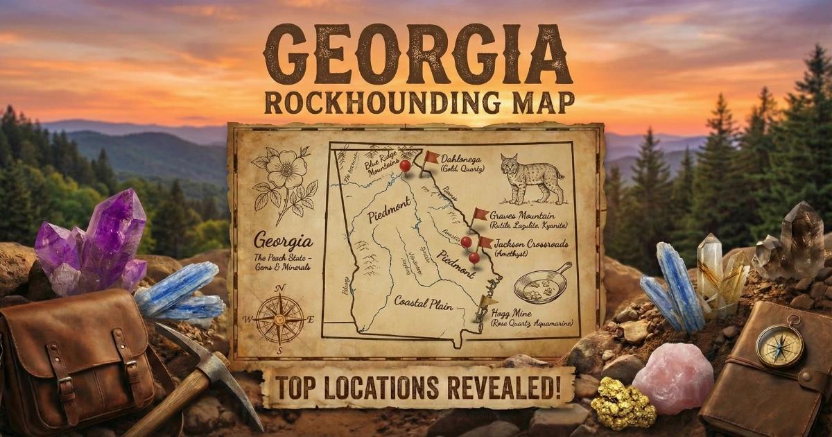
Georgia sits on some of the oldest rock in eastern North America. The northern third of the state — from the Fall Line up through the Blue Ridge — is built on Precambrian metamorphic and igneous basement that has been folded, faulted, heated, and compressed over roughly a billion years. That kind of geologic history produces minerals. Gold, rubies, sapphires, amethyst, lazulite, rutile, kyanite, staurolite, garnet, and iridescent hematite all come out of Georgia ground. If you know where to look and what formation you are standing on, this state delivers specimens that rival localities with bigger reputations.
I have collected at Graves Mountain during open-house weekends, panned gold in the creeks around Dahlonega, and pulled amethyst scepters from red clay at Jackson's Crossroads. Georgia is not a state where you wander aimlessly and hope for the best. The good localities are specific, the access rules matter, and the geology controls everything. This guide covers the rock underfoot, the sites worth visiting, and the practical details you need before you drive out.

Georgia's Geology: Why These Minerals Exist Here
Georgia is divided into five physiographic provinces, and three of them matter for gem hunting: the Blue Ridge, the Piedmont, and the Coastal Plain.
The Blue Ridge province occupies the northeastern corner of the state. It is composed of high-grade metamorphic rocks — gneiss, schist, amphibolite, and quartzite — that formed deep in the crust during the Grenville orogeny (roughly 1.1 billion years ago) and were reworked during later Appalachian mountain-building events. These rocks host corundum (ruby and sapphire), garnet, staurolite, and kyanite. The metamorphic conditions that created them involved temperatures above 500°C and pressures measured in kilobars. That is the environment where aluminum-rich minerals like corundum and kyanite crystallize.
The Piedmont province stretches from the Blue Ridge foothills south to the Fall Line near Macon. The Piedmont is underlain by metamorphosed volcanic and sedimentary rocks intruded by granitic plutons. Graves Mountain, the state's most famous mineral locality, sits in the eastern Piedmont on a mass of metamorphosed volcanic rock — originally a rhyolitic tuff — that was altered by hydrothermal fluids and regional metamorphism. That alteration produced the unusual mineral assemblage (lazulite, rutile, kyanite, pyrophyllite, iridescent hematite) that makes the site so distinctive. The Georgia gold belt runs through the Piedmont and into the Blue Ridge, following a zone of metamorphosed mafic and ultramafic volcanic rocks where gold was deposited by hydrothermal fluids during the Taconic and Acadian orogenies.
The Coastal Plain covers the southern two-thirds of the state. The bedrock here is buried under Cretaceous and Tertiary sediments. The mineral collecting opportunities are different — no metamorphic gems, but fossil shark teeth wash out of marine sedimentary layers along rivers and at coastal exposures. The sediments date from periods when shallow seas covered this part of the continent.
Understanding which province you are standing in tells you what to expect. Do not go looking for rubies in the Coastal Plain or shark teeth in the Blue Ridge. The geology is the map.
Collecting Locations
1. Graves Mountain (Lincoln County)
GPS: Approximately 33.747°N, 82.497°W.
Land Status: Private property. Access is limited to periodic open-house collecting events, typically held in spring (April) and fall (October). These events are organized in coordination with local mineral clubs and societies. No collecting outside scheduled events.
Target Minerals: Lazulite (deep blue phosphate mineral), rutile (red-brown metallic crystals, sometimes twinned), kyanite (blue bladed crystals), pyrophyllite (soft white-green layered mineral), iridescent hematite (thin specular plates with rainbow surface colors), quartz.
Graves Mountain is a world-class mineral locality. The mountain is an exposure of metamorphosed felsic volcanic rock — originally a rhyolite or rhyolitic tuff — that was subjected to both hydrothermal alteration and regional metamorphism. The lazulite occurs as deep blue masses and crystals in a matrix of quartz and kyanite. The rutile forms striking red-brown prismatic crystals, some showing the characteristic knee-twin habit. The iridescent hematite is specular (thin, platy, reflective) and displays interference colors caused by thin-film optical effects on the crystal surfaces.
During open-house events, collectors spread across the exposed faces and waste dumps on the mountain. Arrive at first light if you can — the events draw hundreds of people and the best surface specimens go early. Bring your own rock hammer, chisels, eye protection, and buckets. There is no fee, but you are expected to follow event rules and stay within designated collecting areas. Check with the Georgia Mineral Society or the Southern Appalachian Mineral Society for current event schedules.
2. Dahlonega Gold District (Lumpkin County)
GPS: Dahlonega town center approximately 34.532°N, 83.985°W. Gold-bearing streams radiate outward from town.
Land Status: Mix of private fee-dig/pan operations, commercial mine tours, and public waterways. Recreational gold panning on navigable public streams is generally permitted in Georgia, but always verify current regulations and ownership before entering any waterway or property.
Target Minerals: Placer gold (flour gold to small flakes and occasional nuggets).
Dahlonega was the site of the first major gold rush in the United States, beginning in 1828-1829 — a full twenty years before the California rush. A US Mint branch operated in Dahlonega from 1838 to 1861, producing gold coins stamped with the "D" mint mark. The gold occurs in quartz veins within the Dahlonega gold belt, a northeast-trending zone of metamorphosed volcanic rocks in the Blue Ridge and upper Piedmont. Placer gold eroded from these veins accumulates in stream gravels.
The Consolidated Gold Mine (185 Consolidated Gold Mine Rd, Dahlonega, GA 30533, approximately 34.539°N, 83.978°W) offers underground mine tours and gold panning. The tour takes you into the historic hard-rock mine workings. Panning is provided with guaranteed gold. This is a good starting point if you have not panned before.
For more serious recreational panning, the Chestatee River, Etowah River, and Yahoola Creek and its tributaries all carry placer gold. Work the inside bends of streams where current slows and heavy material settles. Gold concentrates in crevices in bedrock, at the base of large boulders, and in gravel bars. A basic pan, classifier screen, and snuffer bottle are all you need to start. The gold here tends to be fine — flour gold and small flakes — but persistence pays. Some recreational panners working crevices in exposed bedrock have recovered pieces weighing several grams.
3. Jackson's Crossroads Amethyst (Wilkes County)
GPS: Approximately 33.811°N, 82.816°W.
Land Status: Private property. Access has varied over the years — the site has been open for fee-dig collecting at times and closed at other times. Contact the Wilkes County Chamber of Commerce or local rock shops for current access status before planning a trip.
Target Minerals: Amethyst (including scepter crystals), smoky quartz, clear quartz.
The Jackson's Crossroads amethyst deposit produces some of the finest amethyst scepter crystals found anywhere in the eastern United States. The amethyst occurs in clay-filled vugs (cavities) within weathered metamorphic rock. The crystals grow as scepters — a flat amethyst cap sitting on a thinner clear or smoky quartz stem. This growth habit is caused by a two-stage crystallization process where conditions changed between growth episodes. The purple color comes from iron impurities activated by natural radiation.
When the site is open, collecting involves digging through stiff red clay with hand tools. The crystals are often loose within the clay pockets and can be extracted without heavy equipment, but the clay is stubborn and slow to work. Bring a sturdy digging trowel, a garden spray bottle to wash clay off specimens in place, and containers with padding for transport. The amethyst color ranges from pale lilac to deep purple. Some crystals show color zoning — purple tips fading to clear stems — which is typical of the scepter habit.
4. Staurolite (Fairy Crosses) — Blue Ridge Sites
GPS: Collecting areas in the general vicinity of 34.7°N, 83.9°W (Fannin and Gilmer counties, northern Georgia Blue Ridge).
Land Status: Various — some specimens found as float in public stream gravels, others on National Forest land (Chattahoochee National Forest — surface collecting of reasonable quantities for personal use is permitted under Forest Service regulations). Some localities are on private land. Always verify access.
Target Minerals: Staurolite (iron-aluminum silicate, often in cruciform penetration twins — the "fairy cross" shape).
Staurolite forms in medium-grade metamorphic rocks (specifically garnet-staurolite schist) at temperatures between roughly 500°C and 700°C. The crystals are prismatic and often form penetration twins at 60° or 90° angles, creating a distinctive cross shape. These cross-shaped twins are called "fairy crosses" in folk tradition. Georgia's Blue Ridge schists produce them in the same general metamorphic belt that extends into Virginia (where Fairy Stone State Park is located).
Look for staurolite crystals weathering out of mica schist exposures along road cuts, stream banks, and eroded hillsides in the northern Georgia mountains. The crystals are dark brown to reddish-brown, hard (Mohs 7-7.5), and resist weathering better than the surrounding schist, so they accumulate as float in creek gravels. Creek gravel sorting with a classifier screen is an efficient way to find them. Staurolite is denser than most surrounding gravel and will concentrate in the bottom of your classifier.
5. Ruby and Sapphire — Rabun County
GPS: General area approximately 34.88°N, 83.40°W (northeastern Georgia, near the North Carolina border).
Land Status: Mix of private land and Chattahoochee National Forest. Surface collecting on NF land is permitted for reasonable personal quantities. No digging or commercial extraction on federal land without permit. Private land requires owner permission.
Target Minerals: Ruby (red corundum), sapphire (blue and other colored corundum), garnet.
Rabun County sits on the same corundum-bearing metamorphic belt that produces rubies and sapphires across the border in Macon County, North Carolina (the Cowee Valley). The corundum occurs in mafic and ultramafic metamorphic rocks — amphibolite, dunite, and associated rocks — that were subjected to high-grade metamorphism during Appalachian orogenic events. The aluminum-rich conditions in these rocks favor corundum crystallization.
Collecting in Rabun County is more of a prospecting exercise than a structured fee-dig experience. You are working stream gravels and weathered exposures rather than organized mine dumps. The corundum is heavy (specific gravity 4.0) and resistant to weathering, so it concentrates in stream placers. Work gravel bars in streams draining areas underlain by amphibolite and related rocks. The rough is typically small — under a few carats — and tends toward pink ruby rather than deep red. Blue sapphire also appears but is less common. Bring a classifier screen and pan to concentrate heavy minerals from stream gravel, then pick through the concentrate with tweezers and a loupe.
6. Amicalola Falls Area Garnet (Dawson County)
GPS: General area approximately 34.56°N, 84.24°W (near Amicalola Falls State Park).
Land Status: Amicalola Falls State Park (no collecting permitted within state park boundaries). Surrounding area includes Chattahoochee National Forest land (surface collecting permitted) and private property (permission required).
Target Minerals: Almandine garnet, staurolite, kyanite.
The metamorphic rocks around Amicalola Falls include garnet-mica schist that weathers to release almandine garnet crystals. These are dark red to reddish-brown dodecahedral crystals, sometimes with well-formed faces. The garnets range from a few millimeters to occasionally over a centimeter in diameter. Look for them in stream gravels and on exposed weathered schist surfaces outside the state park boundaries. Road cuts along GA-52 and forest roads in the Chattahoochee NF near Amicalola have exposed garnet-bearing schist.
Do not collect within Amicalola Falls State Park itself. Georgia State Parks prohibit the removal of natural materials, including rocks and minerals. Collect on adjacent National Forest land or on private land with permission.
Minerals You Can Find in Georgia
| Mineral | Hardness (Mohs) | Where in Georgia | What to Look For |
|---|---|---|---|
| Gold | 2.5–3 | Dahlonega area, Chestatee & Etowah rivers | Yellow metallic flakes and grains in stream gravel; very heavy, sinks to bottom of pan |
| Amethyst | 7 | Jackson's Crossroads, Wilkes County | Purple quartz crystals, often scepter-shaped, in red clay pockets |
| Lazulite | 5.5–6 | Graves Mountain, Lincoln County | Deep blue masses and crystals in quartz-kyanite matrix |
| Rutile | 6–6.5 | Graves Mountain, Lincoln County | Red-brown metallic prismatic crystals, sometimes knee-twinned |
| Kyanite | 5–7 (varies by direction) | Graves Mountain; Blue Ridge road cuts | Blue bladed crystals in schist or metamorphic matrix |
| Iridescent hematite | 5.5–6.5 | Graves Mountain, Lincoln County | Thin specular plates with rainbow interference colors |
| Ruby (corundum) | 9 | Rabun County | Pink to red hexagonal crystals in stream gravel; very hard and heavy |
| Sapphire (corundum) | 9 | Rabun County | Blue, pink, or white hexagonal rough; scratches steel easily |
| Staurolite | 7–7.5 | Blue Ridge (Fannin, Gilmer counties) | Dark brown cruciform (cross-shaped) twins in schist or as creek float |
| Almandine garnet | 7–7.5 | Amicalola Falls area; Blue Ridge schists | Dark red dodecahedral crystals in mica schist or stream gravel |
| Pyrophyllite | 1–2 | Graves Mountain, Lincoln County | Soft, white to pale green, pearly layered masses |
| Shark teeth (fossil) | 5 (apatite) | Coastal Plain rivers, barrier islands | Black or dark brown triangular teeth in beach sand and river gravel |
Field Identification Tips
Knowing what you are looking at while still in the field saves time and prevents you from hauling home worthless rock. Here are the key tests and distinguishing features for Georgia minerals.
Gold vs. pyrite (fool's gold): Gold is soft (2.5–3 Mohs), malleable, and does not tarnish. If you can flatten it against a rock with your fingernail or a knife, it is gold. Pyrite is hard (6–6.5), brittle, and shatters when struck. Pyrite also has a cubic crystal habit and a sulfurous smell when scratched. In your pan, gold sits at the very bottom and stays bright yellow in all lighting. Pyrite is lighter and tends to wash out with moderate swirling.
Lazulite vs. other blue minerals: At Graves Mountain, lazulite is the deep blue mineral you are most likely to encounter. It has a vitreous luster, a hardness of 5.5–6, and occurs as granular masses or wedge-shaped monoclinic crystals. The color is a distinctive deep azure blue. Kyanite is also blue but forms elongated bladed crystals with a variable hardness (5 along the length, 7 across the width). Azurite (which does not occur at Graves Mountain) is softer (3.5–4) and effervesces in acid.
Amethyst vs. fluorite: Both are purple, but amethyst is quartz (hardness 7, conchoidal fracture, hexagonal prismatic crystals). Fluorite is softer (hardness 4), has perfect octahedral cleavage, and often forms cubic crystals. If you can scratch it with a steel knife, it is not amethyst.
Ruby/sapphire vs. garnet: Both are hard, both are heavy, and both come in red and pink tones. Corundum (hardness 9) scratches garnet (hardness 7–7.5). Corundum forms hexagonal barrel-shaped crystals; garnet forms dodecahedral or trapezohedral crystals. If you have a steel file (hardness 6.5), both will scratch it. Scratch the suspect stone against a piece of quartz — if it scratches the quartz easily and the quartz does not scratch it, you likely have corundum.
Staurolite identification: The cross-shaped twin habit is the giveaway. No other common mineral in Georgia schists forms a penetration twin at 60° or 90° angles. The crystals are dark brown, opaque, and hard enough that they do not scratch easily. If it is cross-shaped and came out of mica schist, it is staurolite.
Tools and Equipment
| Item | Purpose |
|---|---|
| Rock hammer (crack hammer or bricklayer's) | Breaking rock at Graves Mountain and hard-rock exposures. A 2–3 lb crack hammer works for most Georgia collecting. |
| Cold chisels (flat and point) | Splitting matrix rock along seams. Essential at Graves Mountain for extracting rutile and lazulite from hard host rock. |
| Safety glasses | Non-negotiable when hammering. Metamorphic rock throws sharp chips. |
| 10x hand lens (loupe) | Examining crystal faces, identifying small gems in sluice concentrate, and checking for gold in your pan. |
| Gold pan and classifier screen | Dahlonega gold panning and heavy-mineral concentration for corundum and garnet in stream gravels. |
| Snuffer bottle | Picking fine gold from your pan without losing it. |
| Digging trowel (sturdy, not a garden toy) | Clay digging at Jackson's Crossroads amethyst. The red clay is stiff and adhesive — a flimsy trowel bends. |
| Spray bottle | Wetting specimens to reveal true color. Dry minerals in Georgia red clay all look the same — wet them. |
| Tweezers | Picking small crystals from concentrate, clay, and sluice screens. |
| Buckets and padded containers | Hauling material and protecting fragile specimens (amethyst scepters, rutile crystals) during transport. |
| Steel file | Hardness testing in the field. If the specimen scratches the file, hardness is above 6.5. |
| GPS device or phone with downloaded maps | Cell service is unreliable in the north Georgia mountains. Download maps before you leave. |
Legal Framework and Access Rules
Georgia does not have BLM (Bureau of Land Management) land. This is the eastern United States — the federal land here is managed by the US Forest Service (Chattahoochee-Oconee National Forest) and the National Park Service (Chickamauga, Kennesaw Mountain, etc.). The rules differ from western BLM collecting.
Chattahoochee National Forest: Surface collecting of reasonable quantities of rocks, minerals, and fossils for personal, non-commercial use is permitted under Forest Service regulations. "Reasonable quantity" is generally interpreted as what one person can carry. No mechanized equipment, no digging significant excavations, no commercial collection without a permit. Refer to 36 CFR 261.9(a) for the regulatory language. If in doubt, contact the Chattahoochee-Oconee National Forest office in Gainesville, GA.
Georgia State Parks: Collecting rocks, minerals, fossils, and other natural materials is prohibited in Georgia State Parks. This includes Amicalola Falls, Vogel, Unicoi, and all other state parks. Do not collect within state park boundaries. The boundary is the line, not your judgment about how close you are.
Private land: Most of Georgia's best mineral localities — Graves Mountain, Jackson's Crossroads, the Dahlonega commercial operations — are on private land. Written permission from the landowner is the standard you should meet. Verbal permission is better than none but creates ambiguity. Do not assume that unfenced rural land is public land. In Georgia, as in most southeastern states, lack of a fence does not mean lack of ownership. Trespassing on posted land is a misdemeanor.
Rivers and streams: Georgia law generally allows recreational use (including gold panning) on navigable waterways below the ordinary high-water mark. However, the definition of "navigable" is subject to legal interpretation, and adjacent landowners may dispute access. Use established public access points. Do not cross private land to reach a stream without permission.
Shark teeth on the coast: Collecting fossils on Georgia's barrier islands (Tybee, Jekyll, Cumberland, etc.) is subject to individual island management rules. Cumberland Island is a National Seashore — NPS rules apply. Jekyll Island is managed by the Jekyll Island Authority. Check specific rules before collecting.
Ethical collecting: Fill your holes. Do not excavate more than you can restore. Do not damage outcrops that others will want to study and collect from after you. Leave the site better than you found it — or at least no worse. At Graves Mountain open-house events, follow event-specific rules about where you can and cannot hammer.
Interactive Map
Find all Georgia gem hunting sites, fee-dig operations, gold panning locations, and collecting areas on our Georgia rockhounding map with GPS coordinates and access details.