
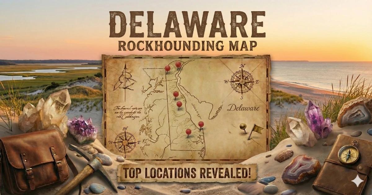
Delaware is the second-smallest state by area and one of the most geologically uniform. Nearly 90 percent of it sits on the Atlantic Coastal Plain — unconsolidated sands, silts, clays, and gravels deposited during the Cretaceous through Quaternary periods. There is no exposed granite, no pegmatite, no alpine veins. If you arrive expecting buckets of gemstones, adjust your expectations now.
The one exception is the far northern tip. A narrow strip of New Castle County, roughly from Wilmington north to the Pennsylvania border, crosses onto the Piedmont physiographic province. Here, Precambrian and Paleozoic metamorphic and igneous rocks reach the surface — gabbro, serpentinite, gneiss, and schist. This sliver of hard rock, covering less than 10 percent of the state, produces the only true mineral specimens Delaware has to offer.
That said, Delaware rewards patient collectors who know what to look for. The Chesapeake & Delaware Canal exposes Cretaceous formations with well-preserved fossils. The Atlantic beaches yield polished quartz pebbles and occasional shark teeth. And the Brandywine Creek drainage, where Piedmont bedrock crops out in stream channels, produces quartz, garnet, and mica. This is a state for sharp-eyed surface collecting, not hard-rock mining.

Collecting Locations
1. Brandywine Creek State Park and Vicinity (New Castle County)
Land Status: Delaware State Park. Surface collecting of loose specimens from the creek bed is generally tolerated for personal use. Do not dig into banks, use power tools, or remove material in bulk. Check current park rules at the entrance station.
GPS: Approximately 39.811°N, 75.577°W (park main entrance off Adams Dam Road).
Vehicle: Sedan OK. Paved road to parking areas.
Specimens: Milky quartz, smoky quartz fragments, almandine garnet (small crystals in schist cobbles), muscovite mica, biotite, occasional feldspar.
Brandywine Creek cuts through Wilmington Complex gneiss and Wissahickon schist in this area. The creek bed exposes cobbles and boulders of metamorphic rock that have weathered out of the Piedmont basement. Walk the stream channel at low water and examine gravel bars. Look for quartz veins in gneiss cobbles — the quartz is milky white and fractures with conchoidal surfaces. Small almandine garnets, typically 2–5 mm in diameter, occur as reddish-brown grains embedded in mica schist. You will not extract gem-quality stones here, but decent garnet-in-matrix specimens are possible.
The best collecting is after spring floods, when high water rearranges gravel bars and exposes fresh material. Late summer low water also works — the exposed stream bed provides more walking area.
2. Iron Hill (New Castle County, near Newark)
Land Status: Iron Hill is partly within Iron Hill Park (New Castle County park) and partly private land. Stay on park property. Do not enter fenced or posted areas.
GPS: Approximately 39.633°N, 75.762°W (Iron Hill Park off Old Baltimore Pike).
Vehicle: Sedan OK. Paved road to trailhead.
Specimens: Serpentinite, magnetite, chromite (trace), talc, chlorite, actinolite, quartz float.
Iron Hill is a geological anomaly in Delaware — an isolated body of gabbro and associated ultramafic rock (primarily serpentinite) that rises about 90 feet above the surrounding Coastal Plain. The hill is part of a Paleozoic igneous complex that was emplaced into Piedmont metamorphic rocks. Iron ore (magnetite and hematite) was mined here from colonial times through the early 1900s.
The serpentinite is a dark green to black, waxy-textured rock. It weathers to a rusty brown surface. Fresh surfaces show the greasy luster typical of serpentine-group minerals. You may find small veins of chrysotile (fibrous serpentine) in some outcrops, but do not collect or disturb asbestiform minerals. Magnetite occurs as heavy black grains in soil and float — a magnet is the fastest identification tool here.
Road cuts and trail-side exposures provide the best viewing. Collecting on park trails is limited to loose surface float. The geology here is well-documented and worth a visit even if you take nothing home.
3. Chesapeake & Delaware Canal (New Castle County)
Land Status: The C&D Canal is operated by the U.S. Army Corps of Engineers. Access to the canal banks varies by section. Some areas are open for walking and fishing; others are restricted. Check with the Corps' Philadelphia District office for current access rules. Fossil collecting for personal use has been tolerated historically, but there is no formal collecting permit.
GPS: Approximately 39.543°N, 75.715°W (near Summit Bridge, a productive section).
Vehicle: Sedan OK to access points along Route 71 and Route 896.
Specimens: Cretaceous-age fossils — belemnites, bivalve molds and casts (Exogyra, Gryphaea), gastropod molds, occasional ammonite fragments, fossil wood, pyrite replacements, marcasite nodules, phosphatic nodules.
When the canal was widened and deepened in the 1920s and again in the 1960s, dredging exposed the Mount Laurel Formation and Merchantville Formation — Upper Cretaceous marine sediments roughly 70–80 million years old. The spoil banks along the canal contain fossils weathering out of gray-green glauconitic marl.
Walk the spoil piles and canal-side banks (where access is permitted) and look for shell impressions in marl fragments. The oyster-like Exogyra is the most common find — thick, curved shells up to 3–4 inches. Belemnite guards (cigar-shaped calcite fossils from squid-like animals) also occur. Pyritized specimens are possible but fragile — wrap them in tissue immediately to slow oxidation.
Rain is your friend here. A few days after a heavy rain, fossils weather out of the marl and sit on the surface. Dry summer conditions make the marl hard and difficult to examine.
4. Cape Henlopen State Park (Sussex County)
Land Status: Delaware State Park. Open to the public. No permit needed for casual beach collecting. Do not disturb dune vegetation or wildlife nesting areas.
GPS: Approximately 38.788°N, 75.090°W (park entrance off Cape Henlopen Drive, Lewes).
Vehicle: Sedan OK to parking areas. Beach driving requires park permit and 4WD.
Specimens: Polished quartz pebbles (clear, milky, rose, smoky), jasper pebbles, chert, shark teeth (Miocene to recent), occasional fossil bone fragments, Cape May gravel (mixed glacial-transported lithologies).
Cape Henlopen sits at the mouth of Delaware Bay, where longshore drift concentrates denser pebbles and fossils along the tide line. The gravel here is not local bedrock — it is transported material, originally deposited by Pleistocene rivers and reworked by wave action. This means you can find rock types from across the Piedmont and even Appalachian sources: quartzite, jasper, chert, and occasionally igneous cobbles.
Walk the high-tide line and the wrack line where shells and pebbles concentrate. After storms, the beach may expose gravel lags that contain shark teeth. These are typically black, triangular, and 0.5–1.5 inches. Most are from Miocene-age deposits (5–20 million years old) that underlie the modern beach sands. Fossil whale bone and ray tooth plates turn up occasionally but are uncommon.
Early morning at low tide provides the widest beach and freshest surface. Bring a mesh sifter (quarter-inch screen) to concentrate small teeth from shell hash.
5. Rehoboth Beach and Delaware Seashore State Park (Sussex County)
Land Status: Delaware Seashore State Park (between Rehoboth Beach and Indian River Inlet) is public. Town beaches at Rehoboth are municipal — no restrictions on casual collecting.
GPS: Approximately 38.720°N, 75.076°W (Indian River Inlet area).
Vehicle: Sedan OK to parking areas. Beach driving available with permit in designated areas, 4WD required.
Specimens: Quartz pebbles, jasper, chert, shark teeth, shell fossils, occasional agate-like chalcedony.
The Indian River Inlet area is particularly productive for shark teeth because the inlet's tidal currents constantly scour the seabed and deposit concentrated gravel. The jetty rocks (imported granite) are not collectible, but the natural gravel between the jetties and along the adjacent beaches contains the same transported Piedmont material found at Cape Henlopen. Collecting conditions are similar — target post-storm low tides for best results.
Minerals and Fossils Found in Delaware
| Specimen | Type | Hardness | Where in Delaware | What to Look For |
|---|---|---|---|---|
| Milky quartz | Mineral | 7 | Brandywine Creek, beach gravels | White, glassy, conchoidal fracture. Common in stream cobbles and beach pebbles. |
| Almandine garnet | Mineral | 6.5–7.5 | Brandywine Creek area | Dark red-brown grains, 2–5 mm, embedded in schist. Dodecahedral crystal form. |
| Serpentinite | Rock | 3–5 | Iron Hill, Newark | Dark green, waxy luster, weathers rusty brown. Dense and smooth to the touch. |
| Magnetite | Mineral | 5.5–6.5 | Iron Hill, Newark | Black, heavy, strongly magnetic. Test with a magnet. |
| Muscovite mica | Mineral | 2–2.5 | Brandywine Creek | Silvery, flexible sheets that peel in layers. In schist and gneiss. |
| Exogyra (fossil oyster) | Fossil | — | C&D Canal | Thick, curved bivalve shell, 2–4 inches. Often chalky white in marl. |
| Belemnite guard | Fossil | — | C&D Canal | Cigar-shaped calcite fossil, 1–3 inches. Smooth, brown to tan. |
| Shark teeth | Fossil | — | Cape Henlopen, Rehoboth, Indian River Inlet | Black, triangular, glossy enamel. 0.5–1.5 inches typical. |
| Jasper / chert pebbles | Rock | 7 | Beach gravels statewide | Opaque, red-brown to gray, waxy luster, conchoidal fracture. |
| Pyritized fossils | Mineral/Fossil | 6–6.5 | C&D Canal | Gold-metallic replacement of shell or wood. Fragile — wrap immediately. |
Field Identification Tips
Quartz vs. calcite on the beach: Both can be white and rounded. Quartz (hardness 7) scratches glass and steel. Calcite (hardness 3) does not scratch glass and fizzes with dilute hydrochloric acid. Most white beach pebbles in Delaware are quartz.
Garnet vs. dark quartz: Garnet is heavier (SG 3.5–4.3 vs. 2.65 for quartz) and typically shows a dodecahedral crystal form — 12-sided rounded shapes. Smoky quartz is prismatic with pointed terminations. In Brandywine Creek schist cobbles, garnets appear as embedded reddish grains that stand out against the silvery mica matrix.
Shark teeth vs. shell fragments: Genuine shark teeth have a glossy enamel surface, sharp edges, and a root at the base. Shell fragments are duller, layered, and lack enamel shine. Dark coloration (black, dark brown, dark gray) indicates fossilization — modern teeth are white.
Serpentinite vs. dark shale: Serpentinite has a greasy or waxy luster and feels smooth. Shale is dull, layered, and splits into thin sheets. At Iron Hill, serpentinite often has a rusty weathering rind — break it open (if loose float) to see the green interior.
Pyrite vs. gold: Not a realistic concern in Delaware, but if you find metallic-yellow material in C&D Canal marl, it is pyrite. Pyrite is hard (6–6.5), brittle, and cubic. Gold is soft (2.5–3), malleable, and does not occur in Delaware's geology.
Tools and Gear
| Item | Why |
|---|---|
| 10x hand lens (loupe) | Examining garnet crystals, fossil details, and mineral textures |
| Magnet | Quick identification of magnetite at Iron Hill |
| Mesh sifter (1/4-inch screen) | Concentrating shark teeth and small fossils from beach shell hash |
| Spray bottle | Wetting fossils and pebbles reveals detail and color |
| Small containers and tissue paper | Protecting fragile pyritized fossils and small teeth |
| Sturdy shoes or rubber boots | Creek walking at Brandywine; muddy canal banks |
| Knee pads | Extended time scanning beach gravel at Cape Henlopen |
| Sunscreen and hat | Beach sites are fully exposed. No shade. |
| Dilute HCl (10%) | Testing calcite vs. quartz on beach pebbles. Optional but useful. |
| Field notebook | Recording GPS, formation, and specimen data |
A rock hammer is generally not necessary in Delaware. Most collecting involves picking loose float from creek beds, gravel bars, and beach surfaces. If you plan to examine marl at the C&D Canal, a geology pick or sturdy screwdriver helps pry specimens from soft sediment.
Legal Notes
State parks: Delaware State Parks allow casual collecting of loose, non-archaeological specimens for personal, non-commercial use. Do not dig into banks, disturb vegetation, or use power tools. Collecting is prohibited in designated natural areas and wildlife refuges. Check with individual park offices for specific rules.
C&D Canal (Army Corps of Engineers): The canal banks are federal property managed by the U.S. Army Corps of Engineers, Philadelphia District. There is no formal fossil-collecting permit program. Personal collecting of surface fossils has historically been tolerated, but policies can change. Contact the Corps district office before visiting. Do not obstruct navigation, damage canal infrastructure, or access restricted zones.
Beaches: Delaware's Atlantic beaches are public below the mean high-water line. No permit is needed to collect loose beach stones, shells, or fossils in non-restricted areas. Cape Henlopen and Delaware Seashore State Park may have seasonal restrictions for bird nesting (typically spring through mid-summer) — observe posted closures.
Private land: Much of northern Delaware's Piedmont geology is on private residential or commercial property. Do not collect on private land without written permission. Construction sites, road cuts, and utility excavations occasionally expose good rock, but these are active work zones — contact the project owner or contractor before entering.
Iron Hill: Iron Hill Park is a county park. Collecting loose surface float on trails is generally tolerated. The historic mine sites on and around the hill may be on private land or restricted. Stay on marked trails and park property.
No BLM land: Delaware has no Bureau of Land Management or National Forest land. All collecting is on state, county, municipal, or private property. Know who owns the ground before you collect.
Practical Tips
- Manage expectations: Delaware is not a destination rockhounding state. Treat it as an opportunity for sharp-eyed surface collecting, fossil hunting, and beach combing. Bring patience and a good loupe instead of a heavy pack.
- Best season: Spring (March through May) for Brandywine Creek — snowmelt and rain raise creek levels, and the receding water exposes fresh gravel. Fall and winter for beach collecting — nor'easters strip sand and expose gravel lags with concentrated teeth and pebbles.
- Combine trips: Northern Delaware is 30 minutes from the Chester County, Pennsylvania mineral districts (famous for Chester Creek chrysotile, williamsite serpentine, and pegmatite minerals). Southern Delaware is 90 minutes from Calvert Cliffs, Maryland (world-class Miocene shark teeth). Plan a multi-state weekend.
- Join a club: The Delaware Mineralogical Society (based in Wilmington) organizes field trips, including access to sites not open to the general public. Membership provides the best path to productive collecting in this state.
- Weather and tides: For beach collecting, check tide tables and plan to arrive at low tide. Post-storm conditions produce the best finds. The Delaware beaches face east, so nor'easters (northeast winds) drive the most erosion.
Interactive Map
Find all Delaware collecting locations on our Delaware rockhounding map with access details and GPS coordinates.