

Colorado sits on top of some of the most geologically active crust in the lower 48. The state straddles the boundary between the stable Great Plains craton to the east and the deformed, uplifted terrain of the Rocky Mountain orogenic belt to the west. That collision of tectonic forces — repeated over more than a billion years — has produced an unusual density of gem-bearing rock types within a single state border. You can pan gold from Precambrian-sourced placers in the morning and crack open Tertiary-age pegmatite pockets above treeline in the afternoon.
I have worked sites in Colorado from the 7,000-foot mesas near Grand Junction up to the 14,000-foot ridgeline on Mount Antero, and the range of collecting conditions is as extreme as the elevation spread. This guide is written for collectors who want to know what is actually in the ground, where to legally access it, and what gear will keep them safe and productive at altitude. If you have never collected above 10,000 feet, read the altitude sickness section before you drive to a trailhead.
Geology of Colorado's Gem-Bearing Terrain
The bedrock story in Colorado starts around 1.7 billion years ago with the assembly of Precambrian crystalline basement — gneisses, schists, and granitic intrusions that form the structural core of the Front Range and the Sawatch Range. This ancient basement rock is the host material for the Pikes Peak granite batholith, emplaced roughly 1.08 billion years ago, and the source of the state's finest amazonite, smoky quartz, and topaz.
During the Laramide orogeny (roughly 70 to 40 million years ago), compressional forces drove thick slabs of Precambrian rock upward through younger sedimentary cover, creating the modern Rocky Mountain ranges. That uplift exposed deep-seated rocks at the surface and fractured them extensively, providing the plumbing for hydrothermal fluids that deposited metallic ores and gangue minerals throughout the Colorado Mineral Belt — a northeast-trending zone of mining districts running from Silverton to Boulder County.
A later pulse of igneous activity during the Tertiary (roughly 35 to 25 million years ago) injected granitic magma into the Sawatch Range. As these plutons cooled, residual fluids rich in beryllium, fluorine, and silica migrated into fractures and formed pegmatite veins — the source of Mount Antero's aquamarine and phenakite. The key geologic principle for collectors: pegmatites form late in the crystallization sequence of a granitic magma, concentrating rare elements into coarse-grained pods and pockets. That is why a single pegmatite vein on Antero can yield beryl crystals while the surrounding granite is mineralogically unremarkable.
On the Western Slope, the Mesozoic sedimentary sequence — including the Morrison Formation (Late Jurassic) — preserves dinosaur fossils and petrified material. The Morrison Formation's mudstones and sandstones were deposited in floodplain and lacustrine environments where organic material was replaced by silica during diagenesis. Collectors working the sedimentary terrain around Fruita, Grand Junction, and Morrison itself encounter a very different set of targets than those working igneous rocks in the high country.
Top Collecting Locations
1. Mount Antero — Aquamarine and Phenakite
- GPS: 38.6739 N, 106.2461 W
- County: Chaffee County
- Elevation: 13,800 - 14,269 feet
- Land status: San Isabel National Forest (public land, free use permit area)
- Target minerals: Aquamarine (gem beryl), phenakite, smoky quartz, bertrandite, fluorite
Mount Antero is one of the highest gem-collecting localities in North America. The pegmatite veins that cut the Tertiary-age Mount Antero granite contain pockets lined with aquamarine crystals ranging from thumbnail-sized fragments to museum-grade hexagonal prisms over 3 inches long. Phenakite — a rare beryllium silicate — occurs in the same pockets and is sometimes mistaken for quartz by inexperienced collectors.
Access is via a rough 4WD road (County Road 277) from the town of Nathrop. The road ends around 13,000 feet, and the final 800-1,200 feet of elevation gain is on foot over loose talus. The collecting season runs from early July through mid-September, depending on snowpack. Snow can close the road as late as July 4 in heavy snow years. Afternoon thunderstorms build almost daily above treeline — lightning is the primary safety hazard. Start your climb before dawn, plan to be off the summit ridge by noon, and carry a weather radio.
The state of Colorado designated aquamarine as the official state gemstone in 1971, based largely on specimens from Mount Antero.
2. Lake George / Crystal Peak — Amazonite and Smoky Quartz
- GPS: 38.9580 N, 105.3520 W
- County: Park County / Teller County
- Elevation: 8,500 - 9,500 feet
- Land status: Mixed — Pike National Forest (public) and private mining claims. Verify claim status before digging.
- Target minerals: Amazonite (green microcline feldspar), smoky quartz, topaz, goethite pseudomorphs, fluorite
The Pikes Peak granite batholith hosts hundreds of pegmatite pockets scattered across Park and Teller Counties. The Crystal Peak area near Lake George is the most productive public-access zone for amazonite — the blue-green variety of microcline feldspar that forms in miarolitic cavities within the granite. The best specimens are combination pieces: sharp amazonite crystals perched on or intergrown with dark smoky quartz crystals, sometimes with topaz or fluorite as accessory minerals.
Collecting here involves surface prospecting along weathered granite outcrops and ridge tops, looking for quartz float and feldspar fragments that indicate a nearby pocket. When you locate a productive vein, careful hand-tool work with chisels and pry bars is needed to open pockets without damaging the crystals inside. The area around Crystal Peak has many active mining claims — use the BLM LR2000 database or a land status app like OnX to confirm that you are on National Forest land before you start digging. The Florissant Fossil Beds National Monument is nearby but collecting within the monument is strictly prohibited.
3. Tarryall Mountains — Topaz
- GPS: 39.1000 N, 105.5000 W
- County: Park County
- Elevation: 9,000 - 10,500 feet
- Land status: Pike National Forest (public) with scattered private claims
- Target minerals: Topaz, smoky quartz, amazonite, fluorite
The Tarryall Mountains are part of the same Pikes Peak granite province that produces amazonite at Lake George, but the pegmatites here tend to be richer in topaz. Colorado topaz is typically colorless to pale blue or champagne-colored, occurring as prismatic crystals in clay-filled pockets within the granite. Crystals are often etched or frosted from natural weathering, which gives them a distinctive matte surface compared to the glassy luster of freshly exposed topaz.
Work the weathered granite outcrops along ridge lines, particularly where you see quartz veins and feldspar-rich float on the surface. Topaz is dense (specific gravity 3.5) and resistant to weathering, so it concentrates in soil and gravel downslope from its source pegmatite. Screening soil with a classifier can be productive where pockets have already been eroded open by natural processes.
4. Sweet Home Mine Area — Rhodochrosite
- GPS: 39.2833 N, 106.0667 W
- County: Park County (near Alma)
- Elevation: 10,500 - 12,000 feet
- Land status: Private mine — no public access to the mine itself. Surrounding National Forest land is open for surface collecting.
- Target minerals: Rhodochrosite (surface float only on public land), pyrite, quartz, galena, sphalerite, tetrahedrite
The Sweet Home Mine produced some of the finest rhodochrosite specimens ever recovered. Single crystals from this mine have sold at auction for over $1 million. Rhodochrosite — manganese carbonate, MnCO3 — is Colorado's designated state mineral (adopted 2002). The Sweet Home mineralization formed in Tertiary-age hydrothermal veins associated with a molybdenum porphyry system at depth. The mine itself is closed to collectors and is privately held.
You will not find museum-grade rhodochrosite lying on the surface nearby, but the mining district around Alma, Fairplay, and the Mosquito Range contains extensive mineralized ground. Surface collecting on National Forest land can yield interesting sulfide specimens, quartz crystals, and occasionally small rhodochrosite fragments in mine dump material. The Alma mining district was historically a silver-lead-zinc producer, and the dumps reflect that mineralogy.
5. Clear Creek — Placer Gold
- GPS: 39.7061 N, 105.6975 W (Georgetown area)
- County: Clear Creek County
- Elevation: 7,500 - 8,500 feet
- Land status: Mixed — BLM, National Forest, and private. Recreational gold panning is permitted on most public land along the creek.
- Target minerals: Placer gold (fine to flake), magnetite, garnet (almandine), pyrite
Clear Creek drains the heart of the Colorado Mineral Belt, carrying gold eroded from Precambrian and Tertiary-age lode deposits upstream. The Georgetown, Idaho Springs, and Empire mining districts were major hard-rock gold producers in the 19th and early 20th centuries, and the creek has been reworked by placer miners since the 1859 Pikes Peak Gold Rush. Fine gold remains in the gravels, particularly behind large boulders, in bedrock cracks, and at the inside bends of meanders where current velocity drops.
Recreational gold panning with a pan, sluice, or hand-operated suction device is legal on most public land along Clear Creek without a permit. Motorized equipment and dredging require additional permits and are restricted in many sections. The Arkansas River near Buena Vista and the South Platte River system are also productive for recreational panners.
6. Conejos County — Turquoise
- GPS: 37.0800 N, 106.0200 W
- County: Conejos County
- Elevation: 8,000 - 10,000 feet
- Land status: Mixed BLM and Rio Grande National Forest. Some areas are on private ranches or active mining claims.
- Target minerals: Turquoise, chrysocolla, malachite, limonite
Southern Colorado's turquoise occurrences are less well known than those in Arizona and New Mexico, but Conejos County has produced collectible material. Turquoise is a hydrated copper-aluminum phosphate that forms in the weathering zone above copper-bearing host rock. Look for it as thin seams, coatings, and nodules in fractured volcanic and altered rock. The material ranges from chalky and pale to hard, dense, and strongly blue-green.
Access in this area requires careful attention to land status. The terrain is a patchwork of BLM, National Forest, private ranch land, and tribal land. Confirm that you are on public land open to mineral collecting before you start working. A GPS unit and current land status maps are essential.
7. Morrison and Denver Basin — Dinosaur Fossils and Petrified Wood
- GPS: 39.6536 N, 105.1911 W (Morrison area)
- County: Jefferson County / Douglas County
- Elevation: 5,800 - 6,500 feet
- Land status: Mixed — some BLM land, state land, and private. Dinosaur Ridge is a protected site (no collecting). BLM land in the greater Denver Basin allows limited surface collecting of common invertebrate fossils and petrified wood.
- Target minerals/fossils: Petrified wood, invertebrate fossils, plant fossils, agate, jasper
The Morrison Formation — the type locality is the town of Morrison itself, just west of Denver — is one of the most productive dinosaur-bearing rock units in the world. The formation's floodplain mudstones and channel sandstones have yielded Stegosaurus, Apatosaurus, Allosaurus, and dozens of other Late Jurassic taxa. Vertebrate fossil collecting requires a paleontological resources permit on federal land and is prohibited entirely in many areas. However, common invertebrate fossils and small pieces of petrified wood (less than 250 pounds per day, up to 25 pounds per person on BLM land) can be collected without a permit on BLM-managed land in the region. The Denver Basin also contains Cretaceous-age marine shales that yield ammonite casts and bivalve fossils at road cuts and construction sites.
Minerals at a Glance
| Mineral | Chemical Formula | Mohs Hardness | Crystal System | Primary Location | Notes |
|---|---|---|---|---|---|
| Aquamarine (beryl) | Be3Al2Si6O18 | 7.5 - 8 | Hexagonal | Mount Antero | Colorado state gemstone. Blue color from trace iron. |
| Amazonite (microcline) | KAlSi3O8 | 6 - 6.5 | Triclinic | Lake George / Crystal Peak | Green color from lead and water in crystal structure. |
| Smoky quartz | SiO2 | 7 | Trigonal | Pikes Peak region, Mount Antero | Color from natural irradiation of aluminum-bearing quartz. |
| Topaz | Al2SiO4(F,OH)2 | 8 | Orthorhombic | Tarryall Mountains, Lake George | Colorless to pale blue. High specific gravity (3.5). |
| Rhodochrosite | MnCO3 | 3.5 - 4 | Trigonal | Sweet Home Mine (Alma) | Colorado state mineral. Pink to deep red. |
| Gold (native) | Au | 2.5 - 3 | Cubic | Clear Creek, Arkansas River | Fine placer gold. Specific gravity 19.3. |
| Turquoise | CuAl6(PO4)4(OH)8 * 4H2O | 5 - 6 | Triclinic | Conejos County | Forms in weathering zone above copper deposits. |
| Phenakite | Be2SiO4 | 7.5 - 8 | Trigonal | Mount Antero | Rare beryllium silicate. Often mistaken for quartz. |
Field Identification Tips
Knowing what you are looking at in the field saves time and prevents you from hauling 30 pounds of worthless rock down a mountain. Here are the key identification tests for Colorado's target minerals.
Aquamarine vs. quartz: Both are hard, glassy, and can be found in the same pocket. Aquamarine is hexagonal with flat terminations and often shows a subtle blue-green tint when viewed down the c-axis (long axis) of the crystal. Quartz terminations are pointed (six-sided pyramids). If you have a hand lens, look at the cross-section: beryl is hexagonal with no striations on the prism faces, while quartz shows horizontal striations perpendicular to the c-axis.
Amazonite vs. green-stained feldspar: True amazonite has a uniform blue-green color throughout the crystal, visible on fresh fracture surfaces. Feldspar stained green by surface copper minerals or lichen will show white or pink on a fresh break. Amazonite also shows the characteristic grid-pattern twinning (perthite texture) of microcline under a hand lens.
Topaz vs. quartz: Topaz is denser than quartz. Pick up both — topaz feels heavier for its size. Topaz has one perfect basal cleavage plane (perpendicular to the long axis), while quartz has no cleavage. If you see a flat, smooth break surface on a clear crystal, it is more likely topaz than quartz. Topaz also has a distinctly slippery feel compared to the slightly gritty surface of quartz.
Rhodochrosite vs. pink quartz: Rhodochrosite is much softer (3.5 - 4 on Mohs scale) than rose quartz (7). A steel knife blade will scratch rhodochrosite easily. Rhodochrosite also fizzes in dilute hydrochloric acid because it is a carbonate mineral. Rose quartz will not react to acid.
Gold vs. pyrite in the pan: Gold is malleable — you can flatten a flake with a knife point. Pyrite is brittle and shatters. Gold stays in the bottom of the pan because of its extreme density (19.3 g/cm3). Pyrite washes out with the lighter material. Gold is a warm yellow; pyrite has a brassy, slightly greenish tint and often shows crystal faces (cubes, pyritohedra).
Turquoise vs. chrysocolla: Both are blue-green copper minerals, but turquoise is harder (5 - 6) and takes a waxy polish, while chrysocolla is softer (2 - 4) and tends to be chalky or botryoidal. Scratch test with a steel point: turquoise resists; chrysocolla scratches easily.
Tools and Gear for Colorado Collecting
Colorado's elevation range demands that you plan for two different collecting environments: alpine sites above treeline and lower-elevation desert, river, and foothill sites.
For alpine pegmatite collecting (Mount Antero, Tarryall, Lake George):
- Rock hammer (2 - 3 lb crack hammer with fiberglass handle)
- Cold chisels (flat and point, 3/4" and 1/2" widths)
- Pry bar (18" - 24" flat bar for opening pegmatite pockets)
- Safety glasses (mandatory when hammering on granite)
- Hand lens (10x loupe for field ID)
- Newspaper and bubble wrap for wrapping crystals
- 5-gallon bucket or sturdy backpack for carrying specimens out
- Knee pads (you will be kneeling on granite for hours)
For gold panning (Clear Creek, Arkansas River):
- Gold pan (14" standard black plastic)
- Classifier screen (1/4" mesh to remove large gravel)
- Snuffer bottle for picking up fine gold
- Glass vial for storing gold
- Small hand trowel or crevicing tool
- Rubber boots or waders (mountain streams are cold year-round)
Alpine safety gear (non-negotiable above 10,000 feet):
- Rain jacket and warm layers (temperatures can drop 30 degrees F in minutes during a storm)
- Lightning crouch position knowledge — do not lie flat
- Weather radio or phone with weather app (check NOAA forecasts before departure)
- Sunscreen SPF 50+ (UV radiation is 40-60% stronger above 10,000 feet)
- 2 - 3 liters of water per person minimum
- High-calorie snacks
- First aid kit with altitude sickness medication (acetazolamide if prescribed by your doctor)
- Map, compass, or GPS — cell service is unreliable above treeline
Altitude sickness warning: If you live at sea level and drive directly to a 14,000-foot trailhead, you will almost certainly feel the effects of reduced oxygen. Symptoms include headache, nausea, dizziness, and shortness of breath with minimal exertion. Spend at least one night at 8,000 - 10,000 feet before working above 12,000 feet. If symptoms worsen, descend immediately — altitude sickness can progress to life-threatening pulmonary or cerebral edema.
Legal Framework for Collecting in Colorado
Colorado has a complex patchwork of land ownership, and the rules for mineral collecting vary by managing agency. Get this wrong and you face fines, confiscation, or trespass charges. Here is the breakdown by land type.
National Forest land (USFS): Casual collecting of reasonable quantities of rocks, minerals, and semi-precious gemstones for personal, non-commercial use is permitted under the Federal Lands Policy and Management Act and Forest Service regulations (36 CFR 228.62). No permit is required for hand tools and non-motorized equipment. You may not use explosives, motorized equipment, or significantly disturb the land surface. Some areas may have additional restrictions — check with the local ranger district.
BLM land: Similar to National Forest — casual collecting of rocks, minerals, gemstones, and common invertebrate fossils and petrified wood is allowed for personal use. The daily limit for petrified wood is 25 pounds plus one piece per day, not to exceed 250 pounds per year. Vertebrate fossils require a permit and are generally restricted to qualified researchers. Designated wilderness areas have additional restrictions on tools and group size.
Mining claims: Colorado has thousands of active, unpatented mining claims on federal land. A valid mining claim gives the claimant the right to the minerals within the claim boundaries, even though the surface is federal land. Collecting minerals on someone else's mining claim without permission is theft. Check the BLM LR2000 database (blm.gov/lr2000) to search for active claims at your target location. When in doubt, use a GPS to mark your position and compare it against claim maps before digging.
State parks and monuments: Collecting is prohibited in Colorado State Parks and National Monuments (including Dinosaur Ridge, Florissant Fossil Beds, Colorado National Monument, and others). Do not remove any rocks, minerals, or fossils from these areas.
Private land: You must have written permission from the landowner. Verbal agreements are not enforceable. Many of Colorado's best collecting sites are on private claims or ranches — always ask first.
Key regulations to know:
- No collecting within 1/4 mile of any active mine without the mine owner's permission
- No disturbing historical or cultural resources (mine structures, cabins, artifacts)
- Pack out all trash — Leave No Trace principles apply on all public land
- Campfire restrictions are common in summer — check current fire bans before building fires at camp
- 4WD roads on National Forest land may have seasonal closures for wildlife or wet road conditions
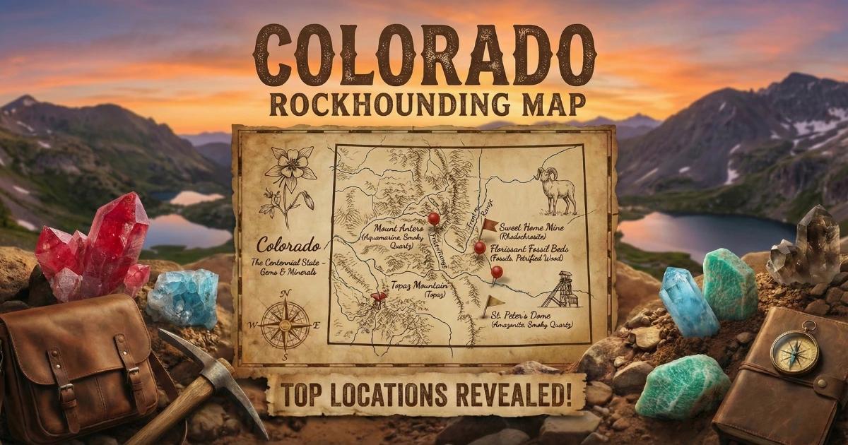
Colorado Rockhounding Map
Use our interactive map to explore collecting locations across the state, including GPS coordinates, land status, and target minerals for each site.
View the Colorado Rockhounding Map
The map includes BLM land, National Forest boundaries, known mining districts, and community-reported collecting sites. Cross-reference any location with the BLM LR2000 claim database before you drive out. Conditions change — roads wash out, claims get staked, and seasonal closures shift. Verify access before every trip.