

Why Arkansas Is One of the Best States for Gem Hunting
Arkansas sits on top of some of the most geologically productive ground in the central United States. The Ouachita Mountains, which run east-to-west through the western half of the state, are the product of a late Paleozoic collision between the North American plate and a microcontinent to the south. That collision folded, faulted, and metamorphosed a thick sequence of Ordovician through Pennsylvanian sediments. Silica-rich hydrothermal fluids migrated through fractures in those deformed rocks and crystallized into the quartz veins that make Arkansas world-famous among mineral collectors. Quartz crystal is the official state mineral, and for good reason — the deposits around Mount Ida and Jessieville rank among the largest and highest-quality occurrences of clear quartz on Earth.
But quartz is only the beginning. In Pike County, an eroded lamproite volcanic pipe allows the public to dig for real diamonds. In Hot Springs County, Magnet Cove — one of the most studied alkaline igneous complexes in North America — hosts rare titanium minerals like brookite that collectors travel across the country to find. And across the Ouachita National Forest, surface collecting on public land yields novaculite, wavellite, and a long list of secondary minerals.
This guide covers the geology behind these deposits, specific locations with GPS coordinates and land-status details, a mineral reference table, field identification methods, the right tools to carry, and current legal rules for collecting in Arkansas.
Geology of Arkansas Mineral Deposits
The mineral wealth of Arkansas traces back to three distinct geological events, each operating on very different timescales.
The Ouachita Orogeny (roughly 300 million years ago). When the ancestral South American landmass pushed into what is now the Gulf Coast margin, it compressed a thick wedge of deep-marine shales, sandstones, and cherts. These sediments were folded into tight east-west trending anticlines and synclines. During and after deformation, silica-saturated fluids moved through fracture networks and open spaces in the folded strata. As those fluids cooled, they precipitated quartz — sometimes as massive milky veins, sometimes as open-cavity crystal pockets with terminated points. The geology is simple in principle: fractured host rock plus silica-rich fluid plus open space equals crystal growth. The Montgomery County and Garland County deposits sit within these Paleozoic sediments, specifically within the Stanley Shale and the Crystal Mountain Sandstone.
Cretaceous alkaline magmatism (roughly 100-95 million years ago). During the Late Cretaceous, deep-sourced magmas intruded through the Paleozoic basement along structural weaknesses. Two of these intrusions matter to collectors. First, the Magnet Cove complex in Hot Springs County — a ring-shaped alkaline igneous intrusion about 4 miles across that hosts over 100 identified mineral species, including rare titanium minerals (brookite, rutile, perovskite), magnetite, apatite, and a range of carbonate and silicate phases. Second, the Prairie Creek lamproite pipe near Murfreesboro in Pike County — the source of the diamonds at Crater of Diamonds State Park. Lamproite is a potassium-rich, volatile-rich igneous rock that originates deep in the mantle, sometimes carrying diamonds to the surface during explosive eruption.
Late-stage hydrothermal alteration and weathering. After the main igneous and tectonic events, continued fluid circulation and surface weathering produced secondary minerals. Wavellite — the green aluminum phosphate mineral prized for its radial crystal sprays — formed where phosphate-bearing fluids reacted with aluminum-rich clays and shales in the Ouachita sequence. Novaculite, the dense microcrystalline silica rock used historically as sharpening stone (the "Arkansas whetstone"), is itself a product of recrystallized Devonian-age bedded chert, toughened and densified by the Ouachita orogeny. In northwestern Arkansas, Mississippian-age limestones and dolomites host lead-zinc deposits of the Tri-State mining district type, with sphalerite, galena, and smithsonite as the primary ore and collector minerals.
Top Gem Hunting Locations in Arkansas
1. Mount Ida Fee-Dig Quartz Mines (Montgomery County)
GPS: 34.5556 N, -93.6336 W (town center; individual mines within 5-15 miles)
Land status: Private — fee-dig operations
Target minerals: Clear quartz points, smoky quartz, phantom quartz, double-terminated crystals, cluster specimens
Mount Ida is the self-proclaimed "Quartz Crystal Capital of the World," and the claim holds up. Several fee-dig mines operate in the surrounding hills, each working different quartz veins within the Stanley Shale. Board Camp Crystal Mine produces clear and smoky quartz from weathered red-clay pockets. Fiddler's Ridge Rock Shop & Crystal Mine is known for double-terminated crystals — points that grew freely in open cavities without attachment to a matrix. Twin Creek Crystal Mine produces large cluster specimens. Fees typically run $20-$50 per person per day. The red laterite clay at these sites is soft enough to dig with hand tools. Most mines are seasonal (spring through fall), so call ahead to confirm hours. A 2WD vehicle will reach all of them.
2. Jessieville / Lake Ouachita Area (Garland County)
GPS: 34.6811 N, -93.0681 W
Land status: Mix of private fee-dig mines and Ouachita National Forest (public)
Target minerals: Clear quartz, milky quartz, druzy quartz, wavellite
The area between Jessieville and Lake Ouachita offers both fee-dig options and legitimate public-land collecting. The Avant Mine (now primarily associated with wavellite specimens but historically a quartz producer) sits in this zone. Crystal pockets here tend to occur along bedding-plane fractures in the Crystal Mountain Sandstone. On National Forest land, surface collecting of reasonable quantities for personal use is permitted without a special permit — but you cannot use mechanized equipment or dig below the surface horizon. Stick to exposed road cuts, creek beds, and eroded hillsides.
3. Crater of Diamonds State Park (Pike County)
GPS: 34.0315 N, -93.6831 W
Land status: Arkansas State Park — fee-dig
Fee: $10 adults / $6 children (ages 6-12)
Target minerals: Diamond (white, yellow, brown, rarely pink or blue), lamproite, jasper, amethyst, agate, calcite
This is the only place in the world where the public can dig for diamonds and keep what they find. The park sits on the eroded surface of a 95-million-year-old lamproite volcanic pipe. The plowed search field covers about 37 acres. Since 1906, over 33,100 diamonds have been recovered, including the 40.23-carat "Uncle Sam" — the largest diamond ever found in the United States. Visitors today average 1-2 diamonds found per day across all guests, with most stones under half a carat and brown or yellow in color. White and fancy-colored stones do appear. The best strategy is surface searching after a heavy rain — water washes soil off the plowed ground and exposes fresh material. Look for translucent, rounded pebbles with an unusual greasy luster that catches light differently from surrounding gravel. The park provides identification services at the Diamond Discovery Center.
4. Magnet Cove (Hot Springs County)
GPS: 34.4750 N, -92.8333 W
Land status: Mostly private — permission required. Some road-cut exposures accessible.
Target minerals: Brookite, rutile, magnetite, apatite, perovskite, pyrite, calcite, kimzeyite garnet
Magnet Cove is a roughly circular alkaline igneous complex about four miles in diameter. It has been studied by mineralogists since the 1840s and has yielded over 100 identified mineral species — including several type localities (minerals first described and named from this location). The name comes from the strong magnetic anomaly produced by concentrations of magnetite in the igneous rocks. For collectors, the draw is brookite — a titanium dioxide mineral that forms sharp, tabular, dark brown to black crystals up to several centimeters across. Collecting here requires landowner permission for most sites. Some exposures along road cuts on public rights-of-way can be examined without trespassing, but always confirm land boundaries. Do not assume any outcrop is public.
5. Ouachita National Forest — General Surface Collecting
GPS: Various — the forest covers over 1.8 million acres across west-central Arkansas
Land status: USDA Forest Service — public
Target minerals: Novaculite, quartz, wavellite, sandstone concretions
The Ouachita National Forest is the largest national forest in the southern United States. Casual surface collecting for personal, non-commercial use is generally permitted. Novaculite — the dense, hard, microcrystalline silica rock that was historically quarried and sold as "Arkansas whetstones" — outcrops in thick beds throughout the forest, particularly along the Novaculite Uplift between Hot Springs and Mena. You will find it as white, gray, or black dense rock with a waxy fracture surface. Wavellite occurs in several road-cut exposures within the forest, typically as green radial sprays on fracture surfaces in shale. Forest Service rules: no mechanized digging, no explosives, no commercial collecting, and you must stay on established roads and trails to reach your collecting area.
6. Northwest Arkansas Lead-Zinc District
GPS: 36.3 N, -94.2 W (general area — Benton and Washington Counties)
Land status: Mostly private — old mine dumps may be on private land. Verify before collecting.
Target minerals: Sphalerite, galena, smithsonite, calcite, dolomite, druzy quartz
The far northwest corner of Arkansas sits on the southern edge of the Tri-State Lead-Zinc Mining District that extends into Missouri and Oklahoma. Mississippian-age carbonates here hosted Mississippi Valley-type (MVT) ore deposits that were mined from the mid-1800s through the mid-1900s. While the mines are closed, old mine dumps and tailings piles occasionally yield hand-sized specimens of honey-colored sphalerite, cubic galena, and botryoidal smithsonite. All of these sites sit on private land. You must obtain written permission from the landowner before collecting. Some old mine sites carry environmental contamination (lead, cadmium), so wash your hands after handling material and do not eat or drink while sorting through dumps.
Arkansas Minerals Reference Table
| Mineral | Hardness (Mohs) | Color | Luster | Primary Location |
|---|---|---|---|---|
| Quartz (clear/smoky) | 7 | Colorless, gray, brown | Vitreous | Mount Ida, Jessieville, Ouachita NF |
| Diamond | 10 | White, yellow, brown, rarely pink/blue | Adamantine to greasy | Crater of Diamonds State Park |
| Novaculite | 7 | White, gray, black | Waxy to dull | Hot Springs area, Ouachita NF |
| Wavellite | 3.5-4 | Green, yellow-green, white | Vitreous to pearly | Avant Mine, Garland County road cuts |
| Brookite | 5.5-6 | Dark brown to black | Metallic-adamantine | Magnet Cove |
| Rutile | 6-6.5 | Reddish-brown to black | Adamantine to metallic | Magnet Cove |
| Magnetite | 5.5-6.5 | Black | Metallic | Magnet Cove |
| Sphalerite | 3.5-4 | Yellow, brown, black | Resinous to adamantine | NW Arkansas zinc district |
| Galena | 2.5 | Lead-gray | Metallic | NW Arkansas lead-zinc district |
| Smithsonite | 4-4.5 | White, blue, green, pink | Vitreous to pearly | NW Arkansas mine dumps |
Field Identification Tips
You do not need a geology degree to identify most Arkansas minerals in the field. Here is what to look for and how to confirm your finds.
Quartz crystals. Six-sided prismatic crystals terminated by six triangular faces forming a point. Hardness 7 — a quartz crystal will scratch glass and steel easily. Clear specimens are transparent. Smoky quartz shows brown to gray coloring from natural irradiation. Phantom quartz contains visible internal "ghost" outlines of earlier growth stages. In the Mount Ida clay deposits, crystals are often loose and can be cleaned with water and a brush.
Diamonds. At Crater of Diamonds, raw diamonds do not look like the cut stones you see in jewelry stores. They appear as small, rounded, translucent pebbles with a distinctive greasy or waxy luster. They are often mistaken for quartz fragments. The key difference: diamonds have an adamantine-to-greasy luster that stands out from the vitreous sparkle of quartz. They also feel slick between your fingers. If you think you have found one, bring it to the park's identification station — staff will confirm it using thermal conductivity testing.
Novaculite. Dense, very fine-grained silica rock. It feels heavier than you expect for its size. It breaks with a smooth, conchoidal fracture similar to flint or chert but denser. White novaculite has a slightly waxy appearance on fresh fracture surfaces. It will scratch glass easily (hardness 7). Do not confuse it with ordinary chert — novaculite is more uniform in texture and typically lighter in color.
Wavellite. Look for radial, fan-shaped sprays of green crystals on fracture surfaces in dark shale. The sprays are unmistakable — they look like tiny green starbursts, typically 1-3 cm across. Wavellite is soft (3.5-4) and will not scratch glass. It fizzes slightly in hydrochloric acid due to its phosphate content.
Brookite. Dark brown to black tabular crystals, often thin and platy. Distinguished from rutile by crystal habit — brookite forms flat, blade-like crystals while rutile forms elongated prismatic needles. Both occur at Magnet Cove, sometimes on the same specimen.
Recommended Tools and Gear
What you carry depends on where you are going and what you expect to collect. Here is a breakdown by site type.
For fee-dig quartz mines (Mount Ida area):
- Garden trowel or hand mattock for digging in soft clay
- 5-gallon bucket for carrying specimens
- Spray bottle with water for cleaning crystals in the field
- Old toothbrush or soft bristle brush
- Newspaper or bubble wrap for wrapping points
- Knee pads — you will be on the ground for hours
- Sunscreen, hat, water, and boots that can handle red mud
For Crater of Diamonds:
- Small garden trowel or flat-blade screwdriver for surface scraping
- Screen classifier (1/8-inch mesh) for wet-sifting gravel
- Spray bottle for wetting soil to spot reflective stones
- Bucket for carrying dirt to the wash station
- Polarized sunglasses — they reduce glare and help you spot the greasy luster of diamonds on wet ground
For general Ouachita National Forest collecting:
- Rock hammer (flat head/chisel head combination) for examining road-cut exposures
- Safety glasses — mandatory when striking rock
- Hand lens (10x loupe) for mineral identification
- Streak plate (unglazed porcelain tile) for mineral testing
- Field notebook and permanent marker for labeling finds with GPS coordinates
- Sturdy hiking boots — Ouachita terrain is steep and rocky
Legal Rules for Collecting in Arkansas
Arkansas is relatively collector-friendly, but you need to know the rules for each land type.
Ouachita National Forest (USFS land). Casual surface collecting for personal, non-commercial use is permitted. You may collect reasonable quantities of common rocks, minerals, and invertebrate fossils. You may not use mechanized equipment, explosives, or excavate below surface level. You may not collect petrified wood in excess of 25 pounds plus one piece per day, with a maximum of 250 pounds per year. You must pack out everything you bring in. Stay on designated roads — off-road driving on National Forest land is prohibited.
Fee-dig mines (private land). Each mine sets its own rules. Fees, tool policies, hours, and collection limits vary. Most mines allow you to keep everything you find. Some restrict the use of power tools or pry bars that could damage the deposit for future diggers. Always follow the operator's rules.
Crater of Diamonds State Park. Finders-keepers policy — you keep any diamond or mineral you find. The park charges a daily admission fee. You may use hand tools only. No power tools, no digging deeper than the plow zone. The park periodically plows the search field to expose fresh material.
Private land outside fee-dig operations. You must have written permission from the landowner. Trespassing on private property to collect minerals is a misdemeanor in Arkansas. This applies to old mine dumps, quarries, and any land without clear public access. When in doubt, ask. Most landowners in rural Arkansas are willing to grant permission if you ask politely and explain what you are looking for.
Army Corps of Engineers land (Lake Ouachita, etc.). Mineral collecting is generally prohibited on Corps-managed land around federal reservoirs. Do not collect on the lake shoreline or dam areas without verifying that your specific location is not Corps-managed.
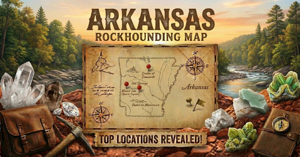
Arkansas Rockhounding Map
Use our interactive map to find specific collecting sites, fee-dig mines, and public-land access points across Arkansas.
View the full Arkansas rockhounding map here.
The map includes GPS waypoints for the locations described in this guide, along with additional sites reported by collectors. If you find a new location worth sharing, you can submit it through the map interface.
Arkansas packs a remarkable density of collectible minerals into a compact geographic area. You can dig world-class quartz crystals in the morning, drive an hour south to search for diamonds at Crater of Diamonds, and stop at a National Forest road cut on the way back to pick up wavellite. Few states offer that kind of variety within a single day's driving radius. Know the geology, respect the land rules, and bring the right tools — the ground will do the rest.