
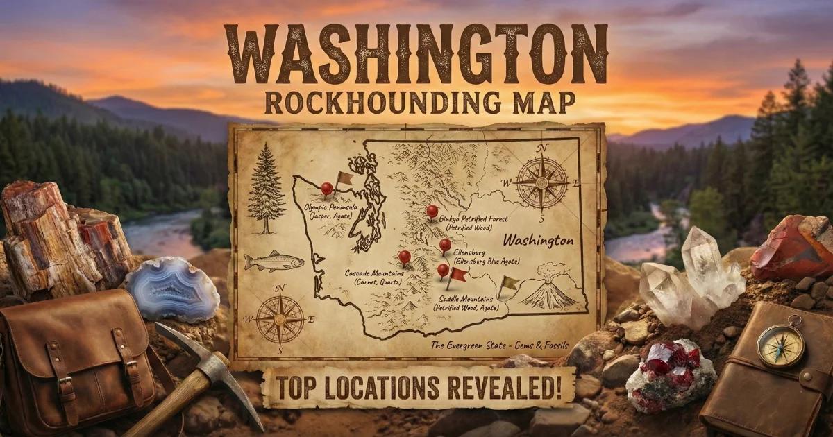
Washington's Geode-Producing Geology
Washington state sits on one of the most volcanically active margins in North America, and that volcanic history is the engine behind every geode and thunderegg you will find here. The eastern two-thirds of the state are blanketed by the Columbia River Basalt Group — a stack of lava flows erupted between 17 and 6 million years ago during the Miocene. These flows cover roughly 80,000 square miles across Washington, Oregon, and Idaho. As each flow cooled, gas bubbles were trapped near the surface, forming vesicles. Over millions of years, silica-rich groundwater percolated through the rock and deposited chalcedony, agate, and quartz crystals inside those vesicles. The result is agate-filled nodules and, in some cases, hollow geodes with druzy quartz interiors.
West of the Cascades, the geology shifts to younger volcanic and sedimentary rocks. The North Cascades foothills contain andesitic volcanic deposits that produce true thundereggs — round nodules with agate or jasper interiors, sometimes with a hollow crystal-lined center. These thundereggs formed in welded tuff and ash flow deposits rather than in basalt, and their mineral fill tends to be more complex and colorful than the basalt-hosted nodules found in the east.
Washington does not produce the sedimentary Keokuk-type geodes found in the Midwest. Every geode and thunderegg in this state is volcanic in origin. If you are coming from a Midwestern geode background, expect a different collecting experience — harder host rock, more varied terrain, and specimens that you often need to extract from solid volcanic matrix rather than pluck from creek gravel.
Top Collecting Sites
1. Walker Valley (Skagit County)
GPS: Approximately 48.47°N, 122.15°W
Land status: Washington DNR (Department of Natural Resources) managed timber land
Vehicle: High-clearance recommended; logging roads can be rough and rutted
Walker Valley sits in the North Cascades foothills about 15 miles east of Sedro-Woolley. The thundereggs here occur in Eocene-age andesitic volcanic deposits — welded tuffs and lahars that host round nodules ranging from 2 inches to over 8 inches in diameter. The interiors contain agate, jasper, chalcedony, and occasionally hollow centers with quartz crystal druzy. Some specimens show vivid color banding in reds, blues, and greens that rival Oregon's famous thunderegg sites.
Collecting at Walker Valley means working on DNR-managed state trust lands that are actively logged. Access roads may be gated during active timber operations. Check the DNR website or call the Northwest Region office before making the drive. When the area is open, you will dig into hillside cuts and road embankments where the thunderegg-bearing tuff is exposed. Bring a pick, shovel, and pry bar — the nodules can be firmly embedded in the matrix. After rain, surface thundereggs wash out along logging roads and ditch lines.
2. Saddle Mountains (Grant/Kittitas County)
GPS: Approximately 46.75°N, 119.70°W (Vantage area)
Land status: Mixed BLM and private land
Vehicle: High-clearance recommended for BLM access roads
The Saddle Mountains are an anticlinal ridge that exposes thick sections of Columbia River Basalt. The vesicular zones in these basalt flows contain agate-filled nodules and occasional true geodes with chalcedony or quartz linings. Specimens typically run 1 to 4 inches. The Vantage area, where I-90 crosses the Columbia River, provides the best road access to BLM-managed parcels along the ridge flanks.
This general region is associated with the Ellensburg Blue agate — an extremely rare blue chalcedony that has become one of the most sought-after agates in the Pacific Northwest. Genuine Ellensburg Blue specimens are exceedingly scarce, and most land where they were historically found is now private. Do not trespass on private ranches hunting for this material. Stick to BLM parcels and public road cuts.
3. Liberty Area (Kittitas County)
GPS: Approximately 47.25°N, 120.65°W
Land status: Okanogan-Wenatchee National Forest (portions), private land
Vehicle: AWD or high-clearance for forest roads
The Liberty gold mining district northeast of Ellensburg has a long history of placer gold mining, but the volcanic terrain also produces agate nodules and small geodes as a byproduct. Creek gravel along Swauk Creek and Williams Creek occasionally yields chalcedony-filled nodules that weathered out of the surrounding Eocene volcanic rocks. National Forest land in the area is open for personal mineral collecting. Combine a geode hunt with gold panning in the same creek system — Swauk Creek is one of the few remaining recreational gold panning streams in central Washington.
4. Horse Heaven Hills (Benton/Klickitat County)
GPS: Approximately 46.10°N, 119.50°W
Land status: Mixed BLM, state, and private
Vehicle: High-clearance for ranch roads
The Horse Heaven Hills south of the Tri-Cities expose Columbia River Basalt flows with agate-bearing vesicle zones. The arid climate and sparse vegetation make surface collecting productive. Nodules erode out of the basalt and accumulate in dry washes and hillside talus. BLM parcels are scattered through the area — use the BLM's online land status maps to identify public land before heading out. This is wide-open rangeland with limited shade and no water sources, so come prepared.
Specimens You Can Expect to Find
| Specimen | Interior Fill | Typical Size | Where Found |
|---|---|---|---|
| Walker Valley Thunderegg | Agate, jasper, chalcedony, occasional quartz druzy center | 2 - 8 inches | Walker Valley (Skagit County) |
| Basalt Agate Nodule | Chalcedony, banded agate, solid fill | 1 - 3 inches | Saddle Mtns, Horse Heaven Hills |
| Basalt Geode (hollow) | Quartz druzy, chalcedony lining | 1 - 4 inches | Columbia River Basalt exposures statewide |
| Ellensburg Blue Agate | Blue chalcedony (extremely rare) | 0.5 - 2 inches | Kittitas County (mostly private land) |
| Creek Agate Nodule | Chalcedony, common opal, agate banding | 1 - 3 inches | Swauk Creek, river gravel bars |
Recommended Tools and Gear
- Rock hammer (3 lb crack hammer): For breaking open specimens in the field and testing basalt exposures.
- Pick and pry bar: Essential at Walker Valley for extracting thundereggs from tuff matrix.
- Shovel (short-handled): For digging into hillside exposures and clearing overburden.
- 5-gallon buckets: For carrying specimens back to your vehicle. Thundereggs are heavy.
- Newspaper or shop towels: Wrap individual specimens to prevent chipping during transport.
- Spray bottle: Wet the surface of nodules and agates to reveal patterns invisible when dry.
- Rain gear: Western Washington sites (Walker Valley) receive heavy rainfall most of the year. Expect mud.
- Offline GPS/maps: Cell service is unreliable at most collecting sites. Download maps before you leave.
- Two spare tires: Logging roads and basalt terrain are hard on tires.
Legal Rules and Access
DNR State Trust Lands: Washington DNR allows recreational mineral collecting on state trust lands, including thunderegg and geode collecting. There is no permit required for personal-use quantities. However, access can be restricted during active timber operations. Check the DNR's online road condition and gate status maps before planning your trip. Seasonal gate closures are common from late fall through spring.
BLM Land: Casual collecting of rocks, minerals, and reasonable quantities of common invertebrate fossils is permitted on BLM-managed land under 43 CFR 8365. The practical limit is what you can carry — typically 25 pounds per day plus one piece. No permit needed.
National Forest: The Okanogan-Wenatchee National Forest allows personal collecting of mineral specimens. No commercial collecting without a special-use permit. Stay on designated roads and trails to avoid resource damage citations.
Private Land: Much of the productive basalt terrain in eastern Washington is privately owned ranch land. Do not cross fences or enter posted land without written permission from the landowner. Trespassing on agricultural land is taken seriously in rural Washington.
State Parks: Mineral collecting is generally prohibited in Washington State Parks. Do not collect at Ginkgo Petrified Forest State Park or any other state park unit.
Best Season to Collect
Western Washington sites like Walker Valley are best visited from late May through October, when logging roads are open and the ground is relatively dry. Eastern Washington is accessible year-round at lower elevations, but spring and fall offer the most comfortable temperatures. Summer in the Columbia Basin regularly exceeds 100 degrees F, and the shadeless basalt terrain amplifies the heat. Winter access to higher-elevation sites is limited by snow and frozen roads.
After spring rains, fresh thundereggs and nodules wash out of hillside exposures. Time your visits a few days after a good rain for the best surface collecting.
Browse our Washington rockhounding map for GPS coordinates and access details on all collecting locations.