
Oregon: The Thunderegg Capital
Oregon adopted the thunderegg as its official state rock in 1965, and no other state comes close to matching Oregon's production of these volcanic geodes. A thunderegg is a specific type of geode that forms in rhyolite lava flows — externally it is rough, ugly volcanic rock, but internally it contains banded agate, plume patterns, moss-like mineral inclusions, or hollow quartz-lined cavities. Every thunderegg is a surprise until you cut it open, and that unpredictability is a large part of the appeal.
Central and eastern Oregon sit on thick sequences of Tertiary volcanic rock — the Clarno Formation (54-40 million years old), the John Day Formation (39-18 million years old), and younger Miocene flows. These formations are the source of Oregon's thundereggs. As rhyolite lava cooled, gas pockets formed throughout the flow. Over millions of years, silica-rich groundwater percolated through the porous rock and deposited chalcedony, agate, and quartz inside these cavities. The surrounding matrix decomposed into soft clay while the silica-filled thundereggs resisted weathering — so they accumulate on slopes and in drainages, ready to pick up.
The distinction between thundereggs and true geodes matters to collectors. Most Oregon thundereggs are solid — filled with banded agate or chalcedony, with no hollow cavity. True geodes (with a crystal-lined hollow center) do occur but are less common. Both form by the same process and in the same rock. The term "thunderegg" comes from a Warm Springs tribal legend about warring mountain spirits who hurled the rocks at each other.
Top Collecting Locations
1. Richardson's Rock Ranch — Jefferson County (Near Madras)
GPS: 44.60°N, 121.18°W (ranch entrance, approximately)
Land status: Private fee-dig operation
Fee: $2 per pound of thundereggs collected (check for current pricing)
Vehicle: 2WD accessible
Nearest town: Madras (approximately 11 miles north)
Richardson's Rock Ranch is the most accessible and beginner-friendly thunderegg collecting site in Oregon. The ranch sits on private land underlain by rhyolite flows that produce excellent agate-filled thundereggs. The operation provides basic digging tools (picks, shovels) and directs you to active digging beds where thundereggs are concentrated in decomposed volcanic soil.
The collecting method is straightforward: dig into the soft, clay-rich soil until you hit thundereggs. They come out easily — the surrounding matrix is far softer than the silica-filled thunderegg itself. Most specimens are 2 to 6 inches in diameter. The interiors range from solid banded agate to plume agate to chalcedony in shades of blue, white, orange, and red. Occasional specimens are hollow with quartz crystal linings.
Richardson's is open seasonally — typically spring through fall. Check their schedule before driving out. The ranch has a rock shop on-site where you can buy pre-cut thundereggs, see examples of what the beds produce, and have your own specimens cut (for a fee). This is the best introduction to Oregon thunderegg collecting if you have never done it before.
2. Priday Thunderegg Beds — Jefferson/Wheeler County (Near Madras)
GPS: 44.55°N, 121.05°W (general area)
Land status: Mixed private and BLM — the famous Priday Ranch beds are on private land (not currently open); some surrounding BLM land produces thundereggs
Vehicle: High-clearance for BLM roads
Nearest town: Madras
The Priday beds produced some of the finest agate-filled thundereggs ever found in North America. The "Priday Plume" variety — clear chalcedony with delicate red and yellow plume inclusions — is a collector icon. Cut Priday Plume thundereggs command high prices in the mineral market.
The original Priday Ranch is no longer open for public collecting. However, surrounding BLM land still produces thundereggs from the same volcanic formation. The quality varies — you will not find Priday Plume material on the BLM parcels — but solid banded agate and chalcedony thundereggs are available. Check with the BLM Prineville District Office (541-416-6700) for current access information and road conditions. Some BLM roads in this area are seasonal and may be impassable when wet.
3. Ochoco National Forest — Crook County (East of Prineville)
GPS: 44.30°N, 120.15°W (general White Fir Springs area)
Land status: National Forest (personal collecting permitted)
Vehicle: High-clearance recommended for forest roads
Nearest town: Prineville (approximately 30 miles west)
The Ochoco Mountains east of Prineville are constructed from the same Clarno and John Day Formation volcanic rocks that produce thundereggs throughout central Oregon. Multiple Forest Service roads access collecting areas in the Ochocos, and the forest is large enough that you can find lightly collected ground with some exploration.
The White Fir Springs and Whistler Springs areas are the best-documented producers. Thundereggs weather out of decomposed rhyolite on hillsides and accumulate in drainages. Walk slowly on slopes above forest roads and scan for the round, rough-surfaced stones sitting on the surface. Fresh material exposes after spring snowmelt and heavy rain.
Collecting for personal use is permitted on National Forest land without a permit. The limit is "reasonable amounts" — generally interpreted as what you can carry out on your back. No mechanized equipment. Backfill any holes you dig. The forest roads are typically open from May or June through October, depending on snowpack.
4. Succor Creek State Natural Area — Malheur County
GPS: 43.15°N, 117.10°W (general canyon area)
Land status: Oregon State Natural Area (collecting permitted in designated areas)
Vehicle: High-clearance recommended; gravel road through the canyon
Nearest town: Adrian (approximately 30 miles east)
Succor Creek Canyon near the Oregon-Idaho border produces thundereggs in the Sucker Creek Formation — Miocene volcanic tuff deposited roughly 15 million years ago. The thundereggs here are distinctive. Many contain unusual fillings including opalite (common opal), moss agate with green chlorite inclusions, and blue chalcedony. Some are partially hollow with druzy quartz crystal linings.
The canyon road is gravel and can be rough, especially after rain. The creek itself is seasonal — it may be dry in summer and running high in spring. Thundereggs weather out of the tuff cliffs lining the canyon and accumulate on the slopes below. Collecting is permitted in designated areas of the State Natural Area — check the posted signs for boundaries. This is relatively remote country, and the nearest services (gas, food) are in Adrian or Homedale, Idaho.
5. Polka Dot Agate Mine Area — Crook County (Near Prineville)
GPS: 44.15°N, 120.50°W (general area)
Land status: Mixed BLM and private
Vehicle: High-clearance required
Nearest town: Prineville
The area south of Prineville around the historic Polka Dot Agate Mine produces thundereggs and agate nodules from John Day Formation rhyolite. The Polka Dot Mine itself is on private land, but surrounding BLM parcels produce similar material. The thundereggs here tend toward smaller sizes (1-4 inches) but can have excellent interior patterns. This is good exploring territory — less visited than the Madras-area sites and with fewer collectors on the ground.
Specimens You Can Find
| Material | Best Sites | Occurrence | Notes |
|---|---|---|---|
| Banded agate (thunderegg fill) | All sites | Very common | Concentric banding in blue, white, red, orange |
| Plume agate | Richardson's, Priday area | Common | Dendritic plume inclusions in clear chalcedony |
| Moss agate | Succor Creek | Common | Green chlorite inclusions resembling moss |
| Chalcedony (blue/white) | All sites | Very common | Shell material and solid fill in thundereggs |
| Quartz druzy (crystal cavity) | All sites | Uncommon | Hollow thundereggs with crystal-lined interiors — true geodes |
| Opalite (common opal) | Succor Creek | Uncommon | Non-precious opal; translucent to milky |
| Sagenite (needle inclusions) | Ochoco NF | Uncommon | Hair-like crystal inclusions inside agate |
| Jasper | All sites | Common | Red, yellow, brown opaque chalcedony; solid fill |
| Picture jasper | Ochoco NF, Succor Creek | Uncommon | Scenic landscape-like patterns |
Recommended Tools and Gear
- Digging tools: Small pick, garden trowel, or entrenching tool. Thundereggs sit in soft decomposed rhyolite — you are digging clay, not hammering rock.
- Rock hammer (2-3 lb): For prying thundereggs from harder matrix and for cracking specimens in the field to check interiors (though cutting is preferred).
- 5-gallon bucket: Standard hauling container. Thundereggs are dense — a full bucket gets heavy fast.
- Eye protection: Always wear safety glasses when cracking or hammering rock.
- Knee pads: You will be kneeling in dirt and gravel. Cheap foam knee pads save a lot of discomfort.
- Water and snacks: Most collecting sites are 30+ minutes from services. Bring enough for a full day.
- Offline GPS maps: Cell coverage is unreliable in central and eastern Oregon. Download maps before leaving Madras, Prineville, or Bend.
- Diamond rock saw (at home): Thundereggs must be cut — not cracked — to reveal their best interior. A 10-inch trim saw with a diamond blade is the standard tool. If you do not own one, rock shops in Madras, Prineville, and Bend offer cutting services for a few dollars per cut.
Legal and Access Information
Fee-dig operations (Richardson's, etc.): These are private businesses on private land. Pay the fees, follow the rules, stay in designated areas. The per-pound pricing at Richardson's means you pay for what you take — no limit other than what you can carry and afford.
BLM land: Casual collecting of rocks, minerals, and gemstones on BLM land is permitted under 43 CFR 8365. The limit is 25 pounds per day plus one piece, not to exceed 250 pounds per year. No commercial collecting without a permit. Hand tools only. This applies to the BLM parcels around Priday, Prineville, and other central Oregon sites.
Ochoco National Forest: Personal mineral collecting is permitted on National Forest land under Forest Service policy. Collect reasonable quantities for personal use. No mechanized equipment. No commercial collecting. Backfill holes and minimize surface disturbance. Many forest roads are seasonal — check with the Ochoco National Forest office in Prineville for road conditions.
State Natural Areas (Succor Creek): Oregon State Natural Areas allow some recreational collecting in designated zones. Check posted signs and current regulations. The rules may be more restrictive than BLM or National Forest land. Contact Oregon Parks and Recreation for current policy.
Private land: Much of central Oregon's thunderegg-producing terrain is on private ranch land. Do not cross fences or collect on private property without permission. Some ranchers allow access — ask at rock shops in Madras and Prineville for leads.
How to Cut Thundereggs
Unlike hollow geodes that can be cracked with a hammer to reveal their interior, thundereggs should be cut on a diamond rock saw. Cracking a thunderegg with a hammer produces an uneven, messy break that does not do justice to the agate inside. A clean saw cut through the center produces two flat faces that show the full banding pattern.
A 10-inch trim saw with a diamond blade is the standard home setup. Use water or oil as a coolant. Cut slowly — let the blade do the work. After cutting, the flat faces can be polished on a series of silicon carbide grits (220, 400, 600) followed by cerium oxide on a felt pad. A well-polished thunderegg half is a display piece that rivals any cut gemstone for visual interest.
If you do not own a saw, every rock shop in central Oregon offers cutting services. Expect to pay $2-5 per cut depending on size. This is money well spent — you get to see what is inside without investing in equipment.
Best Time to Go
Spring through fall (May through October) is the primary collecting season. Many forest roads and backcountry BLM roads are closed or impassable from November through April due to snow, mud, and seasonal road closures. Richardson's Rock Ranch operates seasonally — check their schedule before visiting.
The Succor Creek area in far eastern Oregon is accessible earlier in spring and later in fall than the higher-elevation Ochoco sites. Summer temperatures in the eastern Oregon desert can reach the low 100s, so early morning collecting is advisable in July and August.
Central Oregon base towns — Madras, Prineville, Bend — all have rock shops, gas, groceries, and lodging. Madras and Prineville are the closest staging points for most thunderegg sites and have the most knowledgeable local rock shop owners.
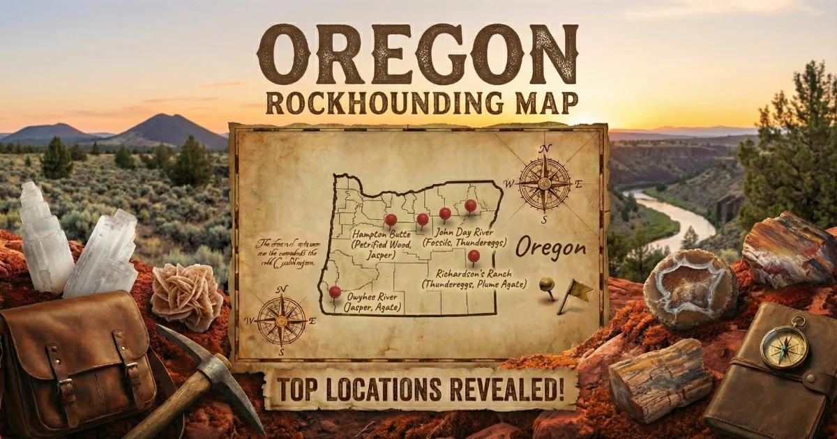
Explore our Oregon rockhounding map for GPS coordinates and access details on all locations.