
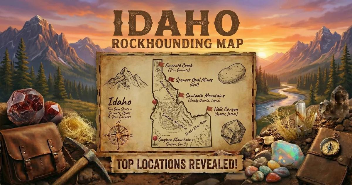
Idaho: Volcanic Ground for Thundereggs and Geodes
Idaho sits on some of the most productive volcanic rock in the western United States. The Snake River Plain — a 400-mile arc of basalt and rhyolite stretching across southern Idaho — traces the track of the Yellowstone hotspot as the North American plate drifted southwest over it during the past 16 million years. That volcanic history left behind thick sequences of rhyolite flows, welded tuffs, and basalt that host gas cavities filled with silica. The result: thundereggs, opal nodules, agate, and quartz geodes scattered across vast stretches of BLM public land.
Idaho is a thunderegg state, not a classic geode state. The distinction matters. Thundereggs form in rhyolitic volcanic rock when silica-rich fluids fill spherical cavities created by gas expansion or differential cooling. Most thundereggs are solid — filled with agate, jasper, or chalcedony. But a meaningful percentage are partially hollow, with open cavities lined with quartz druzy, making them geodes in every functional sense. Idaho also has opal-bearing volcanic rock that produces nodules with precious and common opal.
Geological Framework
Three volcanic provinces drive Idaho's collecting potential. The first is the Snake River Plain itself — Miocene through Pleistocene basalt and rhyolite. The rhyolitic units, especially the Idavada Volcanics and the Chalk Hills Formation, produce thundereggs and agate nodules in the Owyhee region of southwestern Idaho.
The second province is the Challis Volcanic Group in central Idaho. This Eocene-age (roughly 50 to 45 million years old) sequence of rhyolite, dacite, and andesite flows and tuffs is thicker and older than the Snake River Plain volcanics. Gas cavities in these flows filled with chalcedony, agate, and quartz over millions of years.
The third collecting zone is the eastern Idaho rhyolite field near Spencer, where Tertiary-age volcanic rock hosts opal-bearing nodules. The opal here ranges from common white opal to fire opal and occasional precious opal with play of color.
Top Collecting Locations
1. Graveyard Point — Owyhee County
GPS (general area): 43.50°N, 116.95°W (near the Oregon-Idaho border, south of Marsing)
Land status: BLM public land
Vehicle: High-clearance recommended; 4WD for wet conditions
Graveyard Point is one of the most collected thunderegg sites in the Northwest, and for good reason — the material is consistently good and the BLM access is straightforward. The host rock is a rhyolitic tuff (welded ash) that weathers to a soft, crumbly matrix, releasing thundereggs as the tuff erodes. The thundereggs here contain plume agate, moss agate, chalcedony, jasper, and occasional quartz crystal-lined cavities.
Surface material has been heavily picked over after decades of collecting. Plan to bring a shovel and dig into the tuff matrix to find fresh specimens. The thundereggs range from golf ball to softball size, occasionally larger. The exterior is rough, gray-brown volcanic rock. The only way to know what is inside is to cut or crack it open — the exterior gives no reliable indication of the interior quality.
The site is about 20 miles south of Marsing via a gravel road. Bring water, food, and fuel — there are no services. The Owyhee Desert is hot in summer and cold at night year-round.
2. Spencer Opal Mines — Clark County
GPS (general area): 44.36°N, 112.18°W (near Spencer on I-15)
Land status: Private fee-dig operation
Vehicle: 2WD to the mine gate
The Spencer Opal Mines operate a fee-dig site in rhyolitic volcanic rock that produces opal-bearing nodules. The opal ranges from common white and pink opal to orange-red fire opal, with rare specimens showing true precious play of color. The nodules are embedded in decomposed rhyolite and can be dug with hand tools. The mine provides buckets and basic tools; you bring your own rock hammer and safety glasses.
The fee is typically $30 or more per person per day (check their current rates before visiting). The mine is open seasonally — generally late May through mid-September, depending on weather. The town of Spencer is a tiny community on I-15 between Idaho Falls and Dillon, Montana. There is a small opal shop in town where you can see cut and polished specimens from the mine.
3. Challis Volcanic Group — Custer County
GPS (general area): 44.50°N, 114.20°W (Challis area)
Land status: BLM and Salmon-Challis National Forest
Vehicle: High-clearance 4WD required for most backcountry access
The mountains surrounding Challis and Salmon expose thick sections of the Challis Volcanic Group — Eocene rhyolite and andesite flows that produce scattered thunderegg and geode deposits. The material here tends to be different from Owyhee County — more chalcedony and less patterned agate, with some specimens containing solid white opal or quartz druzy interiors. The volcanic terrain is steep, remote, and heavily timbered in the canyons.
Collecting is permitted on both BLM land and Salmon-Challis National Forest for personal use. The forest roads off Highway 93 and Highway 75 provide access, but many deteriorate quickly and are impassable during spring snowmelt. Check road conditions with the Challis BLM Field Office or the Salmon-Challis NF ranger station before heading out. Plan for a full-day trip with no cell service and no services.
4. Bruneau Canyon Area — Owyhee County
GPS (general area): 42.80°N, 115.80°W
Land status: BLM public land
Vehicle: High-clearance 4WD
The Bruneau-Jarbidge volcanic area south of the Snake River Plain produces thundereggs and agate in rhyolitic tuffs similar to Graveyard Point. The terrain is more remote and less visited, so surface material persists longer. The BLM land is open for casual collecting. The Bruneau Canyon rim and the surrounding plateau expose volcanic ash beds with embedded thundereggs. This area is extremely remote — plan fuel, water, and supplies for a day of self-supported collecting.
5. Emmett Area — Gem County
GPS (general area): 43.87°N, 116.50°W
Land status: BLM, private (mixed)
Vehicle: High-clearance recommended
The foothills north and east of Emmett expose Miocene volcanic rocks that produce small thundereggs and agate nodules. Gem County is named for these deposits. The material is typically smaller than Graveyard Point specimens — 1 to 3 inches — but some produce good agate fill with occasional hollow centers. BLM land is accessible from forest roads north of town. Verify land ownership before collecting, as private and public parcels are intermixed.
What You Will Find: Idaho Specimens
| Specimen Type | Typical Size | Common Interior | Where Found |
|---|---|---|---|
| Thunderegg (solid) | 2–6 inches | Plume agate, jasper, chalcedony | Graveyard Point, Bruneau, Emmett |
| Thunderegg (hollow) | 2–5 inches | Quartz druzy center, agate shell | Graveyard Point, Challis |
| Opal nodule | 1–4 inches | Common opal, fire opal, rare precious | Spencer Opal Mines |
| Agate nodule | 1–3 inches | Fortification or moss agate | Emmett, Owyhee Co. |
| Quartz geode | 1–3 inches | Clear to milky quartz crystals | Challis volcanic terrain |
How to Identify Specimens in the Field
Thundereggs look like unremarkable lumps of volcanic rock on the outside. The exterior is typically rough, gray to brown, and covered with the texture of the host tuff. Shape is your best surface clue — thundereggs tend to be roughly spherical to oblate, standing out from the angular fragments of broken tuff around them. Size is another indicator: most thundereggs fall in the 2- to 6-inch range, while random tuff fragments come in all sizes.
You cannot tell what is inside a thunderegg from the outside. A dull, ugly exterior can contain museum-quality plume agate. The only test is cutting. If you carry a rock hammer, you can crack small specimens in the field by striking them on their equator against a hard surface, but cutting with a diamond saw at home produces a much better result.
Opal nodules at Spencer have a slightly different look — the decomposed rhyolite matrix is lighter in color and the opal-bearing nodules sometimes show a waxy or vitreous luster on broken edges. Hold suspect stones to the light; opal may show translucency or faint color play even in rough form.
Recommended Tools and Gear
- Round-point shovel: Essential at picked-over sites like Graveyard Point. You need to dig into the tuff matrix to find fresh thundereggs.
- Rock hammer: For breaking open specimens and prying nodules from matrix
- 5-gallon bucket: For hauling specimens back to your vehicle
- Safety glasses: Flying rock chips are a real hazard when hammering volcanic rock
- Plenty of water: At least 1 gallon per person per day. The Owyhee Desert and Challis backcountry have no water sources.
- Extra fuel: The nearest gas station to many Idaho collecting sites is 50+ miles away
- GPS or phone with offline maps: Cell service is nonexistent at most backcountry sites
- Sun protection: High-desert sun is intense. Hat, sunscreen, and long sleeves.
Legal Rules and Land Access
- BLM casual collecting: 25 pounds per day plus one piece, not to exceed 250 pounds per year. Non-commercial, personal use only. No motorized digging equipment without a permit.
- National Forest: Salmon-Challis National Forest allows personal mineral collecting. No commercial activity without a special use permit.
- Spencer Opal Mines: Private operation — pay the fee and follow their rules. They set daily limits on how much material you can take.
- Owyhee County: Extremely remote. Tell someone where you are going and when you expect to return. Carry emergency supplies — a breakdown 50 miles down a dirt road with no cell service is a survival situation, not an inconvenience.
- Best season: May through October for most sites. Spencer opens late May. High-elevation Challis sites may not be accessible until June or July depending on snowpack. Owyhee County roads become impassable in mud season (March through April).
See our Idaho rockhounding map for GPS coordinates and additional collecting locations.